

.svg)
Article updated March 31, 2026 by Andrew Whipple & Content Editor Christine Potter to reflect additional GPRS service information.
“We didn't know you did that,” is a phrase we at GPRS hear daily. We get it; our services have evolved and expanded over the years, and it can be hard to keep track of them all. So we’ve created this explainer to answer the question, “What, exactly does GPRS do?”
GPRS’ main goal is to deliver accurate, actionable data to our clients every day, so their projects can stay on time, on budget, and safe.
Some of the deliverables you can expect when working with GPRS include:
- High-resolution utility as-builts (PDF or KMZ files)
- Above and below-ground facility and infrastructure mapping
- Conceptual site models (CSM)
- Concrete markings and mapping
- 2D CAD drawings
- 3D models
- As-built creation and existing conditions documentation
- NASSCO-compliant WinCan reports
- Routine water loss surveys
And GPRS’ core services that are used to capture the data we deliver include:
- Utility Locating / Concrete Scanning
- Reality Capture Services
- Video Pipe Inspection Services
- Infrastructure Mapping & Management Services (SiteMap)
- Leak Detection Services
How many of these services are you aware of? If you only recognized a few, keep reading because GPRS probably has a solution that can help you with save money, time, and even lives on your next project.
Utility Locating and Concrete Scanning
This is probably what you know us for because we’ve been providing concrete sawing and drilling clearances for construction projects since 2001, and providing the industry’s most exacting utility locates and maps since 2007. We maintain a consistent 99.8% accuracy rate on both – nationwide.
Any job that involves breaking ground faces the risk of striking utilities or other subsurface obstructions. It is vital to always call your local 811 and hire utility locating professionals, like GPRS, before breaking ground.
Striking utilities or concrete reinforcements like post tension cables can lead to expensive repairs and serious injuries to workers. Because of this, knowing what is below your feet before you dig is very important.
GPRS Project Managers utilize ground penetrating radar (GPR) and electromagnetic (EM) locators to identify subsurface utilities and obstructions within concrete.
Subsurface Investigation Methodology (SIM) is the standard operating procedure used to train every GPRS Project Manager. The guiding principle of SIM is the use of complementary technologies, like GPR and EM locators, to ensure the scan data is accurate. By using these complementary technologies, our SIM-certified Project Managers have maintained 99.8% accuracy on all utility and concrete scans.

Some of the main applications of our utility locating and concrete scanning services are:
- Direction drilling clearance
- Environmental due diligence (supports Phase I and II ESAs)
- UST locating
- Soil boring clearance
- Utility as-built creation
- Excavation clearances on both public & private utility lines
Project Managers mark the ground with spray paint, chalk, or flags using the industry’s universal color code to differentiate various utilities as they scan the site. This gives the client a visual representation of where it is and is not safe to break ground.
Upon the completion of a utility locate, Project Managers use Real-Time Kinematic (RTK) positioning to collect data points and map out the longitude and latitude of the markings. We use the data to create utility maps, CAD files, and KMZ files. Then, we upload them into SiteMap® (patent pending), which we’ll explore in more detail later in the article.
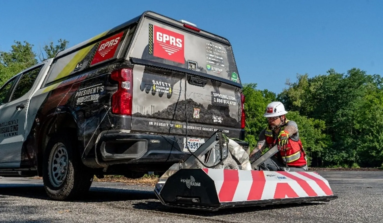
In the summer of 2025, the high-speed GPR array was added to the Project Managers’ toolbelt. It features more than double the number of antennas that typical GPR pushcarts or handheld GPR devices have, which gives it the ability to collect large amounts of data at speeds up to 80 mph. With this new tool, scans across many acres of land or a busy highway only take minutes instead of hours.
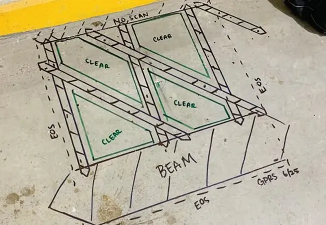
There is not a color code when identifying concrete obstructions like post tension cables, rebar, or conduit. So, we created one: the Green Box Guarantee. When a GPRS Project Manager marks a section of concrete with a green box, that means it is clear of obstructions.
Reality Capture
Accurate as-builts are essential for demonstrating compliance with building codes, regulations, and contractual obligations. They serve as a legal record of the work completed, which can be critical in resolving disputes or claims related to the project. Inaccuracies in as-built drawings can lead to legal challenges, penalties, or the need to redo work to meet compliance standards.
3D laser scanning is the best method to capture accurate as-builts and is the main method used in GPRS reality capture services.
GPRS added 3D laser scanning to our arsenal of services in 2022 through our acquisition of TruePoint Laser Scanning. We also acquired Existing Conditions, a leading 3D laser scanning and visualization firm for architects, in 2024. Through each acquisition, we’ve welcomed many reality capture professionals with decades of experience to the team, and they have helped us grow.
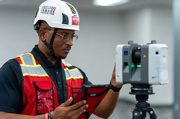
Reality capture services do exactly that: capture your reality by way of accurate existing conditions documentation. It involves the use of LiDAR (Light Detection and Ranging) 3D laser scanners to document and measure sites with extreme precision. All laser scans performed by GPRS Project Managers are 2-4 mm accurate.
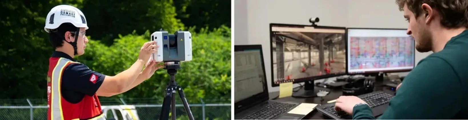
Once a scan is completed, point cloud data of the site is automatically developed and serves as the base data for a wide range of deliverables. GPRS’ in-house Mapping & Modeling team features dozens of professional CAD technicians that can convert and register the raw scan data into drawings and models that can elevate your next project and make managing your facilities simpler.
GPRS can deliver point cloud data in many formats, including:
We can also deliver the following customizable deliverables upon request:
- Aerial Photogrammetry
- Deformation Mapping
- Digital Drawings of GPR Markings
- Floor Flatness Analysis / Contour Mapping
- At-Depth Modeling
- Native Modeling
- New Construction Accuracy Analysis/Comparative Analysis
- Point Cloud Modeling Training Webinars
- Reconciliation of Clients 2D Design Drawings
- Reconciliation of Clients 3D Design Model
- Structural Steel Shape Probability Analysis
- Template Modeling
- Volume Calculations
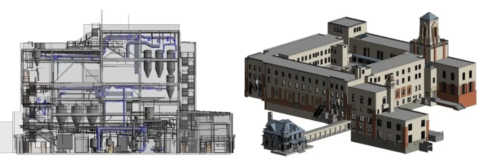
Reality capture services can also assist with GPRS utility locating and concrete scanning services. By scanning a marked-out job site or concrete slab with a 3D laser scanner, the GPRS team can create CAD maps, virtual walkthroughs, and 3D BIM models of underground utilities or the interior of a concrete slab.
Along with LiDAR-based laser scanners, GPRS Project Managers also utilize 3D photogrammetry, which involves taking hundreds or thousands of high-resolution photos that are stitched together to create a 3D model. Our Mapping & Modeling team can render these images to create virtual tours, floorplans, topographical maps, and more.
3D BIM models developed by GPRS can also serve as the base for a digital twin, which is an exact virtual representation of a physical space that uses real-time data to stay updated and accurate. By using Internet of Things (IoT) sensors, the model of the space can be continuously updated with extreme accuracy. The data collected over time can provide clients with valuable information about their building and allow them to note more efficiently areas that need attention.
It is important to note that GPRS does NOT currently provide clients with digital twins. However, we can provide 2-6 mm accurate models that serve as a major building block of digital twin creations.
Video Pipe Inspection
Proper due diligence when managing sewer systems is vital. It can be easy to forget about wastewater infrastructure when it’s working properly. However, when something goes wrong, everyone pays attention. CCTV pipe inspection services, like GPRS’ video pipe inspection (VPI) services, are the most important tool for wastewater asset managers to keep their sanitary and storm sewers running at peak efficiency.
GPRS launched our VPI services in 2020 through our partnership with Encompass Inspections and Master Locators. Another example of GPRS collaborating with other professionals to help ensure complete site visualization for our customers.
The technologies used by VPI Project Managers include:
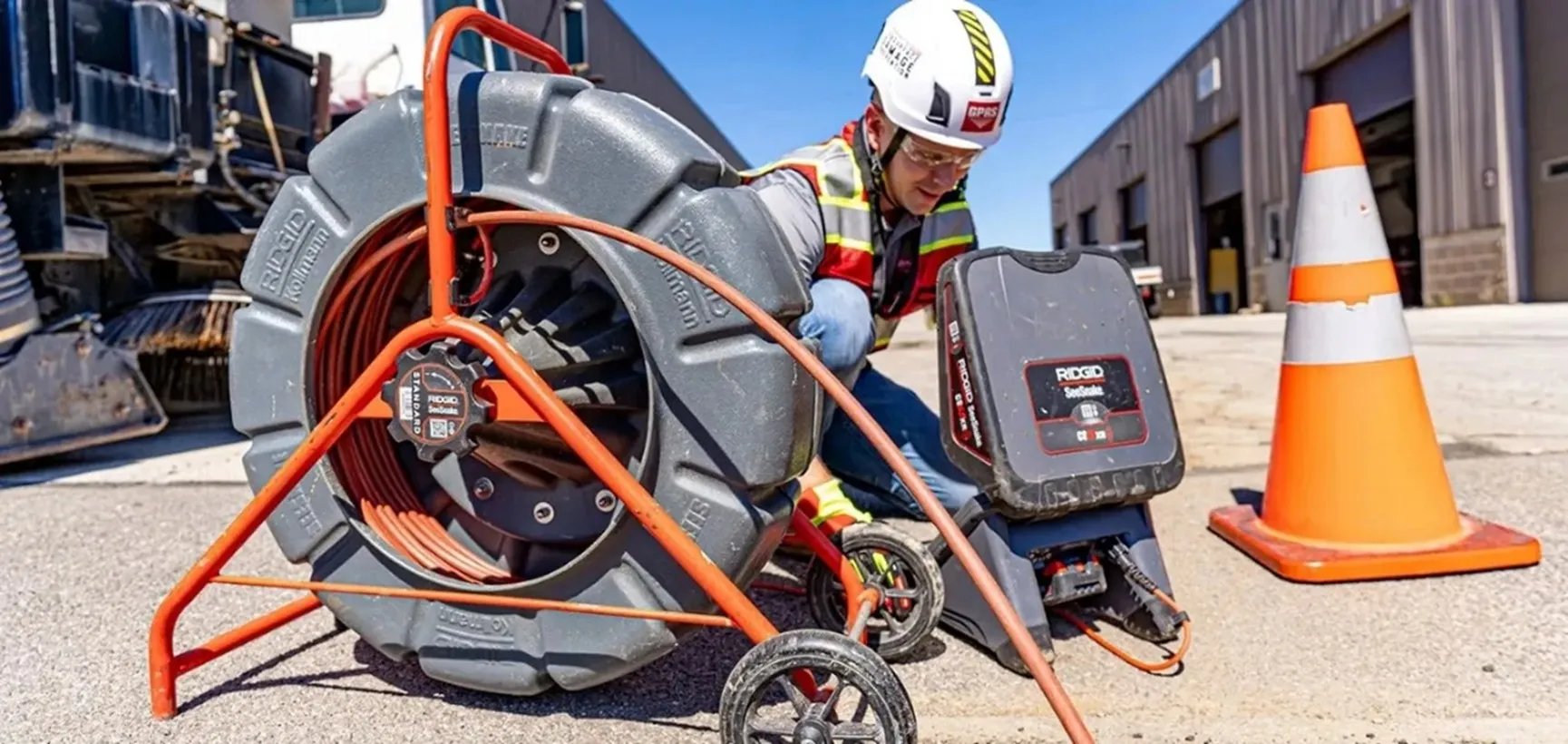
Project Managers also utilize utility locating equipment, like EM locators and GPR, to locate sewer lines, mark their locations on the ground, and map them.
All our VPI Project Managers are NASSCO-trained and certified. NASSCO, or the National Association of Sewer Service Companies, sets industry standards for assessing, maintaining, and rehabilitating underground infrastructure.
Since our Project Managers are NASSCO-certified, they can provide clients with NASSCO-compliant WinCan reports. In these reports, clients receive a list of every identified defect ranked by severity, with photo and video evidence to back up their claims.
Some of the main applications of GPRS’ VPI services include:
- Cross bore mitigation
- Facility condition assessments
- Mainline inspections
- Manhole inspections
- Sewer lateral inspections
- Inclination reports
- Smoke testing
- Dye tracing
- Annual inspection programs
- Mandated pre and post directional drilling inspection
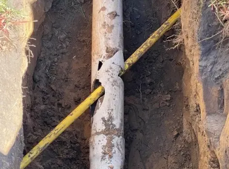
While all the services mentioned above are important, the increasing risks of cross bores, the unknown and unintentional breach of sewer lines, water lines, and other utilities, must be taken seriously. More than one million cross bores exist in the United States. They cause sewer lateral backups, impact the structural integrity of pipes, and can cause severe damage like fatal explosions. VPI services help repair existing cross bores and prevent new ones by providing comprehensive sewer infrastructure maps.
SiteMap
Most facilities or campuses have someone who has worked there for decades and knows everything about its infrastructure. They know exactly where to find the facility’s current paper plans and can tell you all about when they rerouted the sewer lines in the 80s. Their wealth of institutional knowledge is impossible to pass on when they retire, but how?
Going through stacks of paper plans simply isn’t reasonable anymore in the fast-paced, digital ecosystem we all live in. Maintaining institutional knowledge and accurate as-builts are why we created SiteMap® (patent pending).
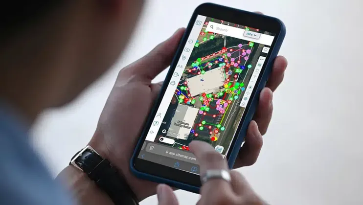
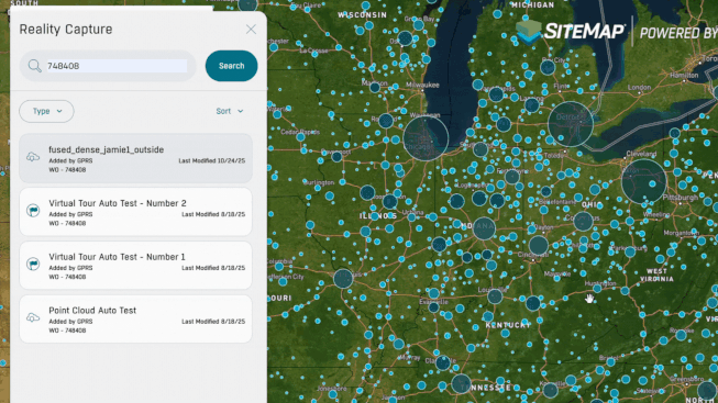
SiteMap is GPRS’ cloud-based infrastructure management platform that has continuously evolved since its development in 2021.
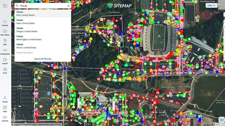
One of the main purposes of SiteMap is to give our clients the ability to access all their subsurface utility data in one secure platform.
Some of the main capabilities of SiteMap include:
- Data that is geospatially accurate
- Importing GPRS-captured data directly into the platform rather than having to do it yourself
- A mobile app that can be used on smartphones and tablets
- 24/7 secure access
- User-friendly and customizable interface
*Though other GIS platforms offer similar features, none match all the capabilities of SiteMap.
SiteMap 2.0 Updates
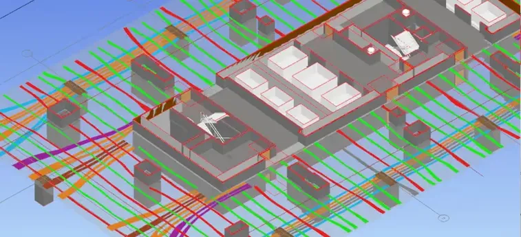
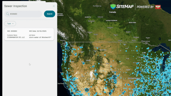
In 2025, SiteMap launched two tools as part of its SiteMap 2.0 updates that integrated more above and below-ground data into the platform. The first was the SiteMap Sewer Layer. This new feature securely stores VPI reports, like NASSCO-compliant WinCan reports, and videos in a single platform.
As shown below, the name of the sewer line, its condition, flow direction, pipe material, depth, CCTV clips from inside the pipes, and detailed notes are all shown in one easy-to-use interface, while also being geospatially accurate on the satellite map. Everything a client needs to know about their sewer system can be uploaded into SiteMap for them to review and make more well-informed decisions.
The second update was the SiteMap Reality Capture Layer, which stores any point cloud data, virtual walkthroughs, CAD drawings, and Revit models in the SiteMap platform.
Before the reality capture layer, models and walkthroughs would be sent as individual files or links. It can be hard to keep track of all that data for a large facility or campus. With the reality capture layer, everything is in one place, ready for review at a moment’s notice inside SiteMap.
The reality capture layer also features several tools exclusive to the platform that help further analyze each deliverable.
Some of the tools that can help further analyze reality capture data include:
- Distance Measurement
- Height Measurement
- Angle Measurement
- Volume Measurement
- Polygon Clipping
- Customizable Splat Quality (Detail of the Model)
- Customizable Navigations / Perspectives
- & Much more!
Some tools can be used to further analyze virtual walkthroughs:
- Exploring the 3D Space: clicking through the virtual landscape of your property allowing you to do virtual walkthroughs from your laptop or mobile device
- Dollhouse View: a complete view where you can view and analyze the entire property, similar to a child with a dollhouse
- View Floor Plans: the complete birds-eye view of your property
- Floor Selector: view all or one floor at a time if your property has more than one
- Measurements: place points anywhere you choose across the model to obtain accurate measurements of that specific area
Lastly, here are tools that allow for further examination of Revit models:
- First Person Point of View
- Measuring Tools
- Explode (disassembling the model)
- Media Browser (hide certain aspects of the model)
- 3D View
- Topographical View
- MEP View
- Civil Engineering View
- Architectural View
- & More!
And like everything you receive in SiteMap, the models are geospatially accurate, which means you can enter the building’s address or find it on your campus, click on an icon placed on the building, and view the models instantly in the app.
SiteMap 3.0 Updates
In February of 2026, GPRS launched several new tools as part of the SiteMap 3.0 update.
The first and most eye-catching update is the Augmented Reality feature on the mobile app.
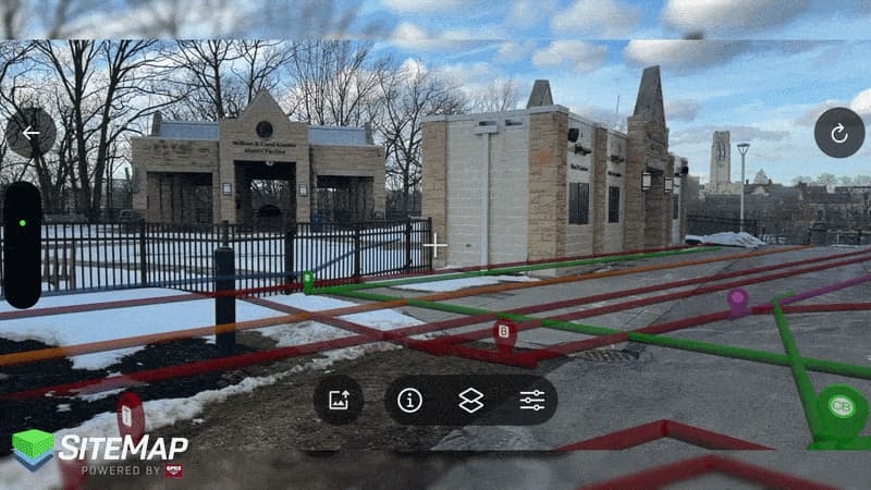
Once Project Managers upload their 99.8% accurate underground utility data, you can view them in augmented reality on your phone.
With augmented reality at your disposal, site walks become simpler and you can identify potential conflicts more easily. To learn more about the Augmented Reality layer or request a demo, click here.
Another new feature launched as part of SiteMap 3.0 was My Dig Board, a morning meeting in your pocket.
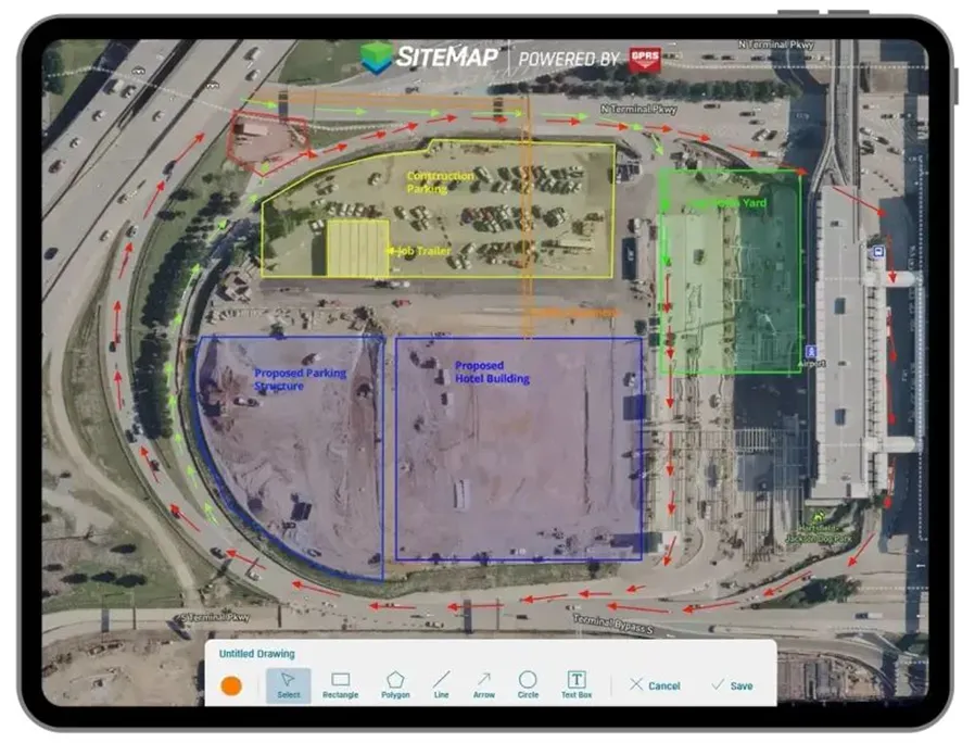
After a 6 AM meeting on the job, information can be lost , or is often changed throughout the day. My Dig Board is the solution to these problems.
Instead of using a whiteboard or a paper plan, you and your team can access a customizable satellite image of your site 24/7, which you can update for everyone at a moment’s notice.
If you need to change the area you plan to excavate or have equipment dropped off, My Dig Board allows you to make the update on the SiteMap mobile app for your entire team to review in real time.
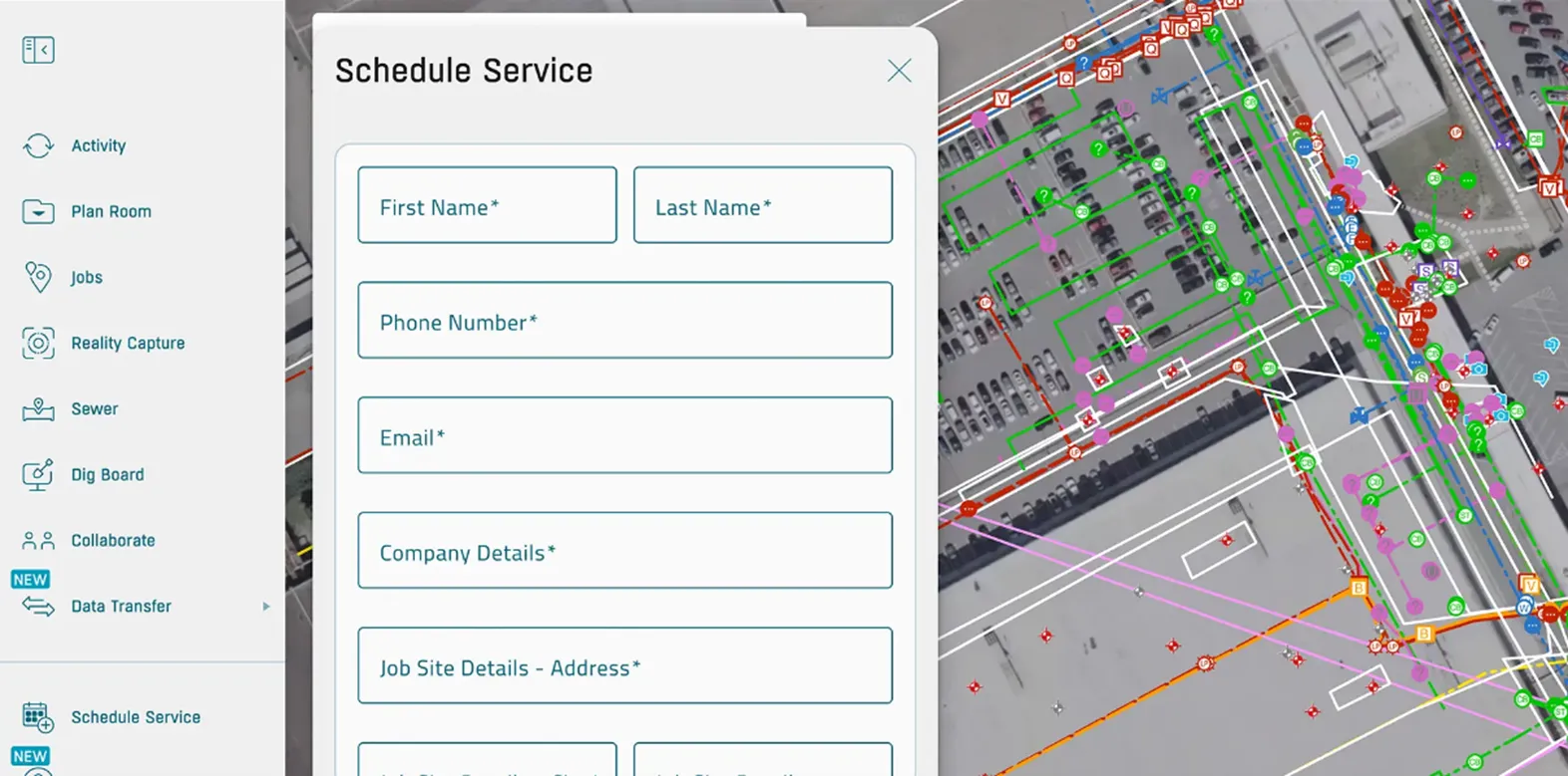
The Customer Self Service form is another new SiteMap feature. To schedule additional GPRS services, you can now open the self-service form on the platform, request the services you need, and even show where you need the service performed on the satellite image of your site. No need for phone tag or email chains.
The services you can request with the Customer Self Service form include:
- Utility / UST Locating
- Concrete Scanning
- 2D / Floor Plan Modeling
- 3D / BIM Modeling
- GIS Mapping
- 3D Laser Scanning
- BOMA Measurements
- Drone Imaging
- Virtual Walkthrough
- Mainline / Lateral Inspections
- Leak Locate / Survey
Other New SiteMap 3.0 updates include:
- Customizable Line Styles: adjust line styles to match your company standards, so every map looks familiar and clear
- Feature Renaming: rename features with labels your team uses so your maps make sense at a glance
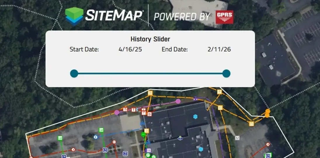
- History Slider: scroll through past data to spot duplicates and see how your site has changed over time
SiteMap offers three different access levels that build on the complimentary Personal access every new GPRS customer receives. Each access level can provide solutions for every business and industry.
Here is a quick overview of those various tiers.
- Best suited for facility management
- Limited to one facility or campus
- Layered data to capture progress and reference points
- Continual access with no end date
- Best suited for facility management
- Limited to one facility or campus
- Layered data to capture progress and reference points
- Continual access with no end date
- Best suited for multiple nationwide projects
- Covers an entire company’s distributed portfolio
- Allows for administrative team collaboration to eliminate information bottlenecks
- Continual access with no end date
If SiteMap sounds like the secret weapon you have been looking for, schedule a demo here.
Leak Detection
Six billion gallons of treated water are lost daily due to untreated leaks. This is known as non-revenue water loss and is causing the loss of billions of dollars each year.
When was the last time you had a routine water loss survey done? With numbers this high, there is a good chance there is an active leak in your water infrastructure as you’re reading this. Non-destructive, acoustic leak detection services help prevent further wasted dollars by efficiently pinpointing leaks in pressurized water pipes.
GPRS added leak detection services and technologies to our toolbox in 2021 after our acquisitions of both NYLD Infrastructure. Their leak detection expertise combined with our vast utility locating experience helped us reach yet another evolution in complete site visualization for our clients.
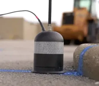
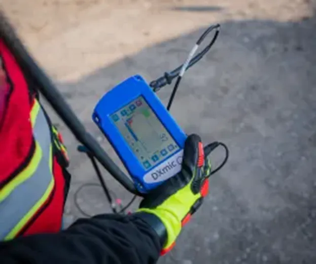
Our Project Managers utilize industry-leading equipment to locate leaks in pressurized water lines and provide insights into your water distribution system. Our leak detection specialists use acoustic leak detectors and leak detection correlators when pinpointing the location of leaks.
Acoustic leak detectors locate leaks with a sensitive ground microphone or an acoustic listening device. The device is either used at the surface level or is dropped into a manhole. Then, our Leak Detection Project Managers use headphones to listen for and isolate the leak tone.
Leak detection correlators, also known as leak noise correlators, use sensors placed on both sides of a pipe that send information back through radio waves. The processing unit compares the data with algorithms designed for certain noise profiles, which determine the exact location of any leaks.
The biggest benefit of utilizing acoustic leak detection and leak detection correlators is that it’s non-destructive. Other methods, such as potholing, involve excavating areas to check the conditions of underground pipes. GPRS leak detection Project Managers can be on site and help you avoid the need for repairs or replacements of damaged ground and structures afterward.
GPR and EM locators can be used to aid the leak detection process by locating the water pipes and marking the location of the lines and potential leaks on the surface.
Along with pinpointing active leaks, GPRS leak detection services can be applied to:
- Routine water loss surveys
- Fire suppression system checks
- Valve exercising
Safety Initiatives
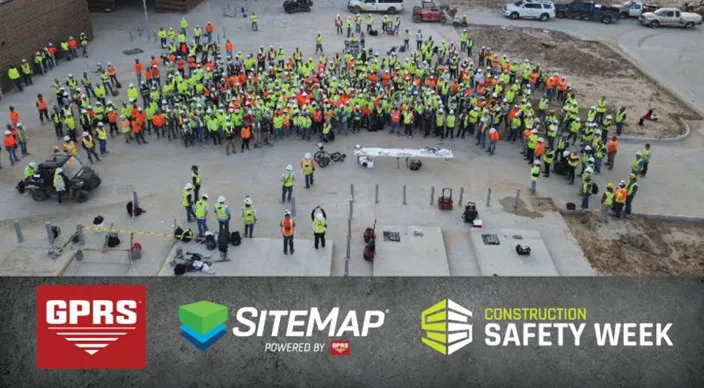
GPRS is a proud sponsor of Construction Safety Week, and the chief sponsor of Concrete Sawing & Drilling Safety Week and Water & Sewer Damage Awareness Week.
Concrete Sawing & Drilling Safety Week is held during the last month of January. Since 2019, our concrete safety experts have visited job sites and offices across the country to talk about the risks involved with concrete cutting and the best practices on how to stay safe while cutting. With all the information they present, attendees can put together personalized safety plans to keep themselves and their teams safe when cutting, coring, or drilling into concrete.

Each May, Construction Safety Week (CSW) is recognized and observed throughout the construction industry. Since 2019, GPRS has been a sponsor of CSW and provides complimentary safety presentations. These presentations focus on workers’ physical and mental health. Each year has a different theme geared towards safer work environments for all. Attendees’ personal safety plans revolve around:
- Underground utility strikes and best practices to prevent them
- Heat-related illnesses, how to prevent them before they occur, and other climate-related risks
- Wearing proper PPE when saw cutting, coring, or drilling through concrete
- Climate related risks on site
- The effects of workers’ mental health on safety and preparedness on the job
And in the last week of October, GPRS provides free safety presentations during Water & Sewer Damage Awareness Week. Some of the items that are covered during these presentations include:
- The risks of improper or infrequent maintenance
- Why water infrastructure is more vulnerable to damage today than ever before
- How to keep non-revenue water loss from hurting your community and bottom line
- How to mitigate the risk of cross bores
- How to create a plan to keep your water infrastructure running at peak efficiency
Throughout all these safety initiatives, our experts have trained tens of thousands of workers to help keep jobsites safer nationwide.
Now that you know everything that GPRS can do, what can we help you visualize?
FREQUENTLY ASKED QUESTIONS
What is SIM?
Subsurface Investigation Methodology (SIM) is a standard operating procedure and set of professional specifications that work as a guide for utility locating experts when scanning for buried utility lines. All GPRS Project Managers are required to achieve SIM 101 certification, which requires 80 hours of hands-on training in a classroom setting and 320 hours of mentorship in the field. For reference, the American Society for Nondestructive Testing’s (ASNT) minimum training recommendation includes eight hours for training and 60 hours practicing GPR to achieve NDT Level 1 certification in ground penetrating radar (GPR) scanning.
SIM requires the use of multiple, complementary technologies, like GPR scanning and electromagnetic (EM) locating, when locating buried utilities or scanning a concrete slab.
How does GPRS contribute to jobsite safety in construction?
GPRS’ #1 focus is safety and part of our mission is the pursuit of 100% subsurface damage prevention because sending your team home safe and sound every day is the most important job we can help you do.
Our Subsurface Investigation Methodology (SIM) provides the gold standard in underground utility locating and concrete scanning, so we can help you ensure your team is clear to cut, core, or drill with confidence. Our Video Pipe Inspection services provide NASSCO-compliant PACP-coded defect and condition reporting, pipe locations, and more. And, our reality capture services provide 2-4 millimeter-accurate structural measurements to help you avoid clashes, reworks, and downtime. Because when you know what’s hidden/underneath, you can build more safely.