

.svg)
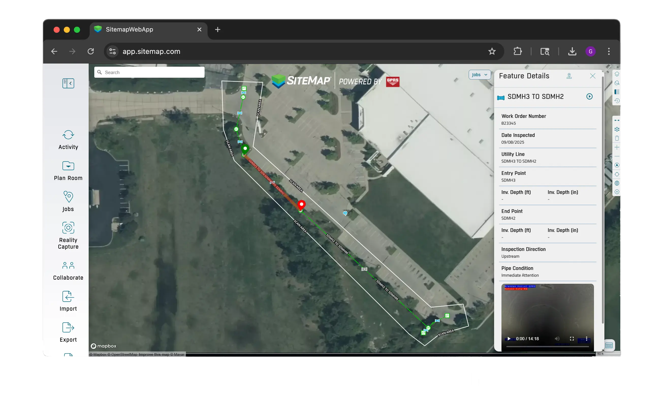
The Ultimate Deliverable: SiteMap Sewer Layer
See Your Entire Storm and Sanitary Sewer System: Video, NASSCO Reports & More as Part of Your VPI Deliverables
No extra software required to see your layered, color-coded, interactive utility maps
Your sewer data is linked directly to SiteMap’s GIS Map Layer & includes:

How Does The SiteMap® Sewer Layer Help You?
You can plan maintenance, repairs, and upgrades to your wastewater and storm systems all in one secure, sharable platform.
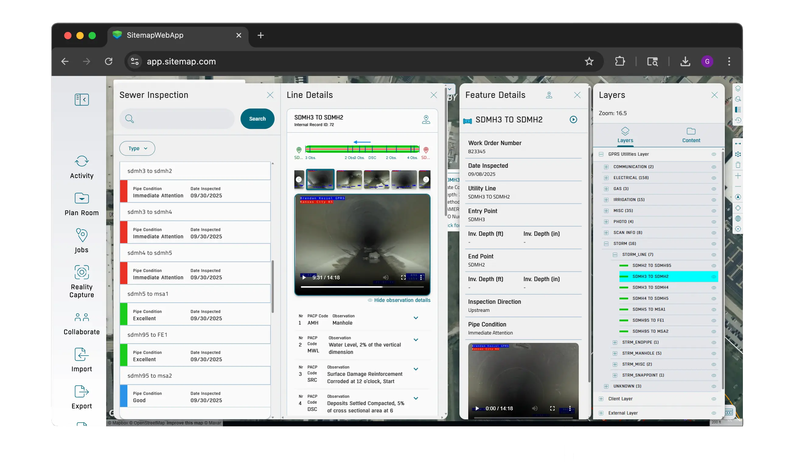
SiteMap’s Comprehensive Sewer Layer is Included When You Order a GPRS Video Pipe Inspection

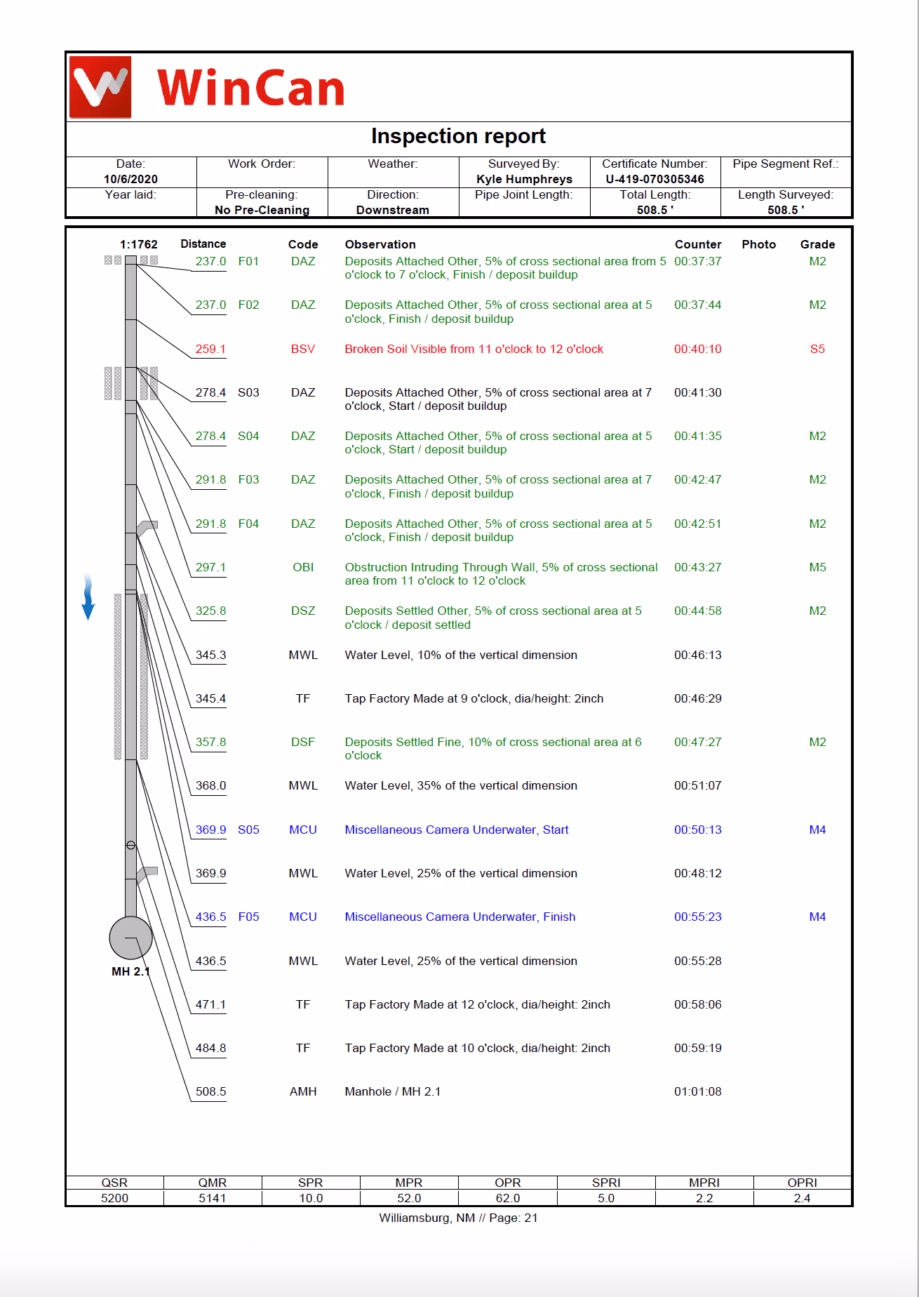
NASSCO-Certified Sewer Reporting
Every GPRS VPI Project Manager is NASSCO-certified in PACP, LACP, and MACP, and trained in our proprietary Subsurface Investigation Methodology (SIM). This means you get expert-level sewer inspections and accurate defect categorization for complete system visibility.
By integrating WinCan software with our advanced sewer scope technology, GPRS delivers interactive, NASSCO-compliant condition reports that include:
With GPRS reporting, you can repair, maintain, and upgrade your sewer infrastructure confidently, backed by industry-leading standards and actionable data.
WinCan Web Video Pipe Inspection Reports
GPRS is proud to provide real time data and in-depth video and photo records as part of the SiteMap Sewer Layer via WinCan Web.
WinCan’s cloud-based platform seamlessly integrates with SiteMap so you can view all your pipe inspection data – including video and photos of pipe conditions – without ever leaving SiteMap.
The software allows us to deliver comprehensive, NASSCO-compliant, and interactive VPI reporting. You can securely view, export, and share your sewer inspection data with anyone you designate via SiteMap or the SiteMap mobile app, giving your team 24/7 sewer data, from anywhere.
It’s important to note that WinCan’s data accuracy can be affected by dirt, debris, or tension on the robotic crawler or push camera’s cable, and it is recommended that sewer lines be cleaned before GPRS deploys VPI equipment.
.webp)
Optimize Your Sewer Asset Management
With SiteMap®, you get accurate data, actionable insights, and real-time visualization to help you reduce risk, cut costs, and improve system reliability.
Schedule SiteMap DemoOur sewer inspection services include:
.webp)


.webp)

Schedule your SiteMap® Demo!
All GPRS VPI Project Managers are NASSCO certified in PACP, LACP, and MACP, in addition to our required Subsurface Investigation Methodology (SIM) certification.
And all of our utility locates & maps utilize Real-Time Kinematic Positioning (RTK), the most accurate global positioning available.
GPRS helps you see the unseen because what’s underneath, matters.
What Can We Help You Visualize?