

.svg)
Concrete Scanning
Concrete scanning starts with our field markings, which come in the form of paint, marker, crayon, and any other method as directed by the client. These markings provide clear, accurate displays of rebar, conduits, post tension cables, and other objects embedded within the concrete slab, while being understandable for anyone who may view them. The Mapping and Modeling team can create customized maps and models that document project results, and provide a permanent record of GPRS findings.

Concrete Markings
Concrete-embedded objects are visually marked on the surface of the concrete by our Project Managers. The Project Manager will indicate the locations using paint, marker, crayon, and any other method to highlight the areas that have an obstruction nearby. Project Managers can even note the depth of the reinforcement or conduit if requested.
Deliverable: Concrete Surface Markings

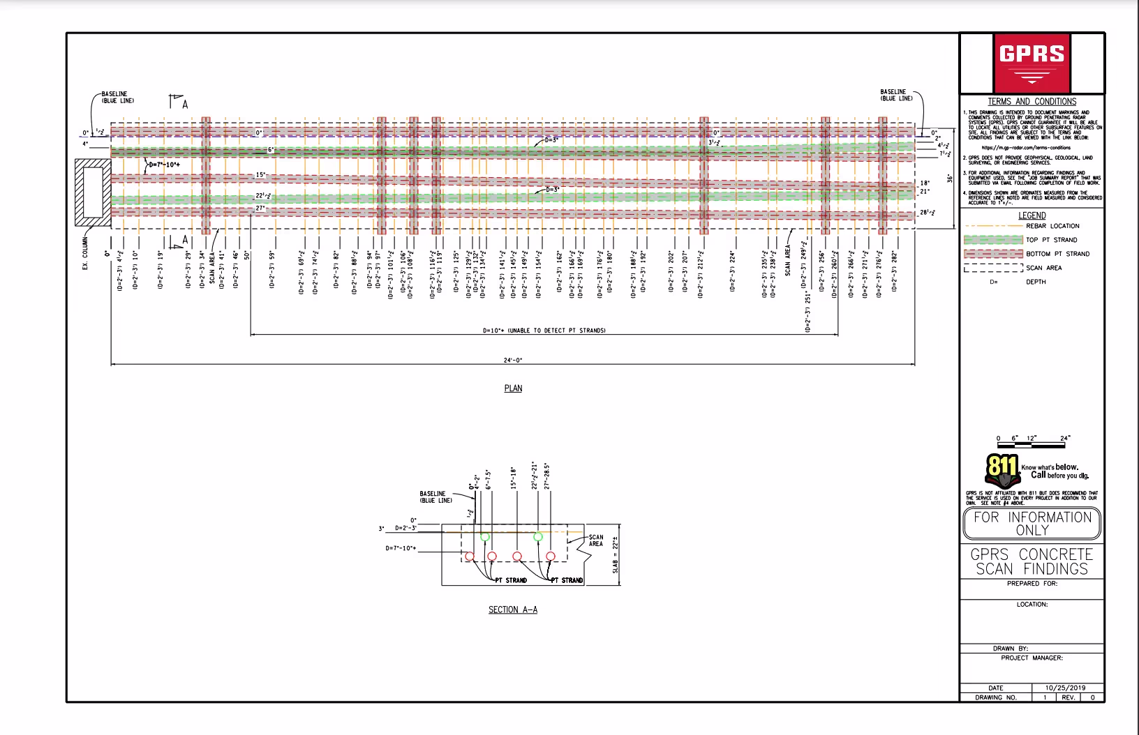
Concrete Analysis
Advanced concrete scanning analysis can be completed by processing GPR data to 2D CAD drawings, including void processing, slab thickness, and rebar depth.
Deliverable: 2D CAD PDF

3D or 2D CAD Reinforcement Locate
GPRS creates 2D CAD of the concrete marking captured in the virtual tour or point cloud. We annotate and overlay the clients' drawings if available. If current plans do not exist, a floor plan will be created using the exports available in the virtual tour processing system we utilize, that is also included in this CAD service offering. Further development of the data into 3D models of the project can be created per the client’s specification for additional fees.
Deliverable: DWG and/or DGN CAD Files, JPEG files of floor or ceiling, 2D CAD PDF, point cloud, 3D BIM model, and/or 3D mesh files.

3D Virtual Tour
GPRS can implement 3D Cameras or 3D Laser Scanners at your site to document all the interior findings. GPRS uses these cameras to create a floor plan of your site with our results added as linework, or to create 3D views and point clouds. Our 3D virtual tour utility lets your team tour the location, add digital notes, and even measure inside the point cloud viewer.
Deliverable: 90 day access to the virtual tour site (this access can be extended as needed).
Hand Sketch to 2D or 3D CAD
The GPRS Mapping & Modeling Team can translate field markings into a permanent digital record of our findings. Our CAD files document the vertical and horizontal positions of reinforcements. We can even overlay the existing floor plan with our data. This information management ensures that scan results are well-documented and can be utilized long after the concrete scan is complete.
Deliverable: DWG and/or DGN CAD files, background image JPEG files, and a PDF plan print out of the CAD sheets.