

.svg)
The architecture, engineering, and construction industries have used photogrammetry to obtain accurate building and site measurements for many years. The 3D rendered images from cameras, laser scanners, or drones allow project teams to document accurate as-built site details and the progress of construction work. These images can be used to create virtual tours, floor plans, 3D models, and more for planning, analysis, and calculations.
When you break down the word photogrammetry – “photo” refers to light, “gram” means drawing, and “metry” refers to measurements. Photogrammetry uses photos to gather measurements from which drawings, maps, and models can be created.
What is Photogrammetry?
Photogrammetry is the process of capturing images and stitching them together (rectifying them) to create a digital model of a structure or site for visualization and analysis. It is a fast way for architecture, engineering, and construction teams to document accurate as-built site conditions.
Triangulation is the principle used by photogrammetry to produce three-dimensional coordinates. By mathematically intersecting converging lines in space, the precise location of a point can be determined.
Photogrammetry uses a 3D camera, which can also be equipped with LiDAR, to digitally document buildings, facilities, and sites with high-resolution photographs. Cameras or LiDAR sensors can be fixed on a tripod, attached as a wearable device, flown via aerial drone, or even affixed to a crane for an aerial view of the site. 4K HDR photographs are taken from different positions and angles to capture a 360° view of the site. LiDAR technology captures three-dimensional site coordinates (x,y,z) in the form of a point cloud.
The photographs and point clouds captured with photogrammetry can be used to create digital twins, virtual tours, floorplans, 2D CAD plan views, 3D models, digital terrain models, and more. The data captured provides clients enough spatial detail to accurately measure depths and distances from one point to another. The point cloud can be used to create a building information model (BIM) or for geographic information system (GIS) data generation and visualization.
3D laser scanners and photogrammetry are both valuable tools for capturing 3D data of an environment. A 3D laser scanner uses LiDAR technology to capture data, while photogrammetry uses cameras to capture images. Both technologies can deliver as-built data; however, they differ in their price, accuracy, and applications.
The choice between LiDAR and photogrammetry depends on the project, with LiDAR being more suitable for applications that require high accuracy and precision, while photogrammetry is more suitable for applications that require a high level of detail and portability.

GPRS Photogrammetry Services
GPRS Photogrammetry Services capture architectural, structural, and MEP system details, plus utility locates and concrete markings with 20-millimeter accuracy. 3D photogrammetry delivers GPRS’ clients precise spatial data for planning, analysis, and calculations. Clients can extract geometric information from the two-dimensional images.
Overlapping photographs can be rectified to create digital twins, floor plans, virtual tours, meshes, 3D models and topographical maps. This precise data aids in project planning, execution, and ongoing maintenance.
What are the Benefits of Photogrammetry?
- Permanent record of existing conditions
- Fast 2D and 3D data collection
- Accurate virtual models of physical assets, structures, and systems
- Digital twins and virtual site tours
- Eliminates the need for site revisits
- Minimal disruption to environment
- Saves time compared to conventional ground surveys
- Non-intrusive and cost effective
- Expedites decision making, increasing project efficiency

GPRS Photogrammetry Add-On Services
WALKTHRU 3D | VIRTUAL TOURS
Get existing conditions and area measurements in real time with 3D photogrammetry via WalkThru 3D. GPRS can provide immersive 3D virtual tours that allow you to walk your team, designers, and stakeholders remotely through your site or facility to eliminate travel and streamline communications and collaboration for geographically scattered organizations. WalkThru 3D allows you to visualize your site, identify potential issues, and make informed decisions without the need for physical presence.
FLRPLN
The GPRS Mapping & Modeling Team can take the rectified, real-time 3D photogrammetry from WalkThru 3D and create an accurate plan view of your project for planning, design, and risk mitigation purposes. A floor plan can also help identify potential hazards, develop emergency action procedures, safety protocols, and train personnel on site-specific procedures.
PROCAP
Capture your construction progress from start through completion with ProCap Progressive Capture. GPRS can capture locations of concrete reinforcements pre-pour, MEP installation progress, provide accurate timelines for stakeholders, and key milestone completions to avoid clashes, change orders, and streamline communications. By capturing scans regularly, clients can track the evolution of the site, monitor construction milestones, and ensure that work is proceeding according to schedule.
TRUBUILT
Eliminate outdated and inaccurate as-builts for your existing construction conditions in real time with 2D CAD plan views of your site or facility infrastructure, above and below ground, to break down information silos and collaborate with comprehensive, layered, data. TruBuilt as-builts can serve as comprehensive documentation for reference, maintenance, and renovation projects.
POINT CLOUD
A point cloud is an E57 file that contains a high-density point cloud, panoramic images, and metadata from each scan location. The E57 file can be used in a range of applications by architects, MEP engineers, general contractors, mechanical engineers, electrical engineers, BIM managers, VDC managers, and other construction professionals who need a higher density point cloud.
3D BIM MODEL
The GPRS Mapping & Modeling Team can generate a standard detail 3D BIM model (building information model) from the photogrammetry point cloud data. A 3D BIM model encompasses not only geometry and spatial relationships; it can also document building features, specific information about the type of materials used, the quantity used, and how those characteristics impact the building as a whole. BIM can be thought of as a database of information: helpful in determining project materials and cost, documenting the site after construction, and facilitating operations of the facility. This information can be used to actively manage a project every step of the way.

What are Some Use Cases for Photogrammetry in Construction?
CONSTRUCTION & RENOVATIONS
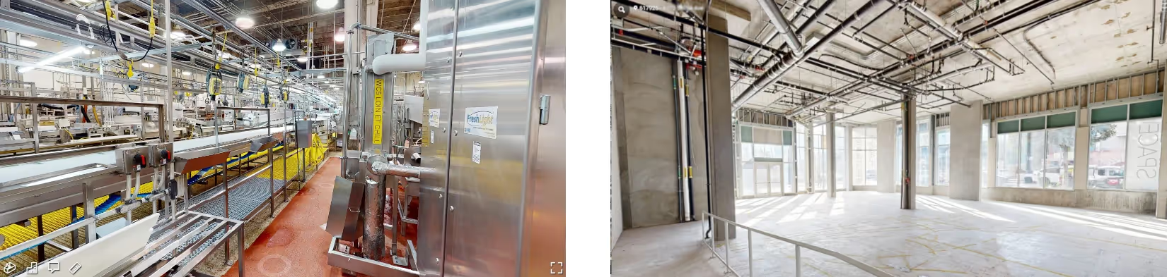
Remove guess work from construction and renovation projects by providing architects, engineers, contractors, and trades with accurate 3D photogrammetry of sites, structures, MEP, and the surrounding environment. Utilize site floor plans & dimensions, utility & concrete markings, and more. You won’t have to guess about measurements, where to cut, anchor, or tie into a utility line, you’ll know. Teams can also evaluate site access options for equipment during construction.
PLANNING & DESIGN
Compare the as-built conditions with the design plan to ensure precise planning and promptly address deviations. Avoid mistakes and inaccurate measurements that lead to costly change orders, reworks, and delays by referencing 3D photogrammetry that can be accessed by AEC professionals and stakeholders on-site or across the country, to ensure accuracy and facilitate collaboration.
CONSTRUCTION PROGRESS
By capturing images of a construction site at regular intervals, photogrammetry can track the progress of construction over time. Project managers can ensure that construction is on schedule and identify any potential issues early on.
FACILITY MANAGEMENT
Photogrammetry delivers accurate information of facility infrastructure and assets, allowing teams to verify dimensions, view the positioning of equipment, pipes, and conduits for management and planning.
ESTIMATING
Estimate construction takeoffs by providing the estimator a breakdown of all the components required to complete a construction project.
WORK COMPLETION & CHANGE ORDER APPROVAL
Verify completed work, approve change orders, take rough measurements to help avoid reworks, and keep your team’s workflow moving – whether your team is on-site with you, or spread across the U.S.
SITE WALKS
Give stakeholders, contractors, designers, and trades a complete virtual tour of your site or facility that can capture as-built details, survey marks, excavation, utilities, paving, concrete work, and more prior to your build. After the work is complete, GPRS can create an updated WalkThru 3D tour to allow your stakeholders, potential tenants or buyers, and others to walk through the finished project.
EMERGENCY PLANNING & RESPONSE
Emergency preparedness is a vital part of risk mitigation for any site or facility. WalkThru 3D provides a realistic emergency response guide to train those on site and act as a resource for first responders. GPRS can add video, URL, and text tags with additional information to your virtual tour so that users can prepare and practice more effectively.
GPRS can create a plan view of your WalkThru 3D Tour with FLRPLN. FLRPLN provides an accurate floorplan layout you can use to create emergency plans, and map features and escape routes. You can then export, save, and print your FLRPLN to utilize as part of your emergency planning.
What Industries Use Photogrammetry?
Photogrammetry can be used in many industries: construction, civil engineering, structural engineering, military intelligence, agricultural, telecom, public safety, and more.
- Construction – By using photogrammetry to capture detailed images of existing buildings or sites, architects, engineers, contractors, and trades can create 2D floor plans, 3D models, and virtual tours that accurately represent real-world conditions for design, analysis, and visualization.
- Civil Engineering – Photogrammetry documents the terrain to plan for urban development, design roads, highways, water and sewage systems, power transmission lines, airports, and more.
- Structural Engineering – Highly accurate rectified photogrammetric images and models allow engineers to assess a site and plan for construction projects.
- Telecommunications – Photogrammetry around a telecommunications tower can provide all the data necessary to create a digital twin. Engineers can utilize the data to check installations and equipment on the tower, identify misaligned antennas, and share their instructions with engineers who can clearly see what should be done and where.
- Military – For the military, photogrammetry can turn aerial imagery into accurate 3D surface maps in real time without any human oversight.
- Agricultural – Photogrammetry can be used to create 3D maps of fields to monitor crop health, analyze soil conditions, and optimize farming practices.
- Cultural Heritage & Preservation – Photogrammetry is used to create 3D models of historical sites, artifacts, and monuments for preservation, research, and virtual tours.
- Film & Entertainment – The entertainment industry relies on 3D models from photogrammetry for building virtual environments for mixed reality, games, and movies. 3D modeling can help bring the planned virtual worlds like cities and other historical places to life with accurate measurements.
- Real Estate – Drones equipped for photogrammetry have been used by many real estate agents to create an accurate image of the properties that they want to sell or rent.
- Forensics & Accident Investigation – Photogrammetry is used to reconstruct crime scenes or accidents to analyze events and gather evidence.
- Archaeology – Overhead photogrammetry provides an opportunity to map surfaces to understand the structures and layout on an archaeological or excavation site.
Why Choose GPRS? The GPRS Difference.
GPRS offers a wide range of photogrammetry, LiDAR, 3D laser scanning, and visualization services. Each GPRS Project Manager works closely with each client to define the project scope and use the right tools to accurately map and model each project.
GPRS Project Managers are required to complete industry-leading Subsurface Investigation Methodology 101 certification before performing field services on your job site. Every Project Manager completes 80 hours of classroom training and 320 hours of field mentoring to achieve 101 certification.
GPRS ensures you have all the information you need to get the job done right, delivering accurate as-built data to expedite project planning and reduce change orders, delays, and costs.
There are advances daily in the applications for photogrammetry. High resolution cameras, drones, and LiDAR laser scanners continue to advance this technology and offer services for many industry needs.
What can we help you visualize?
Frequently Asked Questions
What is 3D Laser Scanning?
3D laser scanning uses LiDAR technology to capture as-built documentation for existing buildings or sites. Once data is acquired, a point cloud is generated and used to develop 2D CAD drawings or 3D BIM models, expediting the design, planning, and development of projects.
What is LiDAR?
LiDAR stands for Light Detection and Ranging. It is a remote sensing technology that uses lasers to measure the distance between the sensor and the target. A laser scanner's sensor emits a laser beam and it measures the time it takes for the beam to bounce back off an object. By repeating this process many times, a LiDAR laser scanning system can create a 3D point cloud that represents the shape and location of every object in the environment.
What are the benefits of as-built drawings?
As-built drawings typically include precise measurements, locations of structural elements, utilities, and other essential features of the completed project. These drawings serve as a reference for future maintenance, renovations, or alterations, providing an accurate representation of how the building was constructed.