.svg)
The standard for most utility locating jobs and travel directions from your cell phone, GPS, with a satellite variance of 2-4 meters, is adequate to get you where you’re going, and has done a fair-enough job of keeping excavators from striking a gas, water, or fiber line.
But as our subsurface infrastructure becomes more complex, greater accuracy is needed, especially when considering the explosion in directional boring utilizing trenchless technology.
Enter RTK – Real-Time Kinematic Positioning.
What is RTK?
Real-time kinematic positioning is not technology, per se, but it is a protocol that utilizes existing GNSS (global navigation satellite system) tech in a new way to provide accuracy within centimeters for geospatial location. RTK improves the accuracy of a GNSS roving receiver by running a series of algorithms to correct for errors in satellite positioning. That is why GPRS is adopting RTK as the standard operating protocol for all GPRS Project Managers and Field Team, to ensure the highest degree of utility location possible for our customers.
This technology has been around since the mid-1980s as an idea developed by Benjamin Redmondi, to provide “positional accuracy that is nearly as good as static carrier phase positioning, but faster.”
Also known as differential GNSS, it was first used as an application in the mid-1990s and has gained in popularity since in a variety of industries.
How does RTK work?
Many global navigation satellite system receivers have an RTK mode which allows them to check satellite positioning data in real time to correct errors for a more accurate locate.
The GNSS receiver does this by comparing a code from the satellite to an internally generated code from the receiver itself. When the spatial difference between the two codes is multiplied by the speed of light, it equals the distance for the correction.
The basic equation looks something like this:
[a – b] x c = distance
Where a and b are the two codes and c is the speed of light.
Not All GNSS Receivers Are the Same
Not all GPS and GNSS receivers have RTK mode, and some require additional fees to allow real-time corrections, so it’s important to make sure your receivers have the ability to correct in the field prior to deployment.
Rovers also come in single-band and multi-band varieties, each with different capabilities.
Single-band devices usually can only collect satellite data from the L1 frequency. Multi-band units can collect on L1, L3, and sometimes even L5. Multiple frequencies mean the unit can receive multiple signals, allowing it to access more satellites. The more satellites available to compute with, the better the odds become of factoring out signal interference coming from tall adjacent buildings, other obstacles, and reflected signals, all of which can muddy precise position coordination.
Typically, a multi-band GNSS device can access GPS (American), Galileo (European), GLONASS (Russian), and Beidou (Chinese) satellite constellations simultaneously.
The roving receiver cannot be used as a stand-alone device. RTK calculations require two parts, the base station, which sits in a fixed position, and the roving receiver, which is either carried or affixed to another piece of equipment, like a truck, so it can be moved easily.
The Role of The Base Station in RTK
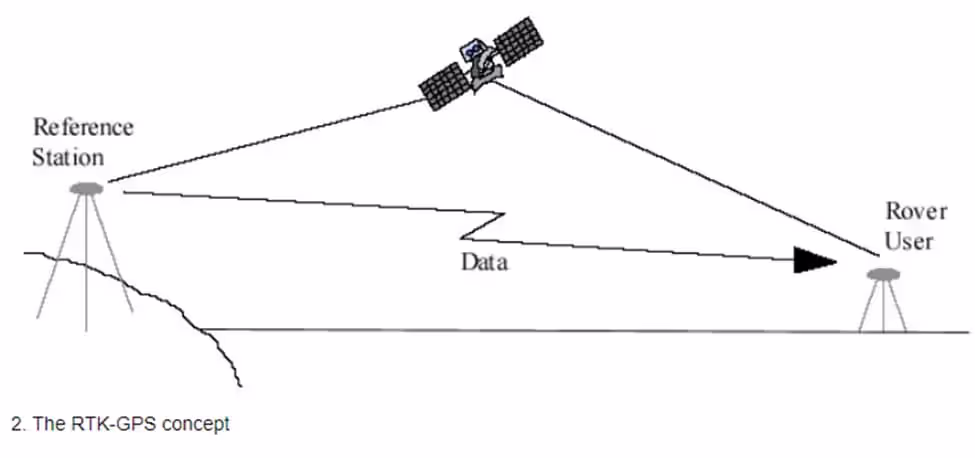
The diagram above provides a very simple depiction of how RTK functions.
The base station must be placed in a location that has been accurately verified based on GPS and/or survey/computer information. The base station calculates the same type of satellite v. internally generated codes and instantly computes any measurement error. Those errors are then sent to the roving receiver, which uses those corrections to update its own position computations to achieve centimeter precision.
Or, as GPRS SiteMap® Market Segment Leader and engineer Matt Mikolajczk puts it,
“The accuracy can be as good as sub-inch or sub-centimeter in the right conditions.”
Communication between the rover and the base station occurs via NTRIP (Network Transport of RTMC by Internet Protocol), which for most people just means “over the internet,” or RTMC (Radio Technical Commission of Maritime Services), also known as LoRA radio communications.
This communication occurs in a fraction of a second, and a single base station can send corrections to multiple rovers, so it is possible to get hyper-accurate real-time positions of multiple locations at once.
It is often possible to find a free, state-funded base station to make the necessary corrections for your GNSS device. If there is not a free option available, there are commercial base station services that allow the user to pay an access fee or subscription to access a base station.
Configuring a base station requires specialized knowledge and the ability to configure the station manually, so it is often both training and cost-prohibitive to deploy them for private use.
How Fast is RTK?
RTK makes its calculations and corrections in milliseconds, so it truly is as close to “real-time” as you can get.
In fact, this ability has led technology providers, like Leica, to experiment with providing nationwide RTK networks. And, for its potential use profile to expand into ever more precise dynamic control and guidance systems.
A raft of scientific papers have explored the use of RTK in guidance systems for the construction industry – specifically in piloting excavation and earthmoving equipment that require expert human control.
“Roberts et al. at Nottingham University, United Kingdom successfully demonstrated that it is possible to work with high precision in several millimeters or less using the RTK (real-time kinematic) GPS (global positioning system) technology applying an earth-moving machinery. He attached two GPSs to a bulldozer blade and one to a cabin to measure the position of cabin and blade, and measured the height accuracy of the GPSs as blade moved by raising or lowering the blades from 0 mm to a height of 100 mm. Finally, he measured the height using GPS as well as the laser and digital leveling sensors to compare the height accuracies of the sensors.” – G.W Roberts, A.H Dodson, V Ashkenazi, “Global Positioning System Aided Autonomous Construction Plant Control and Guidance,” Automation in Construction, Volume 8, Issue 5.
KOMATSU, Leica, and Trimble Corporation, among others, are all experimenting with or applying RTK in a number of industries that require a heightened level of precision.
Applications for RTK
RTK is already used in a wide variety of applications like
- Surveying & Mapping
- Precision Agriculture
- Construction & Excavation
- Autonomous Vehicles (drones & automobiles with self-driving mode)
- Search and Rescue Operations
How does GPRS use RTK?
When a GPRS Project Manager is in the field, they can usually achieve a 1-2 ft. variance for utility locates & utility mapping without RTK. With good visibility, that variance can be well under one foot, but in highly congested areas, it can be well above two feet.
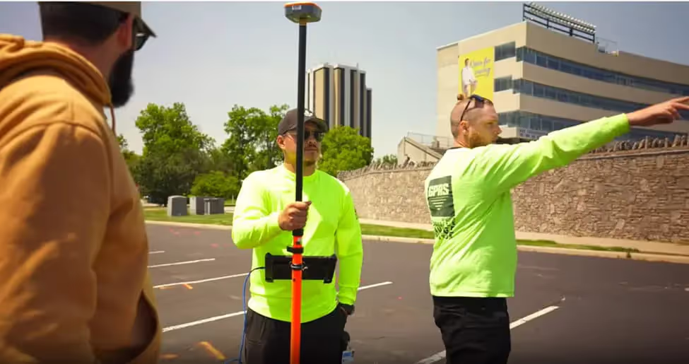
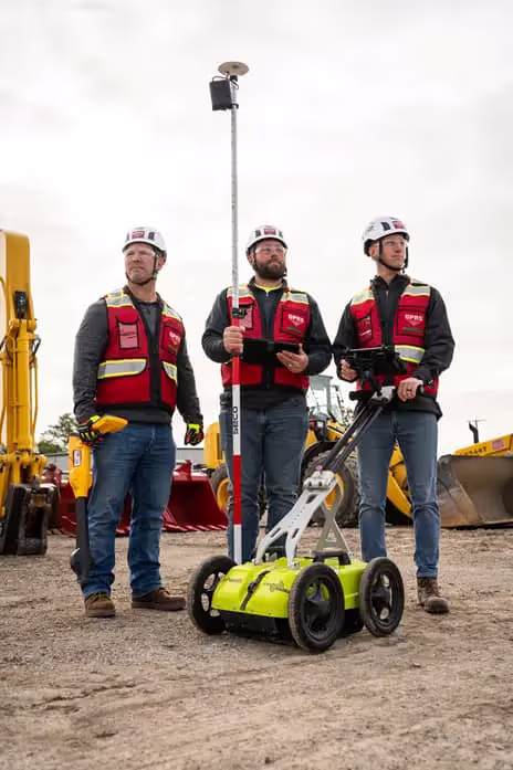
That's why, now, every GPRS Project Manager is equipped with GNSS devices; either a GNSS Geode or our proprietary GeNiuSS iQ device. So, we can utilize RTK to achieve a greater degree of accuracy.
Our accuracy rating is 99.8%+ on over 500,000 jobs and counting.
And when we utilize 3D photogrammetry or 3D laser scanning in conjunction with an RTK-powered utility locate, when using pre-established survey control points, it is our most accurate method of pinpointing utilities and other features.
However, it is important to remember that while GPRS utility locates are accurate enough to support QL-B SUE requirements, we are not a survey company and do not perform SUE ourselves.
All GPRS utility maps, models, and drawings, as well as complimentary .KMZ and PDF files are delivered to our customers via SiteMap®, our new infrastructure mapping and facility management application. Every GPRS customer receives a complimentary SiteMap® Personal subscription as part of their package.
What are the Limitations of RTK?
Line of Sight:
The biggest drawback to the expanse of RTK in the field is the need for clear line of sight between the base unit and the rover. Tall buildings, traffic, and even trees can pose obstacles to its use.
Network Stability:
A clean, steady connection is required among the satellite, base station, and rover, which means spotty cellular service or network issues can degrade RTK’s efficacy.
Cost:
RTK systems are more expensive to purchase and operate than their simpler GPS counterparts, which can be a barrier to use for some. The cost for a new RTK unit ranges from $2,000 to over $15,000 per unit, depending on features and needs.
A Note on RTK Utility Locating Data Overlaying Traditional Satellite Imagery
One surprise that we have to educate many of our customers on is the differential between traditional GPS satellite imagery, like Google Earth, for instance, and the significantly higher degree of accuracy achieved with RTK.
Because RTK's geolocation is more accurate than a standard satellite image, the actual location of your utilities may not line up with where you expect to see them on the map; not because the utilities are mismarked, but because the utility data has been more accurately captured than the satellite image.
RTK has established its efficacy and value in providing pinpoint, centimeter-accurate location data for a variety of industries, and the construction and safety industries are increasingly embracing the technology.
All of GPRS’ 500 nationwide Project Managers are equipped and qualified to provide RTK locates for projects large and small. It’s part of how we Intelligently Visualize The Built World® for our customers.
What can we help you visualize?
Frequently Asked Questions
What are "survey grade" measurements in the context of GNSS RTK, and why are they important in the construction industry?
In the construction industry, "survey grade" measurements refer to the highest level of accuracy and precision achieved using surveying equipment, typically within a few centimeters or millimeters. GNSS RTK (Global Navigation Satellite System Real-Time Kinematic) technology can provide survey grade measurements by utilizing real-time corrections to satellite signals, ensuring that the positioning data is highly accurate. Survey grade measurements using RTK are essential for achieving the precision required in modern construction projects to ensure safety, compliance, and efficiency.
It is important to note that while GPRS can support SUE QL-B survey standards, we are not surveyors, nor do we conduct SUE.
What are some best practices for using RTK in construction projects?
To maximize the benefits of RTK, it's important to follow best practices, such as:
Proper Setup: Ensure the base station or correction service is correctly set up and calibrated for accurate reference data.
Equipment Calibration: Regularly calibrate and maintain GNSS equipment to ensure precision.
Clear Line of Sight: Position the GNSS receiver with a clear line of sight to the sky to avoid signal blockages.
Data Management: Implement robust data management practices to handle and store the precise positioning data effectively.
Training: Provide adequate training for personnel on how to use GNSS RTK technology and interpret the data accurately.