

.svg)
What is a LiDAR Point Cloud?
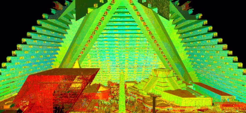
Point cloud data is the term used to refer to the data points collected for a given geographical area, terrain, building, or space. A LiDAR point cloud dataset is created when an area is laser scanned using LiDAR, or light detection and ranging. The dataset contains the X, Y and Z coordinate of every visible detail of the project site. To visualize the project, point cloud data is imported into CAD software. Once imported, it can be parsed, manipulated, and modified to aid in visualization, design, engineering, and construction projects.
How is a point cloud created?
There are two primary tools that can be used to capture a point cloud: laser scanners and photogrammetry.
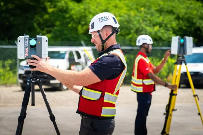
A laser scanner captures point clouds with the highest accuracy. This process is completed by a trained technician to ensure proper collection of data and correct scanning methods. GPRS uses Leica professional-grade laser scanners, NavVis mobile mapping scanners, and the Matterport Pro 3 to capture complete point cloud data.
To generate a point cloud with photogrammetry, cameras capture the space from all angles, and images would be processed with specialized software to reconstruct the space in 3D. Read more about laser scanning equipment.
Why is a point cloud important?
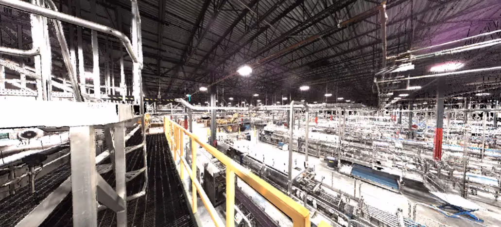
Point clouds provide powerful and dynamic information for a project. By representing spatial data as a collection of coordinates, point clouds deliver large datasets that can be mined for information. The visualization and analysis from point cloud data is invaluable for decision making. CAD technicians transform point clouds into customized deliverables used for visualization, analysis, design, construction, renovation, prefabrication, and facility modifications.
How much time does it take to create a point cloud?
It depends on the project scope. Most projects can be laser scanned in a couple of hours, or larger sites in a few days. After the scan is complete, the data must be registered and can be uploaded to the client. This process can take 2-3 days. 2D CAD sheets and 3D BIM models can be created from the point cloud data. This will take additional time from experienced CAD designers. Contact GPRS to receive a project estimate.
Can a point cloud be created in color?
Data can be captured in intensity (RGB), greyscale (black and white) and full color. Colorized point clouds combines the benefits of a photo (or photogrammetry) with the precision of laser scanning. To complete a full color laser scan, the building or site must have good lighting. Read about the benefits of scanning in color.
How is the point cloud processed?
Registration is the process of compiling individual scans into a cohesive point cloud. It involves taking the raw scan data collected onsite and “stitching it together” to produce a complete 3D composite point cloud of the existing conditions. Getting the registration right ensures the most accurate measurements, 2D drawings, and 3D models. This is an important part of the process, and must be completed by an experienced individual. Once complete, the registered point cloud provides accurate documentation of the as-built space with millimeter accuracy. Read more about the importance of registration.
What formats are point clouds delivered in?
There are many file formats and each one has particular strengths and weaknesses depending on the method of capture and software used. Different scanners produce raw data in multiple formats, and each piece of software has different exporting capabilities. Popular formats are .PTG or .E57 point cloud files and Autodesk Recap files in .RCS and .RCP format.
What deliverables can be created with point cloud data?
To create advanced deliverables, data is imported into a CAD/BIM software, such as Autodesk, where the data is turned into 3D solids and surfaces. The process of transforming point clouds into 3D models or digital twins takes time and requires an experienced CAD technician. Custom deliverables, such as 2D drawings and 3D models, can be provided at any level of detail. Read more about laser scanning deliverables.
What industries use point cloud data?
Point cloud data has become the new standard for the architecture, engineering and construction industry. Having a virtual model of the project gives companies the ability to effectively plan, design, construct, and manage projects. Point cloud data aids in analysis, design, construction sequencing, renovation, prefabrication, asset management, and facility modifications to name a few. Precise point clouds expedite design planning and reduce project costs and change orders.
How GPRS uses point clouds
GPRS (Ground Penetrating Radar Systems), the nation’s largest private utility locating company, provides 3D laser scanning services that capture registered point clouds of existing facilities, structures, and sites. GPRS Project Managers deliver point cloud data in standard formats compatible with Revit, AutoCAD, Navisworks, and other design platforms, supporting as-built documentation, BIM model creation, and existing conditions surveys. All deliverables are stored in SiteMap®, GPRS’ secure infrastructure management platform, giving project teams a permanent, accessible record of existing conditions.
A point cloud is a powerful tool that provides a detailed and accurate 3D representation of objects and environments. They are created using devices like 3D scanners, LiDAR sensors, or photogrammetry techniques and can be delivered in various formats. Point clouds are used across a wide range of industries and can be used to create a variety of deliverables, from 3D models to floor plans and VR environments.
Contact GPRS to request a quote or schedule a service.