industry insights
Featured Articles
Why Do You Need Updated As-Builts on Your Next Project?
Is Utility Mapping Worth the Cost?
10 Keys to a Successful Preconstruction Phase
The preconstruction phase is a crucial period in any construction project, laying the groundwork for successful execution and completion. This phase involves meticulous planning, coordination, and evaluation to ensure that the project progresses smoothly and stays within budget and schedule.
Here are 10 key elements to ensure a successful preconstruction phase:

Initial Concept and Feasibility Study
The preconstruction phase begins with the initial concept and feasibility study. During this phase, the project idea is conceptualized, and its viability is assessed. This involves several key activities:
- Stakeholder Meetings: Engage with stakeholders, including clients, investors, and potential users, to understand their needs and expectations
- Preliminary Design Concepts: Develop initial design concepts and architectural sketches to visualize the project
- Feasibility Analysis: Conduct a feasibility analysis to evaluate the project’s economic, technical, and legal aspects. This includes assessing site conditions, zoning regulations, and potential environmental impacts
- Budget Estimation: Estimate the preliminary budget to determine if the project is financially viable
Site Analysis and Selection
Once the project concept is deemed feasible, the next phase involves site analysis and selection. Choosing the right location is critical to the success of the project. Key activities in this phase include:
- Site Visits and Surveys: Conduct site visits and topographical surveys to gather information about the site's physical characteristics, soil conditions, and existing infrastructure
- Environmental Assessments: Perform environmental assessments to identify potential issues such as contamination, flood risk, and wildlife habitats
- Site Acquisition: Negotiate and finalize the acquisition or lease of the selected site
- Permitting and Zoning Compliance: Ensure that the site complies with local zoning regulations and obtain necessary permits
Design Development
The design development phase is where the project starts to take shape. This phase involves refining the initial design concepts and creating detailed plans and specifications. Key activities include:
- Architectural Design: Develop detailed architectural drawings, including floor plans, elevations, and sections
- Engineering Design: Collaborate with structural, mechanical, electrical, and civil engineers to create comprehensive engineering plans
- Material Selection: Choose appropriate materials and finishes that meet the project’s aesthetic and functional requirements
- Value Engineering: Conduct value engineering to identify cost-saving opportunities without compromising quality and functionality
- Sustainability Planning: Integrate sustainable design principles and technologies to minimize the project’s environmental impact
Budgeting and Cost Estimation
Accurate budgeting and cost estimation are essential to keep the project financially on track. This phase involves:
- Detailed Cost Estimation: Develop a detailed cost estimate based on the refined design and specifications
- Contingency Planning: Include contingencies for unforeseen expenses and risks
- Cost Control Measures: Implement cost control measures to ensure the project remains within budget
Scheduling and Timeline Development
Creating a realistic and detailed project schedule is crucial for timely completion. This phase includes:
- Work Breakdown Structure (WBS): Develop a WBS that breaks down the project into manageable tasks and activities
- Gantt Charts: Create Gantt charts to visualize the project timeline and dependencies between tasks
- Milestones and Deadlines: Establish key milestones and deadlines to monitor progress
- Resource Allocation: Allocate resources, including labor, equipment, and materials, to ensure a smooth workflow
Procurement Planning
Procurement planning involves identifying and sourcing the necessary materials, equipment, and services for the project. Key activities in this phase include:
- Vendor Selection: Identify and select reliable vendors and subcontractors
- Request for Proposals (RFPs): Issue RFPs and evaluate bids from suppliers and contractors
- Contract Negotiation: Negotiate and finalize contracts with selected vendors and subcontractors
- Material Procurement: Ensure timely procurement of materials and equipment to avoid delays
Risk Management and Mitigation
Identifying and mitigating potential risks is crucial to prevent disruptions during the construction phase. This phase involves:
- Risk Assessment: Conduct a comprehensive risk assessment to identify potential risks and their impact on the project
- Risk Mitigation Strategies: Develop and implement risk mitigation strategies to minimize the impact of identified risks
- Contingency Planning: Create contingency plans to address unforeseen issues and emergencies
Regulatory Compliance and Permitting
Ensuring compliance with all relevant regulations and obtaining necessary permits is essential to avoid legal and operational issues. This phase includes:
- Permit Applications: Prepare and submit permit applications to local authorities
- Regulatory Approvals: Obtain approvals from regulatory bodies, including building permits, environmental permits, and safety certifications
- Inspections: Schedule and coordinate inspections to ensure compliance with building codes and standards
Stakeholder Communication and Engagement
Effective communication and engagement with stakeholders are critical to maintaining support and addressing concerns. This phase involves:
- Communication Plan: Develop a comprehensive communication plan to keep stakeholders informed about project progress
- Regular Updates: Provide regular updates through meetings, reports, and newsletters
- Feedback Mechanisms: Establish feedback mechanisms to address stakeholder concerns and incorporate their input
Final Preconstruction Review and Approval
Before moving into the construction phase, a final review and approval are necessary to ensure everything is in place. This phase includes:
- Review Meetings: Conduct review meetings with stakeholders to finalize plans and address any outstanding issues
- Final Approvals: Obtain final approvals from clients, investors, and regulatory bodies
- Readiness Check: Perform a readiness check to ensure all preconstruction activities are complete and the project is ready to proceed to the construction phase

GPRS Services Help Ensure Successful Preconstruction
The preconstruction phase is a critical period that sets the foundation for the entire construction project. By meticulously planning and executing each phase, from initial concept and feasibility study to final preconstruction review and approval, project teams can ensure a smooth transition to the construction phase.
GPRS offers a suite of subsurface damage prevention, existing conditions documentation, and construction & facilities project management services designed to keep you on time, on budget, and safe from preconstruction through O&M.
Our SIM and NASSCO-certified Project Managers utilize state-of-the-art locating technologies such as ground penetrating radar (GPR), electromagnetic (EM) locating, and CCTV camera-equipped sewer pipe inspection rovers to locate, map, and ensure the integrity of your buried infrastructure. With 3D laser scanning, we can document everything above and below ground with 2-4mm accuracy. And our in-house Mapping & Modeling Team can take all this data and create the deliverables you need to communicate with your team and your client.
All this field-verified data is at your fingertips 24/7 thanks to SiteMap® (patent pending), GPRS’ project & facility management application that provides accurate existing conditions documentation to protect your assets and people. Accessible via computer, tablet or smartphone, SiteMap® gives you and your team the data you need to plan, design, manage, dig, and ultimately build better.
From skyscrapers to sewer lines, GPRS Intelligently Visualizes The Built World® to keep your projects on time, on budget, and safe.
What can we help you visualize? Click below to schedule a service or request a quote today!
Frequently Asked Questions
What types of concrete scanning are there?
GPRS provides two specific but different scanning services: elevated concrete slab scanning and concrete slab-on-grade locating. Elevated concrete slab scanning involves detecting embedded electrical conduits, rebar, post-tension cables, and more before core drilling a hole through the slab. Performing a concrete slab-on-grade locating service typically involves scanning a trench line for conduits before conducting saw cutting and trenching to install a sanitary pipe, water line, or something similar.
What type of informational output is provided when GPRS conducts a utility locate?
Our Project Managers flag and paint our findings directly on the surface. This method of communication is the most accurate form of marking when excavation is expected to commence within a few days of service.
GPRS also uses a global positioning system (GPS) to collect data points of findings. We use this data to generate a plan, KMZ file, satellite overlay, or CAD file to permanently preserve results for future use. GPRS does not provide land surveying services. If you need land surveying services, please contact a professional land surveyor. Please contact us to discuss the pricing and marking options your project may require.
How Nearshoring Affects Construction Projects
Nearshoring, the practice of relocating business processes to nearby countries, has become a significant trend in various industries, including construction.
Unlike offshoring, which involves moving operations to distant countries, nearshoring offers geographical proximity, often leading to numerous benefits and some challenges.
Advantages of Nearshoring in Construction
Enhanced Communication and Collaboration
One of the primary benefits of nearshoring is improved communication and collaboration. Proximity to the home country often means fewer time zone differences, making it easier to schedule meetings, conduct site visits, and maintain regular contact with teams. This ease of communication helps in resolving issues promptly and ensures that all stakeholders are aligned with the project’s goals and timelines.
Cost Efficiency
Nearshoring can offer significant cost savings compared to domestic operations while avoiding some of the higher costs associated with offshoring to distant countries. Labor costs in nearshore locations are often lower than in the home country but still competitive, offering a balance between cost savings and quality. Additionally, lower transportation and logistics costs due to proximity further enhance cost efficiency.
Access to Skilled Labor
Many nearshore locations boast a skilled labor force, particularly in specialized areas of construction and engineering. Countries such as Mexico, for instance, have a strong pool of skilled workers in construction-related fields. This access to talent can lead to higher-quality work and innovation, contributing to the overall success of construction projects.
Regulatory and Cultural Alignment
Nearshoring to countries with similar regulatory standards and cultural practices can simplify compliance and integration. This alignment can reduce the time and effort required to understand and meet local regulations, ensuring smoother project execution. Cultural similarities also foster better teamwork and understanding, which are crucial in collaborative construction environments.
Flexibility and Scalability
Nearshoring allows construction companies to scale their operations more flexibly. Proximity makes it easier to adjust project scopes, manage resources, and respond to changing demands quickly. This agility is particularly valuable in the construction industry, where project requirements can evolve rapidly.

Potential Drawbacks of Nearshoring
Infrastructure Challenges
While nearshoring offers many benefits, it can also present challenges related to infrastructure. Some nearshore locations may have less developed infrastructure compared to domestic sites, which can impact the efficiency of construction projects. Issues such as unreliable transportation networks, limited access to high-quality materials, and inadequate utilities can pose significant hurdles.
Legal and Regulatory Differences
Although nearshore locations may have regulatory similarities, differences still exist. Navigating these differences requires careful planning and expertise. Misunderstanding or overlooking local regulations can lead to legal issues, project delays, and additional costs. Therefore, construction companies must invest in local legal expertise to ensure compliance.
Political and Economic Stability
The political and economic stability of nearshore countries can significantly affect construction projects. Unstable political environments or economic fluctuations can lead to disruptions, increased costs, and uncertainties. Companies need to conduct thorough risk assessments and develop contingency plans to mitigate these risks.
Quality Control
Maintaining consistent quality across borders can be challenging. While nearshore locations may offer skilled labor, ensuring that all work meets the desired standards requires rigorous quality control measures. Construction companies must implement stringent oversight and quality assurance processes to uphold the integrity of their projects.
Impact on Project Management
Project Scheduling
Nearshoring can positively impact project scheduling by reducing delays associated with long-distance travel and time zone differences. Regular site visits, meetings, and inspections can be conducted more efficiently, ensuring that projects stay on track. However, it’s crucial to account for any potential delays due to local holidays or other region-specific factors.
Risk Management
Nearshoring necessitates robust risk management strategies. Companies must evaluate political, economic, and environmental risks associated with nearshore locations. Developing comprehensive risk mitigation plans, including contingency measures and insurance, is essential to safeguard against unforeseen events.
Resource Allocation
Efficient resource allocation is critical in nearshoring construction projects. Proximity allows for better coordination of materials, equipment, and labor, reducing lead times and costs. However, companies must ensure that local resources meet quality standards and are available when needed.
Stakeholder Engagement
Effective stakeholder engagement is vital for the success of nearshore construction projects. Regular communication with clients, local authorities, subcontractors, and suppliers is necessary to align expectations and address any issues promptly. Building strong relationships with local stakeholders can also facilitate smoother project execution.
Case Study: Nearshoring in the U.S.-Mexico Construction Corridor
The U.S.-Mexico construction corridor serves as an exemplary model of nearshoring in action. Many U.S. construction companies have established operations in Mexico to leverage the country’s skilled labor, cost advantages, and proximity. This nearshoring strategy has led to numerous successful projects, particularly in the commercial and residential sectors.
Benefits Realized
- Cost Savings: Significant reductions in labor and logistics costs have been achieved
- Improved Collaboration: Proximity has facilitated better collaboration between U.S. and Mexican teams
- Regulatory Compliance: Similar regulatory frameworks have simplified compliance processes
Challenges Faced
- Infrastructure Limitations: Some projects have encountered challenges related to local infrastructure
- Political Risks: Fluctuating political relations between the U.S. and Mexico have introduced uncertainties
Nearshoring presents a compelling strategy for construction projects, offering enhanced communication, cost efficiency, access to skilled labor, and regulatory alignment. However, it also poses challenges such as infrastructure limitations, legal complexities, and political risks. By understanding and addressing these factors, construction companies can harness the benefits of nearshoring to achieve successful project outcomes.
Effective project management, robust risk mitigation, and strong stakeholder engagement are essential to navigating the complexities of nearshoring. SiteMap® (patent pending), powered by GPRS, is project & facility management application that provides accurate existing conditions documentation to protect your assets and people. It’s a single source of truth, housing the 99.8%+ accurate utility locating, concrete scanning, video pipe inspection, leak detection, and 3D laser scanning data our Project Managers collect on your job site.
GPRS SiteMap® team members are currently scheduling live, personal demonstrations. Click below to schedule yours and see how SiteMap® can help you plan, design, manage, dig, and build better today!
Frequently Asked Questions
What are the Benefits of Underground Utility Mapping?
Having an updated and accurate map of your subsurface infrastructure reduces accidents, budget overruns, change orders, and project downtime caused by dangerous and costly subsurface damage.
How does SiteMap® assist with Utility Mapping?
SiteMap®, powered by GPRS, is the industry-leading infrastructure management program. It is a single source of truth, housing the 99.8%+ accurate utility locating, concrete scanning, video pipe inspection, leak detection, and 3D laser scanning data our Project Managers collect on your job site. And the best part is you get a complimentary SiteMap® Personal Subscription when GPRS performs a utility locate for you.
Click here to learn more.
Does SiteMap® Work with my Existing GIS Platform?
SiteMap® allows for exporting of data to SHP, GeoJSON, GeoPackage, and DXF directly from any user’s account that either owns or has a job shared to their account. All these file formats can be imported and utilized by other GIS packages if manually imported by the user. More information can be found at SiteMap.com.
GPRS Focuses on Team Health & Wellness with THRIVE Initiative
When you have a company-wide commitment to excellence and elite customer service, the health and safety of your team needs to be a priority.
Because if your people sacrifice their well-being, they can’t provide the level of service your customers – and your company – expect.
That’s why GPRS puts the health and well-being of every member of our team, from Project Coordinators to Accounting Specialists, to our 500-strong national field team of Project Managers, first. It’s also why GPRS Wellness Coordinator Erin Waggoner created the company’s new health and wellness initiative, called THRIVE.

and overall wellness
THRIVE refers to the desire for all GPRS team members to “Thrive with healthy habits every day.”
Its mission to is to provide team members and their families the ability to “experience positive transformation through accessible education and resources… Empowering them with the five elements of well-being: Physical, Emotional, Financial, Career, and Social, so that GPRS team members will THRIVE.”
The new initiative kicked off with a LinkedIn Live video feed to its first Summer Wellness Workshop event in June, and a second in July, with Dr. Reyna LeVan, a chiropractor and wellness specialist based in Michigan.
June’s workshop focused on physical fitness & stress reduction. A group of more than 40 people took part on-site, and field team members could join via LinkedIn Live to participate flexibility testing learned exercises designed to increase flexibility, balance, and strength.
July’s workshop was also featured on a LinkedIn Live event and focused on nutrition, sleep, and stress reduction.
Waggoner and LeVan, both health subject matter experts and friends, shared how the live event arm of THRIVE has evolved, and what they hope they help GPRS team members achieve.
“My goal is to focus, to do workshops, to do teachings, always have information on the hub, on our wellness page that highlight each of these five aspects,” said Waggoner. “We started with physical and emotional… starting off with these two, I asked Reyna if she could come alongside me, being more of a subject matter expert. We’ve been on the same page for many years, and I’ve learned so much through her practice that I want to share with everyone else.”

Dr. LeVan concurred. “I’m a chiropractor, so that’s my dominant talk, chiropractic and all the other avenues that people can take to impact their health and well-being… So, I geared the first two talks around drills and activities that people can take – and they don’t have to be chiropractic patients – to use in their lives.”
“Last time, we talked about three stressors – physical, emotional, and chemical stress – how to mitigate those and how they affect your body. This time, we did the five aspects of wellness. It’s awesome that you [THRIVE] have five aspects of wellness because mine sort of mimic that. Your nervous system, nutrition, exercise and stretching, your emotions, positive mental attitude, sleep and rest were today’s focus,” Dr. Levan shared.
Why the Focus on Stress?
Stress reduction has become an increasing focus in the construction industry because accident, substance use, and suicide rates continue to climb among contractors and tradespeople. According to the Centers for Disease Control and Prevention, the construction industry had the second highest suicide rate among U.S. workers. And in 2022, the U.S. Bureau of Labor Statistics reported that construction workers suffer more fatalities at work than any other industry.

These alarming statistics have put the issues of mental health and stress front and center as part of Construction Safety Week and prompted some of the industry’s largest general contractors to institute their own wellness initiatives.
One such initiative is Hoffman Construction’s GUTS/Tough Enough to Talk Project that aims to take stress reduction and mental health focus directly onto the company’s jobsites. In reporting earlier this year, one of its founders, Josh Vitale, shared with GPRS that construction workers deal with substance and alcohol issues at almost twice the rate of any other industry.
That’s one of the many reasons Waggoner is passionate about bring wellness into the workplace at GPRS. Human Resources and the company at large have backed her passion by turning the summer events into lunch and learns with buffets of healthy food – most recently including a baked potato bar – and by holding a drawing at each event for gift cards for two lucky participants.
“When you look at all the stressors, all the things that we deal with every day, it's not just here at work. We walk in the door with a whole lot of stuff, a big heavy backpack of things. THRIVE exists to give everyone tools that they can use, they can take back to their family. They can truly use some of these things to create a higher level of wellbeing. And it's for everyone's good,” said Waggoner.
THRIVE is gaining traction among GPRS team members, who seem to feel they have a valuable resource for wellness through their workplace. “A lot of people approached me or sent emails [after an event] because they have more questions,” Waggoner shared. “They want to make changes – they know they need to make changes – most of us do… Right now, it’s just getting the information into the hands of our team members, company-wide, so that’s the goal right now.”
The final installment of GPRS’ Summer Wellness Workshop series will be in August at GPRS’ corporate headquarters in Maumee, Ohio. Dr. LeVan will be discussing how to control your nervous system to switch from sympathetic (fight or flight) to parasympathetic.
“Once people realize how their nervous system works and how to regulate it in a better way on their own, it really ties into emotional well-being. I think people really beat themselves up not realizing why their bodies are doing the things that they’re doing. There’s a lot of emotional trauma stored in our bodies and nervous systems, and we’re helping people understand how to unwind that.”
The THRIVE initiative will continue to hold events surrounding physical, emotional, career, social, and financial wellness throughout the year.
If you’d like to learn more about GPRS and how to become a member of our team, click here.
Brandon Road Interbasin Project Highlights Need for Precision Concrete Scanning
The states of Michigan and Illinois are partnering with the U.S. Army Corps of Engineers on a new project designed to protect the Great Lakes from invasive carp and aquatic nuisance species.
According to a press release issued by the Office of Michigan Governor Gretchen Whitmer, the $1.15 billion Brandon Road Interbasin Project will implement a complex series of invasive carp and aquatic nuisance species deterrents.
The project will receive $274 billion in federal and $114 million in state funding for the first of three phases of work, which will center around the Brandon Road Lock and Dam near Joliet, Illinois, which, according to the press release, is a critical pinch point to stop invasive fish from moving into the Great Lakes.

“Today’s agreement will help us get shovels in the ground as soon as possible on the critical Brandon Road project,” Whitmer said. “The Great Lakes are the beating heart of Michigan’s economy, and Brandon Road will help us protect local communities and key industries, including fishing and boating, that support tens of thousands of good-paying jobs. I am grateful to Governor [J.B] Pritzker in Illinois, the Army Corps of Engineers, and our champions in Congress for their long-term partnerships on this monumental task. Together, we will get the job done so we can protect our lakes and power economic growth for generations to come.”
Invasive carp species such as bighead, silver, and black carp threaten the Great Lakes’ native fish species, such as the lake whitefish, perch, and walleye. Additionally, silver carp are infamous for their ability to leap through the air, posing a health and safety risk to boaters and subsequently reducing the viability of recreational fishing in the areas where this species lives.
Several Great Lakes states and the U.S. Army Corps of Engineers have been working together since 2011 to protect these important bodies of water from invasive species. Below is a brief timeline of some of the highlights from this partnership:
- 2014: The Great Lakes Mississippi River Interbasin Separation Study identified several options for separating the two basins and led to the selection of the Brandon Road Lock and Dam site as the best location to prevent invasive species from entering the Great Lakes.
- 2020: A Planning, Engineering, and Design agreement was signed between Illinois and the U.S. Army Corps of Engineers. Michigan supported Illinois as a nonfederal sponsor and contributed $8 million of the $10.1 million nonfederal funds required.
- 2023: Appropriations in Michigan ($64 million) and Illinois ($50 million) meet the nonfederal requirement to begin construction of the project.
U.S. Congresswoman Debbie Dingell said the Brandon Road Interbasin Project “has been a long time coming and the result of close partnership between many stakeholders...”
“[It] will be pivotal in protecting our Great Lakes from harmful and destabilizing invasive species that threaten the environment, economy, and our way of life,” Dingell added. “I’m proud to have helped secure resources for this project and will continue to work every day to protect our most critical natural resources.”

Successful Concrete Projects Start with Precision Concrete Scanning
Whether you’re renovating – or even demolishing – a dam, or updating a parking structure, safely and successfully working with concrete starts with knowing what’s within that concrete.
GPRS offers a suite of infrastructure visualization services, including 99.8%+ accurate precision concrete scanning to help you avoid rebar, post tension cables, conduit, and any other objects that could be embedded within a slab.
We primarily utilize ground penetrating radar (GPR) scanning to reveal what’s hidden in your concrete. GPR scanners emit radio waves into concrete slabs and detect the interactions between these waves and any subsurface objects to create a readout of hyperbolas that vary in size and shape depending on the type of material detected. GPRS’ SIM-certified Project Managers interpret this data to tell you what was located and estimate its depth within the slab.
SIM stands for Subsurface Investigation Methodology, and it’s the industry-leading training program and process for not only concrete scanning, but also utility locating and sewer pipe inspections. It addresses a step-by-step approach to collecting subsurface data to ensure that the results are repeatable and accurate. SIM practitioners must follow a checklist designed to guarantee optimal results during every concrete scan and utility locate they complete.
Because of our adherence to SIM, GPRS Project Managers have achieved and maintained a 99.8%+ accuracy rate on the over 500,000 concrete scanning and utility locating projects we’ve completed since our founding in 2001.
GPRS’ in-house Mapping & Modeling Team can export the GPR concrete scans completed by our SIM-certified Project Managers to create accurate existing condition as-builts to give you the information you need in a format you can easily work with and share.
From skyscrapers to sewer lines, we Intelligently Visualize The Built World® to keep your projects on time, on budget, and safe.
What can we help you visualize?
Frequently Asked Questions
How is GPR used to identify tendons vs. rebar in a post-tensioned slab?
In post-tensioned structures, we typically find one mat of support rebar near the base of the slab. This mat is generally consistently spaced and remains at a constant elevation. Post tension cables are generally found above this support mat and “draped” throughout the rest of the structure. The elevation of the cable is usually high near the beams and column lines and drapes lower through the span between beams and column lines. Knowledge of these structural differences allows us to accurately differentiate between components. Our Project Managers will leave you feeling confident in our findings and in your ability to drill or cut without issue.
Can GPR determine the difference between rebar and electrical conduit?
Ground penetrating radar can accurately differentiate between rebar and electrical conduit in most cases. We have an extremely high success rate in identifying electrical lines in supported slabs or slabs-on-grade before saw cutting or core drilling.
Additionally, GPRS can use electromagnetic (EM) locators to determine the location of conduits in the concrete. If we can transmit a signal onto the metal conduit, we can locate it with pinpoint accuracy. We can also find the conduit passively if a live electrical current runs through it.
The combined use of GPR and EM locating allows us to provide one of the most comprehensive and accurate conduits locating services available.
Rush of Change: An Expanded View of How AMI Could Help Remake Water Infrastructure
Just forty years ago, nobody would be able to imagine the technology we have today. While many people guessed we’d have flying cars, and magic microwaves that beam down our favorite foods right into our kitchens, nobody could guess what the future would actually hold. While many were right in assuming we’d have video chatting, smart homes, and seamless communication, technology has changed the way we do just about everything. One of these technologies is Advanced Metering Infrastructure (AMI). Originally focused on improving the accuracy and efficiency of water meter readings, AMI's potential extends far beyond its traditional use. By expanding the application of AMI, we can address many of the pressing challenges facing our water infrastructure today. These challenges include resource conservation, efficiency, and even customer engagement. What is AMI, how does it work, and how is it helping to transform the water infrastructure industry?

Understanding AMI
Advanced Metering Infrastructure (AMI) refers to the integrated system of smart meters, communication networks, and data management systems that enable two-way communication between utilities and customers. This infrastructure facilitates real-time data collection and analysis, offering a wealth of information that can be leveraged to improve water management practices. AMI provides countless benefits to water utilities. Along with AMI’s many benefits, it improves a utility’s ability to collect frequent and accurate water usage data to improve billing, leak detection, and water resource management.
Traditionally, AMI has been used to automate meter reading, reducing the need for manual readings and minimizing human error. This has resulted in more accurate billing and better detection of leaks. However, the capabilities of AMI extend far beyond these initial applications.
Just like all equipment, the water meters used by utilities have changed over time. Older technology required that utilities sent technicians to individual sites, such as homes or businesses, to physically read meters. But once the technology changed, meters that allowed for automated meter reading (AMR) became more prevalent and preferred. This provided some savings to utility companies, as meter readers could collect data in simpler ways. As an example, a technician would be able to collect data by driving their truck down a street and remotely getting data from meters nearby. This made it possible for utilities to reduce the staff time needed to read all meters and bill more frequently. Some argue that this also allowed for more accurate readings, reducing bills for some customers, while others argued that meters like this actually raised their bills.
Just as electricity providers replaced their meters, water utilities are striving to do the same. AMI meters provide for remote collection of water use data, in real time. This supports things like more frequent billing, and more importantly it allows a utility company to quickly identify excessive water use that could be the result of leaks. Leaks are a big problem worldwide. According to the U.S. EPA, the average family can waste 180 gallons of water per week, or 9,400 gallons of water annually, all from household leaks. That's enough water to wash more than 300 loads of laundry!
According to IBM, AMI can help utility companies collect a wide range of very important data, including indications of tampering, data collected at set intervals, details regarding power outages and even the quality of electricity supplied. It also offers specific advanced capabilities for endpoints used in electric metering.
Unlike traditional automatic meter reading, the two-way communication model that AMI offers enables more comprehensive data collection. This collection helps companies remotely manage the meter functionality. There are communication networks that serve as the main beat of the two-way communication between smart meters and the head of the AMI system. They can be either wireless or wired, depending on the system. These AMI networks carry data from the smart meters to the head-end system and back and forth, allowing utility companies to send commands to meters to do things like remotely disconnect, reconnect, or even complete firmware updates.
These networks can transmit usage information to water, gas and electric utilities by using mediums such as radio frequency signals, cell networks or broadband connections. They can also use power line communication (AMI meters transmit data over power lines).
The ability to remotely manage meters not only eliminates the need for manual meter readings, but it also enables faster response times in the event of a power outage, or some other issue. These types of meters are changing the way that we interact with utilities, but first we have to detect them. SiteMap® (patent pending), backed by GPRS, provides a platform for your most crucial data, such as your aggregated, annotated maps, your as-builts, your photos, and more. Anyone who orders a GPRS locate job automatically is given a complimentary basic SiteMap® account. SiteMap® is easy to use, and is available on your favorite device, from anywhere.
The Need for Modernizing Water Infrastructure

Water infrastructure in many parts of the world is aging and in dire need of upgrade. In the United States alone, the American Society of Civil Engineers (ASCE) has given water infrastructure a grade of C- in its 2021 infrastructure report card, highlighting the urgent need for investment and modernization. The consequences of outdated infrastructure are significant, including frequent water main breaks, substantial water loss through leaks, and inefficient water use, among other serious issues.
With growing populations, climate change, and increasing demand for water resources, the pressure on existing infrastructure continues to spiral. There is a pressing need for innovative solutions to advance our water systems. This is where an expanded view of AMI comes into play.
When AMI is implemented, utilities are able to easily manage resources, and can even stop leaks before they become a big problem. This leads to savings all around, but can also help reduce water waste, among other waste.
AMI for Water Management
Leak Detection and Prevention
One of the most immediate and impactful applications of AMI is in leak detection and prevention. Water loss through leaks is a major issue for many utilities, with some systems losing up to 30% of their water supply.
The World Bank suggests that on average up to 25-30% of a utility's water is lost in the network as non-revenue water (NRW). Small leakages worldwide are estimated to cost $14 billion per year to utilities. This is not only an issue financially, but also for things like water conservation. Leaks are a pretty large problem for many countries. In the U.S., an estimated 2.1 trillion gallons of water are lost per year due to leaks. That’s the equivalent of tsunami, and it has nearly just as much potential to destroy a community.
Detecting water leaks is important, which is why GPRS recommends regular water loss surveys conducted by our leak detection services as a preventative measure. The more of your subsurface utilities you have mapped, the better you’ll be able to track their stability. By the time a leak becomes apparent, you’re already risking damage to your infrastructure and thousands of dollars in repairs and non-revenue water loss (NRW). Regular water loss surveys help you find leaks before they become emergencies. Routine check ups help:
- Assesses pressurized subsurface water systems
- Pinpoints and marks out any leaks detected
- Allows for planning, targeted repair, and maintenance with minimal excavation
Your GPRS Project Manager can accurately map any pressurized water system, fire loop, or sanitary and storm sewer systems, and other utilities if needed, and provide you with a complimentary PDF and .KMZ file, along with your Leak Detection Report, delivered via SiteMap®. Every GPRS customer receives a complimentary SiteMap® Personal subscription as part of their package.
AMI systems are a fantastic resource, especially when used in conjunction with subsurface utility mapping and regular water loss surveys. AMI systems, with their real-time monitoring capabilities, can quickly identify anomalies in water usage that may indicate leaks. By analyzing data patterns, utilities can pinpoint the location of leaks with high accuracy, allowing for prompt repairs. This not only conserves water but also reduces the costs associated with lost water and infrastructure damage.
Demand Management and Conservation
AMI can play quite the important role in managing water demand. It also helps with promoting conservation efforts. By providing detailed data points on water usage patterns, utility managers can implement targeted conservation programs. For example, during extended periods of drought utilities can use AMI system data to identify areas with high water usage and encourage or enforce conservation measures. Similar actions have taken place in California, where drought is often experienced, and is dangerous.
AMI also enables the implementation of things like tiered pricing structures, these pricing structures can help to incentivize water conservation. Customers can be charged different rates based on their usage levels, encouraging more efficient water use. Electricity providers such as DTE in Michigan have implemented a similar program, with different rates being charged during the day. Real-time feedback through AMI-enabled devices can also empower consumers to monitor and adjust their water consumption, leading to more sustainable practices.
Enhanced Operational Efficiency
Operational efficiency is a crucial aspect of modernizing water infrastructure. AMI can significantly enhance the efficiency of water distribution systems by providing utilities with a comprehensive view of their operations. Real-time data on water flow, pressure, and quality allows for proactive management of the system.
For instance, utilities can optimize pump operations to reduce energy consumption and extend the lifespan of equipment. By monitoring pressure levels, they can identify and address issues before they escalate into major problems. AMI also facilitates predictive maintenance, enabling utilities to schedule repairs and replacements based on actual usage and wear, rather than relying on fixed schedules. This helps adjust to a variety of factors, and unlike traditional methods, changes can be made to foster conservation across the board. Smart metering capabilities like AMI meters are made better by accurate utility mapping. Such metering isn’t possible without the identification of utilities, how they run, and where they run. Sometimes, these systems should only be installed after replacements to utility lines are made to ensure safety and functionality. GPRS helps make these advancements a reality with 99.8% accurate utility locating services.
Improved Water Quality Monitoring
Ensuring water quality is a top priority for utilities. Contaminants and pollutants can enter the water supply through various sources, posing serious health risks to consumers. Traditional water quality monitoring methods often involve periodic sampling and laboratory analysis, which can delay the detection of issues.
AMI can revolutionize water quality monitoring by providing continuous, real-time data on water conditions. Smart sensors integrated into the AMI network can detect changes in water quality parameters such as pH, turbidity, and the presence of harmful substances. Utilities can quickly respond to any anomalies, minimizing the risk of contamination and ensuring the safety of the water supply. However, this shouldn’t be taken as the ultimate solution, and a fine system of checks and balances that also return to traditional methods of testing should be used to ensure the most accurate monitoring.
Customer Engagement and Transparency
Customer engagement is a crucial element in the successful implementation of water management strategies. AMI provides a platform for greater transparency and communication between utilities and customers. Through user-friendly interfaces and mobile applications, consumers can access real-time information about their water usage, billing, and conservation efforts. Some platforms even allow customers to pay for their water bills in increments, seeing their daily usage, and opting to pay for it that day. Some customers may find this system easier to pay for and manage. It also allows customers to have a clear image of their usage, allowing them to adjust their habits and make changes accordingly.
This transparency builds trust and encourages consumers to take an active role in water conservation. Utilities can also use AMI data to educate customers about efficient water use practices and the impact of their consumption on the overall system. By using a collaborative approach, utilities and customers can work together to achieve sustainable water management goals.
Case Studies and Success Stories

Several utilities around the world have already begun to harness the power of AMI to transform their water infrastructure. These case studies provide valuable insights into the potential of AMI and serve as models for other utilities considering similar initiatives.
Singapore's Smart Water Grid
Singapore has long been a leader in water management, and its adoption of a smart water grid is evidence of its commitment to innovation. The Public Utilities Board (PUB) of Singapore has implemented an extensive AMI network and smart grid that covers the entire island. This system provides real-time data on water usage, pressure, and quality, enabling proactive management and rapid response to issues.
Through its smart water grid, Singapore has achieved significant reductions in water loss, improved operational efficiency, and enhanced customer satisfaction. The success of this initiative highlights the potential of AMI to drive transformative change in water infrastructure.
City of Houston's WaterSmart Program
The City of Houston, Texas, has implemented the WaterSmart program, using smart systems like AMI to promote water conservation and improve customer engagement. The program provides customers with real-time access to their water usage data through a user-friendly portal. Customers receive alerts about potential leaks and personalized recommendations for reducing water consumption.
Since its launch, the WaterSmart program has achieved impressive results, including a substantial decrease in water usage and heightened awareness about water conservation. By empowering customers with data and insights, Houston has created a culture of sustainable water use. There is even a drought data visualization tool powered by this program, allowing users to learn more thanks to the data collected.
Since January 2021, Reclamation has selected 666 projects to be funded with $292.6 million in WaterSMART funding, in conjunction with $2.2 billion in non-Federal funding, across the western states.
The Future of Water Infrastructure with AMI
We will continue to grapple with water scarcity, climate change, and aging infrastructure. Our need for innovative solutions becomes increasingly urgent, with too few innovations yearly to match this need. However, AMI represents a powerful tool that can help to address some of these challenges and pave the way for change.
The potential of AMI extends far beyond its initial applications. By embracing technologies like AMI, utilities can unlock new possibilities for leak detection, demand management, operational efficiency, water quality monitoring, and customer engagement. However, realizing this potential requires overcoming challenges and also requires proper utility mapping to take place first. There are miles upon miles of falsely mapped infrastructure, most of which is in desperate need of complete overhaul.
SiteMap® helps project managers, conservationists, and other professionals to visualize the utilities all around them, whether below or above ground. Once properly located, these utilities can be replaced, an/or have smart technologies like AMI installed. From there, routine locating and mapping from a service like what GPRS provides, in conjunction with AMI and other tech can help completely change our current infrastructure for the better.
Through collaboration, investment, and a commitment to innovation, society and those who map it can utilize the power of AMI to essentially completely transform water infrastructure and ensure the sustainable management of this precious resource for generations to come. As we move forward, we will need to utilize as much technology as possible to help change the way we look at and interact with our utilities. If we want a rush of change, we’ll have to open the faucet.
GPRS Intelligently Visualizes The Built World for customers, nationwide. What can we help you visualize?
Federal Funding Helps Kentucky Neighborhood Recover From 2021 Tornados
The State of Kentucky is making $123 million in federal funding available to assist with the ongoing recovery from tornadoes that devastated 126 homes in Warren County nearly three years ago.
The funds are provided by the U.S. Department of Housing and Urban Development (HUD) through the Community Development Block Grant Disaster Recovery (CDBG-DR) Program and administered by the Kentucky Department for Local Government (DLG). According to the DLG’s website, the CDBG-DR Program works to rebuild areas affected by natural disasters.
CDBG-DR funding can be used for long-term recovery projects such as housing, rebuilding the local economy, and restoring infrastructure. Kentucky Governor Andy Beshear told ABC affiliate WHAS11 that $9,562,376 will go toward building 126 affordable single-family homes and two duplexes in Warren County, predominantly in Bowling Green.
“Today marks another milestone in our Western Kentucky tornado recovery efforts,” Beshear said. “Housing has remained a top priority in those efforts, and today we’re taking a major step toward getting more Kentuckians into permanent housing. We promised to be there for the long haul, and we’re keeping our promise.”
Bowling Green is expected to partner with Habitat for Humanity Bowling Green/Warren County, to use $5 million to build 116 single-family homes to be sold to income-eligible tornado survivors.
“We are very excited about this new grant announcement of $5 million to Habitat for Humanity, leading to affordable homes in our community,” Bowling Green Mayor Todd Alcott told WHAS11. “More importantly, it’s going to lead to homeownership. The aftermath of the tornado is in our past, but our future is bright.”
Additionally, the Warren County Fiscal Court and Live the Dream Development Inc. are expected to use $4,562,376 to build 10 single-family houses and two duplexes just outside of Bowling Green.
“Attainable housing is one of our greatest needs, and this will help us,” said Warren County Deputy Judge/Executive Bryan Downing. “We thank the Department for Local Government, this program, and Governor, you and your team, for allowing this to happen.”

GPRS Can Assess Damage After a Natural Disaster
From tornadoes and earthquakes to hurricanes and tropical storms, natural disasters cause extensive damage to buildings and infrastructure.
Buildings and sites can be full of potential safety hazards. Buildings shift, structural integrity is compromised, pipes are damaged, and concrete can develop voids.
A rapid, detailed, and precise infrastructure assessment is crucial after a natural disaster to capture a comprehensive and clear picture of the damage. GPRS can efficiently gather data and evaluate your building or site using the following scanning and mapping services:
3D Laser Scanning
The physical damage to buildings and infrastructure (e.g., residential buildings, commercial buildings, roads) can be documented using 3D laser scanning. This technology captures every point of the building or site, mapping it onto an XYZ coordinate system for intelligent visualization, eliminating guesswork from decision-making. Critical information on existing conditions helps contractors and engineers expedite construction planning by using real-world building data as the foundation.
Utility Locating
Utility locating is crucial for any construction project involving subsurface excavation after a natural disaster. GPRS employs state-of-the-art technology to deliver the most accurate and comprehensive information and mapping for water lines, gas lines, sanitary sewer lines, storm sewers, electrical lines, telecommunications, irrigation lines, abandoned lines, and underground storage tanks. GPRS also provides a complimentary .KMZ file and PDF for every outdoor utility location we perform.
Video Pipe Inspection
Video pipe inspection (VPI) is a sewer inspection service utilizing industry-leading video cameras to identify problems by inspecting underground water, sewer lines, and lateral pipelines. GPRS' NASSCO-certified Project Managers can locate clogs, investigate cross bores, identify structural faults and damage, and perform lateral sewer line inspections.
Concrete Scanning
Given the risks associated with concrete drilling, GPRS Project Managers utilize multiple technologies to ensure safe areas for core drilling and anchoring. Our scanning and imaging services can be performed on any surface, including concrete slabs, walls, columns, and beams. After completing the scanning process, you'll have a clear layout of critical impediments such as post-tension cables, rebar, beams, and conduits.
Identify Subsurface Voids
Identifying concealed subsurface voids is crucial to prevent major failures after a natural disaster. Voids beneath roadways and concrete pose serious hazards, making it essential to detect their existence, location, and size. GPR technology has advanced to the point where subsurface conditions of roadways and concrete can be confidently diagnosed. Early detection of voids with GPR can prevent safety hazards such as structural collapse of concrete, roadway failures, and disjointed storm pipes.
GPRS can be your first step in rebuilding after a natural disaster. We offer rapid response to your job sites, often within 24 hours. With over 500 highly trained Project Managers strategically stationed across every major market in the U.S., we can commit to any project at any location. Our approach ensures quality data that is virtual, cataloged, and secure.
Proper assessment and documentation of damage are crucial. Call GPRS today for a full inspection and damage assessment.
Frequently Asked Questions
Can GPR differentiate between different objects embedded within concrete?
Ground penetrating radar (GPR) can usually differentiate between rebar, electrical conduit, post tension cables, rebar, and other objects that may be embedded within your concrete slab.
In addition to GPR, GPRS’ SIM-certified Project Managers can use electromagnetic (EM) locators to determine the location of conduits in the concrete. If we can transmit a signal onto the metal conduit, we can locate it with pinpoint accuracy. We can also find the conduit passively if a live electrical current runs through it.
What type of informational output is provided when GPRS conducts a utility locate?
Our Project Managers flag and paint our findings directly on the surface. This method of communication is the most accurate form of marking when excavation is expected to commence within a few days of service.
GPRS also uses a global positioning system (GPS) to collect data points of findings. We use this data to generate a plan, KMZ file, satellite overlay, or CAD file to permanently preserve results for future use. GPRS does not provide land surveying services. If you need land surveying services, please contact a professional land surveyor. Please contact us to discuss the pricing and marking options your project may require.
Tackling Lead Contamination: How Water Utility Companies and Citizens Can Unite to Ensure Safe Drinking Water
Yearly, around 1 million people die from lead poisoning. Sadly, millions more, many of them children, also suffer from low level lead exposure. These low levels can cause lifelong health problems like anemia, hypertension, immunotoxicity, and even affect the reproductive organs. The effects of lead exposure could be irreparable. So, mitigating the risk of exposure is a primary goal of city, state, and federal governments.
Despite advances in water treatment and infrastructure, the presence of lead water service lines, lead paint, and lead dust pose a significant risk to public health. With an estimated nine million lead pipelines still in use across the country, in a unique turn of events, water utility companies are now increasingly seeking the help of citizens to identify and address these hazards. This collaborative effort, combined with innovative technologies such as subsurface utility mapping, like what is provided by SiteMap® (patent pending), backed by GPRS, can play a crucial role in reducing the dangers posed by lead pipes.

The Scope of the Problem
The use of lead in pipes, and its historical use in materials like paint, used to be common. However, in 1986, Congress amended the Safe Drinking Water Act to also prohibit the use of pipes that were not “lead free” from being used in public water systems or plumbing that would provide water for human consumption.
At the time, "lead free” was defined as solder and flux with no more than 0.2% lead, this included pipes with no more than 8%. Despite this important ban, many older homes and neighborhoods still rely on these outdated pipes, albeit dangerous, which can leach lead into the water supply. Lead exposure is particularly harmful to children, causing developmental issues, lower IQ, and behavioral problems. For adults, long-term exposure can result in hypertension, mental illness, kidney damage, and reproductive problems. There is no safe level of exposure when it comes to lead.
The Safe Drinking Water Act authorizes the EPA to establish regulations for public water systems, which created the Lead and Copper Rule in 1991, meant to reduce exposure to lead in drinking water. This rule was revised in 2021, offering more detailed and stringent requirements. UNICEF has estimated that 1 in 3 children, with up to 800 million children globally have shown blood lead levels at or above 5 µg/dl. Because of this, it’s recommended that immediate global action is needed to address this problem. Lead is toxic to multiple body systems, including the central nervous system and brain, but also the reproductive system, kidneys, the cardiovascular system, the blood, and even the immune system. WHO estimates that lead is responsible for 30% of idiopathic intellectual disability, 4.6% of cardiovascular disease and 3% of chronic kidney diseases.
A study completed by VOX with the Washington State Department of Health found that two factors contributed the most to lead exposure risk: the age of homes, and poverty. A map showing risk levels across the U.S. was published, with a scale of 1-10 coordinating with colors. The study shows that cities and metropolitan areas tend to have the highest levels of lead exposure risk. For instance, places like New York and Chicago, one in five census tracts, which are geographic areas that usually have between 1,200 and 8,000 people, have very high risks of lead exposure.
For a younger city like Los Angeles, risks are smaller but still present; 12% of census tracts there have risk scores of 10. Despite lead being a clear issue, cities and states aren't required to report data on how many kids have lead poisoning. They also aren’t required to test all children for exposure. This lack of testing represents another issue, as states that do very little testing might show very few lead poisoning cases. This in turn can create the appearance of safety, despite this perception just actually being a byproduct of a lack of data.
Lead exposure risk is greatest in urban areas and less common in Western states. Areas of the country with lower risks were typically shown to be located in less populated Western states like Nevada, Arizona, or Colorado. These states represent where more than 25% of the areas have a lead risk score of 1. Southern states like Florida and Texas, who have more than 15% of their census tracts also showing a lead risk score of 1. On average, 8% of census tracts in a state have a high risk of lead exposure. However, four states stand out as being particularly problematic- Rhode Island, New York, Ohio, and Pennsylvania. These states show that more than 20% of the census tracts have a lead exposure risk of 10. Of the 7,224 census tracts that show risks of 10, which is the highest possible risk level, 92% are located in urban areas. In New York and Chicago, about 20% of census tracts also seem to have the highest risk score.
There are approximately nine million lead pipelines in the U.S. These pipelines are often challenging to locate and replace due to their age, the complexity of underground infrastructure, and incomplete historical records. While every state has at minimum, a few thousand lead pipes, two states stand out for their elevated estimated numbers. Florida leads the nation with an estimated 1.16 million lead pipes, which accounts for 12.62% of the country's total makeup. Illinois comes in second, with a little over 1 million pipes.
The Biden administration announced back in 2021 that it would use $15 billion from the Bipartisan Infrastructure Law to replace all of the lead water pipes in the country within the next decade. According to data released by the White House, there are as many as 10 million homes that still rely on lead service pipes. There are also 400,000 schools and child care facilities also at risk of exposure. The White House has also announced funding for states to improve their individual situations. This allocates $6.5 billion to states for drinking water infrastructure upgrades, while nearly $3 billion of that money is for "lead service line identification and replacement." Florida will receive more than $376 million, and Illinois will receive $332 million, due to exceedingly high numbers of lead pipes. This is just one step of many meant to curb a near-pandemic level problem among our society.
However, before these pipes can be replaced, they must first be located. This wouldn’t be possible without the services and technology that companies like GPRS offer every single day. Represented simply through SiteMap®, lead pipe locations & inventories, as well as just about any other subsurface component, are easily identifiable, shown through accessible, aggregated and annotated maps.

The Role of Citizens in Identifying Lead Pipes
In an unexpected turn of events, water utility companies are now encouraging homeowners and residents to participate in identifying and testing for lead in their water supply. This grassroots effort is different, but is also essential for several reasons:
Access to Private Property: Utility companies often have limited access to private properties where many lead service lines are located. By involving citizens, utilities can gather crucial information about the presence of lead pipes on private land.
Historical Knowledge: Long-term residents may have valuable knowledge about the history of their property and its plumbing, providing insights that utility records might not capture. However, historical knowledge should never be taken as the be all-end all. It’s always recommended that a utility locating company, such as GPRS, is hired to properly locate and map all utilities. Doing so ensures that lead service lines will be reported, and eventually replaced, with minimal issue or damages.
Cost Efficiency: Engaging citizens in the identification process can reduce the financial burden on utility companies, allowing resources to be allocated more effectively toward pipe replacement. This is only true in some cases, and as mentioned above, it’s always recommended that a professional confirm before any digging is started.
To facilitate this process, utility companies are providing resources such as testing kits, instructional materials, and online reporting tools. By empowering citizens with the tools and knowledge to identify lead pipes, we can begin to understand the depth of lead service lines, prioritizing areas for further identification and eventual replacement.
Within the municipal water system industry, Lead Service Line Inventories must be completed and submitted to the EPA in October, 2024 for communities of 50,000 or more. So, in addition to resident-self reporting, municipal water managers will need to hire the services of a professional utility locating company near them to locate and map their water systems.
That’s where GPRS and SiteMap® (patent pending) come in. Our 99.8% accurate utility locating services and industry-leading, interactive digital subsurface infrastructure maps provide municipal managers with the tools they need to track their systems, and their lead service line replacement efforts.
Ground-Penetrating Radar (GPR) and Subsurface Utility Mapping
While citizen involvement is crucial, advanced technologies like ground-penetrating radar (GPR) and subsurface utility mapping are also key to addressing the issue of lead pipes. These technologies enhance the accuracy and efficiency of locating and identifying lead pipes, even in challenging environments.
Ground-Penetrating Radar (GPR)
GPR is a non-invasive technology that uses electromagnetic waves to detect and map subsurface structures. It is particularly useful for identifying buried pipes, including lead service lines, without the need for extensive excavation. Here's how GPR can aid in the fight against lead contamination:
Accurate Detection: GPR can accurately detect the presence and location of lead pipes beneath the ground, even in densely populated urban areas with complex underground infrastructure. GPRS offers a 99.8% accuracy rating across more than 500,000 jobs nationwide. Our 99.8% accuracy rate demonstrates that our equipment, training, and methodology consistently deliver high-quality results nationwide. All 500+ GPRS Project Managers utilize the industry-leading specification called Subsurface Investigation Methodology (SIM) when conducting utility mapping, concrete scanning, sewer camera inspection, or 3D laser scanning.
Minimal Disruption: Since GPR is non-invasive, it causes minimal disruption to the environment and daily activities, making it a cost-effective and efficient tool for large-scale surveys.
Comprehensive Data: GPRS provides detailed data on the depth and condition of pipes, as well as other utilities, helping utility companies prioritize replacements based on the severity of risk.
See The Subsurface: SiteMap® is GPRS’ project & facility infrastructure management application that provides accurate existing condition documentation to protect your assets & people. Every GPRS customer receives a complimentary SiteMap® Personal subscription that allows you to access your layered, geolocated, and annotated construction and facility infrastructure data from anywhere, at any time, from a computer or mobile device with the SiteMap® Mobile App.
Subsurface Utility Mapping
Subsurface utility mapping involves creating detailed maps of underground utilities, including water, gas, and electrical lines. This mapping is essential for planning and executing pipe replacement projects safely and efficiently. Here's how subsurface utility mapping contributes to solving the lead pipe problem:
Enhanced Planning: Accurate maps of underground utilities allow for better planning and coordination of pipe replacement projects, reducing the risk of damaging other infrastructure. SiteMap® allows you to protect your jobsite, your team, your budget, and your reputation with GPRS’ 99.8% accurate subsurface data to prevent utility strikes and damages that could derail your timeline.
Improved Safety: By knowing the exact location of all subsurface utilities, workers can avoid accidents and ensure that replacements are conducted safely. Every 60 seconds there’s a utility strike in the US, GPRS can help prevent this.
Cost Savings: Efficient mapping reduces the need for exploratory digging and minimizes the chances of costly mistakes, making the replacement process more economical.

The Collaborative Approach: A Path to Success
Combining the efforts of citizens with advanced technologies like GPR and subsurface utility mapping creates a powerful strategy for addressing lead contamination. This collaborative approach offers several benefits:
Comprehensive Identification: By leveraging citizen participation and advanced technology, utility companies can create a more complete and accurate inventory of lead service lines.
Prioritization: Detailed data allows utilities to prioritize replacements based on risk factors, such as the concentration of lead, the age of the pipes, and the vulnerability of the population served.
Community Engagement: Involving citizens fosters a sense of community and shared responsibility, leading to greater public awareness and support for water safety initiatives.
Resource Optimization: Combining grassroots efforts with technological tools optimizes the use of financial and human resources, making the replacement process more efficient and effective.
The Future of Lead Pipe Replacement
The collaborative approach of engaging citizens and utilizing advanced technologies offers a promising path forward. However, several key steps are necessary to ensure the success of these initiatives:
Public Education and Outreach
Educating the public about the dangers of lead pipes and the importance of testing and reporting is crucial if municipalities need reliable reporting. One way to achieve this is for utility companies to invest in comprehensive outreach programs that provide clear information on how citizens can participate in identifying lead pipes. This includes distributing testing kits, creating instructional videos, and setting up dedicated hotlines for reporting and inquiries. However, companies may also consider subsidizing those who contract professional services like GPRS.
Government Support and Funding
Addressing the widespread issue of lead contamination requires substantial financial investment. Federal, state, and local governments must provide adequate funding to support pipe replacement projects and the deployment of advanced technologies like GPR. Policy frameworks should also encourage collaboration between utility companies and citizens. The Biden administration has taken the first step, but more certainly needs to be done.
Continued Technological Advancements
Ongoing research and development in subsurface utility mapping and GPR technology will further enhance the ability to detect and replace lead pipes efficiently. Investing in these advancements will ensure that utility companies have access to the most effective tools available.
Building Strong Partnerships
Collaboration between utility companies, government agencies, academic institutions, and community organizations is essential for the success of lead pipe replacement initiatives. By building strong partnerships, stakeholders can share knowledge, resources, and best practices, creating a unified front against lead contamination.
The presence of lead pipes in the U.S. water supply is a significant public health issue that requires immediate and sustained action. By combining the efforts of water utility companies, citizens, and advanced technologies like ground-penetrating radar and subsurface utility mapping, we can effectively identify and replace lead service lines, ensuring safer drinking water for all. Water is needed for everyone and everything, with lead threatening the very fibers of life as we know it. GPRS and SiteMap® are committed to 100% subsurface damage prevention, including the detriment of lead piping, and the issues that are associated with their replacement. By using technology like what is used for our services, communities can ensure that water flows freely, when needed, lead free.
GPRS can help municipal water managers map and inventory their lead service lines for their reporting and replacement needs. Click below to request a quote or schedule service today.
Environmental Benefits of 3D Laser Scanning in Utility Projects
In 1977, the blockbuster film Star Wars debuted, and the idea of lasers as a tool was instantly implanted into the minds of every generation since, replacing laser beam eyes that kids in the 50s once dreamed of. While the lasers in Star Wars were a far cry away from what lasers in the actual world were capable of or were being used for, what we do have is still changing the game for many different industries. We have amazing technologies that are only possible thanks to the development of lasers. 3D laser scanning is a fine example, and has emerged as a powerful tool with significant environmental benefits, particularly in utility projects. But what do 3D laser scanners do? How does 3D laser scanning contribute to environmental sustainability?
An Introduction to 3D Laser Scanning
3D laser scanning, also known as LiDAR (Light Detection and Ranging), is a remote sensing technology that captures precise three-dimensional data of objects and environments using laser light. It operates on the principle of measuring the time it takes for laser pulses to reflect off surfaces, creating detailed point clouds that accurately represent the shape and characteristics of scanned objects. Originally developed for aerospace and military applications, 3D laser scanning has found widespread use in civil engineering, architecture, and facility management due to its high levels of accuracy and efficiency.
3D laser scanning is growing in popularity, and according to some sources, the popularity of the technology has grown by 57% in the construction industry. 3D laser scanning isn’t a new technology, but it has taken from its market entrance in the 90s until somewhat recently to gain greater popularity. The technology was once relatively slow and limited by storage capacity and processor speeds. However, as with any technology, advancements have allowed for some outstanding advancements. Costs have decreased, and the technology is better than ever before. 3D laser scanning is now less of a futuristic nice-to-have tool, and is becoming a project staple for many different industries. Laser scanning can provide benefits including:
- A higher level of detail in visualizations, especially when compared to photos or drawings
- Ability to easily update as-built documentation after construction or other projects is complete
- Convenient integration into 3D modeling software. GPRS’ in-house mapping and modeling team can provide visualizations in a variety of formats
- Reduced physical access requirements for measurement of inaccessible areas
And More!

GPRS and 3D Laser Scanning
GPRS is committed to providing the most accurate and reliable results, whether for utility management, construction, or some other reason. Our 3D laser scanning services can provide the comprehensive look at your project that you need most. In many instances, they can even capture utility and video pipe inspection mark-outs to create CAD drawings or 3D BIM models that integrate your subsurface features with your structural features. Our laser scanning services provide numerous benefits, such as:
Clash Detection
3D laser scans have the ability to capture two million data points per second and measure difficult to reach areas with 2-4mm accuracy to find & avoid clashes before they happen.
Point Clouds
Captured 3D data can be used to create a point cloud that technicians can use to create unique 2D CAD drawings & 3D BIM models. Our Mapping & Modeling Team is able to do this for you.
2D CAD Drawings
GPRS’ Mapping & Modeling Team can translate 3D laser data into 2D CAD drawings that provide your team with up-to-date plan views & record drawings.
As Built Creation
Capture existing condition as-builts with 2-4 mm accuracy to plan, assess progress, and update record drawings for reference.
BIM Modeling / Digital Twin
3D reality capture allows for comprehensive 3D BIM models that can integrate above and below ground features for a digital twin of your facility or project to provide an accurate as-built record.
Virtual Design & Construction
Your 3D point cloud data can be utilized by our in-house design team to create a digital twin of your facility to aid in planning, prefabrication & construction.
Mitigate Risk
GPRS 3D Laser Scanning services can capture our 99.8%+ accurate concrete scanning markouts, with 2-4mm accuracy to create a 3D BIM model that includes the of the interior of your concrete slabs, including PT cables, rebar, conduit, and other embedments, so you can safely cut, core, drill, or anchor with confidence.
See Your Site
Assess existing structural conditions, walk your team or stakeholders through your project or entire facility, take rough measurements for planning, design, or maintenance, and capture floor plans and construction progress with 3D photogrammetry or laser scanning.
GPRS also offers a suite of 3D laser scanning & photogrammetry solutions to match any need:
Accurate existing conditions reporting via a 3D virtual tour so you can walk your team through your site to streamline communications and collaboration without excess travel and expense.
EnvirCapture construction progress, from pre-pour concrete reinforcements to MEP installs, and more to provide accurate timelines and key milestone completions for stakeholders & your team.
Turn our 3D photogrammetry virtual tour into an accurate plan view of your project for design, risk mitigation, and emergency planning.
Accurate existing condition as-builts with 2D plan views of your above and below ground infrastructure to break down information bottlenecks with comprehensive, layered data.
3D Laser Scanning and Environmental Benefits

Minimizing Environmental Disturbance
Traditional construction methods often involve extensive excavation and disturbances. This method often leads to habitat loss, soil erosion, and disruption of natural ecosystems. On the flip side, 3D laser scanning, when paired with ground penetrating radar (GPR), electromagnetic (EM) locating, and video pipe inspection (VPI) allows for non-invasive data collection and useable 2 and 3D objects. It minimizes ground disturbance by capturing detailed information without any need for excavation. This capability is particularly beneficial in sensitive environmental areas where preservation of natural habitats is crucial.
Optimizing Resource Efficiency
Efficient resource management is critical for sustainable development. 3D laser scanning improves resource efficiency in facility or construction projects by:
Reducing Material Waste: The accurate data collected from laser scanning helps optimize material quantities required for construction and maintenance activities, minimizing surplus and waste. GPRS offers possibly the highest accuracy rating on the market, providing 2-4mm 3D laser accuracy, proven across countless jobs nationwide.
Streamlining Logistics: Precise spatial information facilitates better planning and coordination of project details. This helps to reduce fuel consumption and greenhouse gas emissions associated with transportation.
Enhancing Project Planning and Design
Planning and design phases heavily influence project outcomes and environmental impacts. 3D laser scanning enhances these phases by:
Accurate As-Built Documentation: Capturing detailed as-built conditions of existing structural and subsurface infrastructure ensures precise design and planning of upgrades or expansions, minimizing rework and resource-intensive corrections. GPRS’ team has the skills to provide stunning as-builts, which can be delivered via our exclusive and easy to use platform, SiteMap® (patent pending), powered by GPRS.
Simulation and Visualization: Advanced software tools enable stakeholders to visualize proposed designs in the context of existing conditions, fostering informed decision-making and reducing the likelihood of environmental conflicts. SiteMap® offers enhanced visualization, with your Map View and Digital Plan Room, users are able to view and interact with their data like never before. GPRS’ 99.8% subsurface visualization accuracy, aggregated to provide an instant snapshot – past, present & future – secured in one centralized, accessible database.
Facilitating Environmental Monitoring and Compliance
Regulatory compliance and environmental monitoring are integral to sustainable project success. 3D laser scanning supports these efforts by:
Monitoring Changes: Regular scanning sessions allow for the monitoring of structural changes over time, as well as capturing land use alterations.
Ensuring Accuracy: Accurate spatial data aids in compliance reporting by providing verifiable documentation of project activities and environmental impacts, ensuring adherence to environmental regulations and standards.
Promoting Safety and Risk Mitigation
Environmental conservation and management includes ensuring the safety of workers, stakeholders, and the surrounding community. 3D laser scanning contributes to safety and risk mitigation by:
Identifying Hazards: Detecting potential safety hazards and environmental risks through detailed site assessments and analysis of point cloud data.
Optimizing Emergency Response: Providing emergency responders with accurate, up-to-date information on site conditions to facilitate prompt and effective responses to environmental incidents or natural disasters.
3D laser scanning may not be the space-age technology once dreamed of, but it’s pretty close. With 3D laser scanning, we can create amazing, accurate visuals almost out of thin air. Instead of being used for destruction, lasers are being used to help manage our utilities and our environment, which helps conserve energy, resources, and even money. GPRS provides 3D laser scanning services to a wide variety of industries, from construction to utility and facility management. There’s always a place for amazing technology, a dedicated team of professionals, and accuracy. SiteMap® takes the data that GPRS collects and turns it into aggregated, easy to read, annotated maps, and more. View the subsurface simply and see what you’ve been missing.
GPRS Intelligently Visualizes The Built World for customers nationwide. What can we help you visualize?
Ground Penetrating Radar (GPR) in Environmental Studies: Monitoring Groundwater and Contaminant Detection
In the United States, about 50% of our drinking water comes from well water. Because of this, the risk of contamination is a serious matter that needs to be addressed with smart solutions.
Ground penetrating radar (GPR) has emerged as an exciting technology in environmental science, particularly for its non-invasive capabilities in monitoring groundwater resources and detecting migration pathways for subsurface contaminants. GPR has the ability to be one of the smart solutions that water utilities and specialists need to keep our groundwater fresh and safe.
Environmental sustainability relies heavily on effective monitoring and management of groundwater quality and the prompt, early detection of contaminants. Conventional methods often involve invasive procedures that can disrupt ecosystems and pose risks to groundwater integrity. GPR presents a promising alternative, utilizing electromagnetic waves to map subsurface features and identify facilities and anomalies indicative of groundwater levels and contamination presence. GPRS has a multitude of helpful services for mapping utilities, including our cardinal offerings, Ground Penetrating Radar and utility locating services.

The Ins and Outs of Ground Penetrating Radar
Ground penetrating radar functions on the principle of electromagnetic wave propagation. It emits high-frequency pulses into the ground and detects the reflections from subsurface interfaces, which vary in dielectric properties. Analysis of these reflections provides cross-sectional images of the subsurface, shown as hyperbolas, that can detail potential migration pathways, voids, and contaminant zones.
The causes of contamination stem from both point sources and nonpoint sources. Since groundwater moves slowly, the contaminated area may extend through only a small portion of an aquifer for a considerable period of time. The deleterious effects of groundwater contamination on human health have been recorded in abundance. These effects have resulted from pathogenic organisms in groundwater and from toxic chemical composition. It's rather difficult to estimate the extent of contamination on a national basis as the frequency of instances of contamination is widespread and variable. Remedial actions to clean up aquifers are often difficult, expensive, and sometimes aren’t even feasible. Many of the laws and regulations that control groundwater contamination are designed with other objectives.
It is easy to be unaware of the potential problem, as many believe that all water is easily accessible, and that it is heavily treated by cities, towns, and municipalities. Sometimes, due to outmoded facilities, and subsurface sewer system issues, this is not always true. The water sources can become contaminated due to dumping, run off, or some other complication.
Such is the case with Flint, Michigan, where the water has been heavily contaminated with lead, and possible legionella bacteria. The water was rendered undrinkable and unsafe. While some of the issue still remains in some capacity, it has greatly improved. In the early days of the crisis, Flint's nearly 100,000 residents complained their tap water was undrinkable. The water was cloudy, foul smelling, and tasted of chemicals or even something worse. The system suffered E. coli outbreaks, and eventually, the city acknowledged it was in violation of the Safe Drinking Water Act. After ten years of action and outreach, the EPA has declared the water to now have acceptable levels of lead.
Underground Detection
Ground penetrating radar has the ability to help detect issues that can affect water sources before they become disastrous. GPRS provides assistance in Phase I and Phase II Environmental Site Assessments (ESAs), whether for due diligence before a sale or when tracking potential contamination for regulatory concerns. We provide accurate utility locates that map potential preferential pathways for contaminants and can provide detailed and 99.8% accurate conceptual site models (CSM) for 3D site visualization.
Another way GPR can be used is in contaminant hydrology, which GPRS does not provide. In this application, radar data can be used to detect the presence of liquid organic contaminants. Many of these contaminants have dielectric properties which are distinctly different from those of the other solid and fluid components. The resolution of the radar imaging is such that it can also be used in the development of hydrogeologic models of the subsurface. These models are required to predict the fate and transport of contaminants. GPR images are interpreted to obtain models of the large-scale architecture of the subsurface and to assist in estimating hydrogeologic properties such as water content, porosity, and permeability.
GPR is used for all sorts of applications around the globe. From small scale individual utility locates to much larger concrete imaging of an entire high-rise, the applications are endless, especially in terms of the environment. Locating utility lines, abandoned underground storage tanks (USTs), and other subsurface features can help predict transport paths of contaminants. Such in-depth reporting requires an accurate model of the physical, chemical, and biological properties of the site prior to any core sampling or vapor pin installations for environmental investigations and reporting. GPR has tremendous appeal as a noninvasive means of imaging the subsurface, and GPRS has the accuracy and the values you need and want to get the job done well.
Applications of GPR in Environmental Science

While versatile across various fields, GPR's primary applications in environmental science include:
Geological Surveys: Mapping subsurface structures, faults, and stratigraphy.
Archaeological Investigations: Locating buried artifacts and ancient landscapes.
Infrastructure Evaluation: Assessing the condition of roads, bridges, and pipelines.
Groundwater Monitoring Using GPR
Effective groundwater management hinges on accurate data. Other applications of Ground penetrating radar can facilitate this by:
Water Table Mapping: Determining groundwater depth and fluctuations.
Aquifer Characterization: Differentiating between porous and impermeable geological formations.
Flow Path Identification: Tracing groundwater movement and recharge zones.
Through case studies, GPR's utility in informing hydrological models and water resource management strategies becomes evident.
Contaminant Detection with GPR
The identification and characterization of contaminants in groundwater are critical for environmental health. GPR aids in this by:
Plume Mapping: Identifying the extent and migration pathways of contaminant plumes.
Material Discrimination: Distinguishing between natural geological strata and contaminated zones.
Remediation Monitoring: Evaluating the effectiveness of cleanup efforts through pre- and post-remediation surveys.
Again, GPRS does not conduct contaminant hydrology assessments. We map the subsurface facilities and utilities in support of Phase I and Phase II environmental studies.
Advantages and Limitations of GPR
GPR offers several advantages over traditional methods, including:
Non-invasiveness: Minimizing disturbance to natural habitats and archaeological sites.
Real-time Data Acquisition: Providing immediate feedback on subsurface conditions.
High Resolution Imaging: Detailing intricate subsurface structures and anomalies.
Limitations include depth constraints in certain geological settings and the need for skilled interpretation and advanced processing techniques.
Future Directions and Innovations
The future of GPR in environmental applications is promising, driven by advancements such as:
Technological Integration: Combining GPR with GIS and remote sensing for comprehensive spatial analysis, just like we’ve done with our comprehensive platform, SiteMap® (patent pending), powered by GPRS. SiteMap® is an application that can visualize georeferenced utility data, site photos and videos, BIM Models, and CAD files all in one platform. The platform is free for GPRS customers and also has available subscription tiers for different construction and facility needs. SiteMap® shows data in a customizable, intuitive, affordable platform that updates data in minutes.
Enhanced Performance: Developing higher frequency antennas and refined signal processing algorithms.
Automation and Robotics: Implementing autonomous GPR systems for continuous monitoring in remote or hazardous environments.
These innovations aim to overcome current limitations and broaden the scope of GPR's applicability in addressing complex environmental challenges.
GPRS does it differently, offering a non-invasive, high-resolution approach to mapping underground utilities, facilities, and USTs to aid in detecting preferential pathways for contaminants in subsurface environments. GPRS takes it a step further, offering 99.8% accuracy, proven across more than 500,000 jobs nationwide. GPR is changing the way we see and manage our world. And GPRS Intelligently Visualizes The Built World® for customers nationwide. What can we help you visualize?
What are the Benefits of Hybrid Laser Scanning Workflows?

What is a Hybrid Laser Scanning Workflow?
A hybrid workflow is using both terrestrial laser scanners and mobile mapping devices on a project site. We believe this is the next-generation of technology for the AEC community to create digital twin solutions. By integrating the speed of mobile mapping technology with the precision and detail of 3D laser scanning, this hybrid approach offers unprecedented levels of accuracy, speed, and flexibility.
What is a Hybrid Laser Scanning Strategy?
When utilizing this workflow, companies use survey-grade Leica laser scanners to capture the building exterior and establish control points. Then, a complete site walk is performed with the NavVis VLX or the Matterport Pro 3, quickly capturing data from infinite angles. The floor plan and path line that are generated in real-time from the NavVis VLX or the Matterport Pro3 allow clients to easily see the building layout and ensure all areas are covered with plenty of overlap.
What are the Advantages?
Utilizing a hybrid scanning approach, clients can access accurate point clouds with greater speed. With this approach, there is an exponential increase in the amount of square-footage 3D laser scanning companies can scan in a single day with minimal disruption to ongoing operations.
There are advances daily in the applications for terrestrial laser scanners and mobile mapping devices. LiDAR laser scanners and high resolution cameras continue to advance this technology and offer services for many industry needs.
What Types of Projects are Best for Hybrid Scanning?
- Large commercial and industrial properties
- Manufacturing facilities
- Renovation projects
- Retail store layouts
- Public buildings with heavy foot traffic
- Settings with a high degree of room division such as hospitals, hotels, offices, and schools
- Projects with a tight deadline where scanning must be completed quickly
- Projects requiring as-built building documentation or virtual tours
What Software is Utilized with the Hybrid Approach?
NavVis IVION: Data can be uploaded and processed online with the NavVis IVION, formerly called IndoorViewer. This is a very intuitive interface that displays realistic digital twins using 360° panoramic images, point clouds and maps generated by our scanning devices. Our clients can move around digital twins of scanned spaces as if they are on site and use the interactive functionality to add, search for and route to geo-tagged information and take accurate measurements. Point cloud files can easily be downloaded and indexed with Autodesk Recap for preparation to use in Autodesk products such as Revit to create 2D plans and 3D models.
Matterport: Matterport is a 3D data platform trusted by thousands of businesses to securely store and manage 3D digital twins of their properties. The Matterport cloud service requires a separately obtained login and provides collaboration, and customization such as metadata tags, modeling file export, and editing tools.
Why Choose GPRS? The GPRS Difference.
GPRS offers a wide range of terrestrial laser scanning, mobile mapping, photogrammetry, LiDAR, and visualization services. The GPRS Project Manager works closely with each client to define the project scope and use the right tools to accurately document each project.
GPRS Project Managers are required to complete industry-leading Subsurface Investigation Methodology 101 certification before performing field services on your job site. Every Project Manager completes 80 hours of classroom training and 320 hours of field mentoring to achieve 101 certification.
GPRS ensures you have all the information you need to get the job done right, delivering accurate as-built data to expedite project planning and reduce change orders, delays, and costs.
What can we help you visualize?
Understanding Cash Flow Pain Points in the Construction Industry and How to Avoid Them
The construction industry is notorious for its complex financial challenges, with cash flow management being one of the most significant pain points.
Cash flow, the movement of money in and out of a business, is crucial for maintaining operations and ensuring project success. However, the construction sector often faces unique obstacles that can disrupt cash flow, leading to delays, increased costs, and, in severe cases, business failure.

Cash Flow Pain Points in the Construction Industry
Delayed Payments
Delayed payments are a pervasive issue in the construction industry. Projects typically involve multiple stakeholders, including clients, contractors, subcontractors, and suppliers. Payment delays can occur at any level, disrupting the entire cash flow chain. When clients delay payments to contractors, the contractors, in turn, may struggle to pay their subcontractors and suppliers on time. This ripple effect can cause significant financial strain and project delays.
Inefficient Billing Processes
Construction projects often involve complex billing arrangements, such as progress billing, milestone payments, and retainage. Inefficient billing processes, such as inaccurate invoicing or slow approval cycles, can lead to delays in payments. Additionally, discrepancies between the work completed and the invoiced amount can cause disputes, further hindering timely cash flow.
Cost Overruns
Unforeseen cost overruns are common in construction projects due to factors like design changes, unexpected site conditions, and material price fluctuations. These overruns can strain cash flow, as the initial budget may not account for these additional expenses. Without sufficient cash reserves or contingency plans, companies may struggle to cover these unexpected costs, leading to financial instability.
Seasonal Variability
Construction work is often subject to seasonal variability, particularly in regions with harsh weather conditions. During off-peak seasons, the volume of work and, consequently, revenue, may decrease, impacting cash flow. Companies must manage their finances carefully to ensure they can sustain operations during slower periods.
Complex Contractual Terms
Construction contracts are typically detailed and complex, outlining specific payment terms, schedules, and conditions. Misunderstandings or non-compliance with these terms can result in payment delays or disputes. For example, contracts might include conditions for milestone-based payments or retention clauses, which withhold a portion of the payment until project completion, affecting immediate cash flow.
Best Ways to Avoid Cash Flow Issues
Implement Efficient Billing and Invoicing Systems
One of the most effective ways to improve cash flow is by streamlining billing and invoicing processes. Adopting construction-specific accounting software can automate invoicing, track payment schedules, and reduce errors. Ensure invoices are accurate and detailed, including all necessary documentation to minimize disputes and speed up approval cycles.
Negotiate Favorable Contract Terms
Before signing contracts, carefully review and negotiate terms that support healthy cash flow. Aim for favorable payment schedules, such as more frequent progress payments or reduced retainage percentages. Clearly define payment milestones and ensure they align with project timelines. Negotiating these terms upfront can prevent cash flow bottlenecks later.
Maintain Robust Cash Reserves
Building and maintaining cash reserves is crucial for managing unexpected expenses and covering shortfalls during periods of reduced cash flow. Aim to set aside a portion of profits during peak periods to create a financial buffer. This reserve can be invaluable for addressing unforeseen cost overruns or sustaining operations during slower seasons.
Improve Payment Collection Practices
Enhance your payment collection practices to ensure timely receipts. Develop a system for tracking outstanding invoices and follow up promptly on overdue payments. Consider offering incentives for early payments or imposing penalties for late payments. Establishing clear communication with clients about payment expectations can also reduce delays.
Implement Effective Project Management Practices
Effective project management can mitigate many of the factors that contribute to cash flow issues. Implementing robust project planning, scheduling, and monitoring practices helps to identify potential cost overruns early and manage resources efficiently. Regularly review project budgets and forecasts to ensure they align with actual expenditures and adjust as needed.
Leverage Technology and Data Analytics
Utilize technology and data analytics to gain better insights into your cash flow. Construction management software can provide real-time data on project costs, revenues, and cash flow trends. Use this data to make informed decisions, identify potential issues before they escalate, and optimize financial performance.
Foster Strong Relationships with Stakeholders
Building strong relationships with clients, subcontractors, and suppliers can facilitate smoother cash flow management. Clear communication and collaboration can help resolve disputes quickly and ensure everyone is aligned with the project’s financial objectives. Establishing trust and reliability with stakeholders can also lead to more favorable payment terms and reduced delays.
Plan for Seasonal Variability
Develop financial strategies to manage the impact of seasonal variability. This might include diversifying your project portfolio to include work that can be conducted year-round or creating detailed cash flow forecasts that account for seasonal fluctuations. By planning, you can ensure your business remains financially stable during slower periods.
Use Financial Instruments
Consider using financial instruments like lines of credit, invoice factoring, or trade credit to manage cash flow gaps. These tools can provide short-term liquidity to cover expenses while waiting for payments. However, use these instruments judiciously to avoid excessive debt or interest costs.
Regular Financial Audits and Reviews
Conduct regular financial audits and reviews to assess the health of your cash flow. These audits can help identify inefficiencies, areas of overspending, and opportunities for improvement. Staying on top of your financial health allows you to take proactive measures to address cash flow challenges before they become critical.

Control Data = Control Damage = Control Costs
Cash flow management is a critical aspect of running a successful construction business. By understanding the common pain points and implementing best practices to address them, construction companies can improve their financial stability and ensure the smooth execution of projects.
Of course, a single utility strike, or another mistake commonly caused by miscommunication, can decimate your schedule, and subsequently your bottom line.
Ensuring your entire team and your subcontractors are working off the same accurate data is crucial to mitigating this risk and ensuring you remain in control of your project’s budget. That’s why GPRS created JobSite Plus, a program that allows you to own complete control of your site data from top to bottom, ensuring accuracy, accountability, and quality.
JobSite Plus requires all your subcontractors to utilize GPRS for their visualization and locating needs, so you are assured of the quality of the data – from MEP to excavation – and everything in between.
Save yourself the time and hassle of trying to contract with multiple vendors, who each risk the safety of your workers, the success of your project, and your reputation with the decisions they make. Ensure complete control, and the accuracy and quality of your data. Become a GPRS JobSite Plus partner today.
Click here to learn more or click below to schedule a service or request a quote.
How Job Site Plus & SiteMap® Enhance Construction Efficiency
The U.S. construction industry experienced a productivity decline starting in 2017, but in the past two years, there has been a notable boost in productivity, particularly in residential construction. Despite this improvement, the industry still faces challenges, with many projects falling behind and struggling to complete on time.
GPRS now provides a unique solution through our JobSite Plus program. When combined with SiteMap® (patent pending), powered by GPRS, the benefits are further enhanced. But how does JobSite Plus work, and what advantages does it offer?

What is JobSite Plus?
JobSite Plus is a comprehensive program designed to streamline data management and enhance safety and efficiency on construction sites. By centralizing data collection and analysis, it ensures projects are completed accurately and on time, reducing risks and costs associated with errors and delays. According to Census data, the approximate value of construction work done in the U.S. as of May 2023 is estimated at $1.9 billion. This significant investment highlights the potential for complications within the industry.
Finding skilled workers is increasingly challenging, making it harder to secure reliable subcontractors for specific project aspects. In 2021, 62% of contractors reported difficulties in finding skilled workers. With JobSite Plus, GPRS handles all aspects of existing conditions documentation, utility mapping and modeling, and as-builts, delivering the trusted accuracy our clients rely on, nationwide. As a GPRS JobSite Plus partner, GPRS becomes your sole provider for utility locating, concrete scanning, sewer pipe inspection, 3D laser scanning, and mapping & modeling tailored to your project’s needs.
JobSite Plus requires all your subcontractors to utilize GPRS for their visualization and locating needs, ensuring the quality of data across all aspects of your project, from MEP to excavation and everything in between.
Key Features of JobSite Plus
Centralized Data Management
Consolidates all site data into one platform, ensuring consistency and accuracy.
Comprehensive Services
Includes utility locating, concrete scanning, pipe inspection, and 3D laser scanning, providing detailed site insights.
Enhanced Safety
Minimizes risks and enhances safety by using GPRS for critical tasks.
Improved Communication
Ensures all who need it have access to the same accurate data, reducing miscommunications.
Real-Time Data
Offers real-time updates and data sharing, enabling prompt decision-making and issue resolution.
How SiteMap® Enhances JobSite Plus
SiteMap® is a project and facility data management platform that works seamlessly with JobSite Plus, offering additional benefits:
Instant Data Access and Sharing
Allows immediate viewing and sharing of all site data, ensuring everyone is on the same page. Your SiteMap® is available on your favorite device, and anyone can use it, even without extra training.
Collaboration Tools
Provides tools for collaboration, enabling teams to work together more effectively while also reducing errors.
Detailed Visualization
Offers detailed visualizations, including maps,3D BIM models, and CAD drawings, making site layout comprehension easier.
Historical Data Storage
Stores all data collected through JobSite+, allowing easy access to historical data for long-term projects or future reference. This feature is only available for certain subscription levels, in certain circumstances.
Enhanced Reporting
Provides robust reporting features, enabling detailed site data analysis to identify trends and make data-driven decisions.
Benefits of the Integrated System
Improved Efficiency
Centralizing data and providing fast, easy access streamline workflows, reducing time spent on data collection and analysis. This leads to quicker project completion and lower costs. GPRS Project Managers are highly skilled, offering efficient services enhanced by SiteMap® through collaboration, accuracy, and visualization.
Increased Safety
Accurate data and detailed visualizations help identify potential hazards and plan safer workflows. The system provides up-to-date information, ensuring safety protocols are based on the latest data. GPRS Project Managers undergo a rigorous training program, Subsurface Investigation Methodology (SIM), involving 80 classroom hours and 320 mentored fieldwork hours. SIM is the industry's most comprehensive training and certification program. Every GPRS Project Manager is SIM-certified, contributing to our exceptional 99.8%+ accuracy rate for utility locating and concrete scanning on over half a million jobs nationwide.
Better Communication
With all stakeholders accessing the same data through SiteMap®, communication is significantly improved, reducing the risk of miscommunications that can lead to errors or delays.
Cost Savings
The integration of JobSite Plus and SiteMap® helps identify and address issues early, preventing costly mistakes and reducing the need for rework. Efficient resource use and accurate data collection contribute to significant cost savings over a project's lifespan. By handling all your needs, GPRS eliminates susceptibility to price hikes or confusing terms often associated with managing multiple contractors.
As a JobSite Plus partner, you’ll receive a comprehensive SiteMap® Project subscription, enabling instant viewing, sharing, and collaboration on every as-built, locate, drawing, and model of your job site. This ensures that you, your designers, and subcontractors are all working from the same playbook—a single source of truth that guarantees smooth progress and eliminates costly, potentially dangerous mistakes caused by miscommunication or inaccurate information.
The JobSite Plus program, combined with GPRS and SiteMap®, offers a robust solution for managing complex construction projects and workflows. It enhances safety and ensures project efficiency by centralizing data and providing easy access and collaboration tools. This system effectively addresses many common challenges faced in the construction industry.
Contact us today to learn more.
Cities looking to increase energy efficiency of their buildings
The City of Philadelphia, Pennsylvania is looking to increase the energy efficiency of some of its most iconic buildings.
According to a recent article on Whyy.org, city officials are considering upgrades to City Hall, the Juanita Kidd Stout Center for Criminal Justice, and several health centers and homeless shelters.
“There’s going to be some hefty savings in these buildings,” Dominic McGraw, deputy director of energy services & operations of the city’s Municipal Energy Office, told the website.
Proposed enhancements include upgrading these buildings’ HVAC systems, lighting, and building automation systems. McGraw also told Whyy.org that the city will also consider adding solar panels and sustainable resilience measures such as onsite battery storage to these buildings.
According to the city’s own data, 12% of its general fund energy usage goes to four of the buildings under consideration for enhancements: the criminal justice center, City Hall, the Municipal Services Building, and the One Parkway Building.
These buildings already underwent energy efficiency renovations back in 2015. The $12 million project included LED lighting, low-flow plumbing fixtures, weatherization, and insulation of a steam heating system, resulting in annual energy cost savings of over $1.4 million and 7,800 metric tons of annual reduction in the buildings’ greenhouse gas emissions.
McGraw said this new renovation project should be completed in the next five years.

The Need for Energy Efficiency
Energy efficiency projects like the one the City of Philadelphia is considering are becoming a necessity in our electricity-hungry modern world.
The American Society of Civil Engineers gave the U.S.’s energy infrastructure a C- in its most recent Infrastructure Report Card, citing the unreliable nature of our aged power grid infrastructure. And the influx of technology-driven energy needs, such as artificial intelligence and data centers, means there’s less electricity to go around at a time when we need more power than ever before.
Energy efficiency projects can also positively impact our ongoing attempts at reversing the effects of Global Warming. Buildings and manufacturing plants account for about two-third of carbon dioxide emissions in the United States, according to the U.S. Department of Energy.
“Energy not used is energy saved, and the U.S. Department of Energy encourages partners to lead with energy efficiency,” the department wrote on its website.
Philadelphia is not unique in its attempts to increase energy efficiency in the buildings the city owns and operates. In fact, since 2009, the U.S. Environmental Protection Agency has released an annual “Top Cities” list where it spotlights the cities with the greatest number of ENERGY STAR certified commercial and multifamily buildings.
Los Angeles led the way in the agency’s most recently released list with 876 ENERGY STAR certified buildings. Washington, D.C. took second place with 631, and New York third with 390.
According to the EPA, the energy used by commercial buildings is responsible for 16% of the nation’s greenhouse gas emissions and costs more than $190 billion per year. ENERGY STAR certified buildings use an average of 35% less energy and are responsible for 35% less carbon dioxide emissions than typical buildings.
“Cities and communities play an essential role in fighting the climate crisis and reducing energy use in commercial and multifamily buildings,” said EPA Administrator Michael S. Regan. “With help from ENERGY STAR, city leaders and building owners are working together to strengthen their economies and businesses, reduce energy bills, and create a healthier environment.”

Make Your Energy Efficiency Projects More Efficient with GPRS!
Efficiency in the completion of energy efficiency projects is just as important as the projects themselves. That’s why it’s vital to utilize best practices such as hiring a professional utility locating and concrete scanning company to mitigate subsurface damage and employing GIS-based infrastructure mapping to eliminate miscommunication, change orders, reworks, and the subsequent delays.
GPRS offers a comprehensive suite of subsurface damage prevention, existing conditions documentation, and construction & facilities project management services designed to ensure the safety and successful completion of your next project.
Our SIM and NASSCO-certified Project Managers utilize state-of-the-art locating technologies such as ground penetrating radar (GPR), electromagnetic (EM) locating, and CCTV camera-equipped sewer pipe inspection rovers to locate, map, and ensure the integrity of your buried infrastructure. With 3D laser scanning, we can document everything above and below ground with 2-4mm accuracy. And our in-house Mapping & Modeling Team can take all this data and create the deliverables you need to communicate with your team and your client.
All this field-verified data is at your fingertips 24/7 thanks to SiteMap® (patent pending), GPRS’ project & facility management application that provides accurate existing conditions documentation to protect your assets and people. Accessible via computer, tablet or smartphone, SiteMap® gives you and your team the data you need to plan, design, manage, dig, and ultimately build better.
From skyscrapers to sewer lines, GPRS Intelligently Visualizes The Built World® to keep your projects on time, on budget, and safe.
What can we help you visualize? Click below to schedule a service or request a quote today!
Frequently Asked Questions
What are the key benefits of improving energy efficiency in buildings?
Improving energy efficiency in buildings offers several significant benefits:
- Cost Savings: Reduced energy consumption leads to lower utility bills, which can result in substantial cost savings over time
- Environmental Impact: Energy-efficient buildings produce fewer greenhouse gas emissions, contributing to a reduced carbon footprint and helping to combat climate change
- Increased Comfort and Health: Energy-efficient buildings maintain more consistent indoor temperatures, improving occupant comfort. They also often have better ventilation and air quality, which can positively impact health
What are some common strategies for enhancing energy efficiency in buildings?
Several strategies can be employed to enhance energy efficiency in buildings:
- Insulation and Sealing: Proper insulation and sealing of windows, doors, and other openings prevent heat loss in winter and heat gain in summer
- Energy-Efficient Appliances and Systems: Utilizing energy-efficient heating, ventilation, air conditioning (HVAC) systems, lighting, and appliances can significantly reduce energy consumption
- Smart Building Technologies: Implementing smart thermostats, lighting controls, and energy management systems can optimize energy use based on occupancy and usage patterns
- Renewable Energy Sources: Incorporating renewable energy sources, such as solar panels or wind turbines, can reduce reliance on non-renewable energy and lower energy costs
How can building owners assess and improve their building's energy efficiency?
Building owners can take several steps to assess and improve energy efficiency:
- Energy Audits: Conducting an energy audit is a comprehensive way to assess a building's current energy use and identify areas for improvement. Professional auditors can provide detailed recommendations
- Benchmarking and Monitoring: Comparing energy use against similar buildings (benchmarking) and continuously monitoring energy consumption can help track progress and identify inefficiencies
- Upgrades and Retrofits: Implementing the recommendations from energy audits, such as upgrading insulation, windows, HVAC systems, and lighting, can lead to significant improvements in energy efficiency
- Engaging Experts: Consulting with energy efficiency experts and contractors can provide valuable insights and ensure that improvements are implemented effectively and efficiently
GPRS Ensures Safe Concrete Coring at Washington State University
GPRS’ precision concrete scanning services helped ensure the safe coring of concrete slabs during renovations to the fifth-oldest veterinary college in the United States.
Project Manager Bradley Oberklaus provided safe coring locations within buildings that are part of Washington State University’s 125-year-old College of Veterinary Medicine.
According to its website, the college has seven main facilities totaling more than 1.5 million square feet on the WSU Pullman campus and throughout the university system. The college features state-of-the-art laboratories equipped with the latest technology to train students in neuroscience and the molecular biosciences, as well as those earning their Doctor of Veterinary Medicine and other graduate degrees.

The college also houses one of the state’s only biosafety level 3 laboratories, which is designed to study infectious agents or toxins that may be transmitted through the air and cause potentially lethal infections.
The contractor needed to core through the beam-and-joist slabs as part of plumbing work related to the renovations. There was no existing documentation indicating where structural components or utilities may be embedded within the slabs, and striking one of those obstructions would have derailed the project and potentially even endangered the workers completing the concrete coring.
Also known as ribbed slabs or joist slabs, beam-and-joist slabs feature a series of parallel ridges that run along the length of the slab. These ridges are created by constructing a system of ribs or beams underneath the slab, usually made from precast concrete or steel. The ribs are spaced apart at regular intervals and extend from one edge of the slab to the other, providing additional support and strength.
GPRS utilizes ground penetrating radar (GPR) scanners to locate rebar, post tension cables, electrical conduits, voids, and more within all kinds of concrete slabs. GPR scanners emit radio waves into concrete slabs and detect the interactions between these waves and any subsurface objects to create a readout of hyperbolas that vary in size and shape depending on the type of material detected. GPRS’ SIM-certified Project Managers (PMs) interpret this data to tell you what was located and estimate its depth within the slab.
Our PMs can also provide GPR scanning services to determine key slab information for structural engineers, including concrete cover and overlay thickness, concrete thickness, and even dowel placement. We aren’t limited by the size or scope of your site; we have the training and the equipment to fully evaluate your concrete structure.
GPRS’ commitment to Subsurface Investigation Methodology (SIM) has allowed us to achieve and maintain a 99.8%+ accuracy rate when conducting concrete scans.
SIM is the industry-leading training program and process for not only concrete scanning, but also utility locating and sewer pipe inspections. It addresses a step-by-step approach to collecting subsurface data to ensure that the results are repeatable and accurate. SIM practitioners must follow a checklist designed to guarantee optimal results during every concrete scan and utility locate they complete.
Because GPRS adheres to SIM, we’re able to offer our proprietary Green Box Guarantee. Simply put, when we place a Green Box within a layout prior to anchoring or coring concrete, we guarantee that the area will be free of obstructions.
If we’re wrong, we agree to pay the material cost of any damage that occurs.

At Washington State, Oberklaus scanned the beam-and-joist slabs and provided several Green Boxes where the contractor could safely core for the plumbing work.
“It’s an amazing feeling to leave a job site where the customers are happy and confident in doing their work once I’m gone,” Oberklaus said. “It means the world to know that we’re trusted with the safety of so many people, every day.”
From skyscrapers to sewer lines, GPRS Intelligently Visualizes The Built World® to keep your projects on time, on budget, or safe.
What can we help you visualize?
Frequently Asked Questions
How is GPR used to identify tendons vs. rebar in a post-tensioned slab?
In post-tensioned structures, we typically find one mat of support rebar near the base of the slab. This mat is generally consistently spaced and remains at a constant elevation. Post-tension cables are generally found above this support mat and “draped” throughout the rest of the structure. The elevation of the cable is usually high near the beams and column lines and drapes lower through the span between beams and column lines. Knowledge of these structural differences allows us to accurately differentiate between components. Our Project Managers will leave you feeling confident in our findings and in your ability to drill or cut without issue.
Can GPR determine the difference between rebar and electrical conduit?
Ground penetrating radar (GPR) can accurately differentiate between rebar and electrical conduit in most cases. We have an extremely high success rate in identifying electrical lines in supported slabs or slabs-on-grade before saw cutting or core drilling.
Additionally, GPRS can use EM locators to determine the location of conduits in the concrete. If we can transmit a signal onto the metal conduit, we can locate it with pinpoint accuracy. We can also find the conduit passively if a live electrical current runs through it.
The combined use of GPR and EM induction allows us to provide one of the most comprehensive and accurate conduits locating services available.
Nationwide Retail Firm Partners With GPRS To Complete Hundreds Of Existing Condition Assessments Of Their Underground Sewer Systems
Who do you call when you need to accurately assess the storm and sewer systems of your company’s facilities, but don’t want to have to pay for local plumbers throughout the U.S. to come out to the property multiple times to address the same issues?
For this nationwide retailer, the clear answer to that question was the SIM and NASSCO certified Video Pipe Inspection Project Managers at GPRS.
This national retailer was in need of a nationwide CCTV sewer inspection contractor to partner with them to asses & map the existing conditions of their underground sewer and storm systems for over 700 different properties located across the United States.
For most properties, with one property in particular, six key items were needed for the sewer inspections to be successful.
These included:
1. Existing conditions of the pipes
2. Mapping of interior and exterior sewer systems
3. Invert information
4. Pipe size and length
5. Depths of the lines
6. Details within the NASSCO Report of any defects found within the lines being inspected.
What were the problems the customer needed to overcome on this specific project?
Our client was experiencing multiple issues on a specific property. Water infiltration had taken place in the building’s basement level which started to damage electrical components within the store’s main level. With an immediate need for the water infiltration issue to be addressed, the customer started to look for solutions. Their first step to target the matter involved the search for a non-intrusive way to get information on the entire sewer/storm system so that their engineers could assess the next steps needed for remediation. This is why they called GPRS.
Our team of nationwide NASSCO-certified Project Managers where ready and able to meet the call to action, equipped with industry-leading training, equipment, and methodology, to get the job done right, and inch closer to the solution of the problem at hand, the first time around.
Technology used on site
After being called on site to help the client assess their situation, our team, equipped with the industry’s best sewer inspection and utility locating and mapping equipment, accurately located, inspected, and mapped all underground sewer lines with a variety of tools.
These included:
- Video Pipe Inspection Robotic Crawler with Lateral Launch Capabilities

Robotic Crawler w/ CCTV Camera: GPRS crawlers are robust and durable, enabling them to operate in extreme scenarios. Project Managers can provide accurate and reliable views of sewer pipeline conditions and locations. The CCTV cameras can inspect pipes ranging from 6" to 96" in diameter. The lateral launch video tool allows GPRS Project Managers to inspect laterals from the mainline. This tool is capable of cross-bore investigations and mapping the interior condition of hard-to-reach pipes.
- Push Camera

GPRS Project Managers are equipped with push cameras for smaller pipe inspections. These cameras were manually fed into a pipe and provided real-time video feeds. Push cameras also have a locatable sonde for mapping purposes. This tool is ideal for scenarios where the pipe is too small for CCTV sewer inspections.
- Electromagnetic Utility Locator

Electromagnetic pipe and cable locators use a rodder or sonde to emit a specific frequency, which the receiver then detects to precisely locate the underground utility above ground (in the case of a sewer inspection, the frequency of the sonde is located on the head of the crawler or push camera). GPRS Project Managers utilize this piece of equipment in all sewer line inspections in accordance with SIM. For this project in particular, this tool allowed for our Project Managers to accurately locate and track the sewer line crawler, which provided the accurate depth of the sanitary and storm and storm sewer lines being inspected on site.
- Matterport Camera

GPRS utilizes Matterport technology as part of our reality capture services, and our WalkThru 3D, FLRPLN, and ProCap products. These additions provided tremendous value by capturing our 99.8% accurate field markings on the ground to allow our Mapping & Modeling Team to create integrated digital twins that incorporate above and below-ground infrastructure to give the client a, 3D, 360- degree-view of their facility. This data capture was also used in the creation of a 2D CAD drawing for the engineers to help with the design/renovation plans to fix the water infiltration.
- RTK GPS Geode

The proprietary GeNIuSS IQ Lite Global Navigation Satellite System (GNSS) is a multiband system that collects both L1 and L3 frequencies, is capable of survey-grade accuracy (less than 1 inch) when using real-time kinematic RTK) correction, and is resistant to weather and water. The GenIuSS IQ was used by GPRS Project Managers to collect data from the locate and inspection to upload that information within our infrastructure visualization platform, SiteMap®.
Each one of these pieces of professional infrastructure visualization equipment were essential to accurately map the sewer lines located on the property and to provide an easy-to-use GIS map for the engineers to use once the inspection, locate & mapping, and scan were complete via SiteMap®. Reports easily accessible via SiteMap® included a 2D CAD map of the property, a Job Summary Report, Submittal Letter, and the NASSCO report of each sewer and storm line inspected by our team with our CCTV lateral launch camera and crawler. This ensured our client received uniform and easily comprehendible maps and models for all their projects to help streamline their review process.


The CCTV sewer inspection completed by our Project Managers, also supplied our customers with the non-intrusive data information solution they needed to get to the bottom of their wastewater system issues. We were able to help them save time and money, and eliminate the and the potential for plumbers to return to the store multiple times for the same issue.
How You Can Partner With GPRS

This project is one of over 700 that our team has executed with this nationwide retailer. We take pride in our ability to partner with organizations of all sizes to assist in their infrastructure visualization needs. Whether it be a nationwide firm who needs consistency with a sole vendor across the country, or an individual project owner needing the same high quality consistency between all subcontractors on site, our Partnership Plus™ and Jobsite Plus® programs provide you with the opportunity to receive that, and much more.
Our goal at GPRS is to help you Intelligently Visualize the Built World® with on time, on budget, and safe projects that help maintain your reputation in your industry. Our partnerships are available to all GPRS customers and provide an opportunity for you and your team to ensure quality, accuracy, accountability, and control of your projects. By partnering with GPRS as a sole vendor for all your CCTV sewer inspection, Utility Locating, Concrete Scanning, 3D Laser Scanning, Mapping and Modeling, and Leak Detection needs, you benefit from national vendor consistency, industry-leading investigation standards, Rapid Response priority scheduling, dedicated Project Coordinators for your account, fixed pricing, and 48-hour turnaround time when applicable.
Partner with GPRS on your job sites today, so you can communicate, collaborate, dig, drill, manage, engineer, inspect, and ultimately build better.

To learn more about our GPRS Partnership Plus™ and Jobsite Plus® offerings schedule a complimentary meeting with one of our dedicated team members in your area today by clicking the link below!
Partnership Plus™ Jobsite Plus®
Frequently Asked Questions
What is the GPRS Partnership Plus™ Program?
GPRS Partnership Plus™ is an exclusive agreement. It is reserved for partners who want to commit to GPRS’ industry-leading safety protocols regionally or nationwide while we help you solve whatever ground disturbance or infrastructure visualization problems you are facing. This is a partnership that provides you exclusive benefits such as additional safety events and biannual presentations to your crews, as well as high-priority quarterly business reviews with your local Business Development Manager. That’s double the consult time we normally provide. If you are serious about reducing damages, reworks, and budget overruns on your job sites and are looking for a dedicated team to work beside you as a trusted advisor and partner, then Partnership Plus is for you.
What is the GPRS Jobsite Plus® Program?
GPRS’ Jobsite Plus® Program is a tool that equips you with the accurate data you need, exactly when and how you need it, ensuring the same high-quality level is kept for all stakeholders - from subcontractors to owners and everyone in between on an individual job site or project. When you become a GPRS Jobsite Plus® partner, GPRS becomes the only company on site locating utilities, scanning concrete, inspecting pipes, conducting 3D laser scans, and crafting state-of-the-art CAD drawings, maps, and models to fit your project’s needs. This ensures no more chasing down multiple sources of information from subcontractors to ensure the safety of an excavation before breaking ground. Markings, maps, models, and reports collected by GPRS will be uploaded for you into SiteMap®, our revolutionary infrastructure visualization platform to provide you a single source of truth for your above and below ground site data.
What’s the difference between GPRS’ Jobsite Plus® and Partnership Plus™?
GPRS Partnership Plus™ is to help ensure that an entire organization stays safe by assuring the same quality and consistency on projects nationwide by having GPRS as the sole vendor for Subsurface Damage Prevention, Facility and Project Management, as well as Existing Condition Documentation. Jobsite Plus® is all of that, but instead of an entire company and its projects nationwide, it focuses on an individual job site, for an individual general contractor or owner, for the entirety of the project lifecycle.
Turning Offices into Apartments: Is This the Next Construction Boom?
There were 15.1 million vacant homes in the United States in 2022, according to the Census Bureau.
These vacant homes, including rentals, represent 10.5% of the country’s total housing capacity. While there may be enough places to live, not all of them are up to code, safe, or remotely usable. Many of these vacancies exist in places that are experiencing low growth rates. However, cities are booming, with many opting to live in the city for convenience, if they can afford to. This has led more developers to seek unique ways to fit more people into spaces that were not designed as homes. One unique option represents itself in vacant office spaces, providing spaces for those looking to live in heavily populated areas where housing is scarce.
Is this trend a fleeting response to current circumstances, or could it bring in the next construction boom?

The Driving Forces Behind Office-to-Apartment Conversions
Changing Work Patterns
One of the most significant drivers for converting office spaces into apartments is the shift in work patterns. Remote work, initially a temporary solution during the pandemic, has proven effective and, in many cases, more productive. According to the Pew Research Center, around 22 million employed adults in the U.S. (14% of the population) work from home full-time. Additionally, over one-third of workers who can work remotely do so, with 41% in a hybrid setup. It’s estimated that more than 1 in 5 American adults will work remotely by 2025. Upwork’s Future of Remote Work study highlights increased productivity in remote settings, with one-third of hiring managers reporting productivity boosts. Offering remote or hybrid work can also improve employee retention. Owl Labs' State of Hybrid Work 2023 survey found that 26% of full-time office workers changed jobs in 2023, compared to only 17% of hybrid or remote workers. Moreover, companies benefit from reduced overhead costs by downsizing physical office spaces. This has left many office buildings underutilized, making them ideal candidates for conversion into residential properties.
Urban Housing Shortage
While there isn’t a general housing shortage, there is a significant shortage of affordable housing, particularly in urban areas. There are only 7 million affordable units for 11 million households with extremely low incomes, creating a nationwide affordable housing crisis for this demographic. However, for other income groups, there are enough affordable rental units to meet demand.
Converting office buildings into apartments through adaptive reuse offers a practical solution to quickly increase the housing stock. This approach repurposes existing structures, reducing the need for new land development and construction, which can be both time-consuming and environmentally taxing. Additionally, it saves money for developers and new property owners. These converted units are often smaller and less expensive than large, design-build luxury apartments.
Cities like New York, Boston, and Cleveland are embracing adaptive reuse. The Biden Administration is also supporting this trend with federal programs and tax breaks. Currently, there is more vacant office space than at any point since 1979. However, this solution is not without challenges. There are several hurdles to overcome before office space conversions can significantly impact the housing market.
Economic Viability
From a financial perspective, converting office buildings into apartments can be more cost-effective than constructing new residential buildings from scratch. Office buildings, especially those in prime locations, often have robust infrastructure and are already connected to essential utilities. Converting these existing structures can be cheaper and quicker than building from the ground up, even for older buildings that require significant updates. For example, smaller pre-war buildings with natural light can be up to 30% cheaper to convert than to build new. A report from the Urban Land Institute and National Multifamily Housing Council indicates that conversion projects can be completed six to twelve months faster than constructing similar properties from scratch.
The framework of adaptive reuse can significantly reduce construction costs. Additionally, potential tax breaks and the ability to create many rental units within a single building attract investors. This trend has gained momentum, with developers converting over 110,000 apartments from outdated hotels, office buildings, and other structures post-COVID. Currently, more than 58,000 apartments are being converted from office buildings.
While these conversions are often profitable and efficient, they typically require utility work. Many of the buildings are older and need new as-builts, concrete scans, and utility locating services to ensure smooth project completion. SiteMap® (patent pending), powered by GPRS, provides a simple way to visualize your data, both above and below ground. With SiteMap®, you can view your subsurface data, GPRS-backed as-builts, and floor plans. This allows stakeholders to:
- Visualize a space before it’s completed
- Make changes in the early stages without extra cost or hassle
- Invite others to collaborate with the project simply, providing a comprehensive examination and eliminating information bottlenecks
- Ensure that utility hookups and tie-ins are safe and operational
- Check historical data against current data
- Meet regulatory demands
- Identify issues before they become a catastrophe
- Walk through the site before completion, digitally
- And more!
With GPRS’ suite of visualization options, stakeholders can even virtually walk through a building before its completion, allowing them to gain public approval, make changes, develop marketing materials, and more. WalkThru 3D allows you to remotely report existing reality capture to stakeholders, managers, contractors, and trades, so that they can walk through the site at their own pace. And, because it is delivered via SiteMap®, you can even digitally measure inside the image to help plan and design better. GPRS helps you Intelligently Visualize The Built World®, one project at a time.
The Challenges of Office-to-Apartment Conversions
While adaptive reuse to apartments offers numerous benefits, there are still many challenges. Several factors need to be considered to ensure successful conversions, such as:
Zoning and Regulatory Hurdles
One of the main challenges is navigating the complex terrain of zoning laws and regulations. These regulations, while straightforward in principle, designate buildings for specific uses such as residential or commercial. Established largely post-World War II, these laws allowed for the separation of living and working spaces. Many office buildings are situated in areas zoned exclusively for commercial use. Changing these designations to residential use requires approval from local authorities, a process that can be lengthy and bureaucratic. Moreover, building codes for residential spaces are often more stringent than those for commercial properties, requiring extensive renovations to meet safety and habitability standards.
Brett Theodos, a senior fellow with the Metropolitan Housing and Communities Policy Center, notes that “zoning is a speed bump.” He adds, “But mayors are tripping over themselves trying to remove that problem. They are trying very hard to make their downtowns viable, and this is something they can do.”
Cities also face concerns about tax revenue implications. A significant portion of revenue comes from commercial property taxes. Most cities can’t afford to lose the tax base of large office buildings. Unfortunately, even a fully occupied apartment building generates less tax revenue than an office building due to lower density use. This means fewer people on the streets, fewer customers for lunch spots, and, consequently, less tax revenue.
Structural and Design Considerations
Office buildings are designed with different structural and spatial considerations than residential buildings. For example, office floors are typically larger and have fewer partitions compared to apartment units. Converting these spaces into functional and aesthetically pleasing living quarters requires creative architectural solutions. This often involves significant interior reconfiguration, such as adding plumbing and electrical systems for kitchens and bathrooms and ensuring adequate natural light and ventilation. According to some estimates, only 3% of New York City office buildings and 2% in downtown Denver are suitable for residential conversions.
This is where SiteMap® can simplify the conversion process. When professionals can remotely view the building, ensure compliance, and avoid excess dangers, it can reduce regulatory delays. Digital twins and site visualization frequently help developers accurately plan and execute projects, particularly those requiring meticulous planning and attention to detail.
Financial Risk and Market Demand
Despite the potential for high returns, inherent financial risks are present in any real estate development project. Developers must conduct thorough market research to ensure there is sufficient demand for residential units in the area. Economic downturns, changes in housing market trends, or shifts in population dynamics can all affect the viability of these projects. Additionally, the initial investment required for conversion can be substantial, and securing financing may be challenging. This is especially true if the building isn’t ideally suited for conversion, with large floor plans and significant potential changes needed. According to the CBRE Group, costs for certain physical changes can range from $100 to over $500 per square foot, depending on the building design. This necessitates greater risk and investment, which some developers and stakeholders may be unwilling to undertake.
Opportunities and Benefits of Office-to-Apartment Conversions
Despite the challenges, the benefits and opportunities presented by office-to-apartment conversions and adaptive reuse are substantial.
Revitalizing Urban Centers
Many urban centers have been losing vitality, partly due to the reduced demand for office spaces. Converting these spaces into residential apartments can revitalize these areas. Increased residential occupancy can boost local businesses, such as restaurants, retail stores, and entertainment venues, creating a more vibrant and dynamic urban environment. Increasing the number of office-to-residential conversions also leads to more mixed-use spaces in downtown areas, making them more resilient to future changes. This process enhances safety as utilities are continually mapped, renovated, and made available to a larger population. GPRS, with a 99.8% accuracy rating across over 400,000 jobs nationwide, combined with SiteMap®, provides precise and accurate visualizations.
Environmental Sustainability
From an environmental standpoint, repurposing existing buildings is more sustainable than new construction. It reduces the need for raw materials and minimizes construction waste, resulting in a smaller carbon footprint compared to new housing projects. For instance, reusing concrete alone can prevent the release of millions of pounds of carbon dioxide per building. Additionally, many older office buildings are situated in central areas with established public transportation networks, promoting sustainable urban living and reducing reliance on cars.
Addressing Housing Shortages
The most significant benefit is the potential to address the housing shortage crisis. By converting underutilized office spaces into residential units, cities can rapidly increase their housing stock. This is especially crucial in densely populated urban areas where land for new development is scarce. Affordable housing options can be created in prime locations, giving more people the opportunity to live close to their workplaces and essential services.
Case Studies: Successful Office-to-Apartment Conversions
There is a great potential for these spaces, just as we’ve seen in these cases below:
The Equitable Building, Atlanta
The Equitable Building in Atlanta, originally constructed as an office building in 1968, was recently transformed into residential apartments. The conversion project involved redesigning the interior layout to create over 300 modern apartments while preserving the building’s iconic exterior. This project provided much-needed housing in downtown Atlanta while also preserving a piece of the city’s architectural heritage.
100 Van Ness, San Francisco
In San Francisco, the former AAA office building at 100 Van Ness was converted into 418 luxury apartments. The building’s transformation included adding residential amenities such as a rooftop garden, fitness center, and lounge areas. This project showcased how office-to-apartment conversions could cater to high-end markets, offering luxurious urban living spaces with stunning city views.
The Old Post Office, Chicago
Chicago’s Old Post Office is a massive Art Deco building, which had been vacant for decades before being transformed into a mixed-use development. The project included converting parts of the building into residential units while retaining commercial spaces. This adaptive reuse project managed to uniquely provide new housing while creating somewhat of a vibrant mixed-use community, blending residential, commercial, and recreational spaces.
The conversion of office spaces into apartments represents a significant shift in the real estate and construction industry. With a huge homeless crisis, and another affordable housing crisis, becoming creative will be the saving solution and ultimate answer to many housing issues within the nation. SiteMap® helps visualize these projects in stunning accuracy and detail, seeing stakeholders, construction teams, and other professionals throughout the project lifecycle, from planning to move-in day. Backed by GPRS’ elite team of Project Managers, SiteMap® is here to help you Intelligently Visualize The Built World®, as you build it.
GPRS’ SiteMap® team members are currently scheduling live, personal SiteMap® demonstrations. Click below to schedule your demo today!
How to Manage Your Pump Station Better
Managing pump stations and their data is crucial for ensuring efficient operation, minimizing downtime, and maximizing the lifespan of the infrastructure. Pump stations play a critical role in various industries, including water and wastewater management, irrigation, and industrial processes. Effective management of these systems requires a combination of best practices in operation, maintenance, data collection, and analysis.
Understanding Pump Stations
Pump stations are facilities that house pumps and equipment to move fluids from one place to another. They are essential in maintaining the flow of water and wastewater in municipal systems, delivering water for irrigation, and supporting industrial processes. Given their importance, it is vital to manage them effectively to ensure continuous and reliable operation.

Key Components of Pump Station Management
Regular Maintenance and Inspections
Regular maintenance and inspections are fundamental to the efficient operation of pump stations. Scheduled inspections help identify potential issues before they escalate into major problems. Maintenance activities should include:
- Visual Inspections: Regularly checking for signs of wear and tear, leaks, and other visible issues
- Lubrication: Ensuring that all moving parts are properly lubricated to reduce friction and wear
- Cleaning: Keeping the pump station clean to prevent debris from interfering with operation
- Calibration: Regularly calibrating sensors and control systems to ensure accurate readings and operation
Monitoring and Data Collection
Monitoring and data collection are essential for understanding the performance of pump stations. Implementing a robust monitoring system allows for real-time data collection on various parameters, including:
- Flow Rates: Monitoring the flow rates helps in assessing the performance and identifying any deviations from the norm
- Pressure Levels: Keeping track of pressure levels ensures that the pumps are operating within safe limits
- Power Consumption: Monitoring energy usage helps in identifying inefficiencies and opportunities for energy savings
- Vibration and Temperature: These parameters can indicate mechanical issues with the pumps and motors
Advanced monitoring systems can provide alerts and notifications in case of anomalies, allowing for prompt action to prevent failures
Data Analysis and Reporting
Collecting data is only the first step; analyzing and interpreting this data is crucial for making informed decisions. Data analysis can help in:
- Predictive Maintenance: Analyzing trends and patterns to predict when maintenance is needed, reducing downtime and extending equipment life
- Performance Optimization: Identifying areas where performance can be improved, such as adjusting pump speeds or replacing inefficient components
- Cost Management: Understanding the operational costs and finding ways to reduce energy consumption and maintenance expenses
Regular reporting helps in keeping all stakeholders informed about the status and performance of the pump stations. Automated reporting systems can generate daily, weekly, or monthly reports, providing insights into key performance indicators (KPIs).
Integration with SCADA Systems
Supervisory Control and Data Acquisition (SCADA) systems are vital for the effective management of pump stations. SCADA systems provide a centralized platform for monitoring and controlling multiple pump stations. Benefits of integrating pump stations with SCADA include:
- Real-Time Monitoring: Continuous monitoring of pump station operations in real-time
- Remote Control: The ability to control pump stations remotely, reducing the need for on-site personnel
- Data Logging: Automatic logging of operational data for future analysis
- Alarm Management: Real-time alerts for any operational issues, allowing for quick response
Implementing IoT and Smart Technologies
The Internet of Things (IoT) and smart technologies are transforming pump station management. IoT devices and sensors can provide detailed and accurate data, enabling smarter decision-making. Some applications include:
- Smart Sensors: These sensors can provide real-time data on flow, pressure, temperature, and vibration, offering granular insights into pump performance
- Cloud-Based Solutions: Storing data in the cloud allows for easy access and sharing among stakeholders. It also supports advanced analytics and machine learning applications
- Predictive Analytics: Using machine learning algorithms to predict equipment failures and optimize maintenance schedules
Best Practices for Effective Management
Develop a Comprehensive Maintenance Plan
A well-structured maintenance plan should outline all necessary maintenance activities, schedules, and responsibilities. It should include preventive maintenance, predictive maintenance, and corrective maintenance strategies. Ensuring that all team members are aware of their roles and responsibilities helps in executing the plan effectively.
Train Personnel
Proper training of personnel is crucial for effective pump station management. Training programs should cover:
- Operation Procedures: Ensuring that operators are familiar with the correct procedures for operating the pumps and related equipment
- Maintenance Practices: Training maintenance staff on the best practices for maintaining and inspecting equipment
- Safety Protocols: Emphasizing the importance of safety and ensuring that all personnel are aware of the safety protocols
Utilize Data-Driven Decision Making
Making decisions based on data rather than intuition leads to better outcomes. Regularly reviewing the data collected from monitoring systems helps in identifying trends and making informed decisions. Implementing data analytics tools can further enhance decision-making processes.
Establish Clear Communication Channels
Effective communication is essential for coordinating activities and ensuring that everyone is on the same page. Establishing clear communication channels between operators, maintenance staff, and management helps in addressing issues promptly and efficiently.
Leverage Technology
Embracing new technologies can significantly improve the management of pump stations. Investing in advanced monitoring systems, SCADA integration, IoT devices, and cloud-based solutions can lead to better performance, reduced downtime, and lower operational costs.
Regularly Review and Update Management Practices
The field of pump station management is constantly evolving, with new technologies and best practices emerging. Regularly reviewing and updating management practices ensures that the pump stations are managed using the most effective and efficient methods.
SiteMap® Helps You Manage Pump Station Data Better
Effective management of pump stations and their data is essential for ensuring reliable operation, reducing costs, and maximizing the lifespan of the infrastructure. By implementing best practices in maintenance, monitoring, data analysis, and leveraging advanced technologies, organizations can optimize the performance of their pump stations.
SiteMap® (patent pending), powered by GPRS, enables clear communication and seamless collaboration between you and your project team, whether you’re managing one pump station or twelve. Backed by the accurate, field-verified data collected by GPRS’ SIM and NASSCO-certified Project Managers, and accessible 24/7 from any computer, tablet, or smartphone, SiteMap® allows you to plan, design, dig, manage, and ultimately build better.
Click the links below to learn more by signing up for a free, personal SiteMap® demo today.
How Does GPRS 3D Laser Scanning Benefit Engineers And General Contractors?
Who is GPRS 3D Laser Scanning?
GPRS conducts 3D laser scanning to provide a solution to outdated as-built drawings through the use of survey-grade laser scanners, delivering site data that is complete, clean and accurate. Since as-built drawings are often misdrawn, poorly kept, or even lost, site documentation has been perfected through GPRS’s 3D laser scanning expertise. With the capacity to create a true digital twin, GPRS provides accurate data fast and efficiently. Through deliverables such as 3D BIM models, 2D CAD drawings and point clouds, GPRS informs project managers of existing conditions and accurate building information with 2-4 mm accuracy. This technology is invaluable to engineers and general contractors working on sites new and old.

Point Clouds & Models
GPRS specializes in capturing 3D laser scan data and works to provide clients with intelligent deliverables to enhance the understanding of their site and informs decision-making at all levels.
These deliverables take on a variety of forms, but by far the most common is the initial form of data, the point cloud. By using state-of-the-art Leica laser scanners, GPRS collects site data in individual points and creates a point cloud. GPRS then takes these point clouds and produces custom deliverables for a project. Deliverables such as 3D BIM models, 2D CAD models and more are created of the site detailing structural, architectural, and MEP features.
Using just the point cloud data, engineers and general contractors can easily view infrastructure, potential conflicts, and more. And a full 3D model provides even more benefits, including the ability to do a virtual walk-through of the entire site.
GPRS 3D Laser Scanning offers an opportunity for general contractors and engineers to rework outdated plans to negate the inherent risks, inferences and clashes before they happen. With GPRS, these risks are mitigated, as we provide 2-4 mm accurate data and complete scans of entire sites. Using the deliverables mentioned above, GPRS helps contractors take control of the project site by avoiding costly change orders and delays.
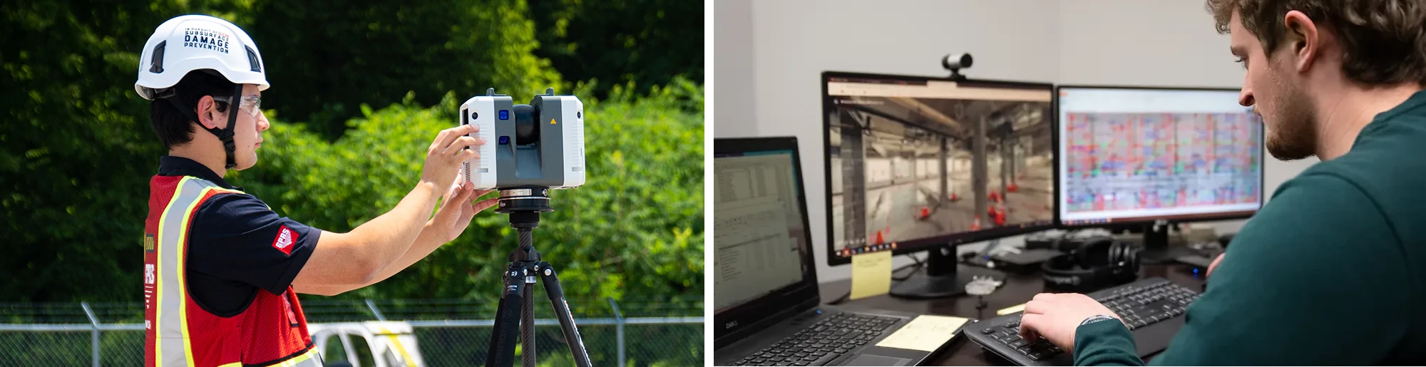
Why GPRS?
Through the use of LiDAR (light detection and ranging), GPRS Laser Scanning offers both an incredible and innovative service. By using Leica 3D laser scanners, we deliver data efficiently and with an accuracy of 2-4 mm. GPRS has cataloged and recorded notable sites such as the Kennedy Space Center, NFL stadiums, LaGuardia Airport and so many more, that have each presented unique requirements or challenges. GPRS uses this data to further develop our expertise in 3D scanning, helping clients plan for challenges before they arise.
We pledge to remain at the forefront of construction technology for our clients. Our powerful data collection methods provide a level of detail and accuracy that allows us to be the leading 3D laser scanning service provider to the architecture, engineering, and construction industries. Whether mapping historic buildings or providing new construction verification, GPRS 3D laser scanning services offer a wide range of utility for many types of projects.
GPRS’s experience in LiDAR 3D scanning, use of survey-grade lasers, and dedication to providing accurate data have made us the leading provider of 3D scanning for the architecture, engineering and construction industries. With a dedicated GPRS team, quick and accurate scanning, and detailed deliverables, engineers and general contractors can rest assured, knowing their sites are properly documented and modeled.
To request a quote from GPRS contact us here.