

.svg)
GPRS 3D BIM Modeling Services
GPRS provides 3D BIM modeling services to help many industries Intelligently Visualize The Built World®. Our 3D modeling services and scan-to-BIM services allow clients to capture, analyze, and define existing conditions through safe, non-contact 3D laser scanning. We have saved clients millions of dollars in downtime and cost overruns with 3D BIM models to aid in design, visualization, space definition, prefabrication, and clash detection.
Precise as-built data delivered in an easy-to-understand BIM model helps plan for projects without the expense and worry of unknown interferences and conflicts.
Laser scanning is an ideal technology for Building Information Modeling (BIM) thanks to its efficiency, accuracy, and level of detail. Laser scanning accurately documents as-built conditions and proves to be invaluable in construction planning and facility modifications.
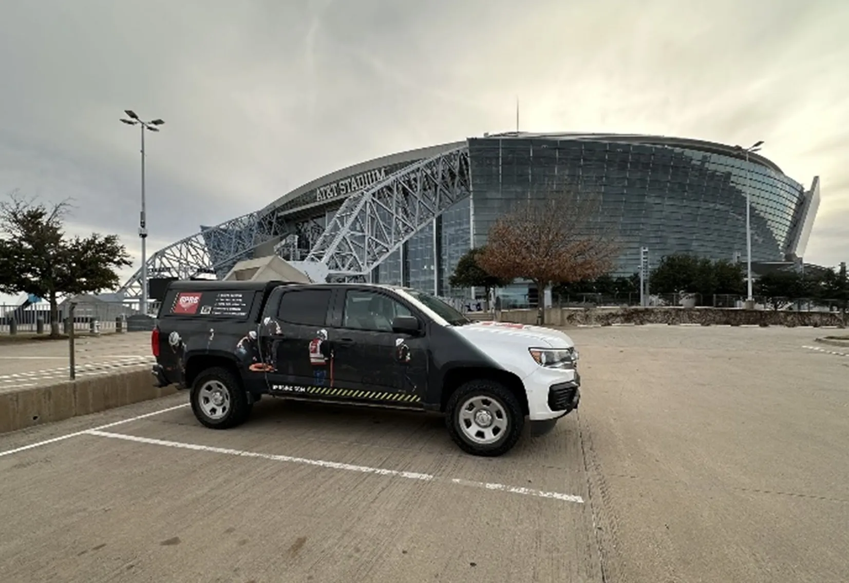
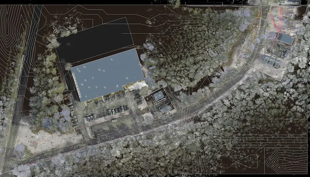
GPRS has earned a national reputation for delivering excellent service in the BIM 3D scanning industry, completing hundreds of projects every year on time and on budget. Our 3D Laser Scanning Project Managers are elite technicians who collect millions of precise 3D data points for a building or site with industry-leading, survey-grade Leica equipment in the form of a point cloud.
The GPRS Mapping & Modeling team has mastered the technology for converting point clouds into BIM-ready, 3D models to support the planning and design needs of any project.

GPRS 3D BIM Modeling Services
GPRS provides 3D BIM modeling services to help many industries Intelligently Visualize The Built World®. Our 3D modeling services and scan-to-BIM services allow clients to capture, analyze, and define existing conditions through safe, non-contact 3D laser scanning. We have saved clients millions of dollars in downtime and cost overruns with 3D BIM models to aid in design, visualization, space definition, prefabrication, and clash detection.
Precise as-built data delivered in an easy-to-understand BIM model helps plan for projects without the expense and worry of unknown interferences and conflicts.
Laser scanning is an ideal technology for Building Information Modeling (BIM) thanks to its efficiency, accuracy, and level of detail. Laser scanning accurately documents as-built conditions and proves to be invaluable in construction planning and facility modifications.
GPRS has earned a national reputation for delivering excellent service in the BIM 3D scanning industry, completing hundreds of projects every year on time and on budget. Our 3D Laser Scanning Project Managers are elite technicians who collect millions of precise 3D data points for a building or site with industry-leading, survey-grade Leica equipment in the form of a point cloud.
The GPRS Mapping & Modeling team has mastered the technology for converting point clouds into BIM-ready, 3D models to support the planning and design needs of any project.
What is BIM?
Building information modeling (BIM) is an intelligent software modeling process that engineers, contractors, and architects (AECs) can use to collaborate on a building’s design, construction, and operation. It’s more than just a model. It’s a process of collecting and managing data throughout a building’s entire life cycle.
BIM encompasses not only geometry and spatial relationships, but it also documents building features, such as specific information about the type of materials used, the quantity used, and how those characteristics impact the building as a whole. BIM can be thought of as a database of information ranging from project materials and cost – to the 3D model after construction – to operation of the facility. This information can be used to actively manage a project from inception to completion, and is one of the ways GPRS helps you Intelligently Visualize The Built World®. Read more about scan-to-BIM.


.avif)


How Can BIM Support Your Project?
BIM enables engineers, contractors, and architects to work on a single project from anywhere in the world. It condenses a plethora of information about every detail into a workable format. BIM makes for easier design, simpler coordination between team members, and easier structure maintenance across the entire built environment.
Is BIM Just for Large Projects?
BIM brings comprehensive site information and value to every project, no matter its size. Providing your team with BIM can expedite planning, improve workflows, and increase collaboration – which means that implementing BIM can save both money and time, regardless of the project scale and complexity.
///INDUSTRIES We serve

Power Transmission & Distribution

Telecom

Renewable Energy

Oil & Gas

Power Generation

Facilities

One Call

Environmental Due Diligence

Civil, Road & Bridge

Design Builds & Remodels

Education

Retail & Restaurant Construction

Water & Sewer
Electric Vehicle Charging

Engineering & Surveying
Other
Who Uses 3D BIM Modeling?
75% of AEC companies use BIM to some extent. A study from Dodge Data and Analytics, “Measuring the Impact of BIM on Complex Buildings,” found these results from AEC pros:
- 93% said BIM improved the quality and function of the final design
- 88% said BIM led to accelerated job completion
- 85% said BIM resulted in a reduction in the final construction cost


AEC companies are realizing that planning virtually before beginning construction brings huge cost and time savings. The AEC industry is going through a digital transformation, trending to the use of digital twins. This means data-rich 3D BIM models are a must. Plant managers are using scan-to-BIM for asset management and upgrades. General contractors are using scan-to-BIM for virtual design planning and fabrication. Architects are using scan-to-BIM to restore historic buildings… And the list goes on and on.
AEC is driving a technical evolution in construction that facilitates a project's success and BIM is the perfect solution.
3D BIM Modeling Options
Below are the level of detail descriptions for GPRS BIM modeling services. These LOD construction features are modeled to your project's specific scope and proposal. By using these detail specifications to scope projects, we can clearly communicate the precision requirements of the BIM model for faster project execution.

Standard Detail

High Detail

Very High Detail
Customizable Maps & Models
3D laser scanning technology helps you take any project from inception to completion with accurate and easy to understand data integration to ensure smooth communication and avoid cost overruns and delays. What project can GPRS help you visualize?
Design & Technical Software Expertise
GPRS Serves Many Industries
3D BIM Modeling Options
Below are the level of detail descriptions for GPRS BIM modeling services. These LOD construction features are modeled to your project’s specific scope and proposal. By using these detail specifications to scope projects, we can clearly communicate the precision requirements of the BIM model for faster project execution.
3D Laser Scanning Pricing
The cost of 3D laser scanning can vary widely depending on your project scope. GPRS customizes every quote specific to your project’s needs. GPRS Project Managers use 3D laser scanners to capture every detail of your site, delivering building dimensions, locations, and layout with millimeter accuracy. This can include the aboveground structural, architectural, and MEP features, plus underground utility and concrete markings. Our Mapping & Modeling Team can deliver point clouds, 2D CAD drawings, 3D BIM models, 3D Mesh models, TruViews, and Virtual Tours at any level of detail.
For more information on 3D BIM modeling, scan to BIM, or 3D laser scanning services contact GPRS at 419-843-7226 or email Laser@gprsinc.com.
Case Studies

.webp)


Scan-to-BIM technology helps you take any project from inception to completion with accurate and easy to understand data integration to ensure smooth communication and avoid cost overruns and delays. What project can GPRS help you visualize?
Laser scanning is an unmatched facility documentation and management tool with benefits that span the life of any facility. Our Project Managers, model designers, and CAD designers work together to help you Visualize The Built World® to help you reduce downtime and costs so that your projects come in on time and on budget.
USIBD is an organization dedicated to creating standards for building documentation. GPRS 3D Laser Scanning strongly believes in the importance of creating specifications and guidelines for the US construction industry. These established criteria drive quality excellence, improve efficiencies, establish expectations and build credibility. For these reasons, GPRS is proud to be a member of US Institute of Building Documentation.
GPRS 3D Laser Scanning is an unmatched facility documentation and management tool with benefits that span the life of any facility. Our Project Managers, model designers, and CAD designers work together to help you Intelligently Visualize The Built World™ to help you reduce downtime and costs so that your projects come in on time and on budget.