

.svg)
3D Laser Surveying
Precise, Rapid Data Collection


///intelligent data for decision making
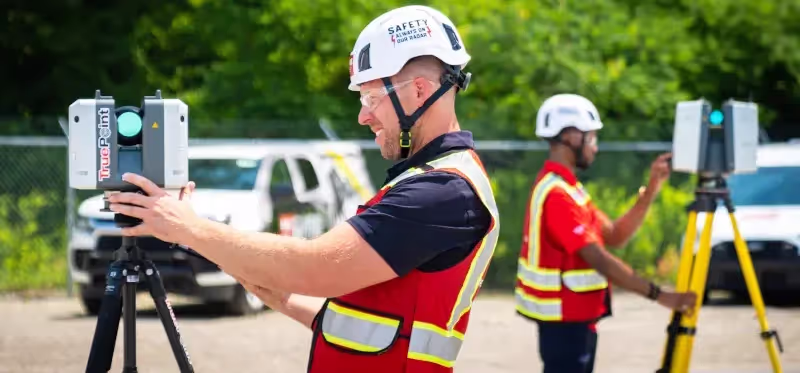
///GPRS 3d Laser surveying services
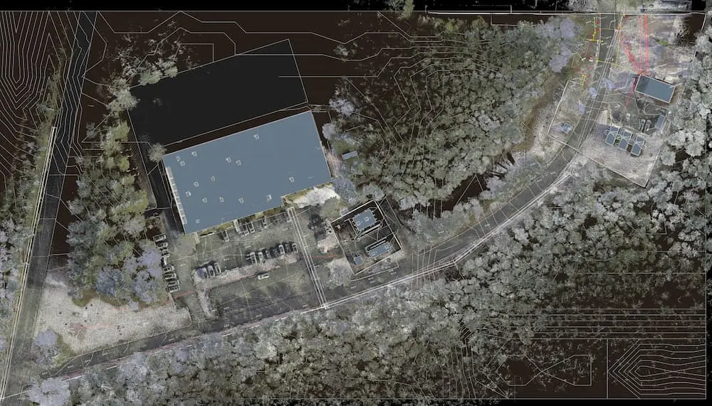
Quickly capture every detail of your building or site, including, architectural features, structural features, mechanical systems, façades, windows, doors, and rooflines, plus terrain, utilities, roadways, pavement, drainage features, signage, and more.

.webp)


.webp)
.webp)
.webp)

.webp)
.webp)
.svg)

///OUr 3D Laser surveying Company


.svg)
.svg)
.svg)
.svg)
.svg)
case Studies


///FREQUENTLY ASKED QUESTIONs
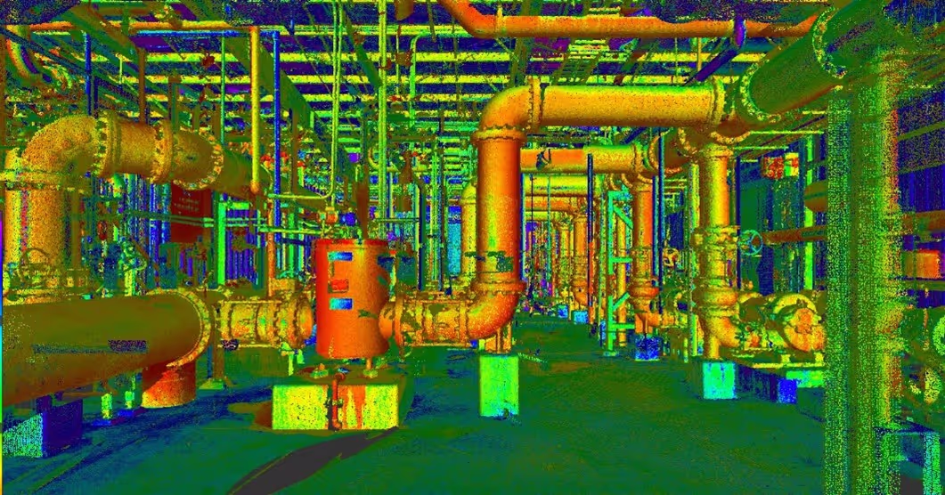
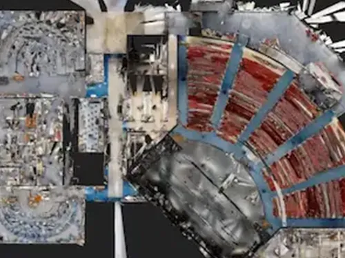
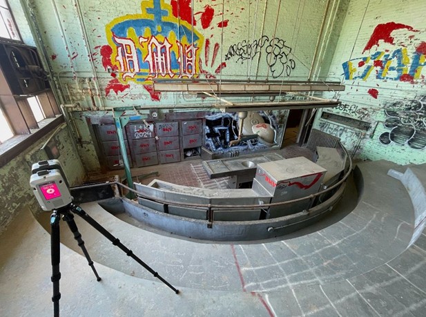
3D laser scanning utilizes LiDAR (Light Detection and Ranging) technology to precisely capture the three-dimensional geometry of a structure or site. This process involves emitting pulsed laser beams that measure distances by calculating the time it takes for the light to reflect back from the target. Each reflected pulse provides a data point with X, Y, and Z coordinates, resulting in millions of measurements that form a detailed spatial representation.
This technology enables the rapid creation of highly accurate digital models and measurements, making it invaluable for applications in architecture, engineering, surveying, and construction. Whether you're documenting existing conditions or planning new developments, 3D laser scanning offers a fast, reliable, and non-invasive solution.
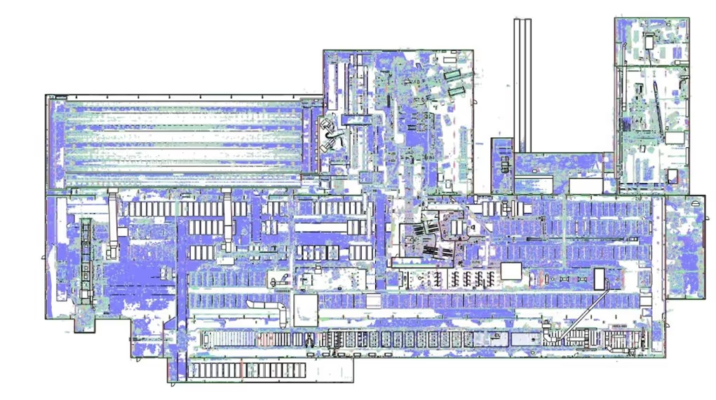
A point cloud is a collection of individual data points in a three-dimensional plane with each point having a set coordinate on the X, Y, and Z axis. The point cloud is the output of the 3D laser scanning process. Point clouds are typically represented by .ptg or .e57 point cloud files and Autodesk Recap files in .rcs and .rcp format. This is also referred to as the raw scan data from the laser scanner.
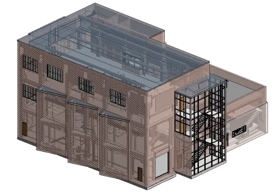
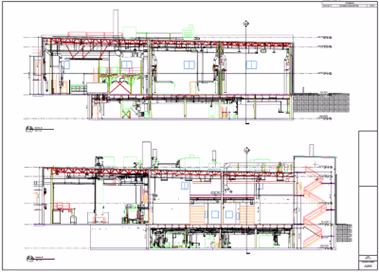
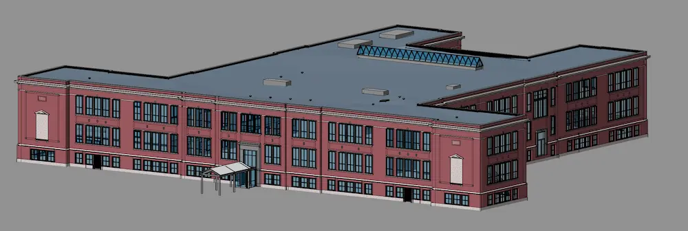
Scan to BIM is a process that uses 3D laser scanning to create a digital model of a site or building, which is then used to create a building information modeling (BIM) model. BIM is a software process that allows architects, contractors, and engineers to collaborate on a building's design, construction, and operation.
A Building Information Model (BIM) is a digital representation of a building or site's physical and functional characteristics. A 3D BIM model includes geometry, spatial relationships, and embedded data, supporting design, construction, and lifecycle management through enhanced collaboration and visualization.
GPRS delivers construction-grade accuracy using high-resolution LiDAR scanners and survey-grade controls and registration. Accuracy depends on site conditions and equipment, but typically achieves tolerances within 2 to 6 millimeters, suitable for verifying existing condtions, design planning, excavation, and managing infrastructure.
With Project Managers all over the US, we work quickly to provide detailed quotes for clients. For most jobs, large areas can be laser scanned in as little as a couple of hours or larger sites in as little as a few days. Entire facilities or campuses can take several weeks to capture the entire site, but most projects are measured in hours or days.