

.svg)
TruePoint Laser Scanning | GPRS
TruePoint Laser Scanning is now a GPRS Company

Schedule Service TodayDiscover More
Images with Captions


Your Trusted Source for Accurate As-Built Data
GPRS is proud to welcome TruePoint Laser Scanning to our team, combining industry-leading 3D laser scanning expertise to our full suite of services.
We provide complete as-built solutions for contractors, engineers, architects, and facility managers, including:
Our SIM-certified Project Managers use advanced Leica scanners and industry-standard software to deliver precise architectural, structural, and MEP data, accurate to within 2–4 mm.
We provide custom deliverables, including:
- Point Clouds
- 2D CAD Drawings
- 3D BIM Models
- Photogrammetry
- Virtual Tours
With nationwide coverage and fast turnaround, we help you reduce errors, avoid rework, and keep your projects on track.
GPRS’ Mapping & Modeling Team transforms point clouds into 2D CAD drawings, 3D BIM models, 3D meshes, TruViews, and virtual tours of the highest quality standards.
Our 3D modeling services and scan-to-BIM services allow clients to capture, analyze, and define existing conditions through safe, non-contact 3D laser scanning.
The 3D models created by our Mapping & Modeling team using the 2-4mm accurate data collected by our 3D laser scanning Project Managers allow for reliable project planning, even when you’re nowhere near the job site.
GPRS 3D laser scanning services provide 2-4mm accuracy by capturing 2 million data points per second for efficient planning, design, and construction.
///Our Services
As-Built Services
As-built services capture exact architectural, structural, and MEP system dimensions and layout of existing buildings, facilities, and sites, making them invaluable for design, construction, renovations, and modifications.
Learn More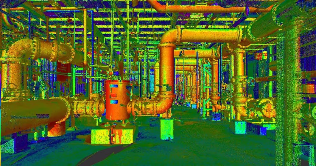
Point Clouds
3D laser scanners record highly accurate digital measurements of sites and assets in the form of a point cloud and can be used to create 2D CAD drawings and 3D BIM models that improve project workflows, shorten turnaround times, and reduce costs.
Learn More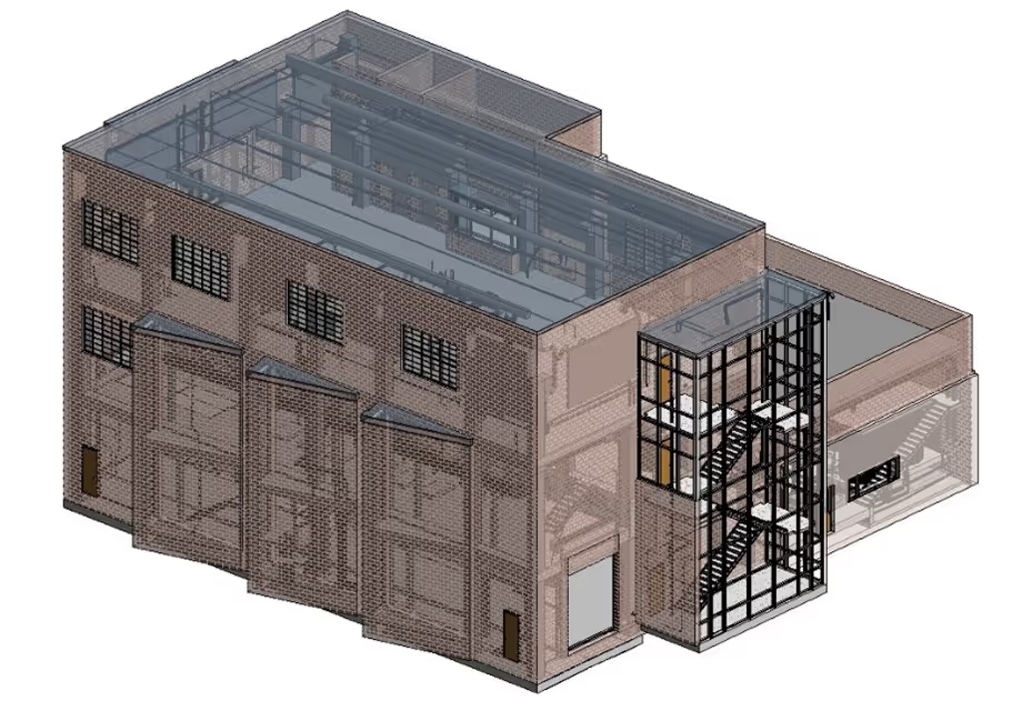
3D BIM Modeling
Intelligent 3D Building Information Models (BIM) provide contractors, engineers, architects, and facility managers an accurate digital twin of buildings and infrastructure to collaborate on design, construction, and operations.
Learn More
3D Photogrammetry
3D rendered images can be used to create virtual tours, floorplans, topographic maps, point clouds, 3D models, and more for planning, analysis, and calculations.
Learn More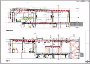
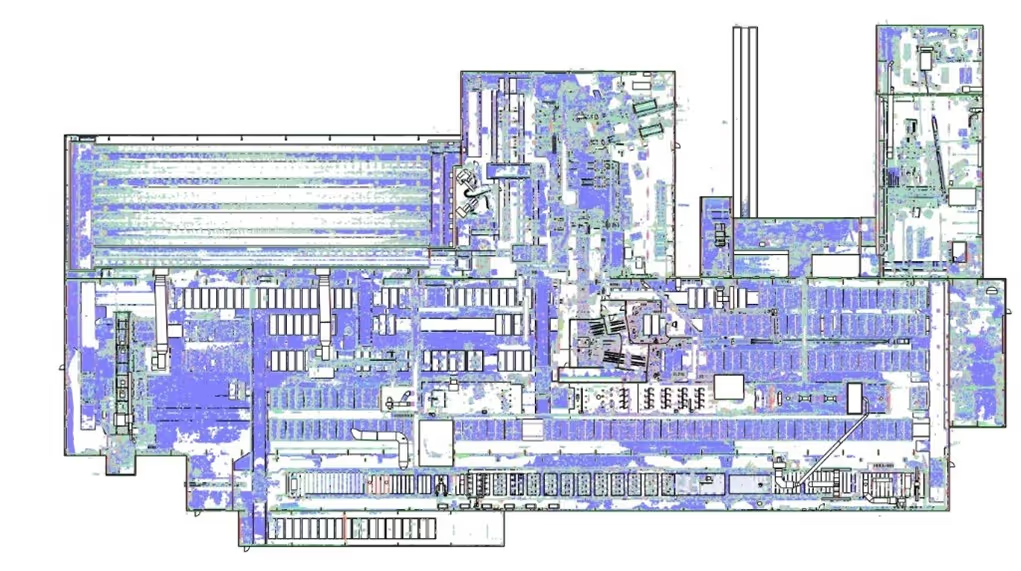
2D CAD Drawings
GPRS can translate 3D laser scan data into 2D CAD drawings that provide your team with up-to-date floor plans, elevations, sections, details, isometric drawings, reflected ceiling plans, and more.
Learn More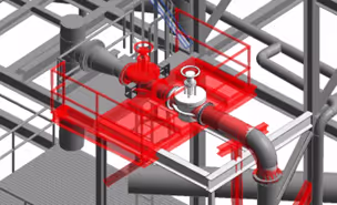
Clash Detection
3D laser scanning captures as-built site conditions with 2-4 mm accuracy, helping to identify potential clashes, prefabricate components, and plan a flawless installation.
Learn More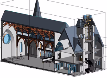
Design-Build
3D laser scanning provides accurate as-built site data to prevent expensive rework by identifying any mistakes early in the design through the construction phase.
Learn More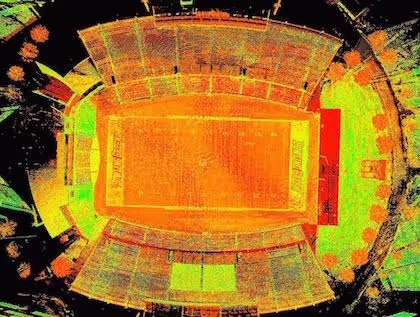
Drone Imagery
GPRS offers rectified photogrammetry, aerial video and images, LiDAR scans, 2D orthomosaic images, CAD drawings, 3D models, and 3D fly throughs thanks to a wide-range of drone services operated by FAA Licensed pilots.
Learn More
///3D Laser Scanning Pricing
The cost of 3D laser scanning can vary widely depending on your project scope. GPRS customizes every quote specific to your project’s needs. GPRS Project Managers use 3D laser scanners to capture every detail of your site, delivering building dimensions, locations, and layout with millimeter accuracy. This can include the aboveground structural, architectural, and MEP features, GPR utility locates & concrete scans, 3D laser & photogrammetry data, and video pipe inspection reports. Our Mapping & Modeling Team can deliver point clouds, 2D CAD drawings, 3D BIM models, 3D Mesh models, TruViews, and Virtual Tours at any level of detail.
