

.svg)
GPRS Reality Capture Services
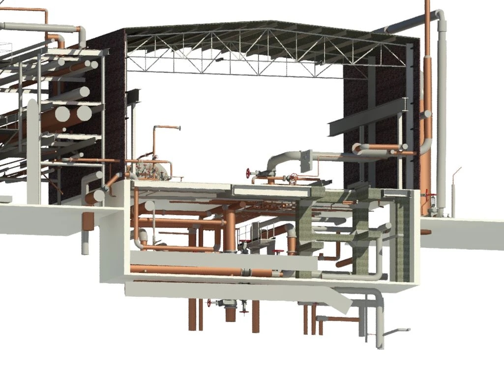
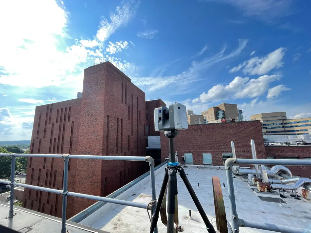
Reality capture generates a highly accurate 3D BIM model of a building or site by scanning real-world conditions with long-range terrestrial laser scanners. Through LiDAR-based 3D laser scanning or photogrammetry, millions of surface points are measured and mapped to create a high-resolution, geometrically accurate model. The resulting dataset integrates directly with design, visualization, and analysis software, supporting efficient planning, construction, and asset management.
.webp)
Reality capture data eliminates uncertainty and provides accurate, actionable information to rely on throughout your project’s lifecycle. Fully customizable to meet your specific project requirements, this data to reduces site visits, optimizes workflows, and ultimately keeps your project running on time, on budget, and safe.
GPRS Reality Capture Services
Reality capture generates a highly accurate 3D BIM model of a building or site by scanning real-world conditions with long-range terrestrial laser scanners. Through LiDAR-based 3D laser scanning or photogrammetry, millions of surface points are measured and mapped to create a high-resolution, geometrically accurate model. The resulting dataset integrates directly with design, visualization, and analysis software, supporting efficient planning, construction, and asset management.
Reality capture data eliminates uncertainty and provides accurate, actionable information to rely on throughout your project’s lifecycle. Fully customizable to meet your specific project requirements, this data to reduces site visits, optimizes workflows, and ultimately keeps your project running on time, on budget, and safe.


.webp)

.webp)
.webp)

.webp)
.webp)


.avif)


Our Process
.webp)


.webp)
.webp)
How Reality Capture Technology Helps You Plan, Build, and Manage Better
GPRS’ Reality Capture services deliver accurate as-built documentation that streamlines your workflow, lowers project costs, and reduces change orders, which enable you to focus on what you do best.
- Easy Collaboration
- Improved Safety
- Informed Decision-Making
- More Accurate Documentation
- Removes Guesswork
- Saves Time and Money
When you partner with GPRS, you receive a complete data set and as-built documentation that can integrate into your design and visualization software.
///INDUSTRIES We serve

Power Transmission & Distribution

Telecom

Renewable Energy

Oil & Gas

Power Generation

Facilities

One Call

Environmental Due Diligence

Civil, Road & Bridge

Design Builds & Remodels

Education

Retail & Restaurant Construction

Water & Sewer
Electric Vehicle Charging

Engineering & Surveying
Other
.webp)


Scan-to-BIM technology helps you take any project from inception to completion with accurate and easy to understand data integration to ensure smooth communication and avoid cost overruns and delays. What project can GPRS help you visualize?
Laser scanning is an unmatched facility documentation and management tool with benefits that span the life of any facility. Our Project Managers, model designers, and CAD designers work together to help you Visualize The Built World® to help you reduce downtime and costs so that your projects come in on time and on budget.
USIBD is an organization dedicated to creating standards for building documentation. GPRS 3D Laser Scanning strongly believes in the importance of creating specifications and guidelines for the US construction industry. These established criteria drive quality excellence, improve efficiencies, establish expectations and build credibility. For these reasons, GPRS is proud to be a member of US Institute of Building Documentation.
GPRS 3D Laser Scanning is an unmatched facility documentation and management tool with benefits that span the life of any facility. Our Project Managers, model designers, and CAD designers work together to help you Intelligently Visualize The Built World™ to help you reduce downtime and costs so that your projects come in on time and on budget.