

.svg)
3D Laser Scanning Services in Orlando, Florida
Capture Reality with Confidence
Outdated or missing as-builts can lead to design conflicts, rework, delays, and unexpected costs. Whether you're planning a renovation, verifying tolerances, or managing a facility upgrade, GPRS 3D laser scanning services give you the precise data you need to make smart, informed decisions.
GPRS is a national leader in 3D Laser Scanning, with expert Project Managers serving Orlando, Florida and surrounding counties including Orange, Seminole, Osceola, and Lake.
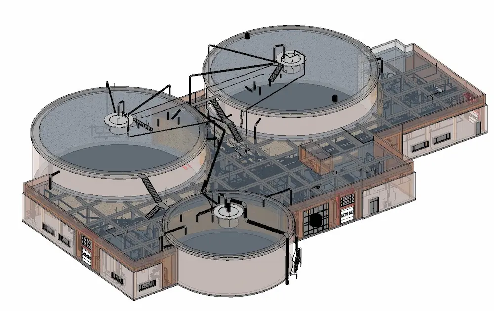
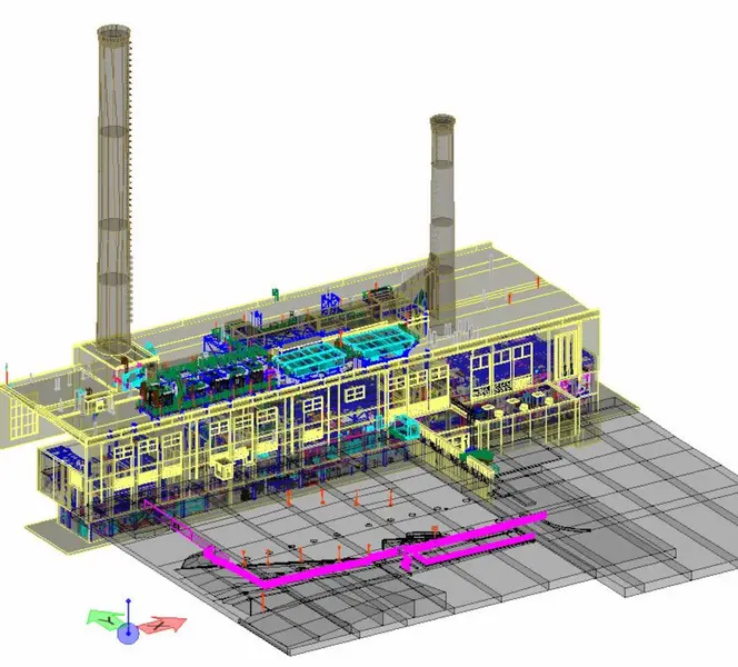
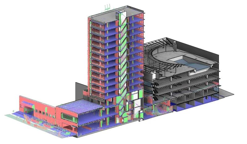
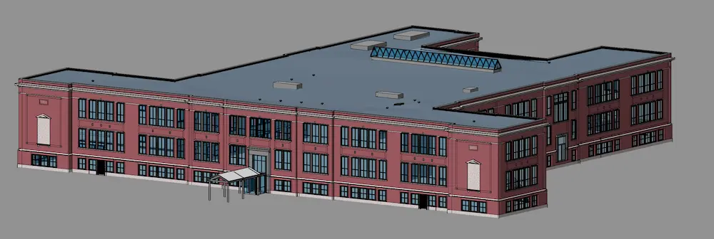
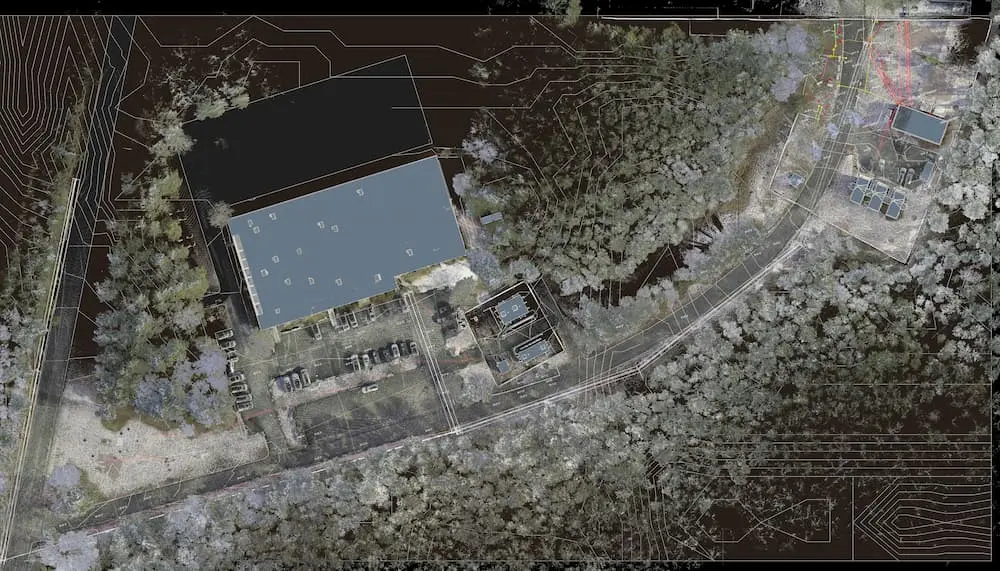
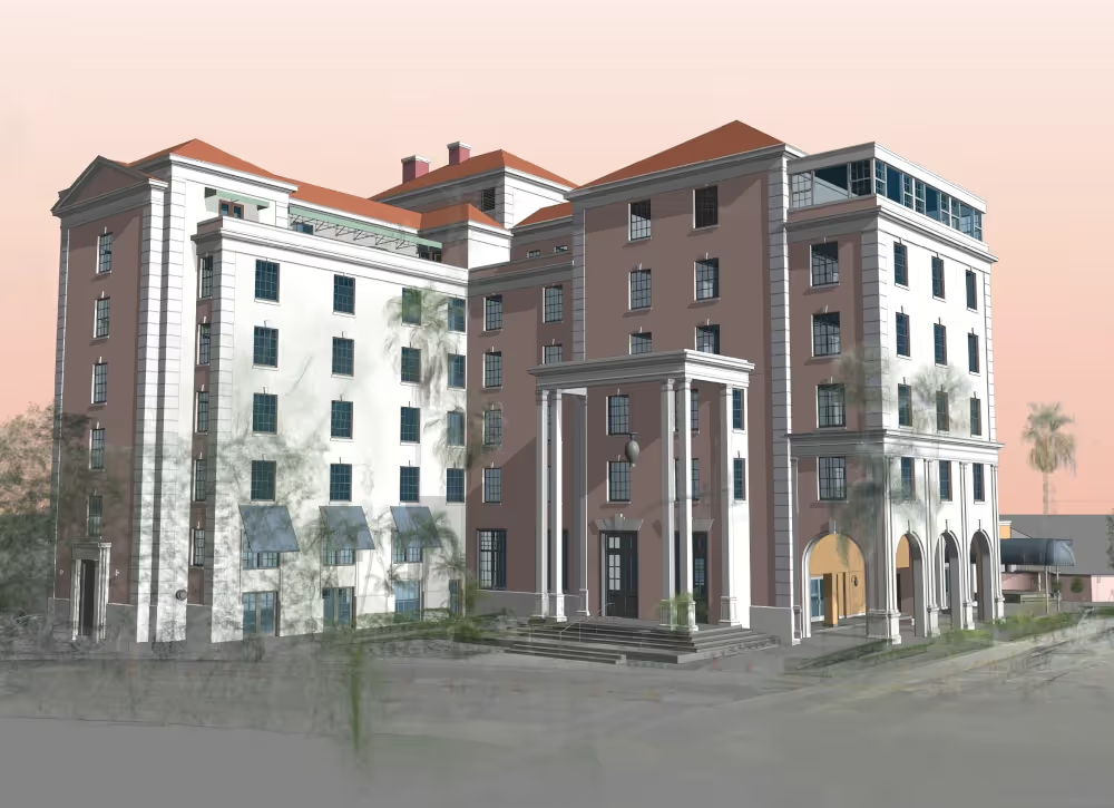
We capture buildings and sites with millimeter-level accuracy and deliver detailed point clouds, CAD drawings, and BIM models, creating a reliable digital foundation for design, construction, and facility management.
GPRS matches the right 3D laser scanning technology to your specific use case, whether it's architectural design, layout verification, clash detection, prefabrication, structural and civil engineering analysis, or facility maintenance. We consider your project scope, environment, and stakeholder needs to deliver the right data in the right format.
GPRS offers custom solutions and deliverables, including:
- High-quality point clouds
- Detailed 2D CAD drawings
- Intelligent 3D BIM models
- Interactive TruViews & Virtual Tours
By partnering with GPRS, you can:
- Access and share up-to-date as-builts
- Develop accurate project costs and timelines
- Avoid costly rework and delays
- Ensure all trades are aligned from day one
3D laser scanning helps you avoid design conflicts, minimize rework, and keep projects on schedule. The result? Lower costs, fewer delays, and greater confidence from start to finish.
Ready to streamline your next project?
Request your free quote today.

///Why Choose Us? The GPRS DIfference.

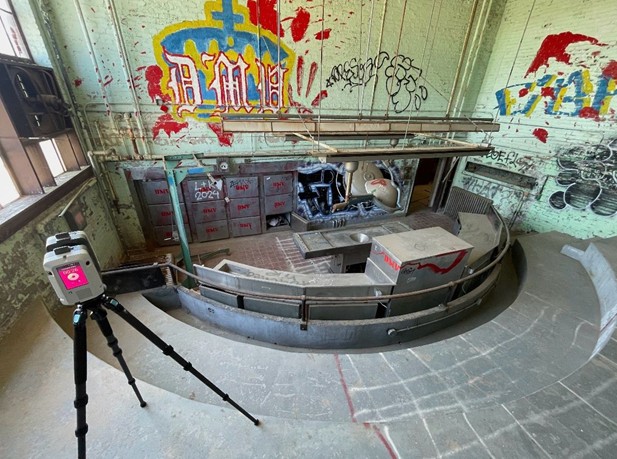
- Collect up to two million data points per second with the highest-quality survey-grade laser scanners
- Capture exact dimensions and measurements of your project site
- Expedite planning and design with accurate as-builts
- Eliminate site disruption and revisits
- Receive precise point clouds, 2D drawings, and 3D models to improve collaboration and coordination
- Tour the location, add digital notes, and measure with a virtual tour
- Reduce project risks, change orders, delays, accidents, and costs
- Agricultural Facilities
- Mixed Reality & 3D Projection Mapping
- Architectural Documentation
- Office & Commercial Buildings
- Concrete Construction
- Overhead Clearances
- Construction
- Oil & Gas Facilities
- Clash Detection
- Power Plants & Process Plants
- Design Build
- Real Estate
- Energy & Utilities
- Stadiums, Arenas & Theaters
- Engineering
- Telecommunications
- Government, Defense & Military Sector
- Schools & Universities
- Healthcare & Pharmaceutical
- Subsurface Utility Engineering
- Historical Documentation & Preservation
- Virtual Design and Construction
- HVAC & MEP Coordination
- Water & Wastewater Treatment Plant
- Accident Reconstruction
- 3D Video Gaming & Software Development
- Industrial, Manufacturing & Distribution Facilities
- Point Cloud Data
- Comparative Analysis
- 2D CAD Drawings
- Deformation Analysis
- 3D BIM Models | Building Information Model
- Floor Flatness Analysis | Floor Contour Mapping
- 3D Mesh Models
- Volume Calculations
- 3D Photogrammetry
- Structural Steel Shape Probability Analysis
- TruView
- Wall Plumb Analysis
- Virtual Tours via WalkThru 3D
- New Construction Accuracy Analysis
- 2D Floor Plans via FLRPLN
- Volume Calculations
- 3D CAD Floor Plans via FLRPLN
- Wall Plumb Analysis
- Template Modeling
- New Construction Comparative Analysis
- Reconciliation of Clients 2D Drawings
- 2D CAD of GPR Markings
- Reconciliation of Clients 3D Design Model
- Reflected Ceiling Plans
- Emergency Floor Plans
- 2D CAD Plan Views, Elevations, Isometric Drawings


Case Studies

.webp)


///client testimonials
"The point cloud model worked out tremendously well. This was almost the perfect project to use it on due to the various intricacies of the building layout and large differences from floor to floor."
N. Pellizzari
Architecture and Planning Professional

"The scans were great. I’m a believer. We couldn’t have done this project without it. We will never do a renovation again without a scan so we will be calling you."
Chuck T.
President
"I've worked with GPRS on several projects; from very small to very large, over the past 5-7 years. They not only understand the built world of point clouds and modeling, they understand people, products and processes."
David D.
Senior Engineer
"Contracting GPRS to do a 3D laser scan has been one of the best project decisions we made. The entire process was quick and accurate."
Vincent M.
Superintendent

CORPORATE OFFICE
///frequently asked questions
A single laser scan typically takes 1–2 minutes, and most buildings can be fully scanned in one to two days. Larger facilities, industrial sites, or campuses may take several days to several weeks, but the majority of projects are completed within hours or days.
3D laser scanning delivers construction grade accuracy, typically within 2–6 millimeters, depending on site conditions, scan range, and project requirements. GPRS achieves this level of precision by using professional grade LiDAR scanners, survey grade controls, and strict field verification and registration procedures, ensuring the data is reliable for CAD drawings, BIM models, and construction planning.
When determining the scope and cost of a 3D laser scanning project, a GPRS Project Manager evaluates factors such as: project location, scope of work, square footage, building or site complexity, access and occupancy conditions, required deliverables, level of detail for CAD drawings or 3D modeling, project timeline, and special requirements, including night or weekend scanning.
GPRS’s in-house CAD/BIM team will produce custom deliverables for your project, ranging from point cloud data 2D CAD drawings, 3D BIM models, 3D mesh models, TruViews, and 3D virtual tours. Deliverables can be provided at any level of detail in a variety of formats including Revit, AutoCAD, ReCap, Navisworks, Civil 3D, BIM 360, A360, JetStream Viewer, and more.
Before GPRS issues a project proposal, our team will confirm whether your deliverables need to be developed within a specific Revit template. The GPRS CAD/BIM Team can work within client-provided templates. This ensures that your project can proceed immediately upon delivery of the 3D BIM model. Make sure we receive your Revit template before modeling begins.