

.svg)

Highlights
THE BOTTOM LINE
GPRS Reality Capture Services expedited the planning phase of an upgrade project at a historic hydroelectric dam.
Industry
Service
Reality Capture
Location
GPRS Project Manager Insight
Deliverables
PROJECT APPLICATION
ASK
Task
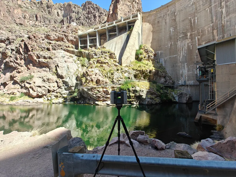
3D laser scan the powerhouses at a hydroelectric dam to create accurate existing conditions documentation prior to planned upgrades.
PROBLEM
- Operators of a nearly 100-year-old hydroelectric dam required precise as-built documentation and 3D models to support planned upgrades
- The dam is situated in a remote, rural environment
- Each powerhouse is a multi-story building densely packed with complex mechanical and electrical systems
Solution
- A GPRS Project Manager conducted 3D laser scans of the powerhouses and surrounding infrastructure
- The Project Manager spoke with personnel on-site prior to scanning to understand the dam’s unique infrastructure
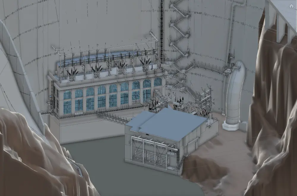
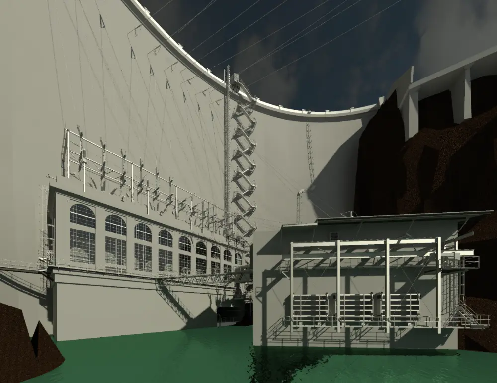
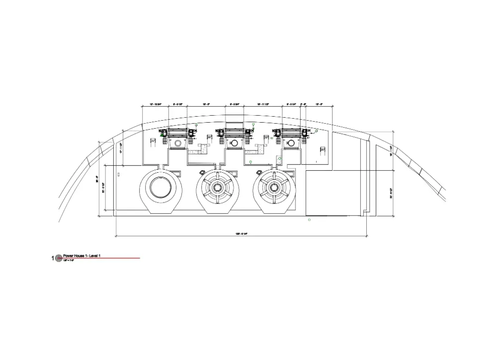
- GPRS in-house Mapping & Modeling Team transformed the accurate data obtained on-site into the client’s desired set of deliverables, including a virtual walkthrough, 3D model, and floor plans
Benefits
- Stakeholders will be able to limit site visits while planning and designing upgrades to the dam by using the deliverables created by GPRS
- The accurate data collected, and the maps and models created from it will minimize change orders, delays, and extra costs
CASE STUDY GALLERY
No items found.


.avif)
