

.svg)

Highlights
THE BOTTOM LINE
A comprehensive site scan, delivering utility maps and a 3D BIM model allowed the architect to plan precise renovations to the stadium’s layout, from design changes and material selection, to cost estimation and construction phasing, with ease.
Industry
Stadiums, Arenas & Theatres
Service
Utility Locating, 3D Laser Scanning, 3D BIM Modeling
Location
Tallahassee, Florida
GPRS Project Manager Insight
Deliverables
PROJECT APPLICATION
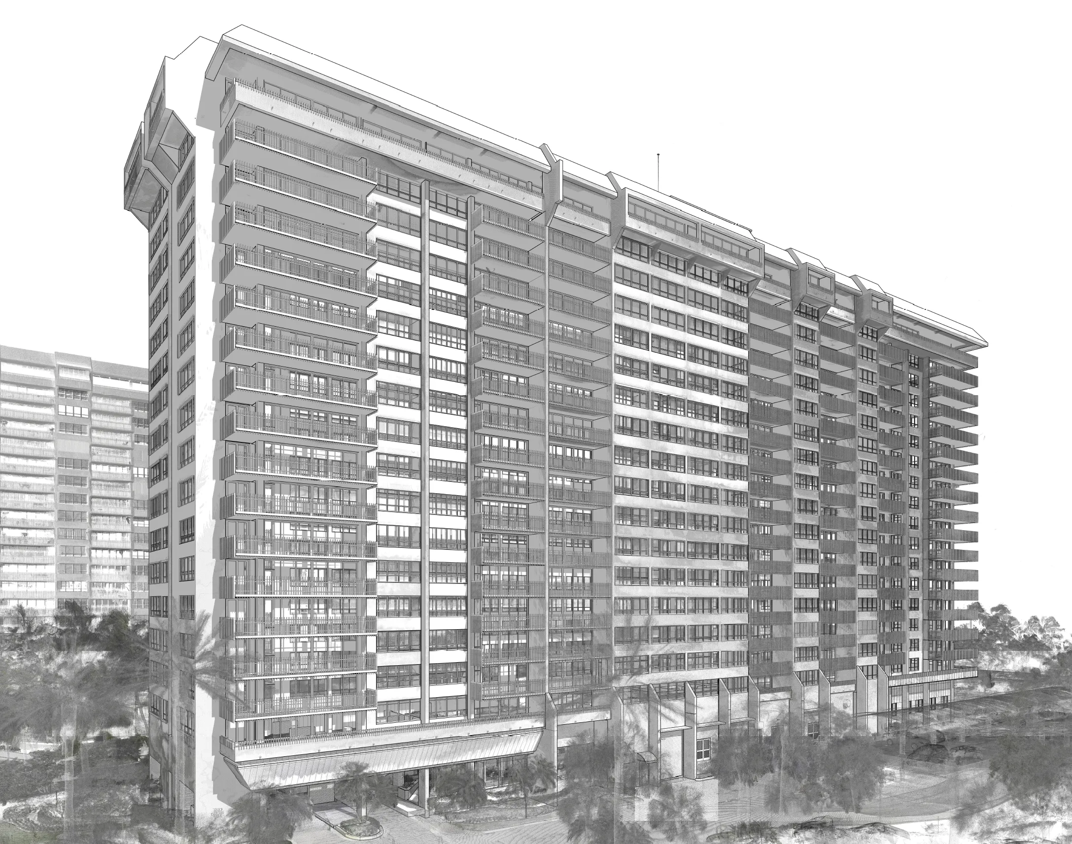
Using LiDAR laser scanners, the GPRS Project Manager captured detailed dimensions, locations, and layouts of architectural, structural, and MEP systems. Using Ground Penetrating Radar (GPR) and electromagnetic (EM) locating equipment, the GPRS Project Manager identified and marked all underground utilities. GPRS' Mapping & Modeling team converted the data collected into utility maps and a 3D BIM model to streamline renovation planning.
ASK
Task
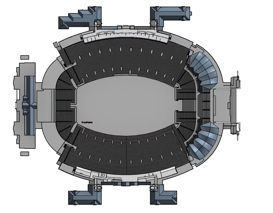
GPRS provided above and below-ground as-built data to Florida State University’s Doak Campbell Stadium, including subsurface utility maps, and an architectural/structural 3D BIM model that the client could access via our SiteMap GIS Platform. A $255-million-dollar renovation project required accurate data to update the stadium seating with founder’s boxes and a field level club.
PROBLEM
- A vast amount of space required as-built documentation, over 600,000 sq. ft. needed 3D laser scanning and two-acres needed utility locating.
- On a college campus, a utility strike can interrupt classes, extracurriculars, and even endanger the lives of faculty and students.
- The renovation changes were complex. A BIM model was needed to provide the stadium owners a better understanding of the architecture and design updates.
- Our client needed a single source of data, where all architects on the team could see the latest design and document their changes.
Solution
- The exterior and interior of the stadium was 3D laser scanned with 2-4 millimeter precision, including three concourse levels, stadium seating, and suites.
- In five days’ time, the GPRS Project Manager was able to map out utilities within a two-acre section under the stadium, including a fire water main, sanitary sewer, storm sewer, and power lines.
- GPRS delivered an up-to-date utility map, intensity map point cloud, TruView viewer files, and a Revit 2021 3D model of the stadium.
- The ArchiCAD model contained both 3D design elements, such as walls and columns, and 2D drafting elements like dimensions, text and labels.
- Working from precise details in the utility maps and 3D BIM model, renovations can be designed right the first time, saving time and costly change orders.
Benefits
- GPRS delivers accurate utility CAD maps to prevent accidental damage to utilities during excavation or construction, enhancing safety.
- The architect utilized the Building Information Modeling (BIM) process to provide their clients a better understanding of the complexities of architecture and design.
- Technical construction drawings (floor plan views, elevation views, cross-sections, iso-metric representations, etc.) can be effortlessly created from the 3D BIM model and shared with all disciplines.
- A BIM model allows architects to plan precise renovations, from design changes and material selection, to cost estimation and construction phasing.
- All as-built data was uploaded into our GIS-based construction platform, SiteMap®, providing the architect with 24/7 mobile access to maps, models, and as-builts—eliminating information silos and enhancing on-site communication.
CASE STUDY GALLERY


.avif)


.avif)
