.svg)
Education

Utility Locating & Concrete Scanning for Schools, Universities, Colleges, and Campuses
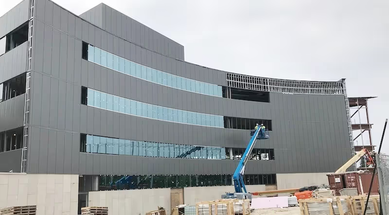
With approximately 75% of higher education campuses and over 50% of K-12 schools planning on starting construction projects last year, construction spend in this space is on the rise. These stats, according to the Construction Productivity Blog, show the trend increasing in the need for safe construction practices. One of the biggest concerns facing contractors when completing these school renovation projects are unknowns regarding underground private property utilities and concrete reinforcement. Due to some of these facilities being decades-old, drawings and maps aren’t always available or even accurate. Seldom are utility as-built drawings updated every time a construction renovation is completed, leaving excavation contractors exposed to utility strikes, shut downs, delays, and injuries. Construction projects on school campuses are time-sensitive due to class schedules and breaks so delays must be avoided.
Schools and campuses are in constant building mode – trying to add more value and capacity for their students. Excavating, digging, trenching, drilling, and boring is a natural result of these projects. Typically, the 811 process is capable of locating the underground facilities prior to these services. GPRS is able to perform these one-call services by partnering with the school and the state sponsored 811 systems to locate the needed tickets.
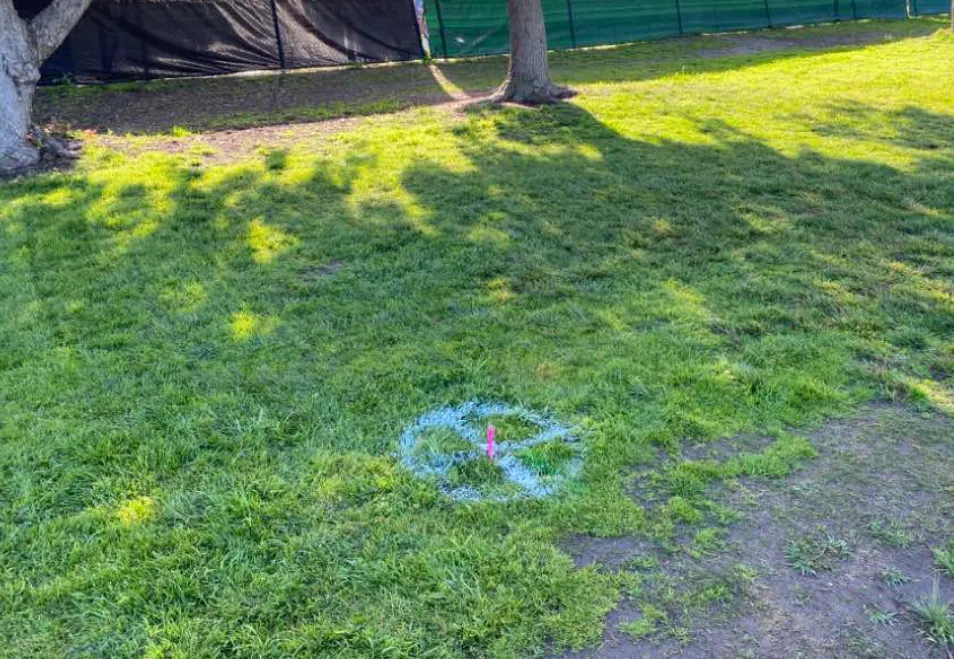
But, what can a general contractor do when the campus is all on private property? GPRS can provide locating services in this scenario as well. Our highly-trained Project Managers will service these campuses that are on private property – just like the public system. A call can be placed to GPRS to locate underground utilities, clear digging areas, create and update utility maps, and review locate tickets. GPRS services are not limited to locating utilities. By utilizing ground penetrating radar, GPRS Project Managers can scan concrete prior to saw cutting or core drilling. Whether scanning interior or exterior areas, using GPRS services helps to keep your team and job site safe.
3D Laser Scanning Services for Schools, Universities, Colleges, and Campuses
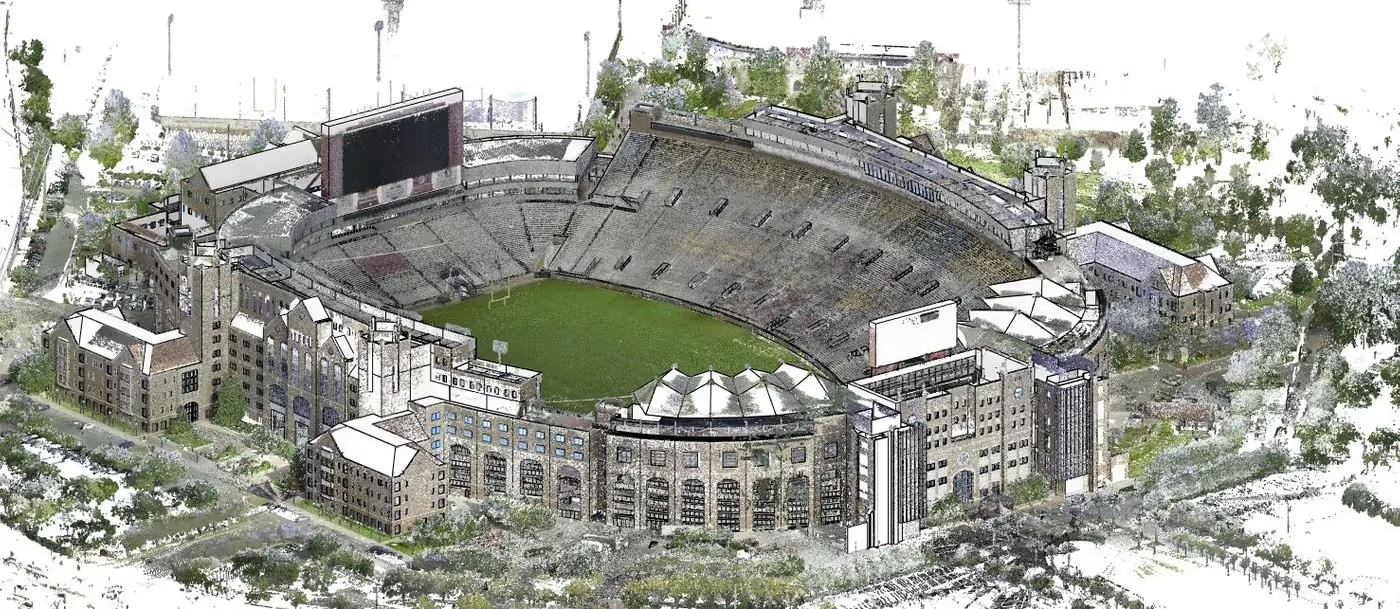
GPRS captures existing conditions as-builts for universities, colleges, and schools to support site renovations and upgrades, delivering precise data to coordinate construction plans, minimize change orders, and save time. From entire schools to campus buildings to stadiums and mechanical rooms, GPRS has extensive experience 3D laser scanning schools, universities, colleges, and institutions.
GPRS brings expertise in many areas, including engineering, architecture, information technology, and construction. Having this combination of knowledge is integral to providing your team with data, drawings, and models that will save time and money on your next project or renovation.
GPRS Delivers Complete Infrastructure Visualization
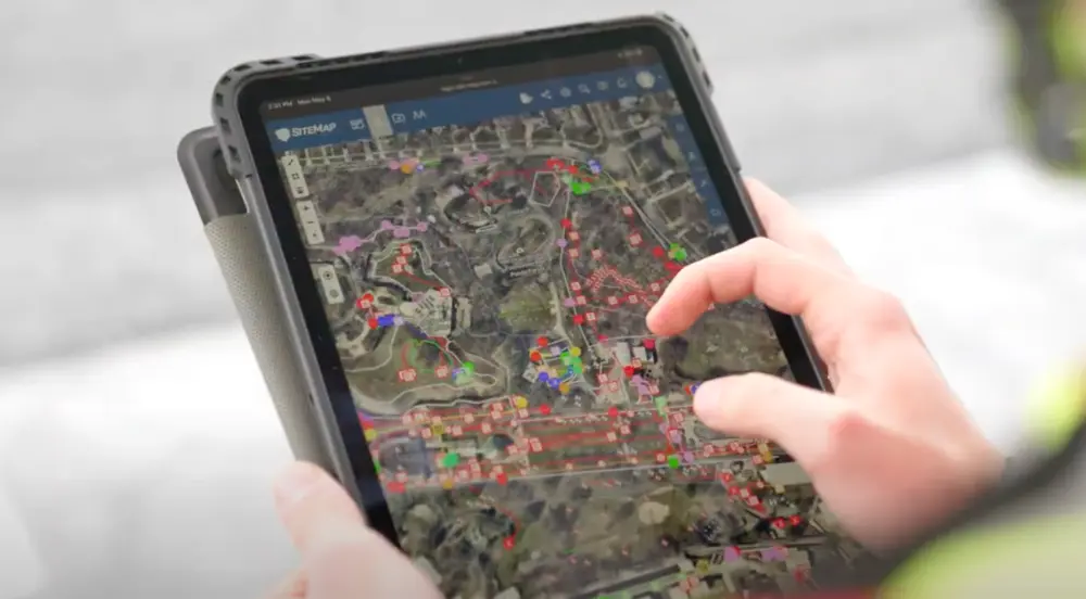
GPRS is the only company in the U.S. that can capture your entire site or facility, above and below-ground, to provide you with accurate as-builts, private and public utility maps, 2D CAD drawings, 3D BIM models, virtual tours, WinCan reports, and more documenting architectural, structural, MEP, and subsurface utility existing conditions, and instantly deliver data via SiteMap®, GPRS’ cloud-based digital storage software and app.
Utility Locating Services
GPRS utility locating services utilize ground penetrating radar (GPR) and electromagnetic (EM) locating technology to locate, mark, and map existing underground infrastructure such as power lines, gas lines, pipelines, water lines, sewer lines, potential voids, and additional buried facilities and utility lines. This information is critical for projects where construction or excavation activities are planned to mitigate accidental utility strikes, plus keep your team and facility safe. GPRS delivers complimentary CAD utility site maps in PDF, KMZ, and SHP file formats, and can export your utility data into a wide variety of drawings, maps, and models to advance communication and collaboration on your project. All clients receive instant access to complete and aggregated site records in Sitemap® GPRS’ digital storage software and app, where data is geolocated, layered, and securely shareable.
Concrete Scanning Services
Concrete scanning is a non-destructive method to assess concrete using GPR to locate, identify, and mark utilities and objects such as rebar, post tension cables, beams, conduits, and piping embedded within concrete slabs and structures prior to anchoring, cutting, coring, and drilling. Concrete scanning ensures the safety of workers and prevents accidents by identifying potential hazards before any work occurs. Concrete markings can be 3D laser scanned to create a permanent record of the site, data can be delivered in 2D CAD drawings, 3D BIM models, and virtual site tours.
3D Laser Scanning Services
GPRS 3D laser scanning services document the exact architectural, structural, and MEP system layout and dimensions on universities, colleges, high schools, and campuses to support site renovations and upgrades, delivering as-built data to coordinate construction plans, reduce change orders, and save time. GPRS Project Managers use industry-leading Leica survey-grade laser scanners to capture 2-4 millimeter accurate existing site conditions in the form of a point cloud. Our in-house Mapping & Modeling Team can transform those point clouds into customized 2D CAD drawings, 3D BIM models, 3D mesh models, TruViews, and 3D virtual tours at any level of detail for visualization, analysis, design, construction, and renovation.
Video Pipe Inspection Services
GPRS video pipe inspection services deploy robotic crawler CCTV cameras, lateral launch cameras, and push cameras to inspect and document water, sewer lines, and lateral pipelines to locate clogs, investigate cross bores, find structural faults and damage, and conduct lateral sewer line inspections. GPRS Project Managers deliver NASSCO-certified WinCan reports with the exact location, video, and photo of each defect, ranked by severity so you can plan for maintenance and repairs.
Leak Detection Services
GPRS specializes in all types of leak detection services, including municipal, industrial, and residential. Our Project Managers are leak detection specialists who utilize multiple technologies to locate your leak and have the expertise to map and provide many other insights into your water distribution and/or fire suppression systems. GPRS does this by utilizing a variety of equipment paired with our industry-leading SIM (Subsurface Investigation Methodology) processes. The equipment and methods used include acoustic leak detectors, leak noise correlators, video pipe inspection (CCTV) cameras & sondes, ground penetrating radar, and electromagnetic locating, among others.
.avif)


CUSTOM SERVICE PLANS

Scheduling

Pricing

Approach

mapping & Modeling
GPRS delivers the most up-to-date, accurate and comprehensive site data possible in the format required for your project. We provide complimentary KMZ and PDF maps with every utility locate we perform. Our Mapping & Modeling Team can create a wide variety of customizable maps and models, from a simple GPS-enabled map of your utility locate, to highly-detailed 2D CAD drawings and 3D BIM models, depending on your needs.
AS BUILT DRAWINGS
2D MAPS & 3D MODELS
SITEMAP® MOBILE APP

One Call Program

Public Property
Private Property

Embedment
Case Studies


.avif)


Related Articles