

.svg)
Geographic Information Systems (GIS) have emerged as a transformative force in the rapidly evolving landscape of the Architecture, Engineering, and Construction (AEC) industries.
Once confined to cartography and environmental studies, GIS technologies now play a pivotal role in planning, designing, constructing, and managing infrastructure. By integrating spatial data with design and engineering workflows, GIS empowers AEC professionals to make smarter decisions, reduce risk, and deliver more sustainable and resilient projects.
What is GIS?
At its core, GIS is a framework for gathering, managing, and analyzing spatial and geographic data. It combines location data (where things are) with descriptive information (what things are like there), enabling users to visualize, question, and interpret data in ways that reveal relationships, patterns, and trends.
In the AEC context, GIS is not just about maps – it's about spatial intelligence. It provides a digital twin of the real world, allowing professionals to simulate, analyze, and optimize every phase of a project lifecycle.
Enhancing Planning and Site Selection
One of the most significant advantages GIS brings to AEC is in the early planning and site selection stages. By layering data such as topography, land use, zoning regulations, environmental constraints, and utility networks, GIS helps stakeholders identify the most suitable locations for development.
For example, an engineering firm planning a new transportation corridor can use GIS to evaluate terrain, assess environmental impact, and analyze traffic patterns – all before a single line is drawn in CAD. This spatial insight reduces costly surprises and accelerates the decision-making process.
Integrating with BIM for Smarter Design
Building Information Modeling (BIM) has revolutionized the way buildings and infrastructure are designed and documented. When integrated with GIS, BIM becomes even more powerful. GIS provides the geographic context – such as terrain, climate, and surrounding infrastructure – while BIM delivers detailed design and construction data.
This integration enables a holistic view of projects. Architects can design structures that respond to their environment. Engineers can simulate how infrastructure will perform under different conditions. Urban planners can visualize how new developments will interact with existing communities.
Combining GIS and BIM allows, for instance, for flood risk analysis on a proposed building site, enabling design modifications that enhance resilience. It also supports compliance with local regulations and sustainability goals.
Streamlining Construction and Project Management
GIS technologies also play a critical role during construction. Real-time data collection from drones, sensors, and mobile devices can be fed into GIS platforms to monitor progress, track assets, and manage logistics.
Construction managers can use GIS dashboards to visualize site conditions, coordinate equipment and personnel, and respond quickly to issues. This spatial awareness improves safety, reduces delays, and enhances collaboration among teams.
GIS also supports 4D and 5D modeling – adding time and cost dimensions to 3D models. This allows project managers to simulate construction sequences, forecast budget impacts, and optimize resource allocation.
Supporting Infrastructure and Asset Management
Once a project is completed, GIS continues to deliver value through asset management. Municipalities, utilities, and facility managers use GIS to maintain infrastructure, monitor performance, and plan maintenance.
A city can use GIS to manage its water distribution network, tracking pipe conditions, identifying leak-prone areas, and scheduling repairs. Facility managers can integrate GIS with IoT sensors to monitor building systems and respond to anomalies in real time.
This lifecycle approach – design, build, operate – ensures that spatial data remains a living asset, supporting long-term sustainability and efficiency.
Enabling Resilience and Sustainability
In an era of climate change and urbanization, resilience and sustainability are top priorities for AEC professionals. GIS provides the tools to assess environmental impact, model natural hazards, and design adaptive infrastructure.
Planners can use GIS to identify flood zones, wildfire risk areas, or heat islands, and incorporate mitigation strategies into their designs. Engineers can simulate stormwater runoff or energy consumption to optimize systems. Developers can evaluate the carbon footprint of different site options.
By embedding environmental intelligence into every phase of a project, GIS helps the AEC industry build smarter, greener, and more resilient communities.
Facilitating Collaboration and Public Engagement
GIS also enhances collaboration among stakeholders. Cloud-based GIS platforms allow architects, engineers, contractors, and clients to access and share spatial data in real time. This transparency improves coordination and reduces errors.
In addition, GIS supports public engagement. Interactive maps and 3D visualizations help communities understand proposed developments, provide feedback, and participate in the planning process. This fosters trust, reduces opposition, and leads to better outcomes.
Real-World Applications
Across the globe, AEC firms are leveraging GIS in innovative ways:
- Transportation: Departments of transportation use GIS to plan highways, optimize traffic flow, and manage construction zones
- Utilities: Electric and water utilities use GIS to map networks, monitor outages, and plan expansions
- Urban Development: Cities use GIS to model growth scenarios, assess housing needs, and plan smart infrastructure
- Disaster Recovery: After natural disasters, GIS helps assess damage, prioritize response, and plan reconstruction
Challenges and Future Directions
Despite its benefits, integrating GIS into AEC workflows is not without challenges. Data interoperability, skill gaps, and organizational silos can hinder adoption. Most GIS systems require the user to upload their data, and that data is only as good as their existing as-builts – which are often inaccurate and/or incomplete.
Advances in cloud computing, AI, and open data standards, however, are making GIS more accessible and powerful than ever.
Looking ahead, the convergence of GIS with technologies like digital twins, augmented reality, and machine learning promises to further transform the AEC landscape. As spatial data becomes more dynamic and intelligent, GIS will be at the heart of designing the cities and infrastructure of the future.
How SiteMap® Represents the Next Generation of GIS Technology
GIS technologies are no longer optional in the AEC industries – they are essential. By providing spatial context, analytical power, and collaborative tools, GIS enables professionals to plan smarter, design better, build faster, and operate more efficiently.
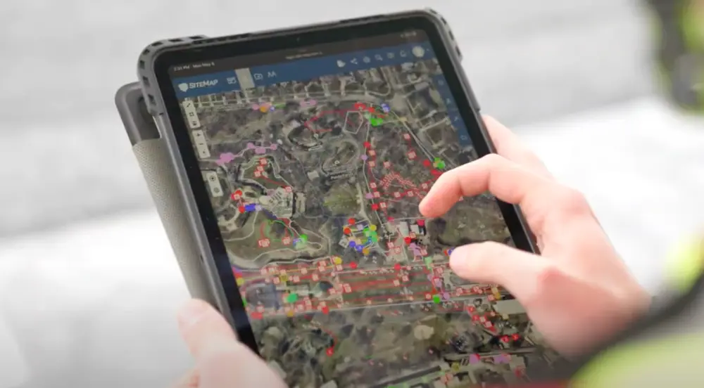
SiteMap® (patent pending), powered by GPRS, is the first-ever GIS infrastructure mapping and facilities management platform that is composed of the accurate, field-verified data collected by SIM-certified GPRS Project Managers. Accessible 24/7 from any computer, tablet or smartphone, SiteMap is a single source of truth for the information you and your team needs to eliminate the mistakes caused by miscommunications. It allows you to plan, design, manage, dig, and ultimately build better.
Click below to schedule a live, personal & free SiteMap demo today!
Frequently Asked Questions
What are the Benefits of Underground Utility Mapping?
Having an updated and accurate map of your subsurface infrastructure reduces accidents, budget overruns, change orders, and project downtime caused by dangerous and costly subsurface damage.
How does SiteMap® assist with Utility Mapping?
SiteMap®, powered by GPRS, is the industry-leading infrastructure management program. It is a single source of truth, housing the 99.8%+ accurate utility locating, concrete scanning, video pipe inspection, leak detection, and 3D laser scanning data our Project Managers collect on your job site. And the best part is you get a complimentary SiteMap Personal Subscription when GPRS performs a utility locate for you.
Does SiteMap Work with my Existing GIS Platform?
SiteMap allows for exporting of data to SHP, GeoJSON, GeoPackage, and DXF directly from any user’s account that either owns or has a job shared to their account. All these file formats can be imported and utilized by other GIS packages if manually imported by the user.