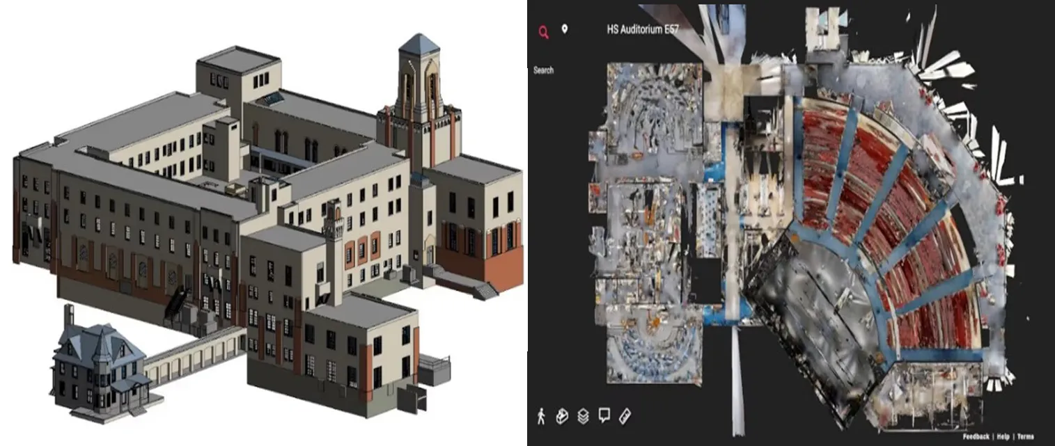
.svg)

.svg)

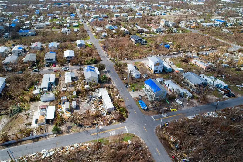
Historic building relocation is the process of moving a building recognized as a National Historic Landmark to avoid the risk of demolition. Outside factors that could threaten a historic building with demolition include environmental threats or nearby development projects.
One of the earliest examples of historic building relocation in America happened in 1889 when the former home of Alexander Hamilton in Manhattan interfered with the development of 143rd street. The bustling city had engulfed its surrounding areas, leading to its relocation 87 years after its construction.
The relocation process in 1889 involved a system of jacks and wooden wheels to lift it from its foundation and several horses and mules to pull the structure to its new home.
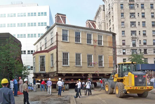
Even though the days of horse-drawn contraptions and wooden wheels are in the past, teams see relocation as the last possible resort if they can’t avoid demolition due to its delicate and complicated process.
THE RELOCATION PROCESS
The process of relocating historic buildings today involves five important phases: assessment, permitting, preparation, transportation, and restoration.
The first and possibly most important phase is assessment and documentation. During the early stages of the project, preservation teams bring in architects and engineers to assess the building’s structural integrity. This portion is particularly vital because it will determine whether the piece of history could survive the move.
Assessing the building means measuring it with extreme precision that traditional methods would have trouble meeting. To counter this, firms often utilize 3D laser scanners in the hands of reality capture professionals to ensure the area is properly measured and documented. 3D reality capture via LiDAR scanning is also faster, as laser scanners only need a few days to scan entire facilities compared to weeks or months needed with tape measurers and graph paper.
The information gathered during this process also helps prepare the foundation of the building’s new destination. The architects and engineers on site use the original foundation data to prepare the structure’s new home.
It is also important to understand the layout of all utilities during the documentation process; both at the original site and the new location. With this information, teams can efficiently disconnect and reconnect the building’s critical infrastructure. Teams can obtain this critical data by calling their local 811 public utility service, and engaging private utility locating professionals.
While it’s a legal requirement to call your local 811 before performing any excavation, they only locate public utilities, which are owned by municipalities and utility providers. Over 60% of all buried utilities are private, so private utility locators are necessary along with 811’s services to paint the whole picture of your subsurface infrastructure. Private locators also provide the depth of each line, the material they are made of, and can find unmarked or abandoned utilities that don’t show up on your plans.
The permitting phase follows the documentation process. Accurate documentation assists with the permitting approval process as it gives local and national government agencies as much information as possible when deliberating the status of their requests.
Permits that are necessary for this process to proceed include:
- Certificate of Appropriateness (COA) from local historic or landmarks commission
- Zoning approval / compliance
- Demolition / removal permits for departure site
- Building permits for the new foundation
- Utility permits
- Public right-of-way permit
- Oversized load permits
Some of the permits required are dependent on where it all takes place as each state has its own historic preservation offices.
Once the site is documented and the necessary permits are approved, the next stage is preparing the building for transportation. It’s about to be separated from its foundation so every building component must be accounted for beforehand. And long gone are the days of wooden wheels and horse-drawn transportation so there is a lot to account for.
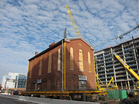
If any non-structural elements, like facades or furniture, interfere with transportation, they could be removed during the preparation process. However, preservation teams prefer to avoid this by any means to keep the site intact as much as possible. Building aspects like chimneys or porches are also subject to removal if they can’t be supported. Anything that isn’t removed must be securely reinforced to avoid damage during transport.
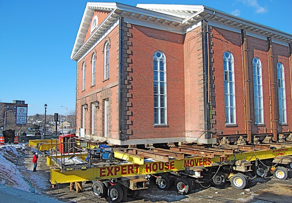
A process known as shoring is the first step of the lifting and transporting process. This involves excavating around the foundation and threading a system of steel beams under the building’s foundation to prevent structural collapse or cracking during transport.
Once the steel framework is in place, a hydraulic jacking system is positioned beneath the stabilizing steel beams. Then, the hydraulic jack slowly and evenly lifts the building in three to six-inch increments until it is one to two feet off the ground and placed onto hydraulic coaster dollies. Hydraulic coaster dollies are the industry standard for structural relocations and have weight capacities above 50 tons per dolly.
After the building is placed on the dolly, it is carefully driven to its new destination with the help of spotters that ensure its safe passage through traffic and infrastructure, like overpasses and bridges.
Now, the moving team is in the home stretch. Once they reach the historic site’s new home, the dollies position the building over its new foundation and lower it into place. The finishing touches include removing the steel shoring beams, reconnecting to utilities, and any restoration work necessary to make certain no historical integrity was lost in the move.
HOW GPRS HELPS HISTORICAL RELOCATIONS
GPRS is no stranger to historical preservation projects like historical building relocations. Our suite of field to finish visualization services help ensure your team is prepared for every step of the process.
As previously mentioned, precise measurements and extensive documentation are vital for this process. The GPRS Reality Capture Team can provide you with 2-6mm accurate drawings and models of your site. Our Reality Capture Project Managers utilize LiDAR-based 3D laser scanners to create 2-4 mm accurate point cloud models within a few hours or days depending on the scale of the project.
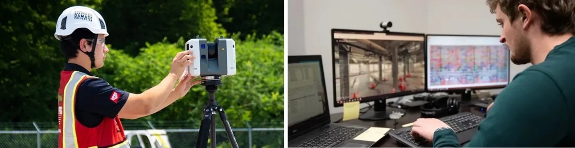
From there, our in-house Mapping & Modeling Team of expertly trained CAD technicians transform the registered point clouds into accurate, actionable deliverables for your team to reference throughout the life of the project. Some deliverables include:
- 2D CAD Drawings
- 3D BIM Models
- 3D Revit Models
- 3D Mesh Models
- BOMA Calculations
- Virtual Walkthroughs
Our SIM-certified Project Managers can also assist with is utility location. Whether your team oversees disconnecting or reconnecting the utilities, it is crucial to know the exact location and depth of each one.
Since 2017, our PMs have maintained a <0.2% at-fault incident rate on utility locating jobs, so these are results you can rely on. Our team will mark out your site with spray paint, chalk, or flags to give you an in-person visual of where the utilities lie. Along with that, all utility data is securely uploaded and delivered to your team via SiteMap® (patent pending), our cloud-based infrastructure management platform. With SiteMap at your disposal, all your site’s data is within arm’s reach or in your pocket at all times with the SiteMap mobile app.
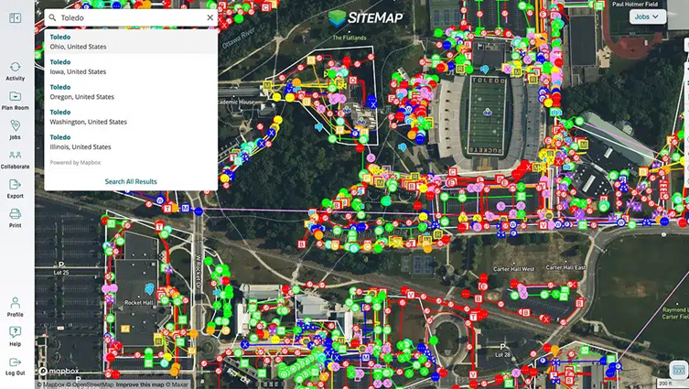
And in 2025, we launched the SiteMap Reality Capture layer that keeps all your point clouds, 3D Revit models, and virtual walkthroughs securely stored and accessible 24/7 within the platform.
Instead of keeping track of multiple links and PDFs that could get lost in the shuffle, SiteMap keeps it all in one place as your single source of truth for any historic preservation or relocation project your team takes on.
CASE STUDY: GPRS ASSISTED THE RELOCATION OF THE HISTORIC BLACKBURN LABORATORY
A historic preservation team hired Bell Architects to evaluate the Blackburn Laboratory building, an abandoned structure on the St. Elizabeth’s Hospital campus. The campus has a troubled history including an infamous autopsy theater in the basement of laboratory. Outside of its problematic history, St. Elizabeth’s Hospital was a pioneer of psychiatric architecture and achieved its historic designation in 1990.
The city of Washington D.C needed to move the former medical science center 65 feet away from its current location as it interfered with a nearby street extension.
GPRS Reality Capture Project Managers Vincent Paul and Marco Prado were tasked with scanning the interior and exterior of the building. Over an eerie three days, they captured every inch of the abandoned facility with LiDAR-based 3D laser scanners.
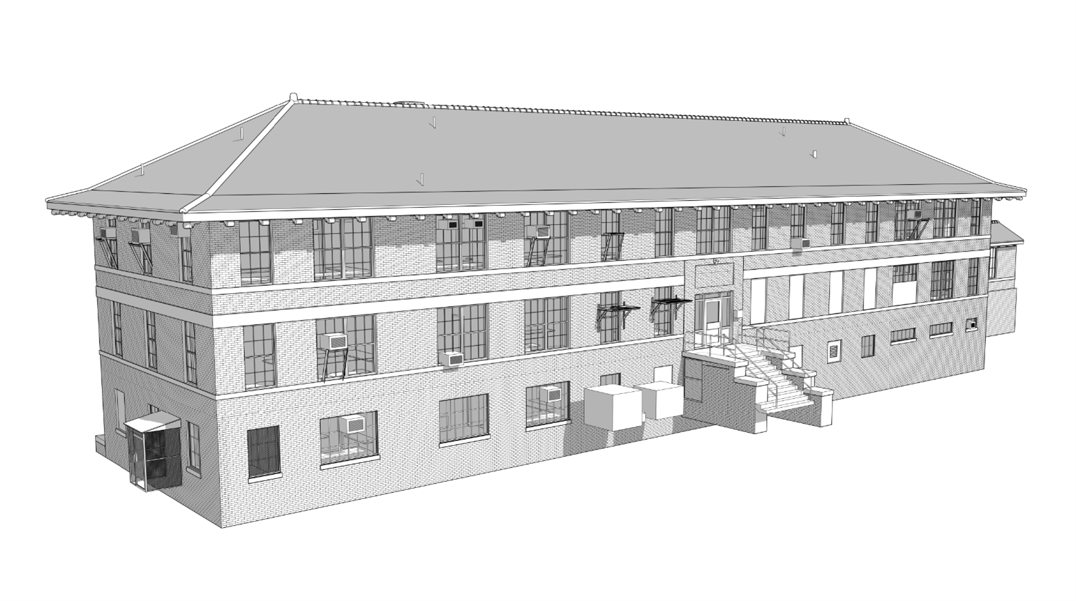
The suite of deliverables we provided to Bell Architects included:
- 3D Revit Model with CAD export
- Reflected Ceiling Plans (RCP)
- Exterior Elevation Plans
- Floor Plans
The project is still progressing thanks to the data we provided, and the relocation date is currently scheduled for October 30, 2026.
FREQUENTLY ASKED QUESTIONS
WHAT IS LIDAR?
LiDAR (Light Detection and Ranging) is a remote sensing tool that builds accurate 3D models of objects and surfaces.
Instead of using radio waves like radar, LiDAR sends out laser pulses from a scanner. These light pulses bounce off objects, and the system measures how long they take to return. This helps calculate exact distances and shapes. It creates detailed three-dimensional data about an object.
Learn more about LiDAR and how GPRS utilizes LiDAR laser scanners here.
WHAT IS POINT CLOUD DATA?
Point cloud data is the term for the billions of data points collected by LiDAR-based laser scanners.
During the scanning process, these laser scanners capture two million data points per second. Each point stores X, Y, and Z coordinates for visible surfaces like walls, doors, and MEP components.
The data points are used by GPRS’ in-house Mapping & Modeling Team to create customized 2D and 3D deliverables for clients.
Learn more about GPRS’ Point Cloud Services here.
HOW IS 3D LASER SCAN DATA PROCESSED?
Once a site is scanned, we process the raw point cloud data by combining individual scans. We remove unwanted noise and convert the data into usable formats like 2D drawings or 3D models.
The level of detail depends on the project’s needs, ranging from basic visuals to complex models.
GPRS follows a structured workflow focused on accuracy, teamwork, and planning to ensure efficient project execution.
Read more about GPRS’ reality capture services here.
CAN GPRS DELIVER CUSTOMIABLE REALITY CAPTURE DELIVERABLES?
We can deliver the following customizable deliverables upon request:
• Aerial Photogrammetry
• Digital Drawings of GPR Markings
• At-Depth Modeling
• Native Modeling
• New Construction Accuracy Analysis/Comparative Analysis
• Point Cloud Modeling Training Webinars
• Reconciliation of Clients 2D Design Drawings
• Reconciliation of Clients 3D Design Model
• Structural Steel Shape Probability Analysis
• Template Modeling
• Volume Calculations
Schedule a service with our Reality Capture Project Managers here.