.svg)

.svg)

Data center construction operates on timelines that most other commercial building types do not. A hyperscale campus may need to deliver its first phase of capacity within 12 to 18 months. Retrofit and expansion projects at existing colocation or enterprise facilities often run on even tighter schedules, with construction sequenced around live operations that cannot tolerate downtime. In this environment, every week of preventable delay has a direct revenue impact.
The most common source of preventable delays in data center construction is inaccurate or missing existing conditions data. When the location of buried utilities is unknown, when MEP layouts inside an existing facility do not match the drawings, or when subsurface infrastructure has never been documented, the result is predictable: utility strikes during excavation, design clashes discovered during construction, change orders, rework, and schedule overruns.
Accurate existing conditions documentation, captured before design begins and verified before construction starts, eliminates these surprises and keeps data center projects on schedule.
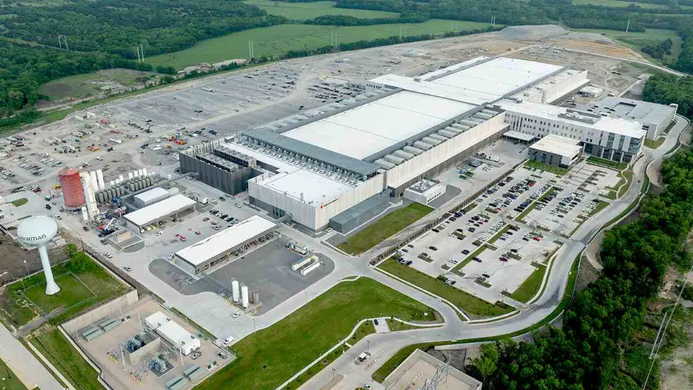
GPRS has helped data center developers close exactly this gap. On one Midwest campus, two GPRS Project Managers used a phased, dual-GPR approach to map 530 acres of buried drainage lines in 46 days, delivering a verified subsurface baseline before excavation began. That kind of upfront utility locating is what keeps a missed line from becoming a change order.
Why Existing Conditions Data Matters More in Data Centers
Data centers present a set of construction challenges that amplify the consequences of working with incomplete or inaccurate site data:
- Dense, high-value MEP infrastructure. Data centers contain some of the most concentrated MEP systems in commercial construction: redundant power feeds, backup generation, UPS systems, cooling distribution (both air and liquid), fire suppression, and extensive cable tray and conduit networks. In retrofit or expansion projects, new systems must be routed through spaces already occupied by existing infrastructure. Without precise documentation of what is already there, design clashes are inevitable.
- Zero-downtime operational requirements. Unlike most commercial construction, data center work frequently occurs adjacent to or within facilities that are actively serving customers. An accidental utility strike or system disruption during construction does not just delay the project; it can trigger service-level agreement violations and direct financial liability.
- Large-scale greenfield sites with undocumented subsurface conditions. Many new data center campuses are built on sites that were previously agricultural or undeveloped land. These sites may have buried drainage systems, abandoned utility runs, or subsurface conditions that are not reflected in any available records. Discovering these during excavation creates immediate schedule and cost impacts.
- Aggressive timelines with limited margin for error. Data center developers operate in a market where speed to capacity is a competitive advantage. Construction schedules are compressed, and the cost of a one-week delay can be significant. There is little room in these schedules to absorb the rework and redesign that result from inaccurate site data.
Brownfield and Retrofit Projects Carry the Highest Risk
While greenfield data center campuses face subsurface unknowns, brownfield and retrofit projects carry the highest risk of inaccurate existing conditions data. These projects involve renovating or expanding facilities that may have been through multiple previous build-outs, each with its own set of as-built records (or lack thereof).
Common scenarios include colocation facilities expanding into adjacent tenant space, enterprise data centers upgrading power and cooling infrastructure to support higher rack densities, and historic or adaptively reused buildings being converted to data center use. In each case, the existing conditions inside and around the building are the single most important variable for design accuracy and construction efficiency.
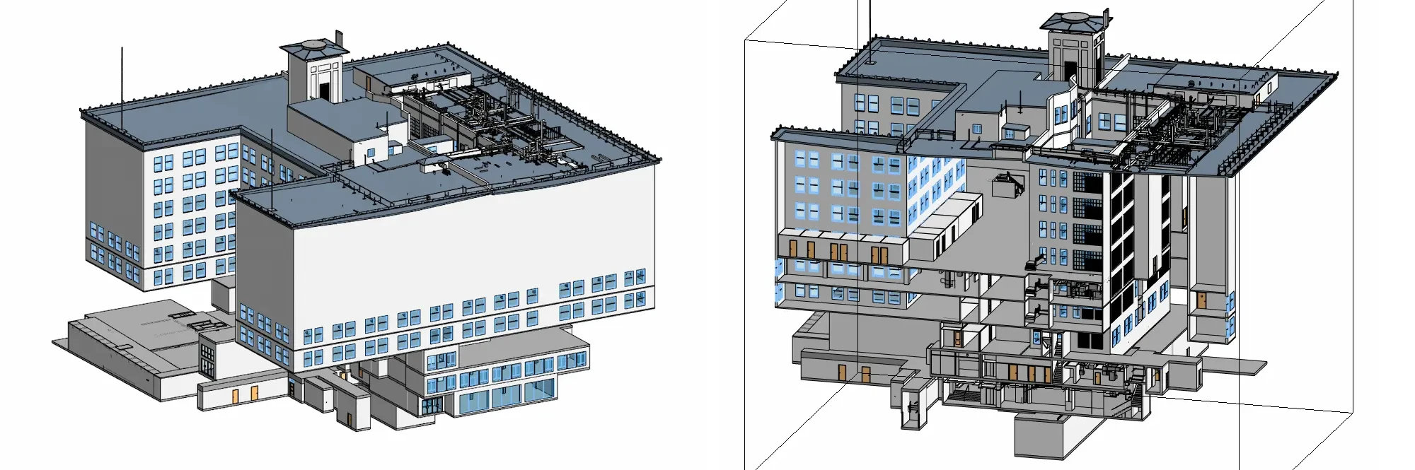
GPRS has supported this type of work firsthand. In Portland, Oregon, GPRS 3D laser scanned 200,000 square feet of the Pittock Block Internet Exchange, an eight-story carrier hotel and data center originally built in 1914. The project required capturing architectural, structural, and MEP as-built data across multiple floors, including active data closets and cooling systems, to support a renovation by Whiting-Turner. GPRS delivered a colorized point cloud, 2D CAD drawings, and an Autodesk Revit 3D BIM model, all completed without disrupting tenant operations or critical systems.
GPRS has done similar work on operational upgrades, capturing the existing conditions data that let a data center expand capacity without guesswork.
How GPRS Delivers Existing Conditions Data for Data Center Projects
GPRS provides the full range of existing conditions services that data center owners, contractors, and design teams need to design, build, and operate with confidence.
Utility locating and subsurface mapping
GPRS SIM-certified Project Managers use ground penetrating radar (GPR) and electromagnetic (EM) locating to identify and map the position and depth of all buried utilities on a data center site, including electrical, gas, water, sewer, storm drainage, irrigation, and telecommunication lines. For large greenfield campuses, GPRS deploys high-speed GPR arrays alongside traditional locating methods to cover large acreage efficiently.
3D laser scanning and BIM modeling
For retrofit and expansion projects, 3D laser scanning captures construction-grade documentation of existing architectural, structural, and MEP systems. The resulting point cloud data is converted into 2D CAD drawings and 3D BIM models that integrate directly into Autodesk Revit and other design platforms. This gives design teams a verified digital baseline for clash detection, prefabrication planning, and construction sequencing.
Concrete Scanning
Data center build-outs frequently require coring, cutting, and drilling through concrete slabs and walls to route power, cooling, and cable infrastructure. GPR concrete scanning identifies the location of rebar, post-tension cables, conduit, and other embedded objects before any cutting begins, preventing accidental strikes that can damage structural elements or disrupt adjacent live operations.
Leak Detection
Data centers with water-based cooling systems (chilled water loops, cooling towers, or direct liquid cooling) are vulnerable to leaks that can damage equipment and disrupt operations. GPRS acoustic leak detection pinpoints the location of pressurized water line leaks without excavation or demolition, allowing repairs to be targeted precisely.
All field data is delivered via SiteMap® (patent pending), GPRS' cloud-based platform, where project teams can access, view, and share utility maps, point clouds, CAD files, and BIM models 24/7 from any device. GPRS has supported data center projects for leading hyperscale and enterprise data platform providers nationwide.
GPRS can help you visualize your data center site, above and below ground, to keep your project on time, on budget, and safe.
What can we help you visualize?

Frequently Asked Questions
Why is existing conditions data important for data center construction?
Accurate existing conditions data prevents the utility strikes, design clashes, and change orders that derail compressed data center schedules, where a single week of delay carries direct revenue impact. The risk is real: roughly 60% of utility lines on a site are privately owned and invisible to 811, so they stay undocumented unless someone maps them. GPRS captures and verifies that data before design begins through utility locating and existing conditions documentation. On one data center campus, two Project Managers mapped 530 acres of buried drainage in 46 days, giving the team a verified baseline before excavation.
How does GPRS map utilities on large data center campus sites?
For large greenfield sites, GPRS combines traditional ground penetrating radar (GPR) and electromagnetic (EM) utility locating with high-speed GPR arrays to cover large acreage efficiently. This phased approach maps buried drainage, electrical, water, sewer, and communication lines across hundreds of acres in a fraction of the time that traditional methods alone would require. In one project, GPRS mapped 530 acres of buried drain lines for a Midwest data center campus in 46 days using this dual-technology approach.
Can GPRS perform 3D laser scanning in an active data center without causing downtime?
Yes. 3D laser scanning is non-invasive and does not produce radiation, noise, or vibration. GPRS Project Managers routinely perform scanning in active data center environments, including server halls, mechanical rooms, and data closets with live equipment. The process captures millimeter-accurate documentation of all architectural, structural, and MEP systems without disrupting operations.
What deliverables does GPRS provide for data center projects?
GPRS delivers field markings, digital utility maps, 3D point clouds, 2D CAD drawings, and 3D BIM models (Autodesk Revit). All data is stored and accessible 24/7 via SiteMap®, GPRS's cloud-based GIS platform. Deliverables integrate directly into design software, providing a verified digital baseline for planning, design, and construction.