

.svg)

Highlights
THE BOTTOM LINE
GPRS provided accurate utility maps and architectural, structural, and MEP data for upgrades without impacting data center operations. All deliverables are secure and accessible to the engineers from anywhere, 24/7 via the SiteMap® GIS Platform and mobile app.
Industry
Data Centers
Service
Utility Locating, Reality Capture, 3D BIM Modeling
Location
Plano, Texas
GPRS Project Manager Insight
“I am SIM-certified, meaning I have completed rigorous technical training across all GPRS services. This allows me to step onto a job site and perform utility locating and 3D laser scanning with maximum accuracy, delivering reliable data that helps clients make confident, informed decisions.” – Dean Sturt, GPRS Project Manager
Deliverables
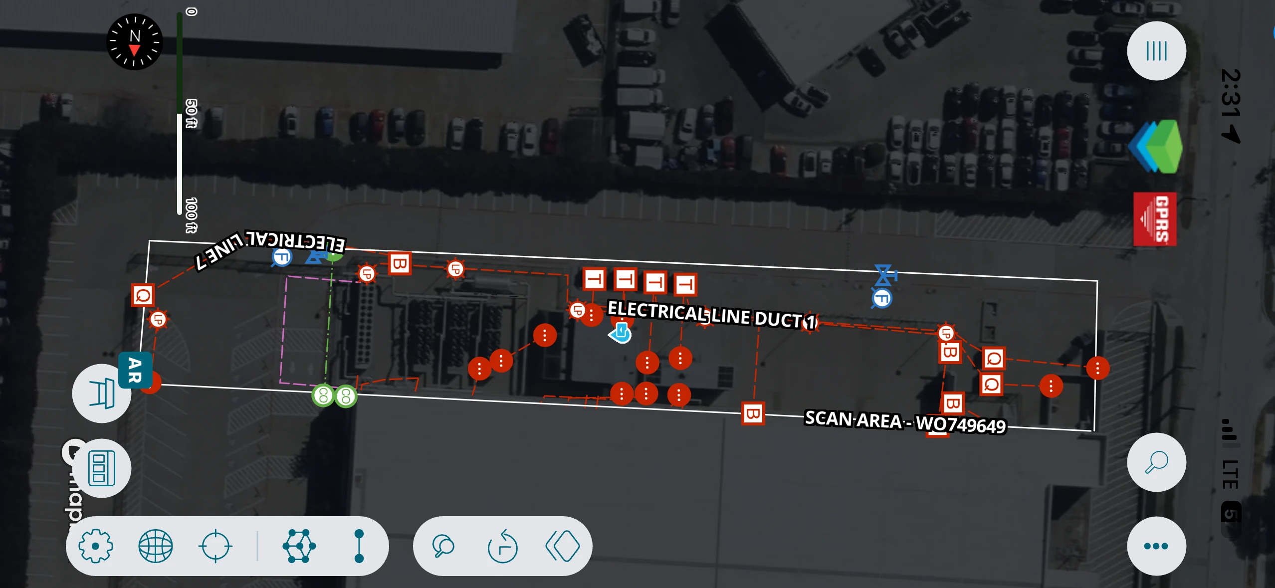
Utility Maps, Point Cloud, 3D BIM Model, SiteMap®
PROJECT APPLICATION
ASK
Task
Deliver subsurface utility and existing conditions site data using utility locating and 3D laser scanning at a 107,000 s.f. high density data center. The GPRS data allowed an engineering firm to plan additional server integrations into the facility’s existing infrastructure.
PROBLEM
- The facility, built in 2011, required upgrades to support additional servers and communication lines
- The engineering firm needed existing conditions documentation of the utility substation, server halls, racks, power supply, generators, chillers, and cooling towers
- The facility could not experience downtime during utility locating and 3D laser scanning mobilization
Solution
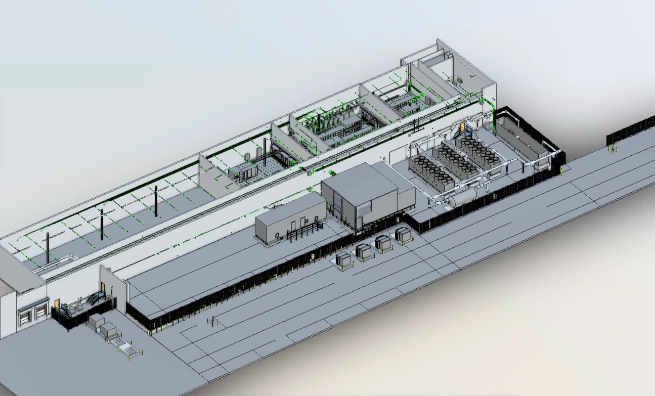
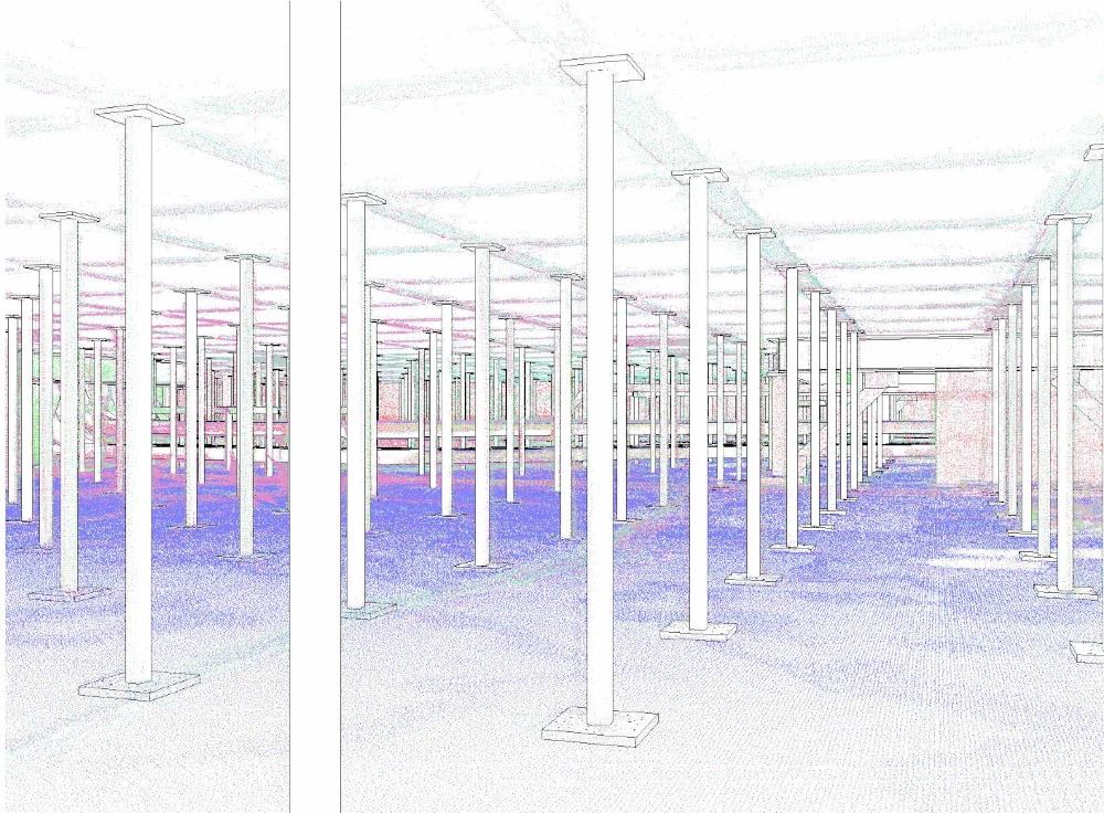
A single SIM-Certified GPRS Project Manager planned and executed utility locating and 3D laser scanning using ground penetrating radar (GPR), electromagnetic (EM) locating, and LiDAR technologies to capture accurate subsurface and structural site data and deliver up-to-date utility maps, point clouds, and a 3D BIM model to the engineering firm for informed project planning.
Data center scope of work:
- 38,000 s.f. of exterior utility locating: findings marked on the surface using paint/pin flags
- 22,000 s.f. of interior 3D laser scanning of electrical and mechanical spaces: 16,000 s.f. above floor and 6,000 s.f. of underfloor areas (with 3 ft. clearance), capturing dense piping and conduit
- 15,000 s.f. of exterior 3D laser scanning to capture electrical and mechanical equipment
Benefits
- Accurate, field-verified subsurface utility maps showing the location and depth of electrical, communications, gas, water, and sanitary/storm sewer infrastructure to reduce risk during excavation and tie ins
- Structural and MEP system layouts and dimensions were captured without disrupting operations
- Server halls, server racks, power supply and cooling systems were documented to support retrofit planning
- Developed a high detail 3D BIM model from point cloud data to deliver architectural, structural, and MEP details for design planning and construction coordination
- TruView virtual tours enabled remote collaboration and faster design decisions
- Centralized digital delivery via SiteMap® gave the engineering team access to verified site data, models, and utility information, all within a single geospatial platform
- Accurate infrastructure as-builts will continue to support informed decision making for upgrades, capacity planning, and long-term facility operations
CASE STUDY GALLERY


.avif)


.avif)
