.svg)
Data Centers

GPRS As-Built Services for Data Center Construction
Accurate site as-builts are critical from initial design through commissioning and ongoing facility management. Clear records of utilities, structures, and systems accelerate design and reduce subsurface damage, change orders, delays, and costs.
Accurate as-built documentation isn’t just a construction detail, it’s a strategic asset. It allows data center projects to scale faster and avoid costly surprises.
We Understand Your Data Center Construction Challenges
Aggressive Timelines: Rapid timelines demand speed without sacrificing quality or safety.
Infrastructure Upgrades: Server, cooling, and power system upgrades must be planned carefully to maintain uptime and operational reliability.
MEP Integration: Upgrading MEP systems in dense infrastructure is challenging, as strict tolerances demand millimeter-level accuracy for prefabrication and installation.
Subcontractor Coordination: Managing multiple trades requires precise sequencing and communication to avoid clashes and schedule delays.
Regulatory Compliance: Local, national, and industry codes demand thorough documentation and regular inspections.
Comprehensive Subsurface and Structural Solutions for Data Centers
GPRS partners with data center owners, contractors, and design teams to deliver subsurface utility and structural as-built data that supports new builds, expansions, and retrofits. GPRS Project Managers are SIM-certified through a rigorous training program in utility locating, concrete scanning, reality capture, video pipe inspection and leak detection that exceeds industry standards. The certification includes over 400 hours of classroom, field, and LiDAR instruction to ensure safe, accurate, and compliant above and below ground as-built data collection.
As-builts that integrate with CAD, BIM, and GIS platforms enable better planning, clash detection, and lifecycle management of data centers.
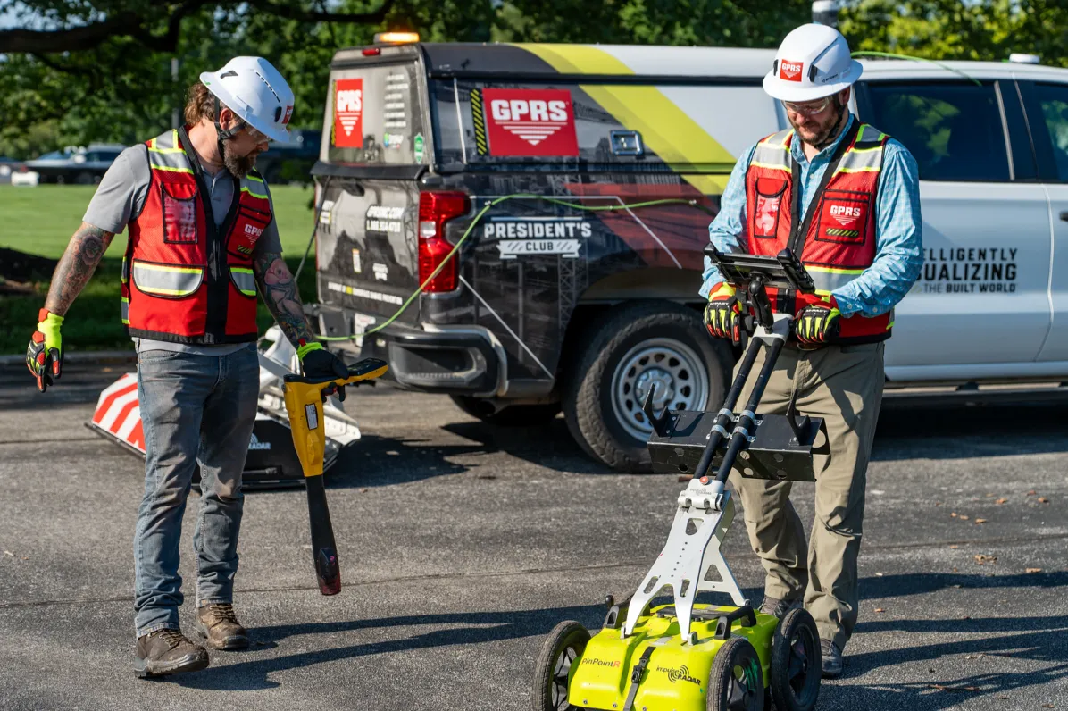
Utility Locating Services: Identifying underground utilities, including electrical, gas, water, sewer, steam, irrigation, and telecommunication lines prior to excavation helps prevent costly damage, serious injuries, project delays, and service interruptions. Learn about GPRS Utility Locating Services.
Concrete Scanning Services: Concrete scanning detects embedded objects like rebar, post-tension cables, and conduits in concrete slabs and walls, ensuring safe coring, drilling, and cutting during build-out. Learn about GPRS Concrete Scanning Services.
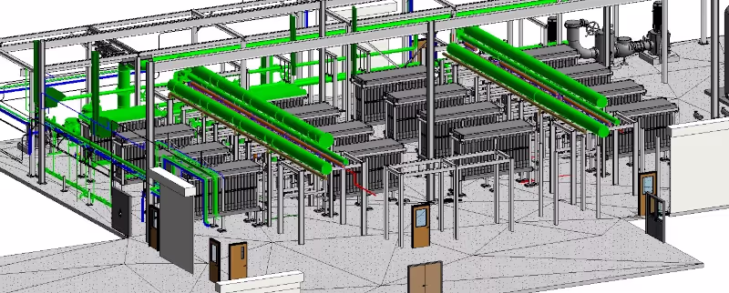
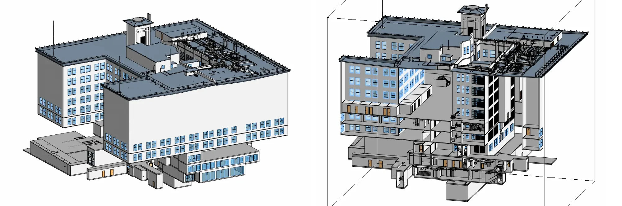
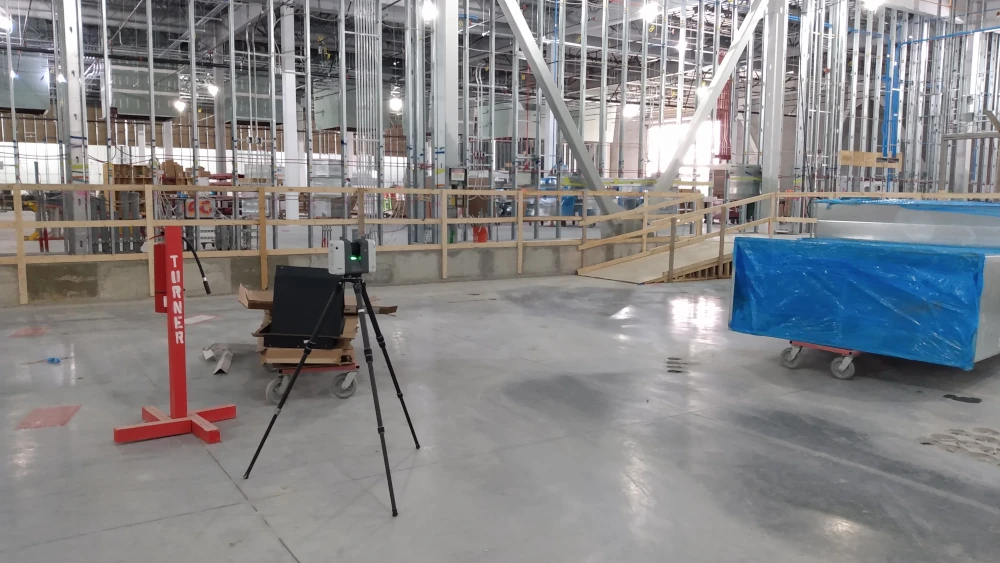
Reality Capture Services: 3D laser scanning with LiDAR captures precise structural and MEP layouts, seamlessly integrating with CAD and BIM. This enables accurate planning, clash detection, and efficient construction sequencing. Learn about GPRS Reality Capture Services.
Video Pipe Inspection Services: VPI services assess the condition and layout of underground sewer and storm systems, identifying blockages, structural issues, or misalignments before construction begins. Learn about GPRS Video Pipe Inspection Services.
Leak Detection Services: Early detection of hidden leaks in walls, ceilings, or underground sewers helps prevent costly repairs and downtime, ensuring critical operations remain safe and uninterrupted. Learn about GPRS Leak Detection Services.
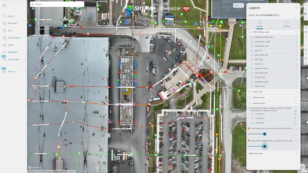
SiteMap® GIS Software: GPRS’ secure, cloud-based platform and mobile app centralizes your project data into an interactive tool for easy access and file sharing. SiteMap provides facility managers with a comprehensive, real-time digital view of their infrastructure above and below ground, including utility maps, concrete imaging, 2D CAD drawings, 3D BIM models, NASSCO reports, and more, all customized to your project’s needs. Learn about GPRS SiteMap GIS Software.

Applications for Data Center Construction
As a data center owner, general contractor, or engineer, you know that every decision can impact uptime, reliability, and long-term value. GPRS helps you design, build, operate, and maintain your facilities with confidence. We’ve supported projects for leading providers including AWS, Microsoft Azure, Google Cloud Platform, and CyrusOne, and we can bring that same expertise to your site.
Accurate as-built documentation from GPRS is essential for every stage of a data center’s lifecycle, from construction and upgrades, to operations and real estate, because it reduces risk, prevents downtime, and ensures long-term reliability and value.
New Construction: Building a new data center requires precise engineering and seamless coordination across trades. You need guaranteed access to power, water, and fiber connectivity, and you can’t afford surprises underground. GPRS identifies subsurface utilities to ensure safe tie ins and compliance with dig policies. After construction, our utility maps and reality capture as-builts give you a permanent record of actual conditions, supporting future expansions and retrofits.
Retrofits & Upgrades: When upgrading power systems, cooling solutions, or communication lines, downtime isn’t an option. GPRS provides detailed as-built records of structures and utilities so you can plan layouts, integrate systems, and avoid costly surprises. With accurate documentation, you reduce clashes, delays, and overruns, keeping your upgrades smooth and your operations reliable.
Facility Management: Your operations depend on Building Management Systems (BMS), but managing dense infrastructure requires more than monitoring equipment. GPRS’ SiteMap platform centralizes your records, utility maps, CAD drawings, and 3D models, into one secure, accessible system. This gives you a real time digital view of your facility, helping you optimize layouts, track assets, ensure compliance, and prepare for emergencies.
Commercial Real Estate Transactions: if you’re buying, selling, or developing data center properties, digital as-builts are a critical asset. GPRS documentation reduces liability, accelerates due diligence, and provides reliable insight into MEP systems. For owners, this means smoother transactions, stronger compliance, and a clear path for future expansion strategies.


Let's Get To Work
Schedule A Project

CUSTOM SERVICE PLANS

Scheduling

Pricing

Approach

mapping & Modeling
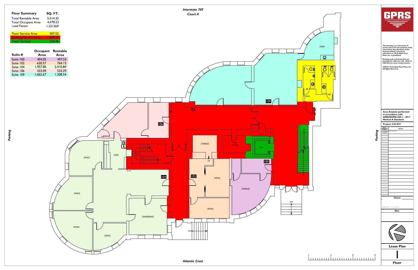
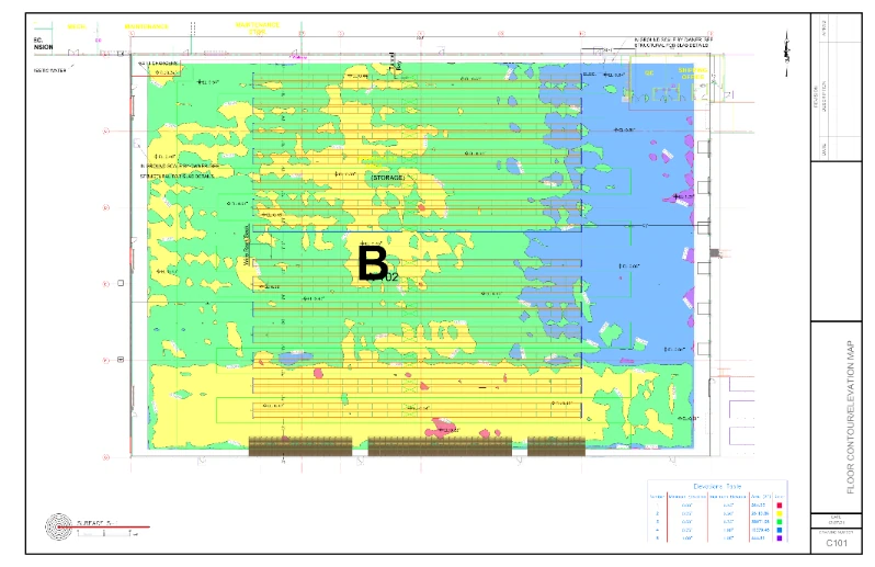
GPRS delivers the most up-to-date, accurate and comprehensive site data possible in the format required for your project. We provide complimentary KMZ and PDF maps with every utility locate we perform. Our Mapping & Modeling Team can create a wide variety of customizable maps and models, from a simple GPS-enabled map of your utility locate, to highly-detailed 2D CAD drawings and 3D BIM models, depending on your needs.
AS BUILT DRAWINGS
2D MAPS & 3D MODELS
SITEMAP® MOBILE APP

One Call Program

Public Property
Private Property

Embedment
Case Studies


.avif)

Related Articles