

.svg)

ENVIRONMENTAL DUE DILIGENCE
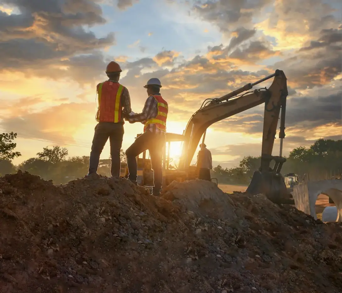
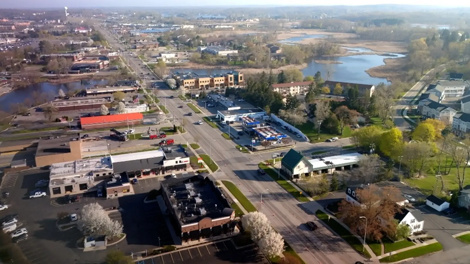
Eliminate Strikes, Reduce Rework in EV Charging Infrastructure
Striking electrical lines around EV charging stations stall projects, raise costs, and jeopardize the safety of workers and others nearby. GPRS delivers 99.8% accurate utility locating on all projects with 2D & 3D solutions delivered via SiteMap® (patent pending) to help you coordinate work, prevent strikes, and stay on schedule.
GPRS Supports EV Charging Projects
Beyond line of sight reality capture for corridors, depots, retail fast charge sites, and campus EVSE.
GPRS partners with charge point operators, engineers, and general contractors to reduce risk, improve coordination, and deliver field-verified as builts across the full EV charging lifecycle.
General Contractors & Subcontractors
Collaborates alongside construction teams to ensure safe excavation and efficient execution. Services include:
- Utility locating
- Concrete scanning
- Leak detection
Ground Penetrating Radar (GPR)
Electromagnetic (EM) locating
LiDAR scanning

Engineers & Surveyors
High-resolution data for design, modeling, and analysis, supporting:
- Corridor alignments
- Depot layouts & feeder routes
- Retail host tie ins & right of way documentation
Concrete scanning
Concrete scanning
Leak detection
Power Utility Providers
Partners with national and regional service providers, supporting:
- Fast charge rollouts & upgrades
- Backbone/make ready expansions
- Central operations & reliability initiatives
Transmission and distribution upgrades
Substation renovations
Grid modernization initiatives

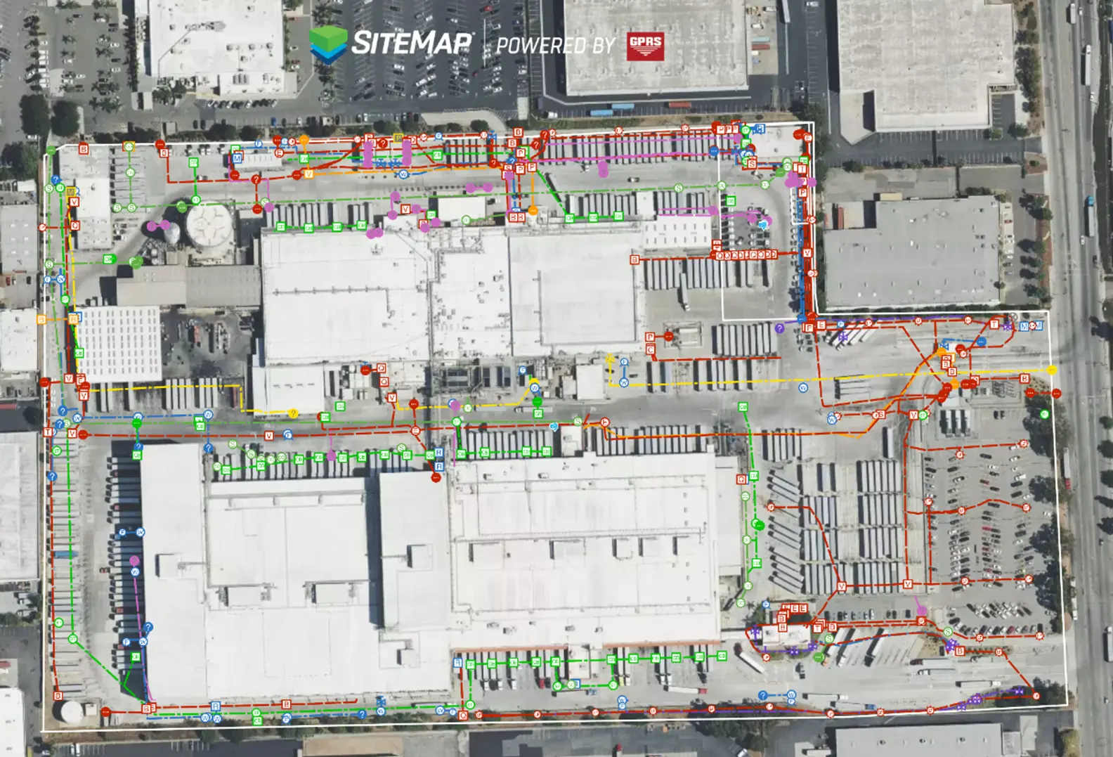
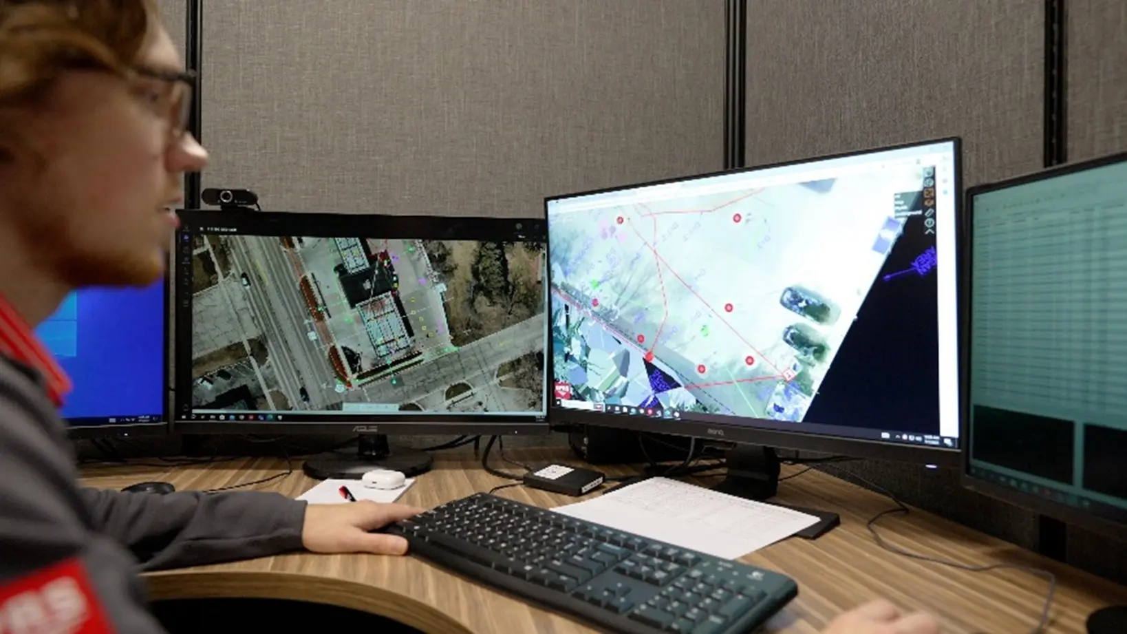
Full-site visualization
2D CAD drawings
2D CAD drawings
3D BIM models
Virtual tours accessible via SiteMap®
How GPRS Supports EV Charging Programs
Delivering with field-verified above and below ground documentation to reduce risk and rework.
Years in Business
Customers
Team Members
Locations
Fast Charge Corridors & Travel Centers
GPRS field-verified data ensures additional EV chargers can be installed safely and efficiently to meet the growing demand of electric vehicles.
Key Challenges
Limited outage windows
Tight tie-in tolerances
Unknown embedded conditions
Our Solutions
Cross bore investigations
Structural condition assessments
Blockage and defect identification
Key Challenges
- Unreliable as-builts
- Strict safety and reliability standards
- Limited outage windows
Our Solutions
- Reality capture services for precise tie-ins, prefabrication, and clearance studies
- Utility locating and mapping to streamline conduit and feeder work
- Above and below-ground documentation to reduce the risk of structural damage and costly delays
Fleet Depots & Logistics Yards
Depot routes, trenching, and make ready work must meet specific clearances while avoiding conflicts with dense existing utilities.
Our Solutions
Utility locating and mapping on public and private property
GPR and EM technology for underground and overhead transmission
Reliable data for HDD, redesign avoidance, and conflict resolution
Key Challenges
- Incomplete or outdated records
- Redesigns and relocations from utility conflicts
- Costly utility strikes
Our Solutions
- Utility locating and mapping that supports SUE Level 2
- Field-verified data, drawings, and models for design reassurance
- Above and below-ground documentation to reduce the risk of structural damage and costly delays
Retail & Mixed Use Hosts
Installing EVSE at live businesses (stores, offices, restaurants) demands exact clearances, safe coring/anchoring, and careful work around building systems and buried utilities.
Key Challenges
- Unknown embedded elements in concrete
- Costly utility strikes
- Strict standards
Our Solutions
- Laser scanning equipment for exact fit up and prefabrication
- Concrete scanning and utility locating for safe digging
- Above and below-ground documentation to reduce the risk of structural damage and costly delays
Our Solutions
Mapping grounding grids, duct banks, and buried conductors
Laser scanning of switchyards, control buildings, and equipment clearances
Millimeter-accurate E57 point clouds and digital twins for design, outage planning, and expansions

Our Solutions
Reality capture for overhead clearance verification
Utility locating for dense underground corridors
NASSCO-certified VPI and CCTV inspections
HDD planning with cross-bore prevention and post-install verification
Meet with our industry experts

Construction Applications
Supporting the full spectrum of modern EV charging infrastructure projects
- Prevent utility strikes when routing feeders and installing eqipment
- Develop 2D and 3D deliverables of your site that enhance the planning process and reduce rework
- Provide SiteMap access for real-time coordination across teams
- Locate underground utilities to help avoid damaging existing infrastructure when trenching or excavating
- Perform comprehensive concrete scans to ensure safe coring and drilling when installing bollards and other equipment
- Deliver digital utility data and as-built records to improve future project planning
- Scan and map all underground utilities to reduce the risk of utility strikes at operating establishments like gas stations, restaurants, and offices
- Provide digital as-builts for tie-ins in tight areas
- Provide SiteMap access for real-time coordination across contractors
Frequently Asked Questions
Before breaking ground, it is important to understand where buried power, gas, water, sewer, and telecom lines are. With the field-verified utility data collected by GPRS, contractors on site can avoid utility strikes and stay on task.
Some deliverables clients can expect to receive when working with GPRS on EV charging infrastructure projects are:
• High-resolution utility as-builts (PDF or KMZ files)
• Above and below-ground facility and infrastructure mapping
• Conceptual site models (CSM)
• Concrete markings and mapping
• As-built creation and existing conditions documentation
Contractors use SiteMap to access information directly on the job site. They can view utility locations, reports, and drawings on a tablet or laptop.
Having this information in the field saves time and keeps workers safe.
With the role-based access, Subcontractors can use SiteMap to see only the information they need for their jobs. This helps them understand where utilities and structures are located without confusion.
Subsurface Investigation Methodology (SIM) is a standard operating procedure and set of professional specifications that work as a guide for utility locating experts when scanning for buried utility lines. All GPRS Project Managers are required to achieve SIM 101 certification, which requires 80 hours of hands-on training in a classroom setting and 320 hours of mentorship in the field. For reference, the American Society for Nondestructive Testing’s (ASNT) minimum training recommendation includes eight hours for training and 60 hours practicing GPR to achieve NDT Level 1 certification in ground penetrating radar (GPR) scanning.
SIM requires the use of multiple, complementary technologies, like GPR scanning and electromagnetic (EM) locating, when locating buried utilities or scanning a concrete slab.
Ready to Break Ground with Confidence?
We deliver 99.8% accurate utility locating and mapping services your team can use immediately.