

.svg)
What Is Geotechnical Engineering?
Every building, road, bridge, and dam derives its structural integrity from the quality of the steel and concrete above ground. Even more important than the above-ground elements, however, are the condition and distribution of the soil, rock, and groundwater beneath it.
The strength of any engineered structure is ultimately contingent on the capacity of the earth to bear its load – and that capacity is far from uniform. Before the first column is set or the first lane of pavement is laid, engineers must conduct a rigorous investigation of subsurface conditions to determine whether the ground can sustain what is being built. That is the domain of geotechnical engineering.
Geotechnical engineering is a specialized branch of civil engineering that investigates the mechanical behavior of soil, rock, and groundwater in relation to infrastructure design and construction. Its practitioners, geotechnical engineers, combine principles from geology, soil science, fluid mechanics, and structural engineering to answer a deceptively simple question: can the ground support what we want to build, and if not, what must be done to make it capable of doing so?
The answers to that question determine the safety and longevity of virtually every piece of infrastructure on earth.
Why Subsurface Conditions Are Critical
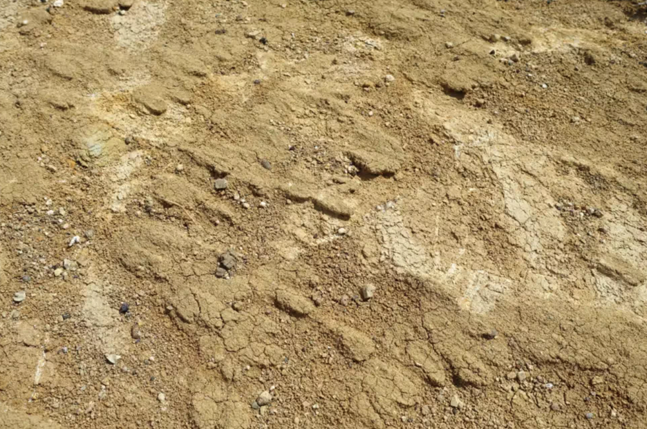
Steel and concrete are manufactured materials produced to precise, predictable specifications. Soil is not. It is a product of millions of years of geological processes, including weathering, erosion, deposition, and biological activity, and it varies enormously from one location to the next. Two building sites separated by only a few hundred feet may have completely different underground profiles.
One might consist of dense, well-compacted gravel capable of supporting enormous loads. Another might contain soft, compressible clay that deforms significantly under pressure. A third might conceal buried organic material, abandoned utility lines, or subsurface voids that shift or collapse over time. GPRS supports subsurface investigations, geotechnical engineers, and environmental due diligence teams conduct research without damages or line strikes.
When engineers fail to account for these subsurface variables, the consequences can be severe. Structures may settle unevenly, causing cracking in walls, misaligned door frames, and warped floors. In extreme cases, differential settlement (where one part of a foundation sinks faster than another) can compromise a building’s complete structural integrity. Slopes may fail. Retaining walls may buckle. Entire sections of roadway may subside. Geotechnical engineers identify these risks before construction begins and adjust designs accordingly, dramatically reducing the probability of costly and potentially catastrophic failures.
The economic stakes are also significant. According to research published in engineering literature, foundation-related failures account for a substantial share of construction defect litigation in the United States each year. Early geotechnical investigation is, by any measure, one of the highest-return investments a project owner can make.
A Brief History of Geotechnical Engineering
Human beings have been building on the earth for millennia, and engineers have grappled with ground conditions for just as long. Ancient Egyptians drove timber piles into soft Nile delta soils to support monumental structures. Roman engineers developed sophisticated drainage systems to manage groundwater beneath their roads and aqueducts. Chinese builders used timber grillages to distribute loads across soft ground. In each case, however, the knowledge was empirical and was accumulated through observation, trial, and sometimes catastrophic error rather than grounded in scientific theory.
The transformation of soil engineering into a rigorous scientific discipline is largely attributable to one figure: Karl Terzaghi (1883–1963), an Austrian-American engineer widely regarded as the father of soil mechanics. In 1925, Terzaghi published Erdbaumechanik (“Soil Mechanics”), the first comprehensive theoretical framework for understanding how soil behaves under applied stress. His consolidation theory – which explains how saturated clay slowly expels pore water and compresses under load – remains foundational to geotechnical practice today. His work gave the field a scientific backbone and established principles that continue to underpin modern analysis and design.
Following World War II, a surge in infrastructure development across North America, Europe, and Asia accelerated the growth of the discipline considerably. The construction of interstate highway systems, major dams, high-rise buildings, and offshore platforms created demand for more sophisticated methods of ground investigation, slope analysis, and foundation design. Professional organizations, graduate programs, and standardized testing methods proliferated. By the latter half of the 20th century, geotechnical engineering had established itself as an indispensable component of every major construction project.
Core Concepts and Technical Principles
Geotechnical engineering encompasses several related technical domains, each focused on a different aspect of how earth materials behave under natural and constructed conditions.
Soil Mechanics
Soil mechanics is the study of how soil responds to physical forces. Soil is not a simple, uniform material, it is a complex mixture of mineral particles, water, and air, and its engineering behavior is governed by the proportions and arrangement of these components. Engineers measure several key properties: shear strength, which describes a soil’s resistance to sliding or shearing failure along an internal plane; compressibility, which quantifies how much a soil mass will deform under an applied load; and permeability, which governs how readily water moves through the soil matrix. Each of these properties varies with grain size, moisture content, and the degree of compaction. Clay soils, for instance, are highly compressible and have low permeability, making them prone to long-term settlement. Sandy soils drain quickly and resist compression but may liquefy under dynamic loading such as earthquakes.
Rock Mechanics
Rock mechanics examines the behavior of intact rock and discontinuous rock masses, which are bodies of rock intersected by fractures, joints, faults, and other structural features. While intact rock is generally far stronger than soil, the presence of discontinuities can create planes of weakness that govern the stability of slopes, tunnels, and underground excavations. Rock mechanics are particularly critical in mining, tunneling, dam abutment design, and the construction of structures on or within hard rock formations. Engineers use field mapping, core drilling, and laboratory testing to characterize rock strength and deformability.
Foundation Engineering
Foundation engineering addresses the challenge of transferring a structure’s weight safely into the ground. The selection of foundation type depends on the magnitude of the structural loads, the depth to competent soil or rock, and the acceptable limits on settlement. Shallow foundations, including spread footings and mat foundations, are appropriate when strong bearing material exists close to the surface. When surface soils are weak or highly compressible, deep foundations such as driven piles, drilled shafts (also called caissons), or micropiles are used to carry loads down to stronger strata. The design of deep foundations requires careful analysis of both end-bearing capacity (the resistance mobilized at the tip of the pile) and skin friction (the resistance developed along the shaft as it moves through surrounding soil).
Slope Stability
Slope stability analysis evaluates the risk of landslides, slumps, and erosion on natural hillsides as well as engineered embankments and cut slopes. Slope failures are triggered by a combination of gravity, water, and changes in material strength. Rainfall saturates soil, increasing pore water pressure and reducing effective shear strength. Undercutting from stream erosion or construction activity removes lateral support. Earthquakes apply dynamic horizontal forces that can instantaneously destabilize a marginally stable slope.
Geotechnical engineers use limit equilibrium methods and numerical modeling to calculate a slope’s factor of safety, the ratio of resisting forces to driving forces, and design stabilization measures such as drainage systems, retaining walls, soil nailing, and rock anchors when the factor of safety is insufficient.
Groundwater Management
Groundwater is one of the most powerful variables in geotechnical engineering. Water exerts pore pressure within soil voids, effectively reducing the contact stress between soil particles and thereby diminishing shear strength. A soil that is perfectly stable in a dry condition may approach failure when saturated.
Groundwater also drives seepage forces, which involve the drag exerted on soil particles as water flows through them. These forces can destabilize embankments and dam cores. Geotechnical engineers design subdrainage systems, impermeable cutoff walls, relief wells, and dewatering systems to manage groundwater during both construction and the operational life of a structure.
How a Geotechnical Investigation Works
A complete geotechnical investigation is a multi-phase process that moves from desktop research to field work to laboratory analysis to engineering judgment. Each stage builds on the last, and the quality of the final design recommendations depends on the thoroughness of the investigation at every step.
Phase 1: Desk Study
Before any field crew sets foot on a site, engineers compile and review all available existing information. This includes published geological maps, borehole records from nearby projects, historical aerial photographs, topographic surveys, and records of prior land use.
A site with a history of industrial use, for example, may harbor buried tanks, utility corridors, or contaminated fill material that must be identified before intrusive investigation begins. This phase is relatively inexpensive and can significantly improve the efficiency of subsequent field work by directing investigation toward the most critical unknowns.
Phase 2: Field Investigation
Field investigation is the core of any geotechnical program. Teams drill boreholes at strategic locations across the site, typically using rotary or hollow-stem auger equipment, to collect samples and run in-situ tests at intervals throughout the soil profile. The Standard Penetration Test (SPT) (ASTM D1586), in which a split-spoon sampler is driven into the soil by a standard hammer dropped from a fixed height, is one of the most widely used field tests in the world, providing both a sample and an indirect measure of soil resistance.
The Cone Penetration Test (CPT) pushes an instrumented probe into the ground at a constant rate, continuously measuring tip resistance and sleeve friction to produce a detailed, real-time profile of soil stratigraphy. Other field techniques include vane shear testing for soft clays, pressure meter testing for in-situ stiffness, and geophysical methods such as seismic refraction and electrical resistivity surveys for broader subsurface imaging.
At GPRS, we utilize a thorough model called SIM or Subsurface Investigation Methodology. SIM is a standard operating procedure comprised of two specifications created for subsurface investigations, one for underground utility locating and one for concrete scanning. SIM is designed to achieve the most accurate results when performing non-destructive subsurface testing.
Phase 3: Laboratory Testing
Samples collected during field work are transported to a geotechnical laboratory for detailed testing. Index tests, including grain size analysis, Atterberg limits, and moisture content determination, classify the soil and provide a framework for predicting its engineering behavior.
More sophisticated strength tests, such as triaxial compression and direct shear, measure the parameters used in foundation and slope stability calculations. Consolidation tests define the rate and magnitude of settlement under sustained load. The combination of field and laboratory data gives engineers a comprehensive picture of subsurface conditions and the parameters needed for design.
Phase 4: Analysis, Design, and Construction Support
With a well-characterized subsurface model in hand, engineers run bearing capacity calculations, settlement predictions, and slope stability analyses using both hand methods and finite element or finite difference computer models. The results inform specific design recommendations: foundation type and depth, allowable bearing pressures, estimated total and differential settlement, required ground improvement, and excavation support requirements.
Many geotechnical engineers remain involved during construction to observe conditions exposed in excavations, verify that assumed bearing strata have been reached, and respond to unexpected conditions as they arise.
Where Geotechnical Engineering Shows Up
Geotechnical engineering is woven into the fabric of nearly every infrastructure sector. Its principles apply wherever a structure must interact with the ground – which is to say, everywhere.
- Buildings and Skyscrapers: High-rise buildings impose enormous, concentrated loads on small footprint areas, requiring deep foundation systems that can transfer hundreds of thousands of tons of load to competent bearing strata far below the surface. The geotechnical investigation for a major urban tower may involve dozens of deep boreholes, extensive laboratory testing programs, and three-dimensional computer modeling of foundation-soil interaction.
- Transportation Infrastructure: Roads, railways, bridges, and airport runways all depend on stable subgrade conditions. Differential settlement beneath pavement structures causes cracking, rutting, and safety hazards. Bridge foundations must be designed to resist not only vertical loads but lateral forces from wind, traffic, and scour – the erosion of streambed material around foundation elements during flood events.
- Dams and Levees: No application demands more rigorous geotechnical analysis than dam engineering. A dam failure releases catastrophic energy and can devastate communities for miles downstream. Geotechnical engineers evaluate seepage through and beneath the dam body, the stability of the embankment against sliding, and the risk of internal erosion – a gradual process in which seeping water progressively removes fine soil particles and eventually creates a continuous channel through the dam.
- Tunnels and Underground Structures: Tunneling requires detailed knowledge of rock and soil conditions along the entire alignment, often over distances of miles. Engineers must predict the stand-up time of the excavated opening, or how long the ground will remain stable without support, and design primary and permanent lining systems accordingly. Unexpected groundwater inflows and zones of weak or swelling rock are among the most common causes of tunneling delays and cost overruns. Unexpected tunnels can also delay or halt projects if they aren’t found before construction starts.
- Energy Infrastructure: Wind turbines, offshore oil platforms, and buried pipelines all present unique geotechnical challenges. Offshore platforms must resist wave and current loads through pile foundations driven into seabed sediments. Wind turbine foundations must handle cyclic lateral loading from rotating blades. Buried pipelines must be protected against soil movement from settlement, frost heave, and landslide activity. Experience is a must when it comes to navigating complex energy projects.
- Environmental Remediation: Landfill design and contaminated site cleanup require geotechnical expertise to characterize subsurface conditions, design containment systems, and ensure that engineered barriers prevent the migration of contaminants into groundwater and surrounding soil.
Common Challenges and Uncertainties
Geotechnical engineering is, at its core, a discipline defined by uncertainty. Unlike structural engineers who design with materials of precisely known properties, geotechnical engineers work with natural materials whose characteristics can shift dramatically over short distances.
A borehole provides an accurate picture of conditions at one point; extrapolating those conditions to the spaces between boreholes requires professional judgment informed by experience and geological understanding.
Groundwater levels fluctuate seasonally and in response to precipitation, irrigation, and neighboring construction activity. Construction operations like vibration from heavy equipment, dewatering of excavations, changes in drainage patterns, can alter subsurface conditions in ways that were not anticipated during the investigation phase. Unanticipated layers of weak soil, buried debris, or artesian groundwater conditions are encountered regularly on construction projects of any scale. Managing these uncertainties through conservative design assumptions, robust monitoring programs, and flexible construction protocols is a defining feature of competent geotechnical practice.
Seismic hazard adds another layer of complexity.
In earthquake-prone regions, geotechnical engineers must evaluate the potential for soil liquefaction. This is a phenomenon in which saturated, loose granular soils temporarily lose their shear strength in response to earthquake shaking and behave like a viscous fluid.
Liquefaction was responsible for widespread damage in the 1964 Niigata earthquake in Japan and the 1989 Loma Prieta earthquake in California, among many others. Modern codes require liquefaction assessments for projects in seismic zones and mandate mitigation measures when the risk is deemed unacceptable.
Ground Improvement Methods
When natural soil conditions are inadequate to support a planned structure without excessive settlement or stability risk, geotechnical engineers have a broad toolkit of ground improvement techniques to improve subsurface conditions prior to or during construction.
- Compaction and Densification: Mechanical compaction using rollers, vibratory plates, or tampers increases soil density and reduces void ratio, improving both strength and stiffness. Vibro-compaction uses a vibrating probe to densify loose sands over depth ranges not accessible to surface compaction equipment.
- Soil Mixing and Stabilization: Cement, lime, fly ash, or other binders can be mixed into weak soils, either mechanically or through injection, to create a stiffer, stronger composite material. Deep soil mixing is commonly used to create improved zones beneath foundations and to construct containment barriers around contaminated sites.
- Preloading and Surcharging: Applying a temporary load to soft compressible soils before construction accelerates consolidation and reduces post-construction settlement. The process can be expedited by installing vertical drains that shorten the drainage path for pore water expelled from the consolidating clay.
- Grouting: Injection of cement grout, chemical grout, or expanding polyurethane foam into soil or rock voids can fill cavities, reduce permeability, and improve strength. Compaction grouting displaces and densifies surrounding soil as grout is injected under controlled pressure.
- Geosynthetics: Geotextile fabrics, geogrids, and geomembranes are manufactured materials used to reinforce soil, provide drainage separation, and contain contaminants. Geogrid reinforcement is widely used in mechanically stabilized earth (MSE) retaining walls and reinforced embankments over soft ground.
Tools and Technology in Modern Practice
Modern geotechnical engineering has been transformed by advances in computational power, remote sensing, and instrumentation. These technologies do not replace professional judgment, but they substantially expand the engineer’s ability to characterize subsurface conditions, analyze complex problems, and monitor performance through the life of a structure.
Finite element and finite difference software packages allow engineers to model complex, three-dimensional soil-structure interaction problems that would have been intractable by hand calculation. Programs such as PLAXIS and FLAC are industry standards for modeling embankment stability, tunnel excavation, and foundation behavior under combined loading conditions. These models incorporate mathematical descriptions of soil stress-strain behavior (constitutive laws) that have been calibrated against decades of laboratory and field data.
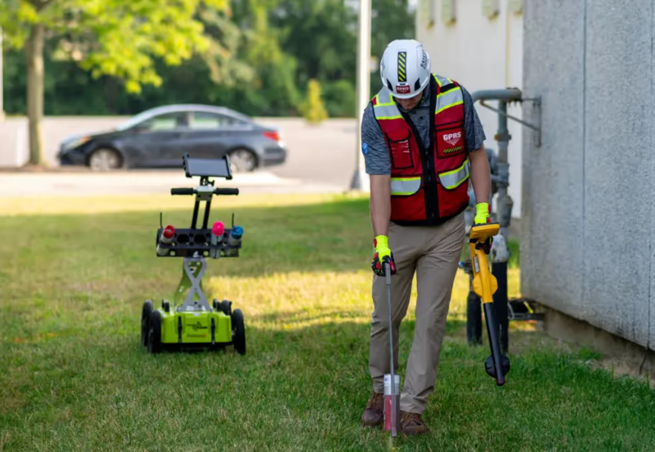
Remote sensing technologies, including LiDAR (Light Detection and Ranging) and satellite-based InSAR (Interferometric Synthetic Aperture Radar), allow engineers to map terrain with millimeter-scale precision and detect subtle ground surface movements, sometimes even before visible distress has occurred. InSAR has been used to identify slow-moving landslides, monitor subsidence over underground mines, and track the performance of dam embankments over time. GPRS supports remote sensing technologies with highly trained teams who can scan and report all kinds of terrain.
Geotechnical instruments including piezometers, inclinometers, settlement plates, extensometers, and strain gauges allow real-time monitoring of groundwater pressure, lateral movement, and vertical deformation within and beneath active structures. When paired with automated data acquisition systems and threshold-based alert protocols, these sensor networks provide an early warning capability that can prevent failures or prompt timely intervention before conditions become critical.
Learning From Failures
Geotechnical engineering, perhaps more than any other branch of the discipline, has been shaped by its failures. The collapse of structures, the failure of slopes, and the catastrophic breach of dams have each revealed gaps in understanding and prompted the development of better investigation methods, more conservative design standards, and improved construction practices.
The 1928 failure of the St. Francis Dam in California, which killed an estimated 431 people, was caused by the failure of weak conglomerate rock and hydraulic uplift at the foundation contact. The 1976 failure of the Teton Dam in Idaho resulted from internal erosion through inadequately designed zones in the embankment.
The 2017 Oroville Dam spillway crisis, the most expensive dam failure-related incident in U.S. history, exposed the consequences of inadequate foundation investigation and material characterization in spillway design.
In each case, post-failure investigations led to lasting improvements in industry practice. The engineering profession treats these events not as embarrassments to be minimized but as essential sources of knowledge.
Detailed forensic analyses are published, peer-reviewed, and incorporated into design codes, training curricula, and professional guidelines so that the same failure mode does not recur.
Sustainability and Climate Resilience
Geotechnical engineers are increasingly called upon to address challenges at the intersection of infrastructure design and environmental change. Rising sea levels, intensifying precipitation events, and shifting drought patterns are altering the ground conditions that existing and future structures must contend with. Coastal erosion, increased landslide frequency, and frost pattern changes are among the hazards that are expected to intensify in many regions over coming decades.
The profession is responding with greater emphasis on adaptive design. Movement in the profession is toward designing infrastructure that can accommodate a range of future conditions rather than being optimized for a single historical baseline.
Geotechnical engineers also contribute directly to sustainability goals by recommending the reuse of existing foundations when structures are renovated or replaced, reducing the material and energy required for new foundation construction. Ground improvement techniques that stabilize native soils in place can eliminate the need to import large quantities of structural fill, reducing truck traffic, emissions, and cost.
Where the Field Is Headed
Several trends are reshaping geotechnical practice in the near term. Machine learning and artificial intelligence are being applied to large geotechnical datasets in the form of CPT records, borehole logs, and laboratory test results to identify patterns and correlations that improve the reliability of subsurface characterization.
Research institutions and major engineering firms are developing models that can predict soil behavior from regional datasets, reducing the number of site-specific tests required in well-characterized geological settings.
Autonomous drilling and sensing systems are beginning to enter the field investigation market, offering the potential for continuous subsurface profiling at lower cost. Wireless, low-power sensor networks which are embedded in embankments, slopes, and retaining structures, enable more comprehensive long-term monitoring of infrastructure performance than was previously economically feasible.
Dense urban environments are creating new demands for creative underground engineering. As surface space becomes scarcer in major cities, geotechnical engineers are working on increasingly complex deep excavation projects, underground transit extensions, and basement construction adjacent to sensitive existing structures.
The ability to predict and manage ground movement during excavation – protecting neighboring buildings, utilities, and tunnels from damage – is among the most technically demanding aspects of contemporary geotechnical practice.
The Bottom Line
Geotechnical engineering rarely appears in project announcements or ribbon-cutting ceremonies. It operates below the surface, literally and figuratively, and its most important contributions are the disasters that never happen.
The evidence for proper geotechnical engineering is in the foundations that never settle, the slopes that never fail, and the dams that never breach. Yet every single structure on earth that stands safely above grade does so because someone first determined that the ground beneath it was capable of bearing the load or took the necessary steps to make it so.
As construction grows more ambitious and climate conditions grow more variable, the discipline’s role will only continue expand. The ground is always there, and understanding it rigorously, scientifically, and with appropriate humility about what remains unknown, is among the most consequential things an engineer can do.
Frequently Asked Questions: What Is Geotechnical Engineering?
What do geotechnical engineers actually do?
Geotechnical engineers investigate the soil, rock, and groundwater conditions beneath a site to determine whether the ground can support a planned structure. They collect field samples, run laboratory tests, and produce design recommendations for foundations, slopes, retaining systems, and ground improvement. On active construction projects, they also observe exposed conditions in excavations and respond when the ground behaves differently than anticipated.
Why does geotechnical investigation matter before construction begins?
Subsurface conditions vary significantly, even across small distances. A site may conceal soft clay layers, buried organic material, abandoned utility corridors, or voids that are invisible from the surface. When those conditions go undetected, structures can settle unevenly, slopes can fail, and foundations can lose bearing capacity. Early geotechnical investigation identifies these risks before construction begins, reducing the probability of costly failures and construction defect litigation.
What happens during a geotechnical investigation?
A complete investigation moves through four phases. The desk study compiles existing geological maps, nearby borehole records, historical photographs, and prior land use data. Field investigation follows, with crews drilling boreholes and running in-situ tests such as the Standard Penetration Test (SPT) and Cone Penetration Test (CPT) to measure soil resistance throughout the profile. Collected samples then go to a geotechnical laboratory for index testing, shear strength testing, and consolidation analysis. Finally, engineers synthesize all data into bearing capacity calculations, settlement predictions, and specific foundation or ground improvement recommendations.
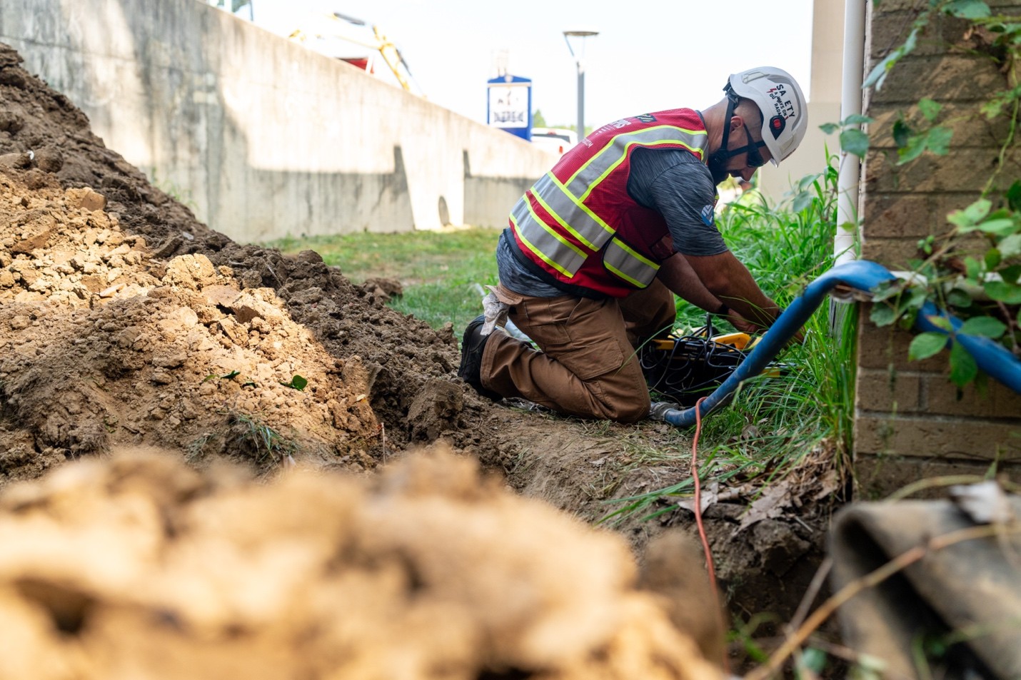
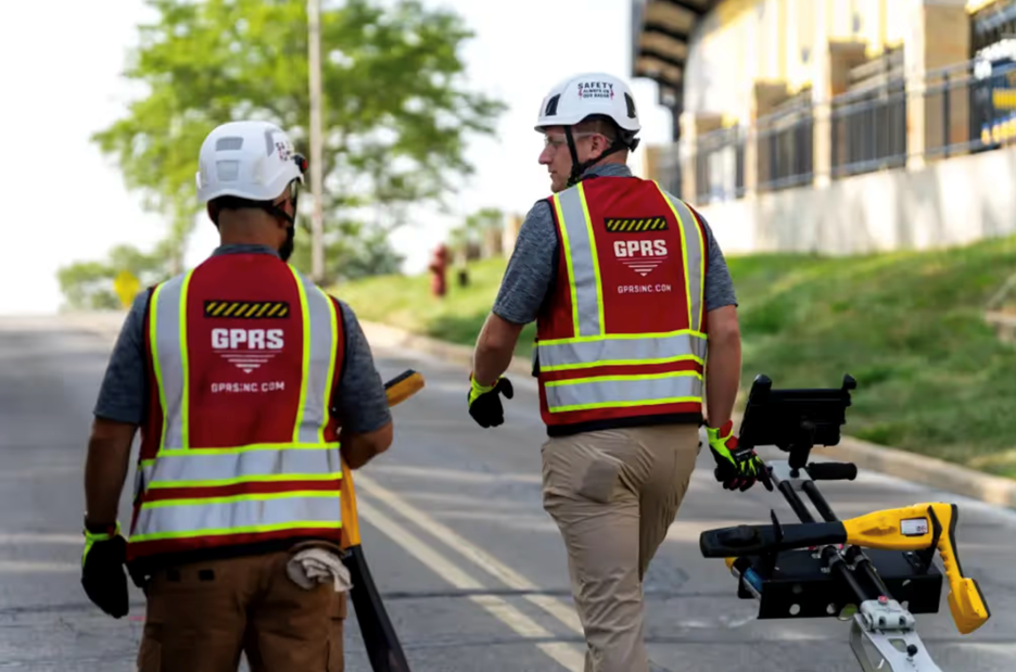
GPRS supports subsurface investigation teams by locating and marking utilities before drilling begins. Utility locating prior to soil boring protects field crews and prevents line strikes that delay investigations.
What is Subsurface Investigation Methodology (SIM), and how does GPRS use it?
SIM, or Subsurface Investigation Methodology, is a standard operating procedure GPRS developed for non-destructive subsurface testing. It comprises two specifications: one for underground utility locating and one for concrete scanning. SIM follows a three-step approach focused on achieving the most accurate results before any intrusive work begins. By applying SIM on geotechnical projects, GPRS helps investigation teams work with confidence, protecting the borehole program from damage or unexpected line strikes.
What are soil borings, and why are they central to geotechnical investigations?
Soil borings are drilled holes advanced into the ground to collect soil and rock samples at depth. They are the primary method geotechnical engineers use to directly observe and test subsurface conditions. During a boring program, crews drill at strategic locations across a site and extract samples at regular intervals using split-spoon samplers, thin-walled tube samplers, or core barrels, depending on soil type and required sample quality. Those samples are logged in the field and sent to a laboratory for index testing, strength testing, and consolidation analysis.
Soil borings also allow in-situ testing. The Standard Penetration Test (SPT), one of the most widely used field tests in the world, measures soil resistance by counting the blows required to drive a sampler a set distance, providing both a physical sample and an indirect measure of density and strength. Before any boring program begins, locating and marking buried utilities is a required step. GPRS locates underground utilities prior to soil boring to protect field crews and prevent costly line strikes that halt investigations.
What types of infrastructure require geotechnical engineering?
Geotechnical analysis is required wherever a structure interacts with the ground, which covers nearly every infrastructure category. High-rise buildings require deep foundation systems to transfer enormous, concentrated loads to competent bearing strata. Roads, railways, and bridges depend on stable subgrade conditions. Dams demand rigorous analysis of seepage, embankment stability, and internal erosion risk. Tunnels require detailed knowledge of rock and soil conditions along their entire alignment. Energy infrastructure such as wind turbines, offshore platforms, and pipelines each present unique geotechnical loading and movement challenges.
How do geotechnical engineers manage groundwater on construction projects?
Groundwater reduces the contact stress between soil particles, which decreases shear strength and can push a stable soil profile toward failure. Engineers design subdrainage systems, impermeable cutoff walls, relief wells, and temporary dewatering systems to control groundwater during both construction and long-term operations. GPRS supports water and sewer infrastructure teams by locating existing buried utilities before excavation or dewatering work begins, reducing the risk of conflicts with underground systems.
What role do modern technologies play in geotechnical practice?
Finite element software such as PLAXIS and FLAC allows engineers to model complex three-dimensional soil-structure interaction that manual calculations cannot resolve. LiDAR and satellite-based InSAR detect millimeter-scale surface movements and can identify slow-moving landslides or subsidence before visible distress appears. Piezometers, inclinometers, and automated sensor networks provide real-time monitoring of groundwater pressure and lateral movement in embankments, slopes, and retaining structures throughout the operational life of infrastructure. Machine learning is also entering the field, being applied to large datasets of borehole logs and CPT records to improve subsurface characterization accuracy.
GPRS supports geotechnical and remote sensing programs with trained field teams capable of scanning, locating, and documenting subsurface conditions across a wide range of terrain and project types.
How does geotechnical engineering connect to environmental work?
Geotechnical expertise is central to environmental due diligence, remediation planning, and landfill design. Engineers characterize subsurface conditions at contaminated sites, design containment systems to prevent contaminant migration into groundwater, and evaluate existing fill materials that may have been placed without engineering controls. GPR supports environmental and geotechnical teams by providing non-destructive subsurface imaging before intrusive work begins, which protects field crews and reduces the risk of disturbing buried hazards.
How does GPRS support geotechnical investigations?
GPRS provides a suite of services that directly supports geotechnical and environmental field programs. Ground-penetrating radar (GPR) locates and maps buried utilities, tanks, and anomalies before soil borings or excavations begin, preventing line strikes and protecting field crews. SiteMap®, GPRS’s infrastructure mapping platform, allows project teams to document and share subsurface findings in a single accessible location. For complex or remote sites, GPRS teams apply reality capture services to produce accurate as-built records of existing conditions that support design and construction decision-making.
Contact GPRS to discuss how our subsurface investigation services can support your next geotechnical program.