

.svg)
3D Photogrammetry is a Low-Cost Investment with Many Benefits
Imagine having instant access to your site’s spatial data at any point during the construction process, including measurements, floor plans, and virtual tours for a fraction of the cost of 3D laser scanning. How would that change your team’s workflow and productivity?
Many clients would benefit from a walkthrough of their site during different stages of construction. 3D photogrammetry can deliver a 3D virtual record of the project before, during, and after construction. Now imagine having this as-built documentation quickly at a low-cost.
GPRS 3D photogrammetry services use a professional-grade 3D camera to capture high-resolution 360° images and LiDAR point clouds. GPRS 3D photogrammetry offers 20mm accuracy within a 10m range and has a maximum of 100m scanning range. It takes less than 20 seconds per scan location to collect more than 100,000 data points. Clients receive an immersive and interactive walkthrough of their building’s architecture, structure, utilities, and MEP systems in real-time.
Photogrammetry is a low-cost existing conditions construction documentation investment that can quickly transform sites into digital twins. The technology captures layout and dimensional data in color, and clients can import e57 point clouds and .OBJ files directly into CAD or BIM modeling software.
Existing condition documentation by way of 3D photogrammetry can be used to design modifications and upgrades before beginning construction. It can record the location of utilities, concrete reinforcements, and MEP installations. It can also provide progressive capture on a jobsite so everyone can see what’s been done and what milestones are still to be completed. Plus, it can provide a virtual tour of a site upon project completion.
Recent GPRS 3D Photogrammetry Services
A power company that delivers electricity and gas to Massachusetts customers and communities requested a GPRS WalkThru 3D of the utility locate for their site.

A water company that manufactures and supplies water dispensers and multi-gallon bottled water to retail locations requested GPRS 3D photogrammetry of their facility.

An architect requested GPRS as-builts prior to remodeling existing warehouse space and the installation of new machining and manufacturing equipment. They needed to understand all underground electrical, plumbing, sewage, and compressed air lines before construction to make sure they did not damage the existing systems.

To efficiently plan and manage your project and keep it on time and on budget, reach out to one of GPRS’ 500 Project Managers located across the United States. Our Project Managers will quickly mobilize to document your site in photo-realistic 3D. Our in-house Mapping & Modeling Team rectifies the 3D photogrammetry to digitize your site into WalkThru 3Ds, floor plans, progressive capture (PRO CAP), and TRUBUILTs.
With 3D photogrammetry, clients can digitize and view their space, get accurate measurements, design modifications, and more. GPRS offers project executives, general contractors, and field teams a comprehensive set of add-on tools to receive as-built data, make informed decisions, and optimize construction design and workflows.
WALKTHRU 3D VIRTUAL TOURS
Receive accurate existing condition documentation, as-builts, and dimensional information in real time with WalkThru 3D Virtual Tours. GPRS uses 3D photogrammetry to provide immersive site walkthroughs and 3D virtual tours that allow project teams, designers, and stakeholders to remotely walk through a site or facility. WalkThru 3D eliminates travel and improves communication and collaboration. It also allows clients to intelligently visualize their site, identify potential issues, and make informed decisions without the need for physical presence.
WalkThru 3D can be delivered digitally and accessed via SiteMap® so that your virtual tour can be downloaded, saved, and shared to any laptop, tablet, or smartphone, and is accessible 24/7.

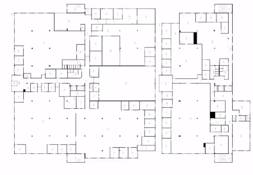
FLOORPLAN
The GPRS Mapping & Modeling Team can take the rectified, real-time 3D photogrammetry from WalkThru 3D and create accurate existing conditions as-built floor plans of a project site for design planning, risk mitigation, and emergency planning purposes. Floor plans are precise 2D CAD construction drawings that provide project teams accurate layout, dimensions, and details of a building or structure. It helps everyone visualize the project site, communicate with clients and contractors, and comply with codes and regulations. GPRS 2D floor plans can be used to identify potential hazards, develop emergency action procedures, safety protocols, and train personnel on site-specific procedures.
GPRS 2D floor plans can be delivered digitally and accessed via SiteMap® so that they can be downloaded, saved, and shared to any laptop, tablet, or smartphone and is accessible 24/7.
PROCAP
PRO CAP Progressive Capture can document construction progress from start through completion with 3D photogrammetry. GPRS’ Project Managers can accurately record the precise details of a project site from the location of utilities and concrete reinforcements to MEP installation locations, and more with 3D rectified imagery. We can provide PRO CAP on a regular schedule for the life of a project, whether it be bi-weekly, monthly, or customized to a client’s needs.
By capturing scans regularly, clients can track the evolution of the site, monitor construction milestones, manage project timelines, and ensure that work is proceeding according to schedule. Accurate record images can help to avoid clashes, change orders, and streamline communications.
PRO CAP Progressive Capture is valuable when managing projects from a remote location or managing multiple project sites.
PRO CAP scans can be delivered digitally and accessed via SiteMap® so that they can be downloaded, saved, and shared to any laptop, tablet, or smartphone and are accessible 24/7.

TRUBUILT
Eliminate outdated and inaccurate as-builts with TRUBUILT, real-time reality capture 2D CAD plan views of infrastructure – above and below ground. TRUBUILTs are accurate existing condition as-builts of a site or facility. They break down information silos and allow team members to collaborate with comprehensive, layered, data. TRUBUILT as-builts can serve as comprehensive documentation for reference, maintenance, and renovation projects.
Clients can access, copy, download, and share TRUBUILT as-builts via SiteMap® to keep their projects on time, on budget, and safe.

What is SiteMap®?
GPRS recently developed SiteMap®, a cloud-based user-friendly software that quickly and securely delivers 3D photogrammetry data, maps, and models for construction and infrastructure projects. SiteMap® provides customers with GPRS accurate as-built information – from our 99.8%+ accurate utility maps & concrete imaging results to CAD drawings and fully integrated 3D BIM models that meld 2-4mm accurate aboveground as-builts & below ground infrastructure to create a digital twin of any site.
3D photogrammetry can be accessed via SiteMap® to view site documentation, make informed decisions, coordinate work, and minimize errors. Clients can share data easily with team members, digitally measure inside 3D photogrammetry files, and use features like annotation, markup, and feedback to communicate with team members, clients, and contractors.

Why GPRS? The GPRS Difference.
GPRS reality capture services Intelligently Visualize The Built World® to create a digital representation of the real-world conditions of a construction site or an existing building.
GPRS utilizes 3D photogrammetry for reality capture to deliver accurate as-built data to construction professionals to make informed decisions and manage and execute projects. 3D photogrammetry enhances accuracy, efficiency, safety, and communication throughout the entire construction process, from initial design to project completion.
If your project requires a higher level of accuracy, GPRS also offers 3D laser scanning that provides 2-4 millimeter accurate records of existing as-built conditions. 3D laser scan data can be processed by our in-house Mapping & Modeling Team to deliver point cloud files, 2D CAD drawings and 3D BIM models to help you plan, design, manage, and build better.
With over 500 Project Managers in every major city across the United States, GPRS has an unmatched nationwide service network that makes it quick and easy to find local experts. GPRS specializes in 3D laser scanning, 3D photogrammetry, asset digitization, 3D virtual tours, digital twins, scan to CAD, and scan to BIM for the in the AEC industry.
What can we help you visualize?
Frequently Asked Questions
What is the Meaning of Photogrammetry?
When you break down the word photogrammetry – “photo” refers to light, “gram” means drawing and “metry” refers to measurements. Photogrammetry uses photos to gather measurements from which drawings, maps, models, and virtual tours can be created.
What are the Benefits of Photogrammetry?
- Permanent record of existing conditions
- Fast 2D and 3D data collection
- Accurate virtual models of physical assets, structures, and systems
- Digital twins and virtual site tours
- Eliminates the need for site revisits
- Minimal disruption to environment
- Saves time compared to conventional ground surveys
- Non-intrusive and cost effective
- Expedites decision making, increasing project efficiency
What Industries Use Photogrammetry?
Photogrammetry can be used in many industries: construction, civil engineering, structural engineering, telecommunications, military intelligence, agricultural, cultural heritage & preservation, real estate, film & entertainment, public safety, forensics & accident investigation, archaeology, and more.