
.svg)

.svg)

The speed and coverage needed for you to do things like read this article require a lot of complex infrastructure nationwide. Telecom providers are scrambling to upgrade their equipment and technology, even when their physical space is limited.
The industry term for this continual push for more is compound expansion. Compound expansions occur when adding physical space and/or equipment to an existing telecommunications site, also known as a tower compound, to broaden coverage, allow for technology upgrades, or accommodate additional telecom tenants.
The compound expansion process typically involves:
- Site assessments by field engineers
- Lease negotiations
- Obtaining building permits and zoning approvals from local municipalities
- Excavation and foundation work
- Erecting a new perimeter fence
- Connecting the upgraded infrastructure into the existing cables
- Integrating and testing the new equipment
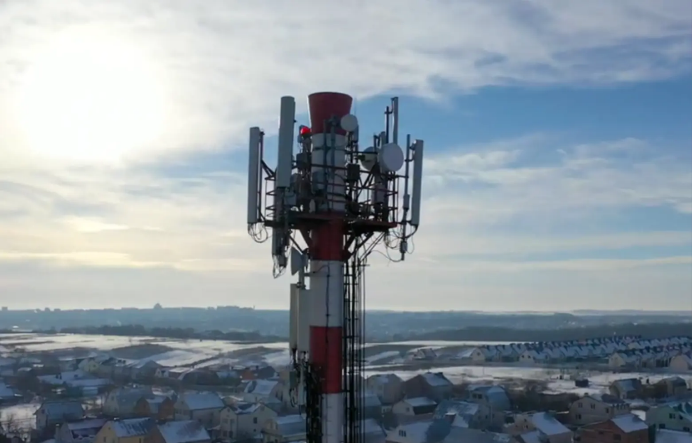
The densification of 5G network towers across the United States plays a huge role in the need for compound expansions. As more providers strive toward superior network reliability, that means more wireless towers need specific infrastructure that they don’t have the space for and they need them quickly.
Because these expansions are moving at breakneck speeds, federal policies have been put in place to make the process smoother. In October of 2020, the Federal Communications Commission (FCC) voted on policies to accelerate the process of existing compound expansions as long as it does not “substantially change the physical dimensions of the structures.” The ruling also stated that the new equipment and infrastructure cannot increase the area by more than 30 feet.
So, even though there are initiatives in place to assist with the densification of 5G, there are still limits.
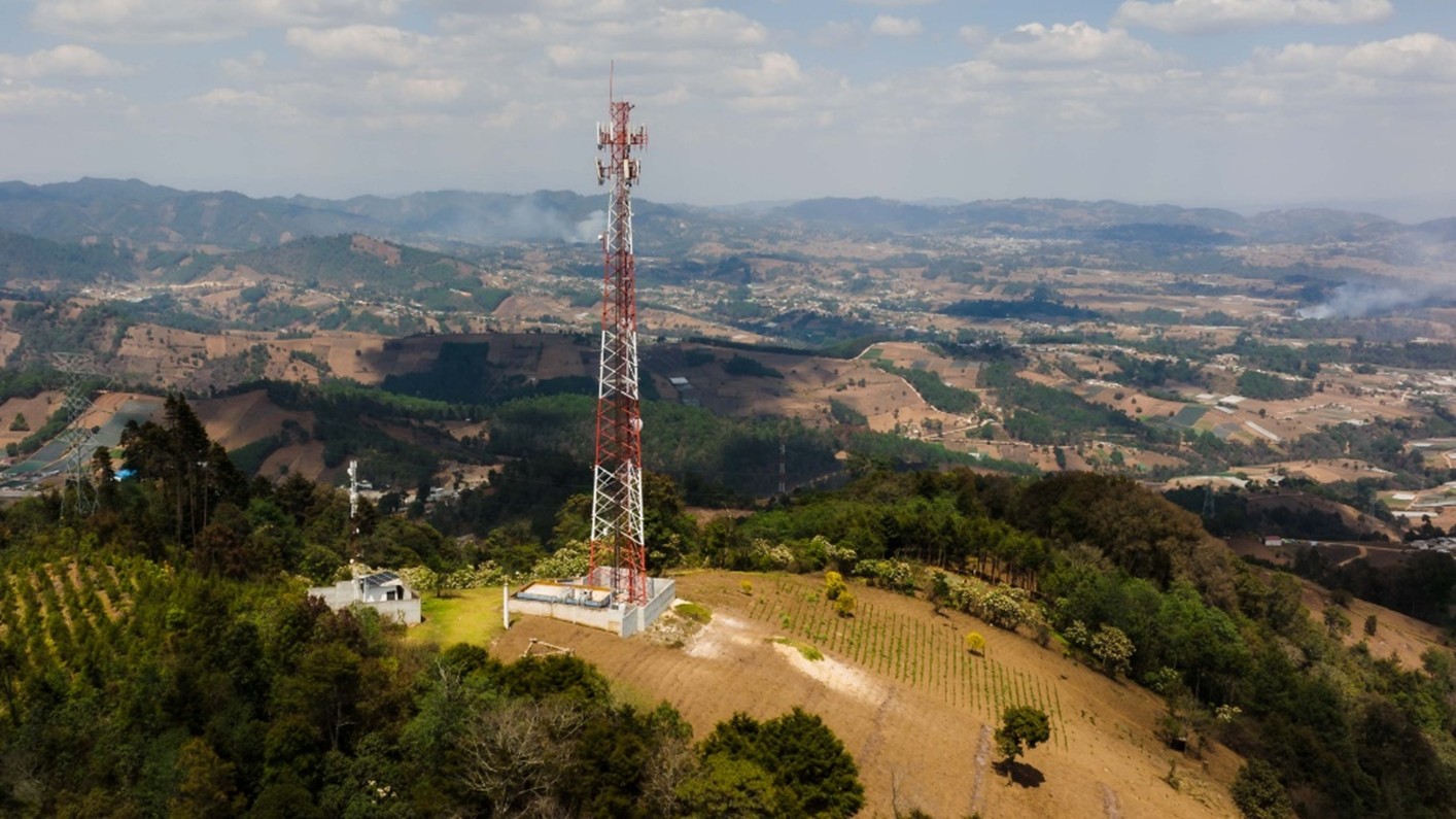
Examples of the kinds of technology upgrades that would warrant a compound expansion include additional cabinets to house sensitive hardware, like routers and cables, upgraded HVAC systems, high-capacity backup generators, and solar panel integrations.
Tight deadlines and rising demand create risk when performing these upgrades. Some of the risks your team can encounter when performing compound expansions include:
- Striking existing utilities or concrete reinforcements during excavations
- Electrical and fire hazards
- Structural failure during installation
- Legal action from lease and zoning noncompliance
Applications and services that mitigate these risks must be utilized to ensure projects stay safe and on schedule.
How to Mitigate Risk on Compound Expansion Projects
Utility and Concrete Scanning
Whether you are breaking ground to install a fence or a new back-up power generator, it’s vital to know what’s underground first. A line strike at a wireless tower compound can result in service outages, high repair costs, and fatal injuries for workers.
It’s vital to call your local 811 before performing any digging on site. However, since not all utility owners are registered with 811, you should also hire a professional utility locating company like GPRS to provide you with complete utility locating information before you put a shovel or bucket in the ground.
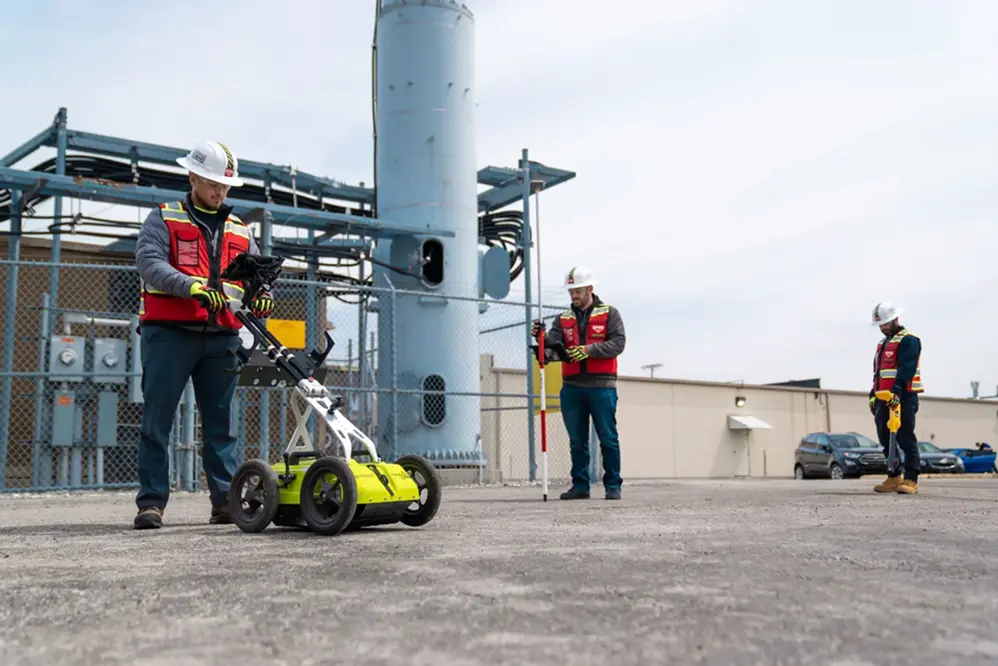
Striking concrete reinforcements, like conduit and post tension cables, is just as dangerous to a project as a utility strike when cutting or coring into concrete slabs. Concrete scanning professionals, like GPRS Project Managers, provide you with a full view of where it is and isn’t safe to cut or core.
A complete map of what lies beneath your feet will keep your team safe and the project on time.
Updated Existing Conditions Documentation and As-Builts
During the design process, precise and up-to-date measurements are crucial to make sure everything is properly mapped out and scheduled. Paper plans are hard to rely on and manual hand measuring tactics are not practical anymore in this fast-moving industry. Without documentation a team can trust, they are more susceptible to electrical hazards, structural failures, and legal noncompliance.
When developing existing conditions documentation, the level of accuracy obtained using LiDAR-based 3D laser scanners is second to none. If it is operated by a professional, like GPRS Reality Capture Project Managers, the data produces a point cloud file that is 2-4 mm accurate.
And once that data is gathered, professional CAD technicians use that data to develop 2D drawings and 3D models that are also millimeter accurate.
Deliverables that could assist your next compound expansions include:
- 2D CAD Drawings
- 3D BIM Models
- 3D Revit Models
- 3D Mesh Models
- BOMA Calculations
- Virtual Walkthroughs
- At-Depth Modeling
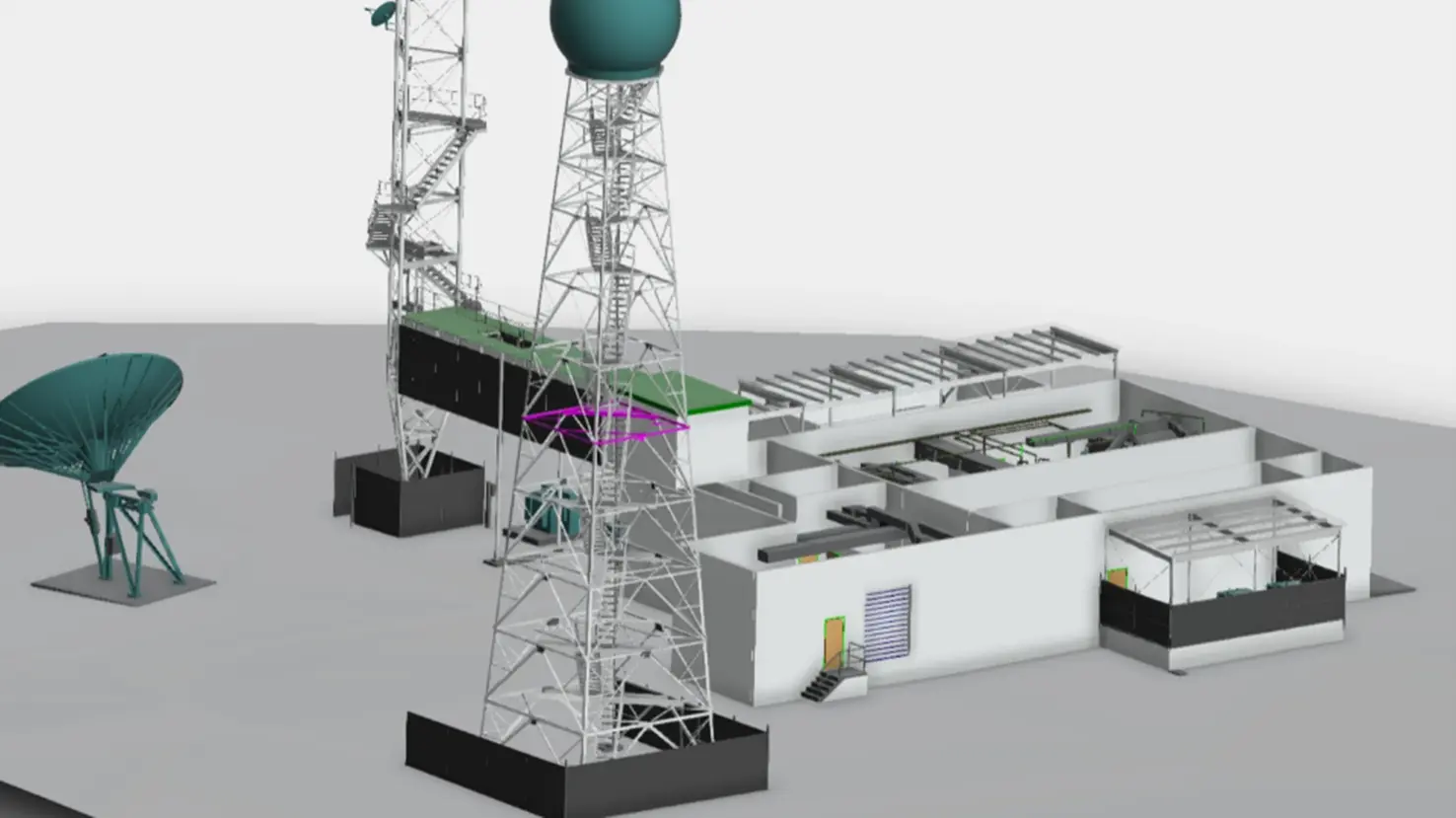
With precise drawings and models of your site at your disposal, your team can:
- Avoid electrical and fire hazards through the development of MEP as-builts and 3D BIM models to generate clash detection reports
- Reduce the risk of structural failure by providing engineers with highly accurate structural as-builts for enhanced planning capabilities
- Lower the risk of legal noncompliance with a detailed layout of the property that helps make sure planned renovations don’t exceed zoning and leasing restraints
GPRS + SiteMap® = Your Single Source of Truth
With hundreds of SIM-certified Project Managers in the field across the country, GPRS can provide compound expansion projects with the solutions they need within their tight deadlines. From the design phase to post construction analysis, GPRS’ field-verified data can help.
Each service offered by GPRS provides site owners, general contractors, and engineers with very useful information when planning and executing compound expansions.
GPRS Project Managers have maintained a less than 0.20% at-fault incident rate in concrete scanning and utility locating since 2017, so your team can dig with confidence with GPRS on your team.
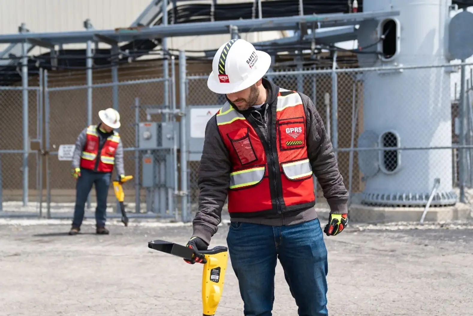
And our Reality Capture Project Managers and in-house Mapping & Modeling Team can bring every millimeter of your site into clear view to allow for better planning and execution of the project.
All this data and more is securely housed in our cloud-based infrastructure management platform, SiteMap (patent pending).
SiteMap started as a utility data platform where our Project Managers use GPS and RTK-positioning to digitally document their findings and upload them into the platform. The platform has evolved to add state-of-the-art features to its utility data storage capabilities, including:
- The Reality Capture Layer that stores all your site’s point clouds, virtual walkthroughs, and Revit models in digital areas that are geospatially accurate
- The Sewer Layer that keeps all your NASSCO-certified VPI reports, CCTV footage, and anything else you would need to know about your sewer lines in one task bar
- SiteMap Mobile’s Augmented Reality Feature that gives you the ability to see your site’s underground utilities above ground through your phone or tablet camera
- History Slider that allows you to see how your site has changed throughout the course of your projects
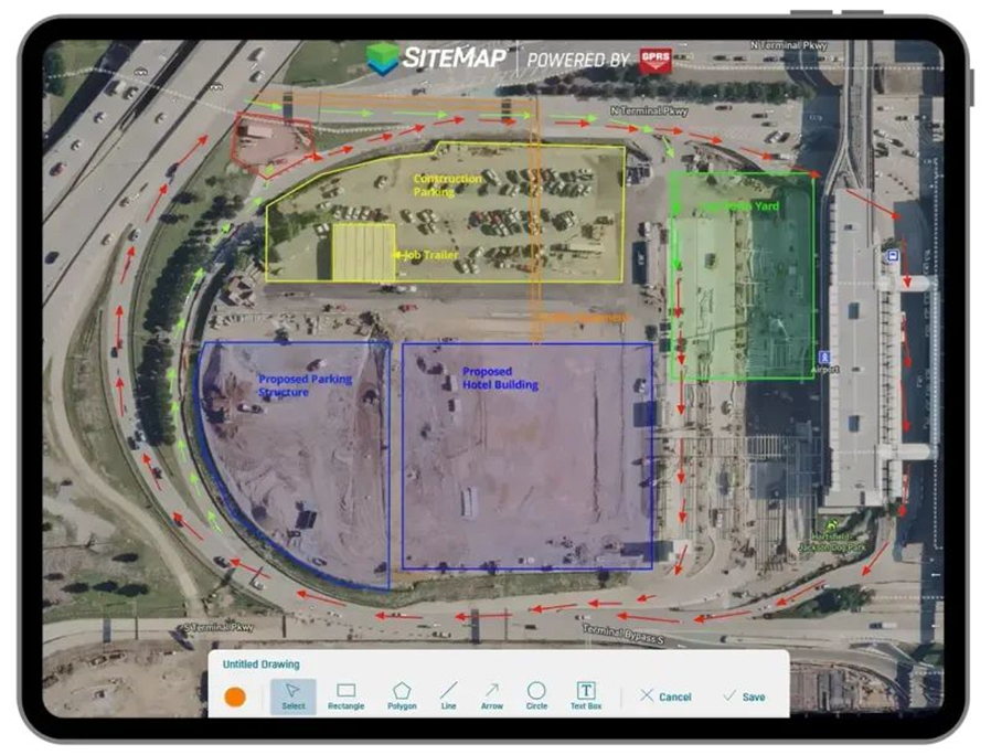
Another SiteMap feature that would be very useful while performing compound expansions is My Dig Board. With so many things happening so quickly on site, critical information can get lost in the job trailer.
My Dig Board acts as your digital job trailer that you can use to instantly update so your team to keep them in the loop in real time. If you change a material delivery area, or where you will be pouring fresh concrete, you can map it out right in the platform with shapes, arrows, and text boxes, so no information gets lost in the chaos. And as long as the appropriate people have access, whether it’s a team of contractors and trades, or multiple telecom tenants, everyone stays updated.
With all your site’s data in the palm of your hand 24/7, compound expansion projects can progress safely and efficiently so the initiative can finally catch up to the demand.
From concrete to cabinets, GPRS Visualizes YOUR Built World® above and below-ground to ensure your projects in the telecom industry stay on time, on budget, and safe.
What can we help you visualize?
FREQUENTLY ASKED QUESTIONS
What is SIM?
Subsurface Investigation Methodology (SIM) is a standard operating procedure and set of professional specifications that work as a guide for utility locating experts when scanning for buried utility lines. All GPRS Project Managers are required to achieve SIM 101 certification, which requires 80 hours of hands-on training in a classroom setting and 320 hours of mentorship in the field. For reference, the American Society for Nondestructive Testing’s (ASNT) minimum training recommendation includes eight hours for training and 60 hours practicing GPR to achieve NDT Level 1 certification in ground penetrating radar (GPR) scanning.
SIM requires the use of multiple, complementary technologies, like GPR scanning and electromagnetic (EM) locating, when locating buried utilities or scanning a concrete slab.
Can SiteMap scale as my portfolio grows?
Yes. SiteMap is designed to scale from a jobsite to a multi-site or campus-wide portfolio.
The platform centralizes utility maps, CADD/BIM files, drone imagery, and sewer records in one secure system that can be accessed across teams.
GPRS supports that growth by collecting above and below-ground site data, providing controlled sharing, and keeping information available 24/7 on desktop and mobile devices.
Request a demo of SiteMap here to learn more about the platform.
Can GPRS support fast rollouts?
Yes, GPRS can support fast project rollouts with nationwide coverage. We have a team of over 500 Project Managers in the field ready to meet your project’s needs in a timely manner.
Our team can provide yours with data and deliverables to keep your projects on time, on budget, and safe.
And as our team uploads site data into SiteMap, teams can reference that data in future projects and have data they can rely on at all times.
Request a quote for any of GPRS core services here.
How are utility maps delivered?
Along with being delivered as interactive GIS layers via SiteMap, GPRS utility maps are delivered as PDFs, CAD files, and KMZ exports.
Each format gives teams the ability to view, share, and integrate subsurface data into their workflows and ensure they avoid utility strikes. Your team can reference that data in future projects and have data they can rely on at all times.


