

.svg)
GPRS’ video pipe inspection and infrastructure mapping services ensured the underground pipes of an energy company in New York could be properly analyzed by the Department of Environmental Conservation (DEC).
Land Remediation Inc., a civil construction and environmental services company stationed in New York, was hired by National Grid to conduct the site’s biennual underground sewer pipe inspection.
National Grid's compliance with the DEC inspections underscores their commitment to keeping their team and the community safe. The inspections are done every other year to assess the conditions of the pipe segments and make sure the maintenance-related waste products from operations don’t interfere with groundwater infrastructure.

GPRS Project Manager Christopher Frias was tasked with investigating the site’s ground and stormwater systems by utilizing a remote-controlled CCTV mainline crawler and push camera.
Land Remediation Inc. had previously hired another firm whose technology and processes could not accommodate their requirements
“They were able to get more information with the technology that we use, because the cameras are more sophisticated and we have the zoom feature,” Frias explained. “So, if there was an inspection and the rover can't continue forward, whether it was groundwater or stormwater, our zoom feature can at least give the client an idea of what's ahead in the pipe.”
Along with the ability to see past obstructions, the video zoom feature can provide clients with a more detailed view of pipe conditions and any potential defects.
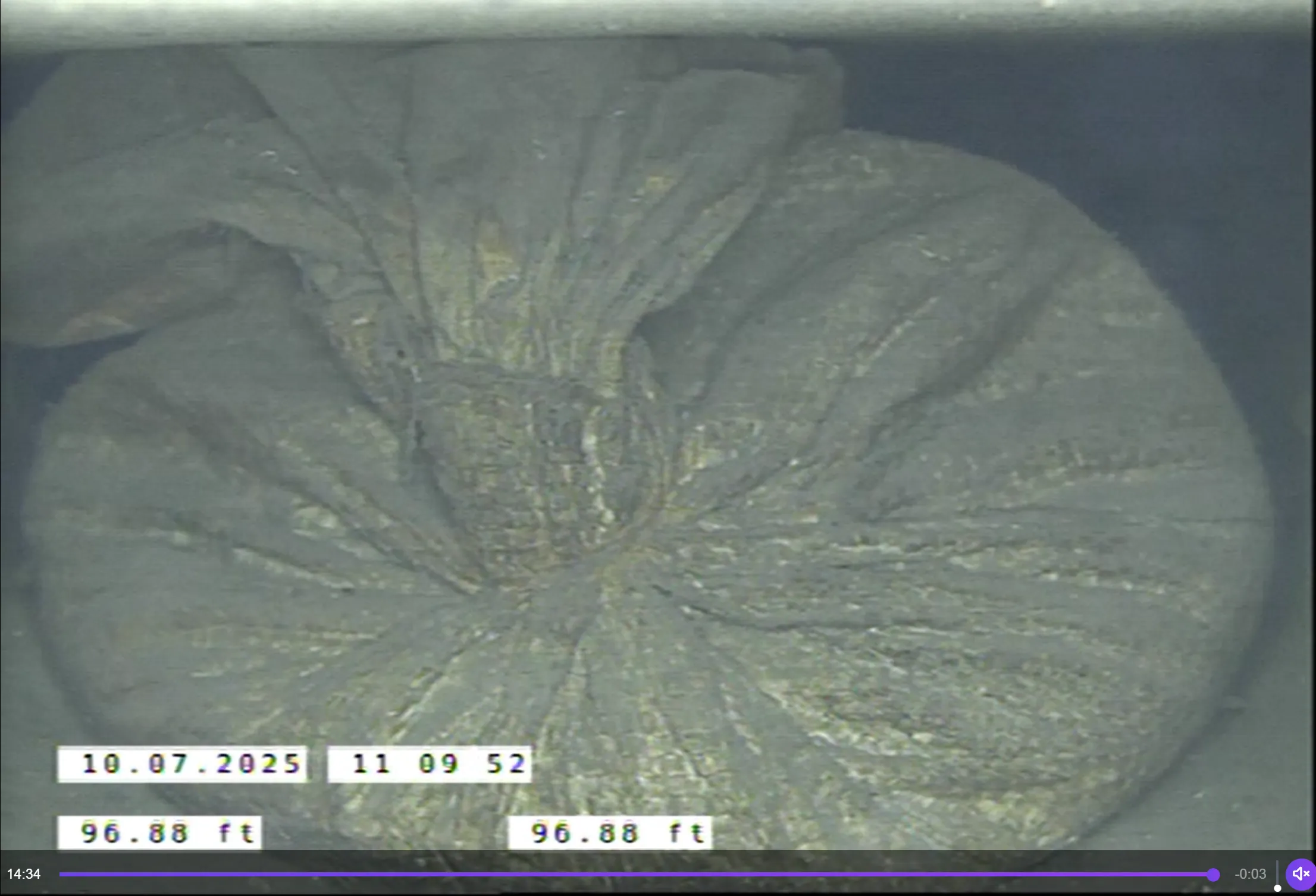
During his investigation, Frias noticed a lot of blockages, including something he was shocked to discover.
“I had noticed a lot of sediment had built up within the pipes. A couple of days before I arrived there, they had a big rainstorm,” Frias explained. “The amount of sediment in the pipes is kind of a normal thing on sites like these, but because of that rainstorm, a lot of that sediment had gotten pushed in and there were certain blockages - more so in their storm system. In their ground water system, there was only so much that I could scope because a lot of it was packed with sediment.”
“The most shocking thing that I was able to find was closer to the catch basin that was next to the subsystem that they used. We found a sandbag. It was like those 20- or 30-pound bags that you buy at Home Depot or Lowe's,” Frias continued. “It was lodged in the stormwater pipe, and it basically had backed up the system for the stormwater.”
A large blockage like a 20+ pound sandbag can lead to flooding, which could put the workers, their equipment, and the community they serve at risk. Compromising a site that supplies electricity and gas to a community could lead to widespread disruptions and shutdowns of essential services.
The site had experienced some stormwater overflow in the past year, so Frias’ discovery ensured the client could address the blockages to prevent further damage.
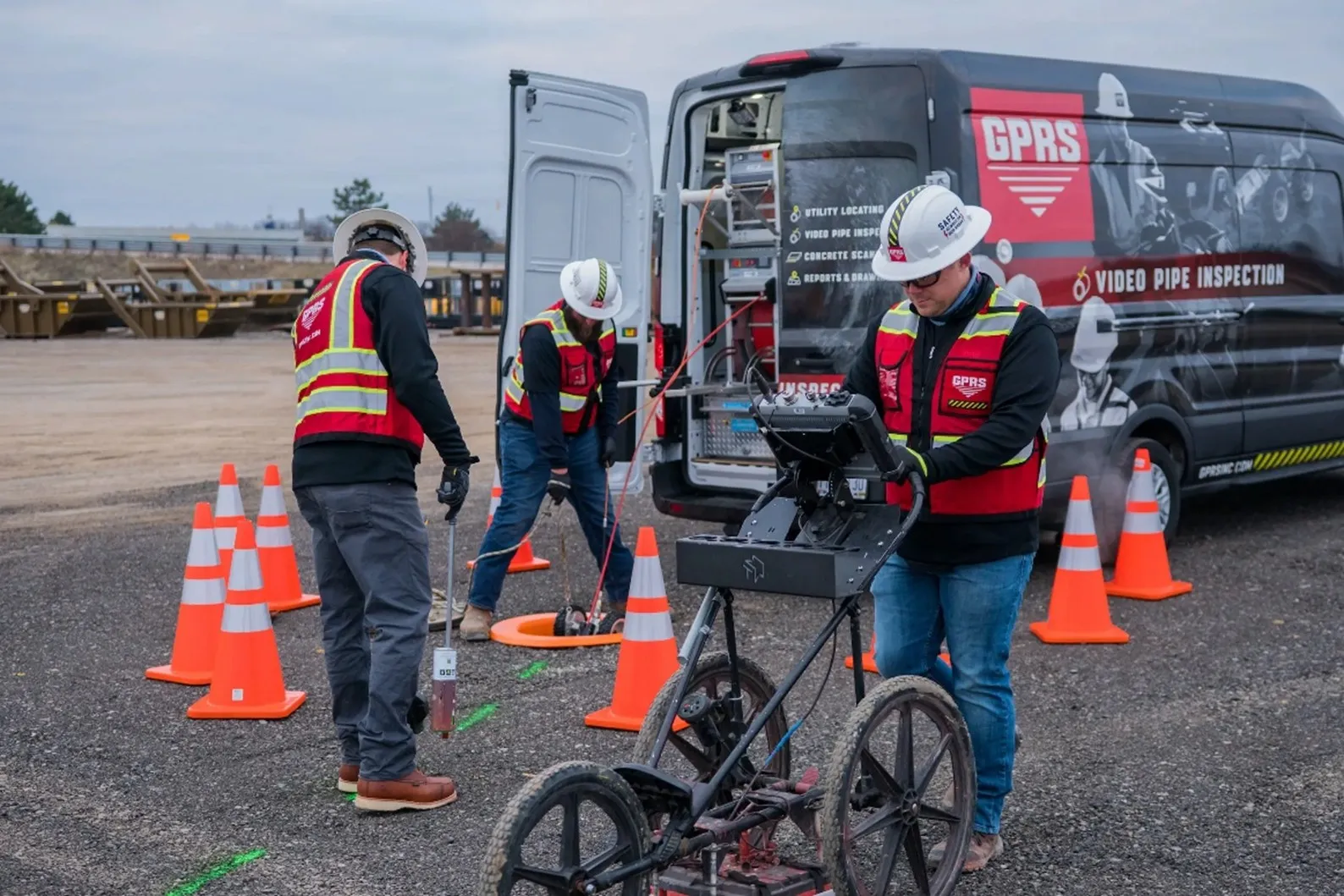
Even though water filled some of the pipes, Frias was still able to investigate and record the pipes’ conditions with his state-of-the-art equipment.
“That's also one of the benefits of the types of rovers that we use, they can do inspections even if they're somewhat submerged in water,” Frias explained.
Upon the completion of the investigation, Frias uploaded his findings to SiteMap® (patent pending), GPRS’ cloud-based infrastructure management platform. With SiteMap, all our clients’ underground infrastructure data can be securely stored in one platform.
In 2025, GPRS added a new feature to SiteMap, the SiteMap Sewer Layer.
The SiteMap Sewer Layer keeps our client’s NASSCO-compliant WinCan reports and videos in one location to allow for easier analysis and more seamless communication between team members. The data is also geolocated. After being identified using our 99.8% accurate underground utility scans, the sewer lines will populate on the satellite map of the site in their geospatially accurate locations.
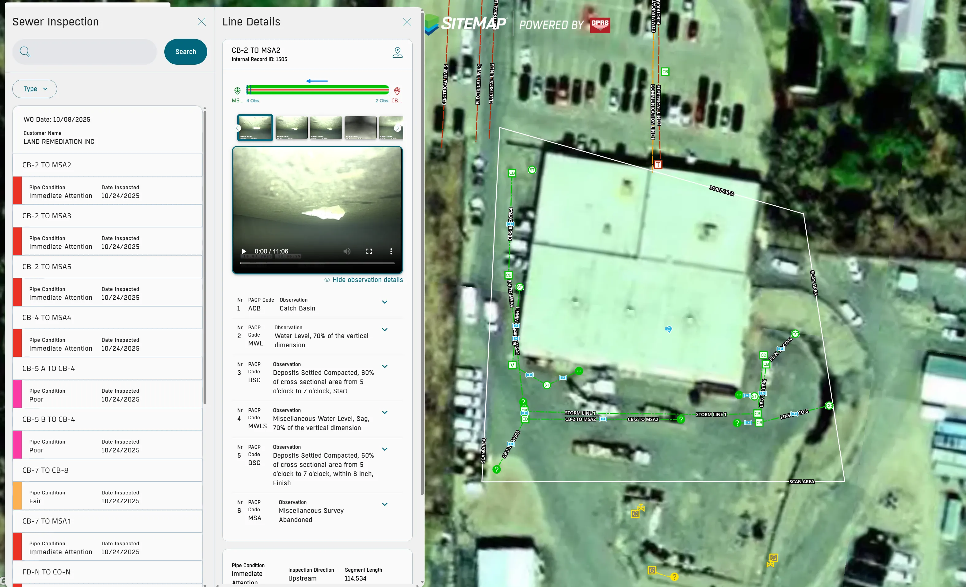
When Frias shared the SiteMap Sewer Layer with the customer, they were happy to have their data securely accessible on the platform.
“I had mentioned to them that yet that we provide the video inspection aspect. We do the NASSCO reporting and then we can also create a map for that. And once I said that, they were like, ‘what do you mean?’
I explained that there are certain enhancements that we now have, so that if I name an access point, the SiteMap team can take the video file that I recorded, attach it to the line, and then the customer instead of having to go through 36 videos, can click that one line segment to physically see the inspection that was done from access point line segment to the next access point. They were impressed not only because our mapping system matched theirs, but also, when I was doing the locating aspect, they were under the impression that one line segment from a catch basin to another catch basin ran in a certain direction. With our locating equipment I was able to determine it was not what they thought. So, they were happy to see that.”
Frias summed up the added value for SiteMap for this particular customer. “With all the abilities that we have with SiteMap, we can name access points, whether it's a lift station, round catch basin, or square catch basin. It's always good to have as much information as you can and that that's something that we can provide the client and they were very happy with that.”
Thanks to the video evidence and data provided through the SiteMap Sewer Layer, Land Remediation Inc. had all the information they needed to send to the Department of Environmental Conservation for further instructions on how to address the issues.
From skyscrapers to sewer lines, GPRS Visualizes the Built World to keep your projects on time, on budget, and safe.
What can we help you visualize?
FREQUENTLY ASKED QUESTIONS
What is Subsurface Investigation Methodology?
Subsurface Investigation Methodology (SIM) is a standard operating procedure and set of professional specifications that work as a guide for utility locating experts when scanning for buried utility lines. All GPRS Project Managers are required to achieve SIM 101 certification, which requires 80 hours of hands-on training in a classroom setting and 320 hours of mentorship in the field. For reference, the American Society for Nondestructive Testing’s (ASNT) minimum training recommendation includes eight hours for training and 60 hours practicing GPR to achieve NDT Level 1 certification in ground penetrating radar (GPR) scanning.
SIM requires the use of multiple, complementary technologies, like GPR scanning and electromagnetic (EM) locating, when locating buried utilities or scanning a concrete slab.
What size sanitary sewer and stormwater pipes can GPRS inspect with its Video Pipe Inspection service?
Our elite, NASSCO-certified VPI Project Managers have the capabilities to inspect pipes from 2” in diameter and up.
Can you locate pipes in addition to evaluating them for defects?
Yes, our SIM and NASSCO-certified Project Managers use VPI technology equipped with sondes, which are instrument probes that allow them to ascertain the location of underground utilities from an inaccessible location. This allows them to use electromagnetic (EM) locating to map sewer systems at the same time they’re evaluating them for defects.