

.svg)
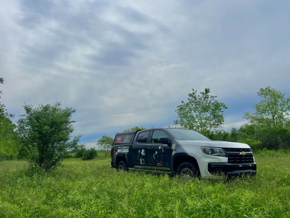
GPRS deployed multiple forms of subsurface investigation technology to clear 19 soil boring locations across 130 acres in Pennsylvania.
Project Managers Eliott Nero and Kyle Longino utilized electromagnetic (EM) locating and ground penetrating radar (GPR) scanning to ensure there were no utilities within 10 ft of each of the planned soil boring locations in Mercer, Pennsylvania.
The soil borings were part of the client’s construction planning process.
“They were doing samples of the soil and some samples of gas in the soil,” Nero said.
Also known as soil tests or geotechnical investigations, soil borings are conducted to gather information about the subsurface soil and geological conditions and assist with the design of foundations, assessment of environmental conditions, planning for infrastructure projects, and more.
There are several methods available for conducting soil borings. Among them, direct push and hollow stem auger drilling are the most widely used techniques for collecting soil samples and are generally effective in a variety of conditions.
Direct push drilling involves using hydraulic pressure to insert a pipe into the ground, extracting a cylindrical soil sample in the process. Hollow stem auger drilling, on the other hand, uses rotating hollow auger pipes with cutting teeth to bore into the soil and retrieve samples. While these two methods are the most commonly employed, alternative techniques are available when specific site conditions require them.
Following the soil boring and subsequent analysis, it may be necessary to install monitoring wells to continue testing, particularly for groundwater assessment. These wells are typically installed using similar drilling methods.
Geotechnical drilling is a critical step in confirming that the subsurface conditions are suitable for supporting a future structure. This process is conducted before construction begins and involves collecting rock and soil samples from below the anticipated foundation depth at various points across the site.
Whenever excavation or drilling equipment breaks the ground surface, there is a potential risk of hitting underground utilities. This is why it is essential to hire a professional utility locating company like GPRS to identify and mark all underground utilities before drilling begins, ensuring safety and preventing service disruptions.
GPRS uses EM locating and GPR scanning to locate and map buried utilities.
GPR scanners emit radio waves into the ground, then detect the interaction between those waves and any buried materials like utility lines or underground storage tanks (USTs). These interactions are displayed in a readout as a series of hyperbolas, which vary in size and shape depending on what kind of material was located.
GPRS Project Managers go through extensive training to be able to interpret the data collected with GPR to tell you what was located and provide an approximate depth for each located object.
EM locators are the perfect complement to GPR scanning when conducting utility locates.
Rather than locating buried objects, EM locators detect the electromagnetic signals radiating from metallic pipes and cables. These signals can be created by the locator’s transmitter applying current to the pipe, or from current flow in a live electrical cable. They can also result from a conductive pipe acting as an antenna and re-radiating signals from stray electrical fields (detected by the EM locator functioning in Power Mode) and communications transmissions (Radio Mode).
Signals are created by the current flowing from the transmitter which travels along the conductor (line/cable/pipe) and back to the transmitter. The current typically uses a ground to complete the current. A ground stake is used to complete the circuit through the ground.
By combining the strengths of GPR and EM locating, along with our industry-leading training program, GPRS provides 99.8% accurate utility locating data to help prevent costly and potentially dangerous subsurface damage during your excavation projects.
Nero and Longino were asked to very there were no utilities within a 10 ft radius of each of the 19 soil boring locations. The biggest challenge to completing this job was that the field was covered in dense undergrowth.
“…It changes a bit as far as what equipment we can use,” Nero explained. “Like today, we were not able to take the GPR cart around because of the tall weeds and moisture on the weeds. This affects GPR data.”
“…We mostly relied on our EM locators to do passive radio and power modes sweeps,” Longino added.

The data Nero and Longino collected was uploaded into SiteMap® (patent pending), GPRS’ infrastructure mapping software application. Accessible 24/7 from any computer, tablet or smartphone, SiteMap serves as a single source of truth for the accurate, field-verified data you need to plan, design, manage, dig, and ultimately, build better.
From soil borings to sewer pipe inspections, to 3D BIM Model creation and beyond, GPRS Intelligently Visualizes The Built World® to keep your projects on time, on budget, and safe.
What can we help you visualize?
Frequently Asked Questions
Can GPRS Project Managers distinguish between the different utilities they locate?
In most situations, we can identify the utility in question without any problems, although it is not always possible to determine what type of utility is present. When this happens, we attempt to trace the utility to a valve, meter, control box, or other signifying markers to determine the type of utility buried.
What type of informational output does GPRS provide when conducting a utility locate?
Our Project Managers flag and paint our findings directly on the surface. This method of communication is the most accurate form of marking when excavation is expected to commence within a few days of service.
GPRS also uses Real-Time Kinematic Positioning (RTK) to collect data points of findings. We use this data to generate a plan, KMZ file, satellite overlay, or CAD file to permanently preserve results for future use. GPRS does not provide land surveying services. If you need land surveying services, please contact a professional land surveyor. Please contact us to discuss the pricing and marking options your project may require.