

.svg)

Better Planning Starts with Accurate Data
Consider our team an extension of your own – a team that is dedicated to delivering a comprehensive visualization of your project, above and below-ground – to help you avoid clashes, change orders, delays, and rework and improve communication and collaboration.
What Our Customers Say
Start accurate, Stay accurate
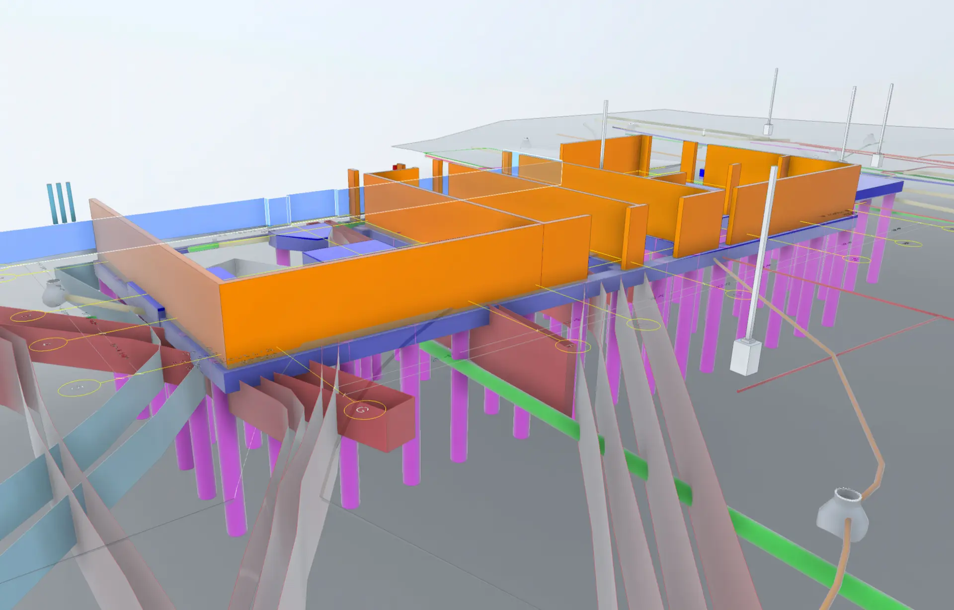
Intelligently Visualizing the Built World for Rudolph Libbe Hospital Addition
Integrated above and below-ground reality capture & BIM modeling can help discover building footprint design clashes before they cost time and money
View Case Study

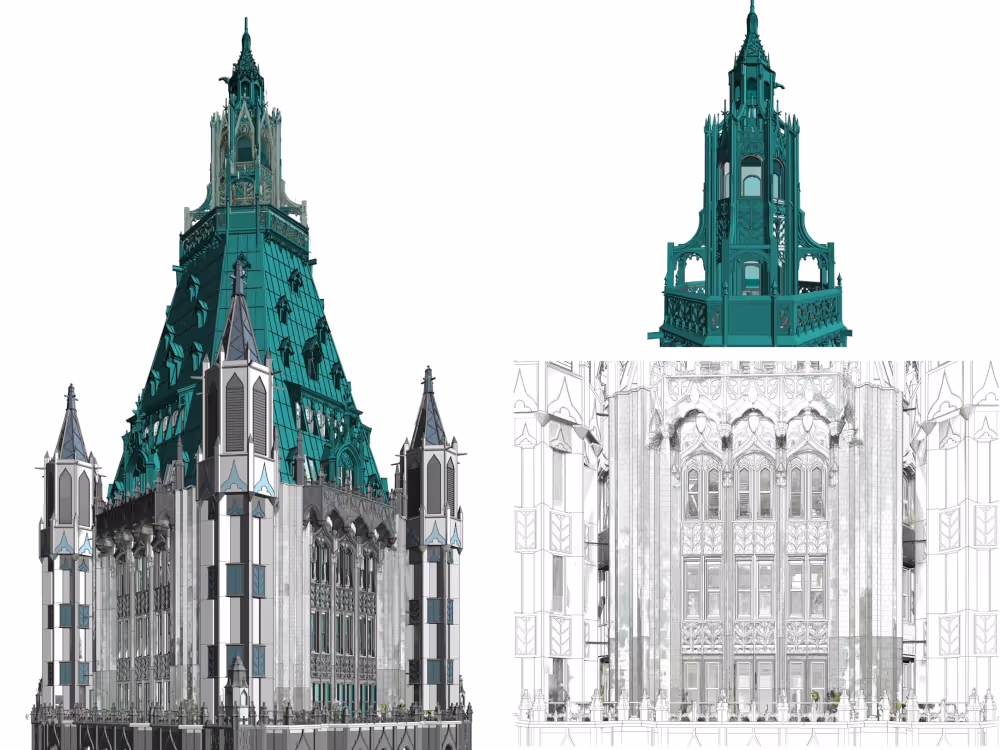
Laser Scan & Drone Survey for the Woolworth Building Pinnacle Penthouse
Phased BIM modeling can provide architects and engineers with the ability to visualize changes accurately and tailor client deliverables
View Case Study
Concrete Scanning & Laser Scanning for Parking Garage Renovation
Creating interior 3D models of concrete slabs can ensure continuity in as-built record keeping and provide clearances for future work
View Case Study

All of your accurate site data is secured and your files are delivered via our industry-leading project and facility management software platform, SiteMap® (patent pending). SiteMap provides you with a GIS-based record of your site’s existing conditions – and can include everything from a layered, interactive underground utility map through phased BIM. Your information can be updated, aggregated, and securely shared – to give you complete control. Every GPRS customer receives complimentary SiteMap Personal access as part of our services.
Whether you need a simple MEP drawing or reflected ceiling plan, or complex integrated 3D BIM models and walkthroughs of your structures, your subsurface facilities, and even what’s inside your concrete, our in-house Mapping & Modeling Team can create it.
GPRS CUSTOMER REVIEWS
"The model has been working great so far, the Recap and Revit tips and tricks you showed have been very helpful in getting the best use out of the point cloud files."
Di G.
Project Architect
Read More Reviews
"Contracting GPRS to do a 3D laser scan has been one of the best project decisions we made. With their help we were able to reduce cost, increase productivity, and deliver the project on time."
Vincent M.
Superintendent
Read More Reviews
"Excellent level of detail, and excellent summary of work provided via email. Following the scan there's no one else I've worked with that delivers this level of detail and quality."
Matt Wilcox
JTM Construction
Read More Reviews
"GPRS ensured safe drilling areas in over 150 locations through very congested floor slabs. The accuracy of the information provided was remarkably sound."
Mike Keith
Senior Project Superintendent
Read More Reviews