DELIVERING THE BEST SERVICE AND MOST ACCURATE DATA FOR RELIABLE PROJECT PLANNING IN Los Angeles.

The leading service provider in Utility Locating, Ground Penetrating Radar (GPR), 3D Laser Scanning, Video Pipe Sewer Inspection, Concrete Scanning, Leak Detection, & Industry Leading Maps and Models near Los Angeles

Welcome to GPRS Los Angeles. We Visualize The Built World™ to help you reduce costs and change orders, save time, and keep everyone on your project safe.

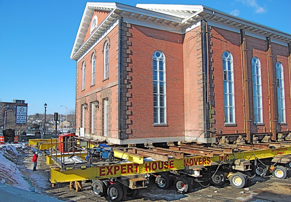
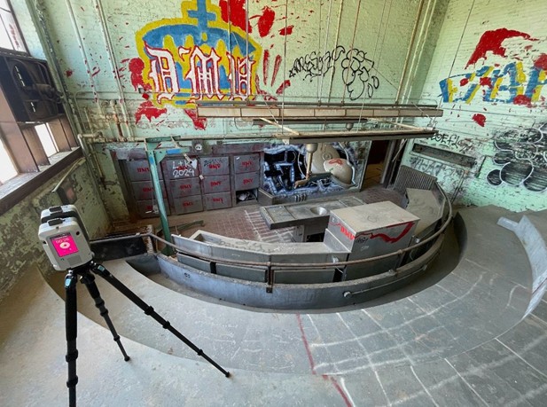
Our comprehensive services include ground penetrating radar (GPR) and electromagnetic (EM) locating for post tension concrete imaging and subsurface utility locating, 3D laser scanning for millimeter-accurate measurements for any facility, acoustic leak detection and NASSCO certified video pipe (CCTV) inspection for facilities and municipal infrastructure, and drone imaging for orthomosiac aerial photogrammetry, all conducted by elite, SIM certified Project Managers.

Our Mapping & Modeling Team can utilize the data to provide everything from our complimentary KMZ & PDF images for any underground utility locate to precise 2D CAD drawings and 3D BIM models to meet your needs.

What can we help you visualize?
[need phone number]

Our comprehensive services include:

  • Utility Locating: 60% of all utility lines are private, not public. 811 locates only public utilities, and does not provide depths for those locates. Our utility locating services employ both GPR and EM technology to provide a necessary and accurate supplement to One Call locates to provide utility mapping, and clearances for soil boring and direction drilling.
  • Concrete Scanning: Every GPRS concrete scan is backed by our exclusive Green Box Guarantee. Our accuracy rate for post tension concrete imaging is 99.8%+, so when we provide you with a green “clear” space to saw, cut, core, or drill, you know that you can count on our data when planning your project. If we get it wrong, we will pay for the cost of the damage.
  • 3D Laser Scanning: Our elite Project Managers employ survey-grade 3D LiDAR scanners to gather data that is accurate to within millimeters, and do it in far less time than manual measuring. The 3D point cloud data provided by the scans can then be utilized to create precise drawings, maps, and models to detect and avoid costly clashes and change orders, to allow for seamless off-site prefabrication, and as-builts that streamline everything from the design to O&M phase of your project.
  • Maps & Models: From the complimentary .KMZ & PDF files we provide for every outdoor utility locate to millimeter-accurate, complex 2D CAD drawings and 3D BIM models, GPRS’ Mapping & Modeling Team can deliver. We provide complete utility mapping, concrete image mapping, Matterport scanning, 3D point clouds, mesh models, and complete 3D BIM models and walkthrough tours so that everyone on your project has the most accurate, real-time information, delivered in an easy-to-use format for the entire project life cycle.
  • Video Pipe Inspection: If your project needs a CCTV video pipe inspection to check for water leaks or sewer defects, our specially trained and NASSCO certified VPI Project Managers utilize state of the art robotic crawlers and lateral launch push cameras to inspect your water infrastructure, and WinCan software to provide detailed reporting that includes each pipe defect found and its severity, screenshots of interior pipe conditions, and video files of the complete inspection for evaluation and reference. 
  • Leak Detection: GPRS Project Managers employ both acoustic leak detectors (highly sensitive microphones, headsets, and electronic devices) and leak noise correlators (which use an algorithm to detect leak sounds) to gather data in the field. That data can then be used to provide the precise location of any pressurized water line leak, so that you can locate without the need to pothole and can excavate only in the area to be repaired.
  • Drone Imagery: Our drones are fitted with state-of-the art cameras to provide UAS Thermographic and Magnetic Imagery to find previously hidden subsurface voids, damaged solar panels, and abandoned oil well heads. We also provide arial site imagery and building façade imagery to provide top-down facility mapping and avoid costly and time-consuming scaffolding inspections.
  • SiteMap: We can also provide you with the industry’s only comprehensive, top-down, facility infrastructure visualization & contextual map, all cross-referenced and delivered in a single, secure, shareable, and easy-to-use geospatial interface via SiteMap.


GPRS WIDENS THE GAP WITH ELITE SERVICE TO MEET YOUR NEEDs

Safety is always on our radar, our work is accurate within millimeters, and we get it right 99.8% of the time. So, you can be confident that we’ve located every pipe, conduit, line, tank, support, and void, above and below ground to Intelligently Visualize The Built World for you and your teams.

GPRS INDUSTRY EXPERTISE

power trasmission & distribution
Power Transmission & Distribution
Learn More
Telecom
Learn More
Renewable Energy
Learn More
Oil & Gas
Learn More
Power Generation
Learn More
Facilities
Learn More
One Call
Learn More
Environmental
Learn More
Civil, Road & Bridge
Learn More
Design Builds & Remodels
Learn More
Education
Learn More
Retail & Restaurant Construction
Learn More
Water & Sewer
Learn More
Engineering & Surveying
Coming Soon
Electric Vehicle Charging Icon
Electric Vehicle Charging
Learn More
Outline of U.S. Border

Nationwide
Service Available

Contact our Los Angeles team and our nearest project manager will contact you.

Serving Los Angeles, L.A., Chula Vista, Irvine, Anaheim, 0.C., Southwest California, San Bernardino, Riverside, Palm Springs, Carlsbad, Escondido, San Diego, Bakersfield, Fresno and Temecula.


We also work in the following California counties Los Angeles, Monterey, San Benito, Kings, Orange, Riverside, San Bernardino, Kern, Ventura, Tulare, San Diego, San Luis Obispo and Imperial County.