3D Laser Scanning Services in Wisconsin

As an architecture, engineering, or construction professional, you understand that projects require a tremendous amount of planning and coordination. GPRS 3D Laser Scanning can deliver accurate as-builts, point clouds, 2D CAD drawings, 3D photogrammetry, and 3D BIM models to expedite project planning and reduce change orders, delays, and costs.

Whether you are a general contractor or facility manager planning renovations or modifications, or an architect or engineer who requires precise project data, GPRS provides accurate existing conditions documentation, reality capture, and scan-to-BIM services to bring your design and construction projects in on time, and on budget.

When you need accurate architectural, structural, and MEP system dimensions, locations, and layouts for design, prefabrication, clash detection, facility modifications, or asset management, call GPRS. 3D laser scanning minimizes shutdowns and disruptions, eliminates the need for site revisits, and provides accurate as-built data to reduce risk and increase project efficiency.
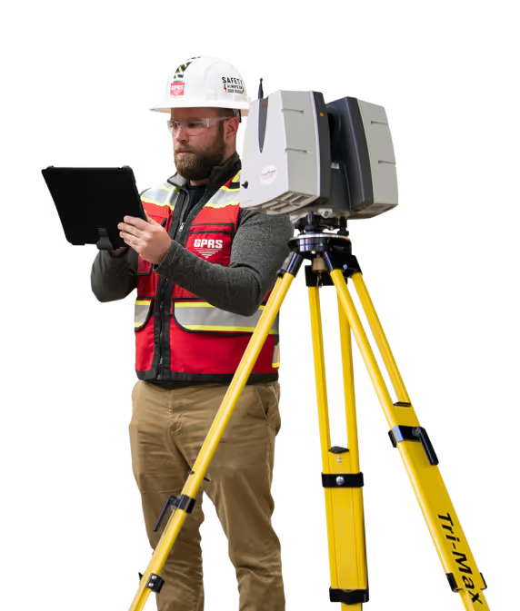
A man in a hard hat holding a tablet.

Green Bay 3D Laser Scanning

920-510-4467laser@gprsinc.com

Madison 3D Laser Scanning

608-250-0690laser@gprsinc.com

GPRS Project Managers

GPRS is the leading provider of 3D laser scanning services in Wisconsin. Our Project Managers document your site with the Leica ScanStation P-Series and the Leica RTC360 3D laser scanners, capturing up to 2 million data points per second with 2-4 millimeters accuracy. Each Project Manager completes the most extensive training program in the industry, with 80 hours of hands-on classroom training and 320 hours of mentorship in the field, plus another 40 hours of LiDAR training to deliver expertise in 3D laser scanning equipment and field knowledge.

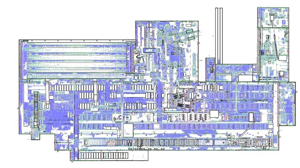
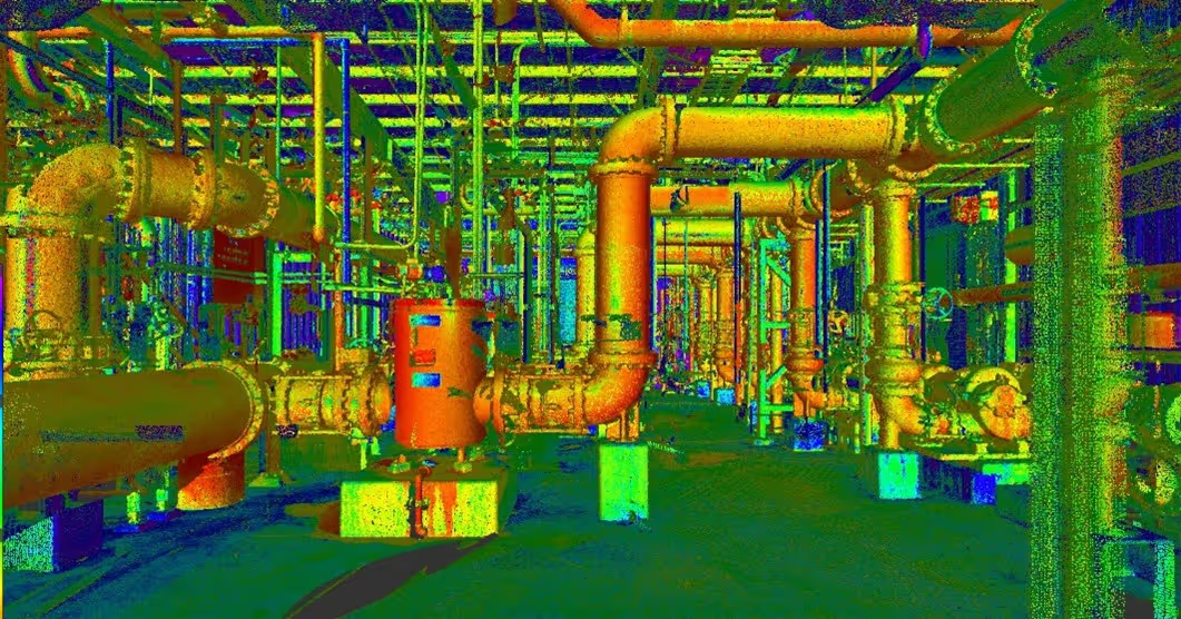
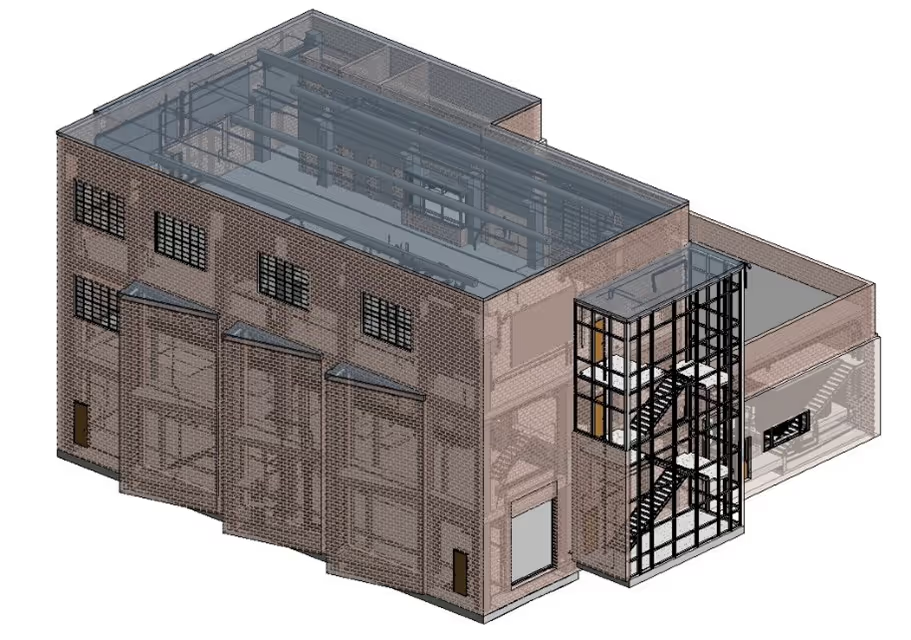
A 3D image of a factory with pipes and valves.A drawing of a road with a red line on it.A 3D drawing of a building with a staircase.

GPRS Mapping & Modeling Team

Construction drawings and models streamline planning, visualization, and coordination on your project because they provide a single source of truth for designers, architects, engineers, and contractors. GPRS’ in-house Mapping & Modeling Team can customize as-built data, 2D CAD drawings, 3D BIM models, 3D mesh models, virtual tours via WalkThru 3D, digital twins, floor plans via FLRPLN, and more to ensure you have all the information you need to get the job done right, delivered via GPRS’ SiteMap® digital storage software and app.

Maps and models can be produced at any level of detail in a variety of formats such as Revit, AutoCAD, ReCap, Navisworks, Civil 3D, BIM360, A360, Bentley, Leica Cyclone, Cintoo, and more. We have optimized workflows for importing data, registration, creating deliverables, quality checks, and transferring data to clients.

Not sure what you need? Not a problem. Our experienced Project Managers will work closely with you to define the project scope and use the right equipment and software to accurately map and model your project to accomplish your goals.

WHY CHOOSE US? 

THE GPRS DIFFERENCE.

With GPRS, clients can rest assured that our rigorously trained Project Managers use state-of-the-art technology to deliver the accurate as built information you need to do the job right. GPRS leads the industry to deliver precise as built information to enhance communication and collaboration among your project teams.

GPRS 3D Laser Scanning Services can bring these benefits to your project:

  • Collect up to two million data points per second with the highest-quality survey-grade laser scanners
  • Capture exact dimensions and measurements of your project site
  • Expedite planning and design with accurate as-builts
  • Eliminate site disruption and revisits
  • Receive precise point clouds, 2D drawings, and 3D models to improve collaboration and coordination
  • Tour the location, add digital notes, and even measure with a virtual tour
  • Reduce project risks, change orders, delays, accidents, and costs
GPRS main Logo: Intelligently Visualizing the built world | GPRS

GPRS 3D Laser Scanning Services in Wisconsin

A blueprint of a building with a lot of wires and a person in the corner.
As-Built Construction
As-builts provide an accurate record of a building or site’s existing conditions, including architectural, structural, utility, and MEP system dimensions, locations, and material specifications for reliable project planning.
Point Cloud of a Factory
Point Clouds
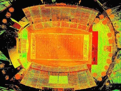
By representing spatial data as a collection of x, y, and z coordinates, point clouds deliver 2–4-millimeter accurate datasets of buildings, facilities, and sites that can be mined for information. This 3D dataset of existing site conditions can be processed into 3D BIM models, 3D meshes, and 2D CAD drawings.
BIM Modeling of a Infrastructure
BIM Modeling
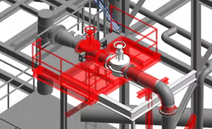
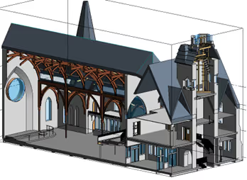
3D BIM models deliver a geometrically accurate digital representation of a building or site, capturing infrastructure, spatial relationships, maintenance information, product models, as well as additional property and layer information. GPRS transforms point clouds into custom 3D BIM models and 3D mesh models at any level of detail, supplying a powerful tool to collaborate on a building’s design, construction, and operation.
3D Photogrammetry in a Warehouse
3D Photogrammetry
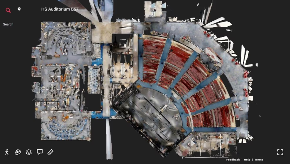
The 4K HDR photographs and LiDAR point clouds captured with Matterport photogrammetry can be used to create digital twins, virtual tours, floor plans, 2D CAD plan views, 3D models, and more to communicate design and renovation plans, coordinate construction activities, develop emergency plans & safety procedures.
2D CAD Drawings | GPRS
2D CAD Drawings
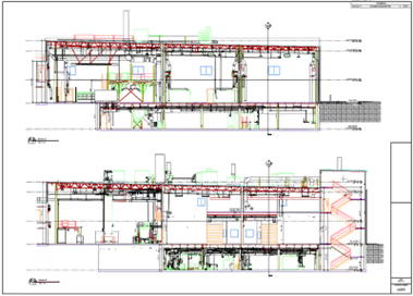
Site plans, floor plans, elevations, sections, details, isometric drawings, reflected ceiling plans, and more can be created and used for record-keeping, construction & renovation planning, building modifications, trade coordination, and maintenance.
A man working on a computer with a monitor and keyboard.
Mapping & Modeling
Discover all types of scan-to-BIM deliverables and determine which ones best suit your needs. Accurate data allows clients to expedite design planning & engineering, extract 3D coordinates and measure distances, along with the ability to tour, mark-up, and share with the project team.

We provide 3D Laser Scanning Services to these Wisconsin counties & many more:

  • Laramie County
  • Natrona County
  • Campbell County
  • Sweetwater County
  • Fremont County
  • Albany County
  • Sheridan County
  • Park County
  • Teton County
  • Uinta County

Our portfolio of work includes projects in these Wisconsin cities & many more:

  • Cheyenne, Wyoming
  • Casper, Wyoming
  • Gillette, Wyoming
  • Laramie, Wyoming
  • Rock Springs, Wyoming
  • Sheridan, Wyoming
  • Evanston, Wyoming
  • Green River, Wyoming
  • Riverton, Wyoming
  • Jackson, Wyoming

3D Laser Scanning for Building Redevelopment

Accurate 3D BIM modeling allowed the developer and two architectural firms to collaborate and more easily communicate with their general contractor, which saved time and money on a massive adaptive reuse project
$30 Million Hotel & Parking Garage Adaptive Reuse Project Required Accurate 3D Visualizations
Laser scanning to create a 3D BIM model of a 15-story hotel and adjacent parking garage for building redevelopment. The developer requested a 3D BIM model that accurately captured existing conditions in a cloud-based platform so they could document, view, and plan for structural renovationsWith a 3D model, the architectural team was able to view the existing conditions at the onset of the project. The model was then updated as construction progressed to keep all parties on the same page throughout the projectThe 3D model allowed the firms to communicate construction requirements to the general contractor to avoid miscommunications, reworks, delays, and cost overruns
$30 million-budgeted adaptive reuse project converting 130,000 sq. ft. hotel property into 100 residential units Most floors of the building were completely gutted: only the exterior envelope and interior circulation core remained intact With two architectural firms, a developer, and a G.C. meant that this project involved many professionals a lot of planning before breaking ground The developer requested a 3D BIM model that accurately captured existing conditions in a cloud-based platform so they could document, view, and plan for structural renovations With a 3D model, the architectural team was able to view the existing conditions at the onset of the project. The model was then updated as construction progressed to keep all parties on the same page throughout the project The 3D model allowed the firms to communicate construction requirements to the general contractor to avoid miscommunications, reworks, delays, and cost overruns The 3D model allowed the architectural team to troubleshoot the restoration and adaptation while keeping historic elements intact to preserve the building's characterDelivering the 3D BIM model in a digital format with the ability to update and edit, streamlined communication and collaboration across a large and diverse project team to bring the project in with fewer clashes, reworks, and mistakes, saving time and money
All
3D Laser Scanning
3D Laser Scanning

Laser Scanning Expedites Airport Renovations

GPRS provided 3D laser scanning services for John Glenn International Airport in Columbus, Ohio. The client was upgrading the existing airport entrance. Renovations included the installation of a prefabricated ceiling panel system and new doors. The primary objective of the laser scan was to capture the ground, curbs, ceiling beams, and related structural features to design and prefabricate the upgrades.
GPRS provided 3D laser scanning services for John Glenn International Airport in Columbus, Ohio. The client was upgrading the existing airport entrance. Renovations included the installation of a prefabricated ceiling panel system and new doors. ‍
John Glenn International Airport – Columbus, Ohio Airport Entrance Upgrades Requires 3D Laser Scanning ‍ TASK: GPRS provided 3D laser scanning services for John Glenn International Airport in Columbus, Ohio. The client was upgrading the existing airport entrance. Renovations included the installation of a prefabricated ceiling panel system and new doors. The primary objective of the laser scan was to capture the ground, curbs, ceiling beams, and related structural features to design and prefabricate the upgrades. ‍ CHALLENGE: The client had a 60-day window to complete renovations, and no in-house engineers. The airport entrance did not match the architectural drawing; the ceiling structure was sloped where the drawings showed it level, and differing beam heights and widths between two levels of the airport created additional challenges. They needed accurate as builts to tie the upgrades to the existing structure and align with the camber of the structure. The client also had to deliver precise measurements to the ceiling panel system prefabricator and to provide the builders of the custom doors precise measurements on entryways. This would minimize any assumptions that could lead to field changes and schedule delays during construction. ‍ SOLUTION: The airport, which serves 7 million annual travelers, needed to remain in operation with little to no interruption of services. So, 3D laser scanning was completed at night during low passenger activity periods, so the airport could remain in operation. The GPRS Mapping & Modeling Team worked closely with the client to create maps and models to expedite components and minimize inaccuracies. 2D CAD drawings, and a 3D BIM model were delivered, which eliminated field adjustments and delays during renovations. The laser scan data also helped the client to plan how the new entrance would tie into the existing entrance, while taking into account all of the field variables.
All
3D Laser Scanning
3D Laser Scanning
Mapping & Modeling

Brick Manufacturer Uses 3D Laser Scanning For Facility Upgrades

This client requested as-built data, 2D CAD drawings, and a 3D BIM model of their 150,000 square feet facility in 12 business days. The 3D model will allow this manufacturer to discover any discrepancies between the design model and existing conditions so they can make necessary adjustments before the facility upgrade begins.
The demand for wood molded brick continues to grow as architects and designers utilize more brick in building designs. To keep up with this demand, our client, the largest molded brick manufacturer in the United States, is planning upgrades to its Shoemakersville, Pennsylvania facility. These upgrades include adding a second kiln to increase capacity and modernizing equipment to improve product quality. The client requested point cloud data, 2D CAD drawings, and a 3D Revit model to understand the existing conditions of the facility.
The client requested point cloud data, 2D CAD drawings, and a 3D Revit model to understand the existing conditions of the facility.
Brick Manufacturer Uses 3D Laser Scanning For Facility Upgrades Location: Shoemakersville, Pennsylvania Task: The demand for wood molded brick continues to grow as architects and designers utilize more brick in building designs. To keep up with this demand, our client, the largest molded brick manufacturer in the United States, is planning upgrades to its Shoemakersville, Pennsylvania facility. These upgrades include adding a second kiln to increase capacity and modernizing equipment to improve product quality. The client requested point cloud data, 2D CAD drawings, and a 3D Revit model to understand the existing conditions of the facility. Challenge: Our client was on a tight timeline. They requested as-built data, 2D drawings and a 3D BIM model of their 150,000 square feet facility in 12 business days. To complete the facility upgrades, they needed line, equipment, and tie-in points. Solution: 150,000 sq. ft. of space was 3D laser scanned in two days on-site with the Leica P50 ScanStation and the RTC360 laser scanner. 279 laser scans were taken to capture complete as-built data of the site’s structure, equipment, and MEP. Deliverable: GPRS delivered an LOD 200 design-intent architectural, structural, and MEP Revit Model, 2D AutoCAD floor plans and interior elevations, and an RCS point cloud file. MEP piping and conduit 2 inch and larger, HVAC ductwork, pumps, motors and equipment were 3D modeled to within ¼ inch accuracy. The 3D model will allow our client to discover any discrepancies between the design and existing conditions so they can make necessary adjustments before the facility upgrade begins. Added Value: Coordinating the work of designers with structural, MEP, and other construction teams is often difficult. Laser scanning provides a fast and accurate way to collect large amounts of site measurement data which can be used to expedite the retrofit design process. 3D scanning will help this client design to the actual as-built conditions, reducing clashes and change orders. Inaccurate data would slow teams down, increase the risk of miscommunication, and create prefabrication and installation problems that could lead to rework.
All
3D Laser Scanning
3D Laser Scanning
Mapping & Modeling

We Have Two Ways To Request An Online Quote:

  1. If you are familiar with Laser Scanning, fill out the form below
  2. If you are new to Laser Scanning, click here for more detailed prompts

GPRS
INTELLIGENTLY VISUALIZING THE BUILT WORLD®