3D Laser Scanning Services in Pennsylvania

As an architecture, engineering, or construction professional, you understand that projects require a tremendous amount of planning and coordination. GPRS 3D Laser Scanning can deliver accurate as-builts, point clouds, 2D CAD drawings, 3D photogrammetry, and 3D BIM models to expedite project planning and reduce change orders, delays, and costs.

Whether you are a general contractor or facility manager planning renovations or modifications, or an architect or engineer who requires precise project data, GPRS provides accurate existing conditions documentation, reality capture, and scan-to-BIM services to bring your design and construction projects in on time, and on budget.

When you need accurate architectural, structural, and MEP system dimensions, locations, and layouts for design, prefabrication, clash detection, facility modifications, or asset management, call GPRS. 3D laser scanning minimizes shutdowns and disruptions, eliminates the need for site revisits, and provides accurate as-built data to reduce risk and increase project efficiency.
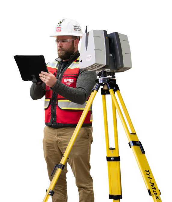
A man in a hard hat holding a tablet.

Request A Quote

I am the homeowner on a residential project
Format: 123-456-7890

Project Location

Project Information

To select multiple options, press CTRL

Project Notes *

File Attachments


Philadelphia 3D Laser Scanning

215-871-9231laser@gprsinc.com

Pittsburgh 3D Laser Scanning

412-639-7564laser@gprsinc.com

GPRS Project Managers

GPRS is the leading provider of 3D laser scanning services in Pennsylvania. Our Project Managers document your site with the Leica ScanStation P-Series and the Leica RTC360 3D laser scanners, capturing up to 2 million data points per second with 2-4 millimeters accuracy. Each Project Manager completes the most extensive training program in the industry, with 80 hours of hands-on classroom training and 320 hours of mentorship in the field, plus another 40 hours of LiDAR training to deliver expertise in 3D laser scanning equipment and field knowledge.

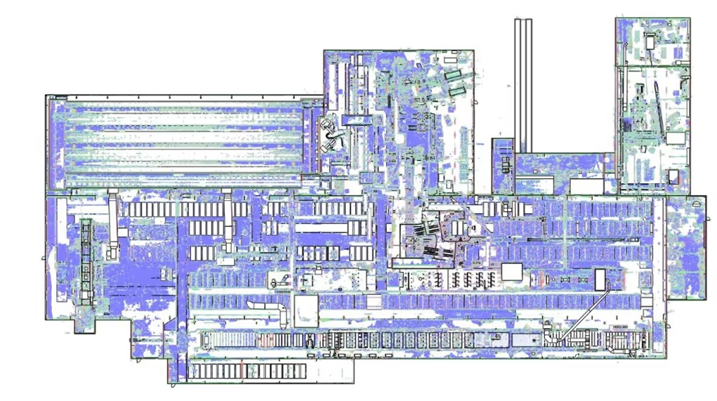
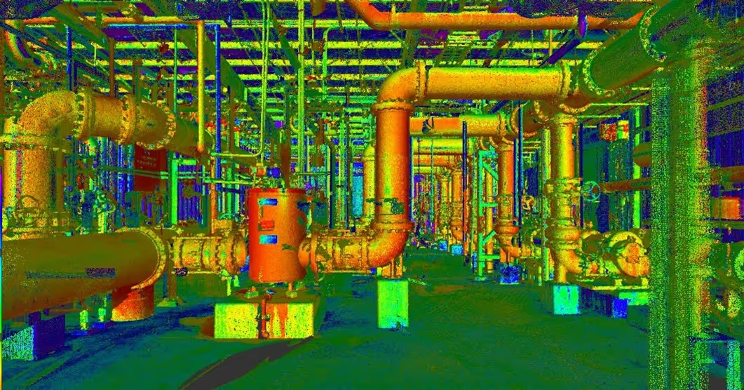
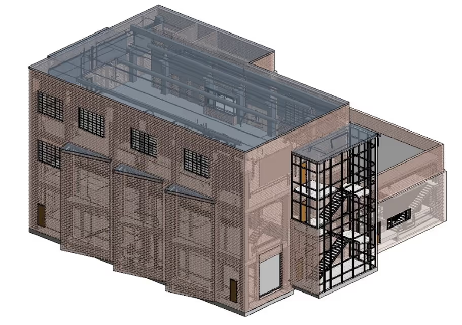
A 3D image of a factory with pipes and valves.A drawing of a road with a red line on it.A 3D drawing of a building with a staircase.

GPRS Mapping & Modeling Team

Construction drawings and models streamline planning, visualization, and coordination on your project because they provide a single source of truth for designers, architects, engineers, and contractors. GPRS’ in-house Mapping & Modeling Team can customize as-built data, 2D CAD drawings, 3D BIM models, 3D mesh models, virtual tours via WalkThru 3D, digital twins, floor plans via FLRPLN, and more to ensure you have all the information you need to get the job done right, delivered via GPRS’ SiteMap® digital storage software and app.

Maps and models can be produced at any level of detail in a variety of formats such as Revit, AutoCAD, ReCap, Navisworks, Civil 3D, BIM360, A360, Bentley, Leica Cyclone, Cintoo, and more. We have optimized workflows for importing data, registration, creating deliverables, quality checks, and transferring data to clients.

Not sure what you need? Not a problem. Our experienced Project Managers will work closely with you to define the project scope and use the right equipment and software to accurately map and model your project to accomplish your goals.

WHY CHOOSE US? 

THE GPRS DIFFERENCE.

With GPRS, clients can rest assured that our rigorously trained Project Managers use state-of-the-art technology to deliver the accurate as built information you need to do the job right. GPRS leads the industry to deliver precise as built information to enhance communication and collaboration among your project teams.

GPRS 3D Laser Scanning Services can bring these benefits to your project:

  • Collect up to two million data points per second with the highest-quality survey-grade laser scanners
  • Capture exact dimensions and measurements of your project site
  • Expedite planning and design with accurate as-builts
  • Eliminate site disruption and revisits
  • Receive precise point clouds, 2D drawings, and 3D models to improve collaboration and coordination
  • Tour the location, add digital notes, and even measure with a virtual tour
  • Reduce project risks, change orders, delays, accidents, and costs
GPRS main Logo: Intelligently Visualizing the built world | GPRS

GPRS 3D Laser Scanning Services in Pennsylvania

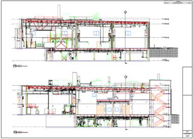
A blue and white drawing of a building with a lot of wires.
As-Built Services
As-built services capture exact architectural, structural, and MEP system dimensions and layout of existing buildings, facilities, and sites, making them invaluable for design, construction, renovations, and modifications.
Learn More
A green and blue image of a factory with pipes and valves.
Point Clouds
3D laser scanners record highly accurate digital measurements of sites and assets in the form of a point cloud and can be used to create 2D CAD drawings and 3D BIM models that improve project workflows, shorten turnaround times, and reduce costs.
Learn More
A 3D model of a building with a staircase.
3D BIM Modeling
Intelligent 3D Building Information Models (BIM) provide contractors, engineers, architects, and facility managers an accurate digital twin of buildings and infrastructure to collaborate on design, construction, and operations.
Learn More
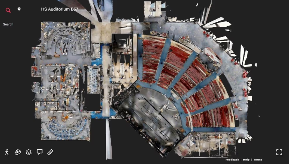
A picture of a building with a red circle in the middle.
3D Photogrammetry
3D rendered images can be used to create virtual tours, floorplans, topographic maps, point clouds, 3D models, and more for planning, analysis, and calculations.
Learn More
A drawing of a building with a red roof and a green roof.
2D CAD Drawings
GPRS can translate 3D laser scan data into 2D CAD drawings that provide your team with up-to-date floor plans, elevations, sections, details, isometric drawings, reflected ceiling plans, and more.
Learn More
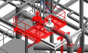
A red pipe with a blue wire running through it.
Clash Detection
3D laser scanning captures as-built site conditions with 2-4 mm accuracy, helping to identify potential clashes, prefabricate components, and plan a flawless installation.
Learn More
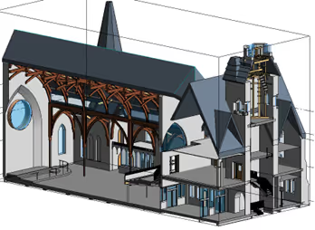
A 3D drawing of a church with a steeple.
Design-Build
3D laser scanning provides accurate as-built site data to prevent expensive rework by identifying any mistakes early in the design through the construction phase.
Learn More
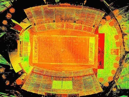
A stadium seating chart with a red line on the field.
Drone Imagery
GPRS offers rectified photogrammetry, aerial video and images, LiDAR scans, 2D orthomosaic images, CAD drawings, 3D models, and 3D fly throughs thanks to a wide-range of drone services operated by FAA Licensed pilots.
Learn More

We provide 3D Laser Scanning Services to these Pennsylvania counties & many more:

  • Philadelphia County
  • Allegheny County
  • Montgomery County
  • Bucks County
  • Delaware County
  • Lancaster County
  • Chester County
  • York County
  • Berks County
  • Lehigh County

Our portfolio of work includes projects in these Pennsylvania cities & many more:

  • Philadelphia, Pennsylvania
  • Pittsburgh, Pennsylvania
  • Allentown, Pennsylvania
  • Reading City, Pennsylvania
  • Erie, Pennsylvania
  • Upper Darby, Pennsylvania
  • Scranton, Pennsylvania
  • Lower Merion, Pennsylvania
  • Bensalem, Pennsylvania
  • Abington, Pennsylvania

GPRS 3D Laser Scans Hard Rock Stadium For Mixed Reality Super Bowl Feature

3D laser scanning captures real-world spaces with millimeter precision for clients to create engaging virtual reality experiences.
GPRS 3D laser scanned the Hard Rock Stadium for use in a mixed-reality experience during the 2020 Super Bowl on February 2. Mixed reality is a blend of physical and virtual worlds that includes both real and computer-generated objects. The two worlds are "mixed" together to create a realistic environment.
Case Study: TruePoint 3D Laser Scans Hard Rock Stadium For Mixed Reality Super Bowl Feature We would like to thank The Famous Group, the Miami Dolphins and the Hard Rock Stadium for allowing us to be a part of this project.” - Ryan Hacker, President of TruePoint Laser Scanning Location: Hard Rock Stadium, Miami, Florida Task: TruePoint 3D laser scanned the Hard Rock Stadium for use in a mixed-reality experience during the 2020 Super Bowl on February 2. Mixed reality is a blend of physical and virtual worlds that includes both real and computer-generated objects. The two worlds are "mixed" together to create a realistic environment. Challenge: It was important to the client that the existing spatial layout was captured with great accuracy. When generating the mixed reality experience, computer-generated objects must precisely interact with the physical environment to sell the realism. Solution: The upper and lower stands, field topography, LED display screens, LED ribbon around stadium, two Hard Rock Stadium signs and roof structure were documented with a survey-grade Leica P40 ScanStation. In two days onsite, 172 laser scans of precise point cloud data was captured. TruePoint’s team of in-house engineers quickly generated a 3D Revit model for the client. The client planned to use Autodesk Maya, a 3D computer animation, modeling and rendering software to create an augmented reality (AR) simulation. Deliverables: TruePoint delivered point cloud files in .rcs format, a 3D Revit Model, and a FBX file. The client was also able to view the model progress using Autodesk A360, a web-browser application that allows engineers and project teams to work together more easily in an online workspace. Added Value: “Everything we do at TruePoint Laser Scanning is highly custom. This client wanted portions of the stadium modeled in LOD 100 and portions modeled in LOD 300. Our deliverables were customized, so the client is only paying for what they need,” Aaron Hunt, Lead Technical Manager. For information on 3D laser scanning for mixed reality applications, contact TruePoint 3D Laser Scanning at 419-843-7226 or info@truepointscanning.com. Watch the NFL 100 ceremony prior to Super Bowl LIV featuring this six-minute video of mixed-reality graphics executed by Fox Sports and The Famous Group. hard-rock-stadium-3d-laser-scanning-5.JPG The upper and lower stands, field topography, LED display screens, LED ribbon around stadium, two Hard Rock Stadium signs and roof structure were documented with a survey-grade Leica P40 ScanStation. hard-rock-stadium-3d-laser-scanning-1.png TruePoint quickly generated a 3D Revit model of the stadium for use in Autodesk Maya, a computer animation software. hard-rock-stadium-3d-laser-scanning-2.png The client requested a custom Revit model, portions were modeled in LOD 100 and portions in LOD 300. hard-rock-stadium-3d-laser-scanning-3.jpg The client was able to view the model progress using Autodesk A360, a web-browser application that allows project teams to work together in an online workspace.
All
3D Laser Scanning
3D Laser Scanning
Mapping & Modeling

3D Laser Scanning The House of the Seven Gables Historical Site

3D laser scan data will help to identify structural issues, deterioration, and other factors affecting The House of the Seven Gables historical site and deliver the architect 2D plans and a 3D BIM model to develop architectural designs for restoration.
3D laser scan and model The House of the Seven Gables property in Salem, Massachusetts for historical preservation. The exterior shells of the Turner-Ingersoll Mansion (also known as The House of the Seven Gables), The Retire Beckett House, Hooper-Hathaway House, Nathanial Hawthorne Birthplace, Primm House, and features of the Seaside Colonial Revival Gardens were 3D laser scanned with the Leica RTC360, capturing highly detailed and accurate digital as-builts, to deliver 2D elevations and a 3D BIM model of each property to the architect.
3D laser scan data will help to identify structural issues, deterioration, and other factors affecting The House of the Seven Gables historical site and deliver the architect 2D plans and a 3D BIM model to develop architectural designs for restoration.
Highlights THE BOTTOM LINE 3D laser scan data will help to identify structural issues, deterioration, and other factors affecting The House of the Seven Gables historical site and deliver the architect 2D plans and a 3D model to develop architectural designs for restoration. INDUSTRY Historical Preservation SERVICE 3D Laser Scanning; Mapping & Modeling LOCATION Salem, Massachusetts PM Insight The properties look well preserved from the outside, yet the historic site's preservation manager is aware of the the myriad ways climate change is threatening the integrity of the structures. Deliverables Point Cloud, 3D BIM Model, 2D CAD Elevations Task 3D laser scan and model The House of the Seven Gables property in Salem, Massachusetts for Union Studio Architects historical preservation. The exterior shells of the Turner-Ingersoll Mansion (also known as The House of the Seven Gables), The Retire Beckett House, Hooper-Hathaway House, Nathanial Hawthorne Birthplace, Primm House, and features of the Seaside Colonial Revival Gardens were 3D laser scanned with the Leica RTC360, capturing highly detailed and accurate digital as-builts, to deliver 2D elevations and a 3D BIM model of each property to the architect. PROBLEM The House of the Seven Gables strives to preserve their historic buildings in the face of several challenges, including deterioration due to climate, weakening of the seawall, and mold in the basement of the Nathaniel Hawthorne Birthplace. As a National Historic Landmark District, the property is confined by preservation standards set by the federal government and the town of Salem. Because of these terms, unlike making renovations to a modern home, every modification at the Seven Gables property must be approved by multiple stakeholders to ensure that historical accuracy is maintained. The client also had budget constraints due to the project’s nonprofit status, so the job scope narrowed from 3D laser scanning eight buildings to five. Existing Conditions, a GPRS company, worked closely with Union Studio to efficiently supply them with the data and deliverables they required, knowing the allocated budget for this project. Solution 3D laser scanning will play an important role in the preservation of these historic buildings, by delivering as-built data, drawings, and models for design planning and decision making. 3D laser scanning documented the exterior building shells, delivering precise measurements and building footprints. For the Hooper Hathaway House basement, 3D laser scanning captured the architectural and structural features, geometry, and spatial layout. Benefits 3D laser scanning captured highly detailed and accurate digital measurements of The Gables’ buildings and infrastructure to create as-built drawings and 3D BIM models for this architectural preservation project. Union Studio Architects can reference accurate site data to create and share design plans with all project stakeholders.
All
3D Laser Scanning
3D Laser Scanning

3D Laser Scanning To Expedite The Installation Of ACM Panels

The client was able to fabricate components offsite and plan a flawless installation based on our existing condition data and 3D model. Plus, GPRS' work was conducted entirely at night, mitigating any disruption to construction
Field verification to prefabricate ACM panels
Our client was installing ACM panels to the canopy of a newly constructed airport terminal. The construction plans did not match the existing conditions at the site. A deviation could cause a major issue. The installation process needed to be precisely planned to avoid rework.
The construction plans did not match the existing conditions at the site. The installation process needed to be precisely planned to avoid rework • The shape of the canopy was complicated and stood 65 feet in the air. The client needed field verification and a plan to expedite proper installation of the panels • Installers were working overhead in a lift; there was no room for trial and error Solution • The Project Manager conducted a site walk to devise a plan for the client • The canopy and curtain wall of the airport terminal were 3D laser scanned to capture precise as-built data and generate a 3D model and 2D drawings to facilitate ACM panel installation • 22" x 34" 2D CAD drawings were created with the panel layout for the client to take to the field. This allowed each panel to be labeled with a custom number, cut and shim points Benefits • Laser scanning obtained exact measurements for the client and took away any guesswork from this project • To circumvent the active construction site, the Project Manager scanned the site at night to eliminate movement and trades working • The client was able to fabricate components offsite and plan a flawless installation
All
3D Laser Scanning
3D Laser Scanning
Mapping & Modeling

GPRS
INTELLIGENTLY VISUALIZING THE BUILT WORLD®