

.svg)
Healthcare and Pharmaceutical
GPRS is the nation's leading provider of utility locating, concrete scanning, 3D laser scanning, video pipe inspection, and leak detection services for the healthcare and pharmaceutical industry. GPRS services can help clients throughout the entire lifecycle of a project, from pre-planning to design and construction, through operations and maintenance.
GPRS has worked closely with the healthcare sector including many sites such as hospitals, surgery centers, clinics, medical office buildings, nursing homes, pharmaceutical facilities, manufacturing facilities, research labs, production lines, packaging zones, and distribution facilities, among others.
We deliver up-to-date, accurate data to improve communication and coordination, identify hazards to keep all workers safe, reduce errors and reworks, and deliver your project on time and on budget.
With Project Managers in every major market and city across the United States, GPRS has an unmatched nationwide service network that makes it quick and easy to find an expert Project Manager in your area. GPRS can reach your location within 24 to 48 hours of contact to solve all and any of your project needs. We can manage data, maps, and models for the entire site. Important operational data can be accessed in real-time via GPRS’ SiteMap® digital storage software and app to improve operational safety, plan for maintenance, and prevent operational disruption.

GPRS Delivers Complete Infrastructure Visualization
GPRS is the only company in the U.S. that can capture your entire site or facility, above and below-ground, to provide you with accurate as-builts, private and public utility maps, 2D CAD drawings, 3D BIM models, virtual tours, WinCan reports, and more documenting architectural, structural, MEP, and subsurface utility existing conditions, and instantly deliver data via SiteMap®, GPRS’ cloud-based digital storage software and app.
Utility Locating Services
GPRS utility locating service utilizes ground penetrating radar (GPR) and electromagnetic (EM) locating technology to locate, mark, and map existing underground infrastructure such as power lines, gas lines, pipelines, water lines, sewer lines, and additional buried facilities and utility lines. This information is critical for projects where construction or excavation activities are planned to mitigate accidental utility strikes, plus keep your team and facility safe. GPRS delivers complimentary CAD utility site maps in PDF, KMZ, and SHP file formats, and can export your utility data into a wide variety of drawings, maps, and models to advance communication and collaboration on your project. All clients receive instant access to complete and aggregated site records in Sitemap® GPRS’ digital storage software and app, where data is geolocated, layered, and securely shareable.
Concrete Scanning Services
Concrete scanning is a non-destructive method to assess concrete using GPR to locate, identify, and mark utilities and objects such as rebar, post tension cables, beams, conduits, and piping embedded within concrete slabs and structures prior to anchoring, cutting, coring, and drilling. Concrete scanning ensures the safety of workers and prevents accidents by identifying potential hazards before any work occurs. Concrete markings can be 3D laser scanned to create a permanent record of the site, data can be delivered in 2D CAD drawings, 3D BIM models, and virtual site tours.
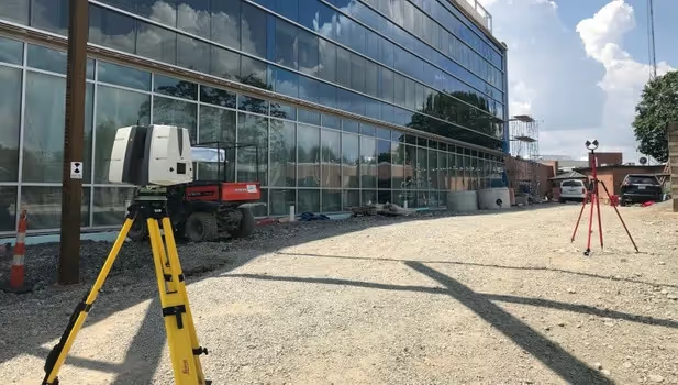
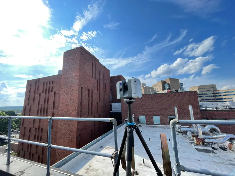
3D Laser Scanning Services
3D laser scanning can be used for a variety of applications, such as planning facility modifications, plant maintenance, renovation, prefabrication, asset management, floor flatness and levelness analysis, locating underground utilities and so much more. GPRS 3D laser scanning services document the exact architectural, structural, and MEP system layout and dimensions of existing buildings, facilities, and sites. GPRS Project Managers use industry-leading Leica survey-grade laser scanners to capture 2-4 millimeter accurate existing site conditions in the form of a point cloud. Our in-house Mapping & Modeling Team can transform those point clouds into customized 2D CAD drawings, 3D BIM models, 3D mesh models, TruViews, and 3D virtual tours at any level of detail.
Video Pipe Inspection Services
Video Pipe Inspection Services by GPRS deploy robotic crawler CCTV cameras, lateral launch cameras, and push cameras to inspect and document water, sewer lines, and lateral pipelines to locate clogs, investigate cross bores, find structural faults and damage, and conduct lateral sewer line inspections. GPRS Project Managers deliver NASSCO-certified WinCan reports with the exact location, video, and photo of each defect, ranked by severity so you can plan for maintenance and repairs.
Leak Detection Services
GPRS specializes in all types of leak detection services, including municipal, industrial, and residential. Our Project Managers are leak detection specialists who utilize multiple technologies to locate your leak and have the expertise to map and provide many other insights into your water distribution and/or fire suppression systems. GPRS does this by utilizing a variety of equipment paired with our industry-leading SIM (Subsurface Investigation Methodology) processes. The equipment and methods used include acoustic leak detectors, leak noise correlators, video pipe inspection (CCTV) cameras & sondes, ground penetrating radar, and electromagnetic locating, among others.


CUSTOM SERVICE PLANS

Scheduling

Pricing

Approach

mapping & Modeling
GPRS delivers the most up-to-date, accurate and comprehensive site data possible in the format required for your project. We provide complimentary KMZ and PDF maps with every utility locate we perform. Our Mapping & Modeling Team can create a wide variety of customizable maps and models, from a simple GPS-enabled map of your utility locate, to highly-detailed 2D CAD drawings and 3D BIM models, depending on your needs.
AS BUILT DRAWINGS
2D MAPS & 3D MODELS
SITEMAP® MOBILE APP

One Call Program

Public Property
Private Property

Embedment
Case Studies


%20(1).jpg)


Related Articles

.avif)


