

.svg)
ENVIRONMENTAL DUE DILIGENCE
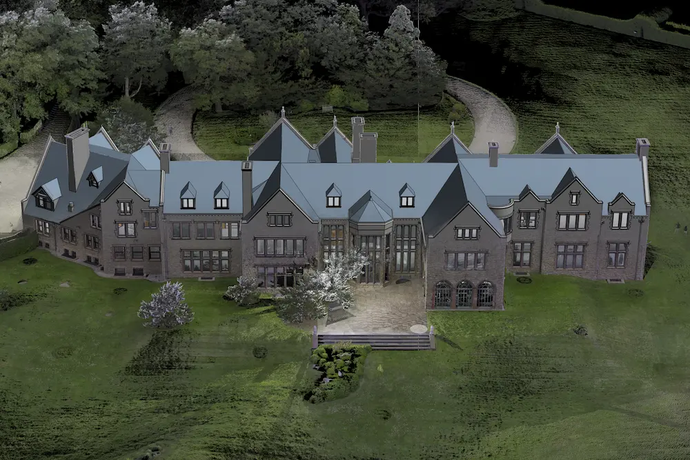
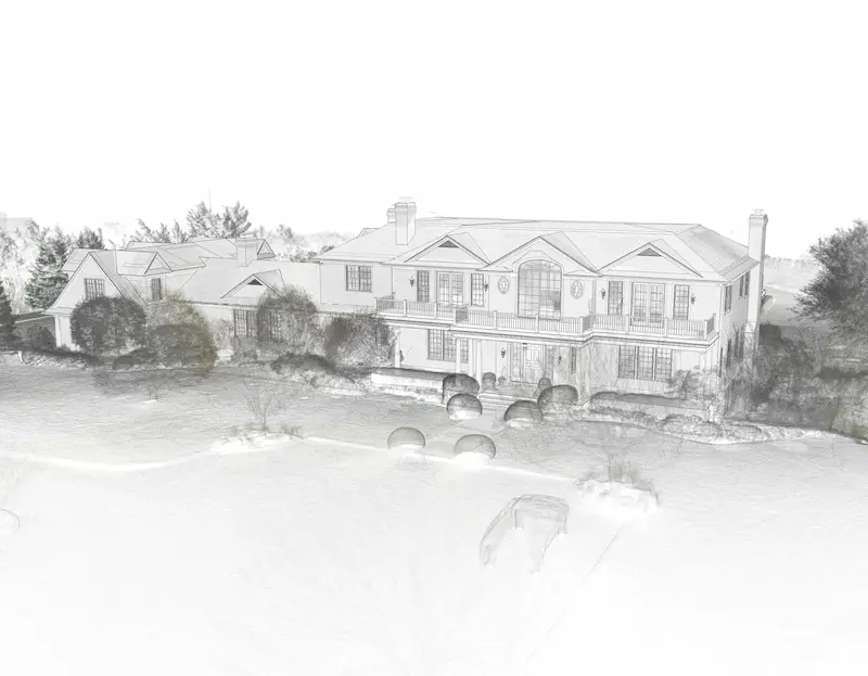
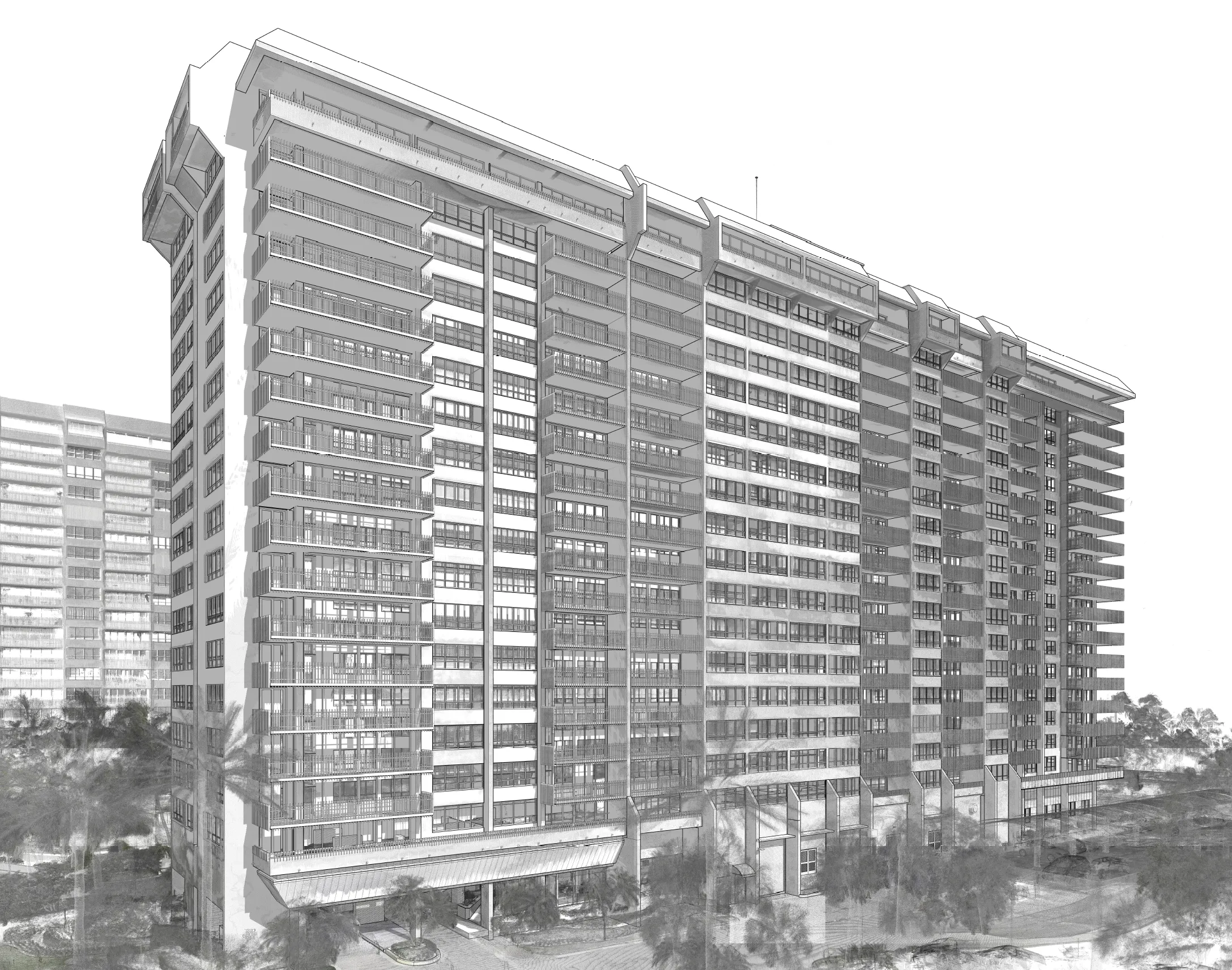
Visualize Your Fine Home Before You Build
GPRS provides full site visualization, both subsurface and structural, along with SiteMap® (patent pending) to give your team 24/7 access to digital as‑builts.

.svg)

.svg)
.svg)
.svg)


.png)
.png)
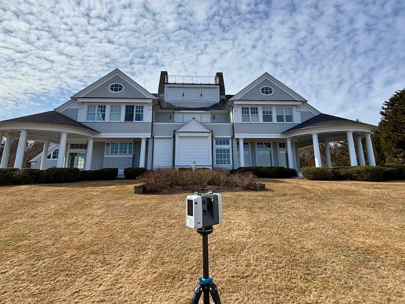
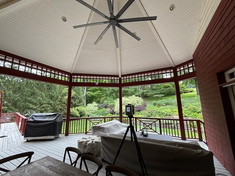
Beyond line-of-sight reality capture for fine home projects
GPRS partners with architects, designers, homeowners, contractors, engineers, and landscaping teams to deliver field-verified as‑builts that save time, resources, and improve coordination throughout the fine home project lifecycle.
Architects & Interior Designers
Reality capture services via 3D laser scanning and subsurface data to help you:
- Reduce turnaround times
- Improve design accuracy
- Satisfy your clients
- Inform core drilling & anchorage decisions
Ground Penetrating Radar (GPR)
Electromagnetic (EM) locating
LiDAR scanning
Homeowners
Maps private and public utilities, images slabs, and creates verified as-builts to help:
- Protect your assets
- Advisors access information anytime via SiteMap
- Reduce on-site visits with remote virtual walkthroughs
Concrete scanning
Concrete scanning
Leak detection

Mechanical Contractors
Supports mechanical contractors with 99.8% accurate utility locating and concrete scanning, along with reality capture to:
- Locate public and private utilities and embedded conduits
- Help reduce strike risk and costly rework
- Capture 3D laser scans of mechanical rooms and service corridors
- SiteMap centralizes all verified data to provide access for stakeholders
Transmission and distribution upgrades
Substation renovations
Grid modernization initiatives
General Contractors and Saw Cutting Specialists
Concrete scanning services to identify post tension cables, embedded conduits, and other critical elements to help:
- Reduce structural risks and avoid costly delays during interior or slab changes
- View and manage subsurface data anytime
- Get instant access to project information in an intuitive interface
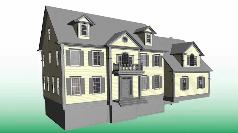
Full-site visualization
2D CAD drawings
2D CAD drawings
3D BIM models
Virtual tours accessible via SiteMap®
Years and 120,000 Projects Completed Since 2001
Accuracy in Utility Locating & Concrete Scanning
SIM-Certified Project Managers You Can Trust, Every Time
Access to Your Data with SiteMap® GIS Software & App
Historic Preservation
Preserving a historic property requires balancing authenticity with modern performance standards.
Key Challenges
Limited outage windows
Tight tie-in tolerances
Unknown embedded conditions
Our Solutions
Cross bore investigations
Structural condition assessments
Blockage and defect identification
Key Challenges
- Historic properties often contain undocumented utilities and hidden infrastructure
- Outdated as-builts increase building damage risks
- Each building may have unique geometry, damage, and historical significance
Our Solutions
- Utility locating services to identify underground anomalies
- Reality capture services help ensure architectural authenticity and supports system upgrades
- 3D laser scanning to capture every detail of your property
- SiteMap stores all your as-built documentation, CAD, building information models (BIM), and virtual tours

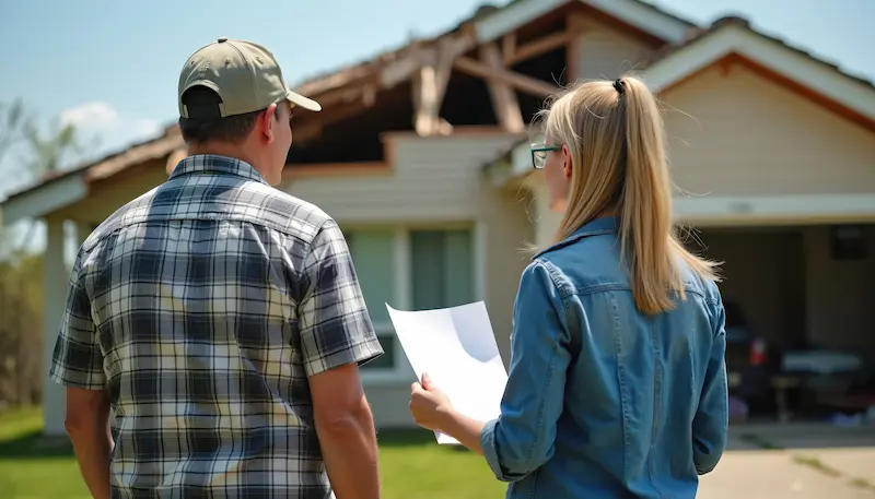
Renovation
Renovating your home introduces structural and safety challenges that require verified as-built data.
Our Solutions
Utility locating and mapping on public and private property
GPR and EM technology for underground and overhead transmission
Reliable data for HDD, redesign avoidance, and conflict resolution
Key Challenges
- Unknown utilities, embedded steel, and undocumented tie-ins can cause costly delays
- They can also compromise load-bearing integrity
- Inaccurate as-built conditions cause change orders and budget overruns
- Rework from inaccurate documentation can tie up to 30% of construction costs
Our Solutions
- Utility locating to identify active and abandoned lines and detect underground anomalies
- Concrete scanning to reveal embedded steel, rebar, and conduit before saw cuts
- Reality capture services to aid in precise planning throughout your project
- Video pipe inspection (VPI) to verify tie-ins and document laterals
- SiteMap centralizes all your 2D CAD drawings, 3D BIM models, as-built records, and immersive virtual tours
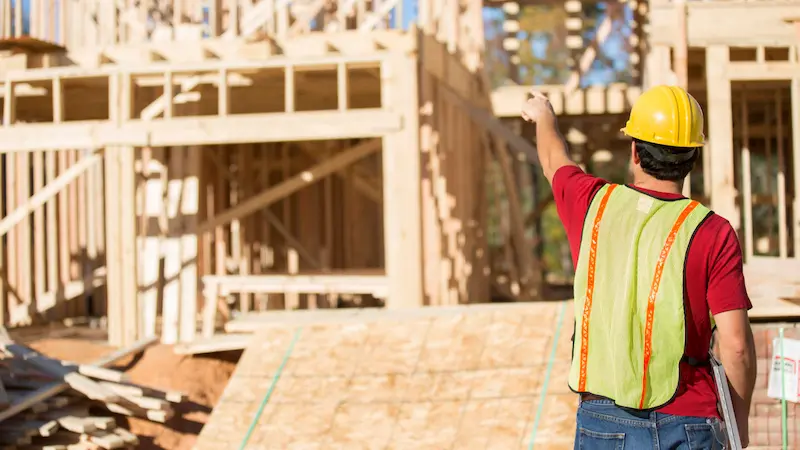
New Build Luxury Homes & Additions
High-end residential projects demand precision from initial planning to final execution.
Key Challenges
- Additions, pools, and complex MEP integrations introduce tight tolerances
- Lack of verified subsurface data increases the risk of striking post tension cables, conduits, or embedded steel
- Result: costly rework and schedule overruns
Our Solutions
- Utility locating services to verify tie-ins for water, gas, and electrical service
- Reality capture services to document exterior and interior 3D laser scans for design-intent models
- CAD drawings and 3D BIM models for informed construction planning
Our Solutions
Mapping grounding grids, duct banks, and buried conductors
Laser scanning of switchyards, control buildings, and equipment clearances
Millimeter-accurate E57 point clouds and digital twins for design, outage planning, and expansions
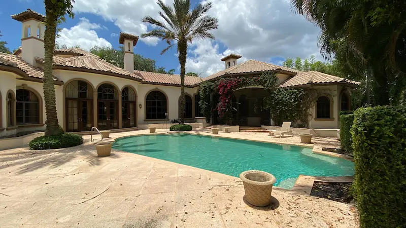
Outdoor & Landscape Projects
Pools, patios, irrigation systems, and hardscape features add a lot of subsurface complexity to fine home properties. This includes water supply lines, electrical feeds for lighting and pumps, and gas lines for outdoor kitchens or heaters.
Key Challenges
- Properties with pools/pool houses/garages with restrooms usually have more utilities
- Increases strike risk during excavation
- Excavating without precise mapping can cause high repair costs, delays, and potential liability
Our Solutions
- Utility locating services identify irrigation lines, pool supply and return, and private power feeds
- Detects leaks in water lines serving remote structures and outdoor features
- Delivers georeferenced utility maps via SiteMap
Our Solutions
Reality capture for overhead clearance verification
Utility locating for dense underground corridors
NASSCO-certified VPI and CCTV inspections
HDD planning with cross-bore prevention and post-install verification
Connect with Our Industry Leader

Connect with Our Industry Leader
We equip your project team with precise, real‑time structural and site data, empowering you to make informed decisions, avoid costly risks, and deliver every fine home project with confidence.
- Capture true as-built conditions using 3D laser scanning
- Deliver HABS/HAER-compliant CAD and BIM models for restoration planning
- Archive BIM models for long-term preservation and compliance
- Locate post tension cables and embedded conduit before interior cuts to prevent utility strikes
- Verify load paths and beam sizes with 3D laser scans for informed design decisions
- Capture high-resolution point clouds for BIM models and prefabrication planning
- Capture exterior reality data for renovation planning, and accurate site visualization
- Detect leaks in water lines serving remote structures and outdoor features
- Set safe excavation offsets to prevent strikes and costly repairs
- Perform pre- and post-install VPI on sewer laterals and mains
- Document tie-ins for accurate records
- Centralize NASSCO-certified inspection reports and CAD files in SiteMap for secure collaboration
- Capture design intent models for architectural planning and layout optimization
- Deliver true as-built models for contractors to address wall alignment and routing needs
- Provide immersive virtual tours for remote stakeholders and Project Managers
.avif)

What Our Clients Say
Frequently Asked Questions
Manual measurement methods are slow, labor intensive, and often inaccurate. 3D laser scanning adoption can help you reduce turnaround times, avoid costly delays, and satisfy your client. You can think of GPRS as an extension of your team, so you can devote your time to what you do best.
Accurate as-builts give you a current, verified record of your home, both exterior and interior, and saves you time and money because architects, contractors, and stakeholders can plan with confidence, reduce maintenance costs, and avoid costly rework or surprises behind finishes.
3D laser scanning provides a non‑destructive, highly accurate record of a historic residence’s true geometry. This cutting-edge technology captures irregularities that hand measurements often miss, such as out‑of‑square rooms, curved beams, and settled floors so preservation teams can understand existing conditions.
Break Ground with Confidence
GPRS delivers accurate subsurface data and reality capture for every phase of your fine home project.