
.svg)

.svg)

What Is a Conceptual Site Model (CSM)?
A Conceptual Site Model (CSM) is a three-dimensional representation of an environmental site that helps stakeholders understand site conditions, contamination sources, migration pathways, and potential receptors, including people and ecological systems. The model serves as one of the most important communication and decision-making tools throughout environmental site assessment, corrective action, and remediation projects.
A CSM helps environmental professionals understand:
- Contaminant sources and release mechanisms
- Migration pathways and transport processes
- Exposure pathways
- Potential receptors (people, structures, groundwater, ecosystems)
- Environmental and safety risks
- Site-specific data gaps
A CSM is considered a living document that is refined throughout the lifecycle of a project because site conditions continually evolve as new information is collected.
What are the Core Components of a Conceptual Site Model?
According to the EPA, a standard CSM is built on a "source-pathway-receptor" framework and is often refined throughout a project's life cycle.
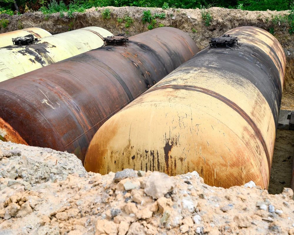
The source of contamination identifies where pollutants originated, the mechanisms by which they were released, and the specific contaminants involved. Common sources may include leaking underground storage tanks, chemical spills, historical industrial operations, or other releases to the environment. Understanding the source is essential for determining the nature, extent, and severity of contamination and for developing an effective investigation or remediation strategy.
Migration pathways describe how the contamination travels through the environment, including groundwater transport, storm and sewer infrastructure, soil vapor migration, surface runoff, or wind dispersion. These pathways often determine where contamination will travel and what may require corrective actions.
Exposure points and receptors identify exactly where human or ecological populations might come into contact with the contamination, and the specific route of exposure, such as inhaling vapors, dermal contact, or ingesting contaminated drinking water.

What are the Benefits of a Conceptual Site Model?
As a central communication tool, a CSM helps stakeholders, regulators, and environmental engineers to:
- Identify and prioritize data gaps
- Focus investigation efforts
- Reduce uncertainty
- Evaluate remediation alternatives
- Improve communication among project teams
- Support regulatory compliance
- Lower project costs and timelines
- Guide risk-based decision-making
A CSM provides a structured framework for organizing site information to identify what is known and unknown, define the critical questions that must be answered, and guide decision-making. By creating a clearer picture of site conditions, environmental professionals can prioritize field activities, allocate resources more effectively, and focus attention on the areas that present the greatest risk or uncertainty.
Who are the Stakeholders that Utilize Conceptual Site Models?
Environmental Consultants
Environmental consultants use a Conceptual Site Model as the foundation for environmental investigations and risk evaluation. It helps them design Phase I and Phase II Environmental Site Assessments, identify data gaps and uncertainties, determine appropriate sampling locations and depths, and select analytical parameters. As new information becomes available, consultants refine the CSM to improve the understanding of site conditions, support risk assessments, and effectively communicate findings and recommendations to both clients and regulatory agencies.
Engineers
Engineers use a CSM to develop and refine corrective action and remediation strategies. By understanding contaminant sources, migration pathways, and affected environmental media, including soil, groundwater, vapor, and surface water, they can evaluate treatment alternatives, design remediation systems, and recommend solutions that best meet project objectives.
Regulators
Regulators use a CSM to assess whether site investigations and corrective actions are protective of human health and the environment. The model helps them verify that all contaminant sources, migration pathways, and potential receptors have been identified and evaluated. Regulators also use a CSM to determine whether additional site characterization is necessary, assess regulatory compliance, and support risk-based closure decisions or no-further-action determinations.
Property Owners and Developers
Property owners and developers use a CSM to better understand environmental liabilities, risks, and potential impacts to property value or redevelopment plans. The model supports environmental due diligence during acquisitions and transactions, helps identify development constraints and opportunities, and provides a basis for estimating remediation costs and project schedules. It also serves as a tool for tracking progress toward site closure and demonstrating reductions in environmental risk.
Remediation Contractors
Remediation contractors use the CSM to understand the location, extent, and behavior of contamination before implementing field activities. The model helps them safely and efficiently plan excavation, treatment, and monitoring activities, identify target remediation zones, and establish excavation boundaries. As remediation progresses, contractors use updated CSMs to evaluate treatment effectiveness, adapt field operations, and ensure remedial objectives are achieved.

What are CSM Applications in Petroleum and Gas Station Sites?
Petroleum sites are among the most common and challenging locations where Conceptual Site Models are used. Gas stations, convenience stores, bulk fuel terminals, refineries, and other fuel-handling facilities often require detailed site characterization to understand the nature and extent of fuel-related contamination. CSMs help environmental professionals on petroleum and gas station sites identify release sources, evaluate soil and groundwater impacts, assess vapor intrusion concerns, and understand potential exposure risks to nearby receptors.
These properties often contain:
- Underground storage tanks
- Fuel distribution lines
- Utility networks
- Legacy infrastructure
- Historical contamination concerns
Accurate utility locating and site documentation are critical for developing an effective CSM because contaminants can migrate along utility corridors, sewer systems, and other subsurface infrastructure. Reliable site data helps environmental teams:
- Support Phase I and Phase II Environmental Site Assessments
- Guide tank removals
- Reduce excavation risk
- Support remediation activities
- Maintain regulatory compliance
Other Sites That Utilize Conceptual Site Models
Industrial Facilities
Industrial facilities such as manufacturing plants, chemical processing facilities, refineries, metal plating operations, and warehouses use CSMs to evaluate historical and current releases of chemicals, solvents, petroleum products, and heavy metals. These models help identify contaminant sources, migration pathways, and potential risks to human health and the environment.
Commercial Properties
Commercial properties such as shopping centers, office buildings, dry cleaners, and automotive repair facilities often use CSMs as part of environmental due diligence, property transactions, and redevelopment efforts. The models help stakeholders evaluate environmental risks and determine whether additional investigation or remediation is needed.
Brownfields and Redevelopment Sites
Brownfields and redevelopment sites frequently require CSMs to characterize existing contamination and evaluate potential risks before redevelopment can occur. These models support cleanup planning, risk management, and redevelopment decision-making while helping ensure the site is suitable for its intended future use.
Landfills and Waste Management Facilities
Municipal landfills, hazardous waste landfills, transfer stations, and recycling facilities use CSMs to assess environmental impacts associated with waste disposal activities. CSMs help evaluate migration, landfill gas generation, groundwater contamination, and potential exposure pathways to nearby communities and ecological receptors.
Mining and Mineral Processing Sites
Mining operations, abandoned mines, tailings facilities, and smelters use CSMs to understand the movement of metals and mining-related contaminants through soil, groundwater, surface water, and sediment. These models help assess environmental impacts and guide remediation or long-term management efforts.
Military and Federal Facilities
Military bases, former defense sites, training ranges, and federal research facilities often have complex contamination histories involving fuels, solvents, explosives, PFAS, and other hazardous substances. CSMs help investigators understand these complex conditions and develop efficient corrective action strategies.
Transportation Facilities
Transportation facilities such as airports, rail yards, ports, and maintenance facilities use CSMs to evaluate environmental impacts from fuel storage, vehicle and equipment maintenance activities, industrial operations, and the use of chemicals for operational processes. The models help identify contaminant sources and assess risks to surrounding environmental resources.
Agricultural Sites
Agricultural sites, including pesticide storage areas, fertilizer facilities, and agricultural chemical manufacturing operations, use CSMs to evaluate the movement of pesticides, herbicides, nitrates, and other agricultural chemicals. These models support assessments of potential impacts to soil, groundwater, and nearby receptors.
Residential and Community Sites
CSMs are also used at residential and community sites where contamination may pose a risk to residents. Common applications include vapor intrusion investigations, lead-contaminated properties, residential developments built on former industrial land, and neighborhoods affected by nearby contamination sources.
Surface Water and Sediment Sites
Rivers, lakes, wetlands, harbors, and other aquatic environments use CSMs to understand how contaminants move between sediment, surface water, groundwater, ecological habitats, and human receptors. These models are critical for evaluating both environmental and human health risks.
Emerging Contaminant Sites
As concerns about emerging contaminants continue to grow, sites affected by PFAS, 1,4-dioxane, chlorinated solvents, and other emerging chemicals increasingly use CSMs. These models help stakeholders understand contaminant behavior, migration patterns, and potential exposure pathways while supporting investigation and remediation efforts.
Virtually Any Environmental Site Can Benefit from a Conceptual Site Model
Any site where stakeholders need to understand the relationship between contaminant sources, migration pathways, environmental media, such as soil, groundwater, surface water, air, and potential receptors can benefit from a Conceptual Site Model. Whether supporting environmental assessments, risk evaluations, remediation projects, regulatory closure, or redevelopment activities, the CSM serves as a critical tool for informed decision-making throughout the site lifecycle.
Explore GPRS environmental services and see how we help professionals make informed decisions with accurate, field-verified data.
The Importance of Accurate Site Characterization
Like any 3D model or BIM model, a Conceptual Site Model is only as reliable as the data behind it. The quality of site characterization directly impacts the accuracy of risk evaluations, remediation decisions, and project outcomes.
Environmental consultants, engineers, regulators, property owners, and remediation contractors must understand:
- Existing infrastructure
- Utility systems
- Sewer and stormwater networks
- Building geometry
- Subsurface conditions
- Potential contaminant migration routes
Incomplete site documentation increases uncertainty, drives up investigation costs, and can lead to inaccurate assumptions about risks and remediation requirements.
This is where GPRS provides value.
How GPRS Supports the Development of a Conceptual Site Model
GPRS provides field-verified data on subsurface infrastructure and existing site conditions that strengthens environmental investigations and improves the accuracy of Conceptual Site Models. GPRS delivers reliable information to help environmental professionals make safer decisions, reduce uncertainty, and develop more effective CSMs.
We offer a suite of services to help environmental professionals gather accurate, field-verified site data and develop comprehensive Conceptual Site Models.
GPRS Utility Locating Services
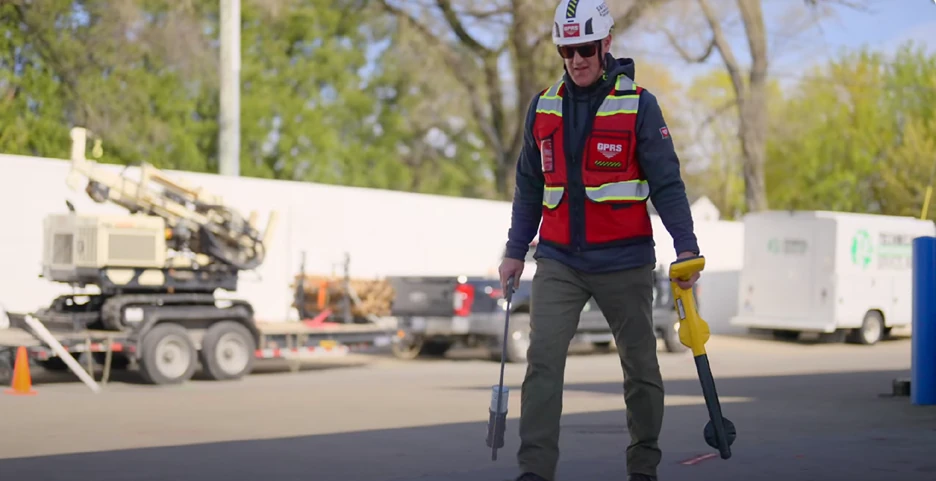
One of the most common sources of uncertainty during environmental investigations is undocumented subsurface infrastructure. GPRS helps eliminate that uncertainty through private utility locating services that combine ground penetrating radar (GPR), electromagnetic (EM) locating technology, and RTK (real-time kinematic) positioning.
We identify underground utility location, depth information where possible, mark findings on-site, and deliver GPS-enabled maps in .KMZ, .SHP, .PDF, CAD, and BIM formats. Layered digital maps are available in the SiteMap® GIS platform, giving your team a clear, accurate view of subsurface utilities.
Accurate utility data helps environmental professionals document subsurface infrastructure and identify potential contaminant migration pathways, understand utility trench impacts, and avoid utility strikes during sampling and drilling.
GPRS Video Pipe Inspection (VPI) Services
Sewer and stormwater infrastructure can significantly influence how contamination moves beneath a site. Through video pipe inspection (VPI), GPRS helps environmental teams understand the condition, connectivity, and potential environmental impacts of these underground systems before they become larger problems.
GPRS deploys robotic mainline crawlers, lateral launch cameras, push cameras, and manhole cameras to inspect mains, laterals, and manholes. These inspections help to identify pipe deterioration, cracks and defects, root intrusion, collapsed sections, infiltration and exfiltration points, and hidden migration pathways. Understanding the condition and connectivity of sewer infrastructure allows environmental teams to better evaluate contaminant transport mechanisms and potential exposure risks.
GPRS Reality Capture Services
Environmental sites often contain complex relationships among buildings, utilities, infrastructure, drainage systems, and mechanical equipment that can influence contaminant migration, remediation planning, and overall site understanding. GPRS Reality Capture services utilize advanced 3D laser scanning, LiDAR technology, and photogrammetry to document existing conditions and produce custom CAD drawings and BIM models. These deliverables provide environmental professionals with a highly accurate digital representation of the site, helping them better understand infrastructure relationships, reduce uncertainty, and improve coordination throughout site characterization and remediation efforts.
GPRS CSM Development
Beyond collecting field data, GPRS' Mapping & Modeling Team can develop a custom CSM that brings all site information together into a single, easy-to-understand visualization. The integration of utility locating, reality capture, video pipe inspection, and other site characterization data can help environmental teams gain a more complete understanding of how site infrastructure and environmental conditions interact.
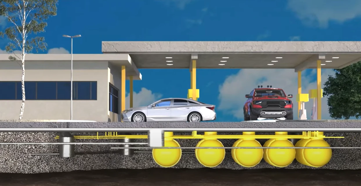
GPRS' Mapping & Modeling Team can also develop a custom CSM that provides a three-dimensional representation of subsurface infrastructure and environmental conditions. A centralized model helps teams to visualize:
- Utility corridors
- Potential contaminant pathways
- Infrastructure relationships
- Areas of uncertainty
- Potential vapor migration routes
- Potential subsurface voids
GPRS SiteMap® GIS Platform
SiteMap is a software developed by GPRS that stores all your project data in one GIS platform, keeping your jobsite records up to date and organized. It provides customers with accurate as-built information, including utility maps, 2D CAD drawings, 3D BIM models, NASSCO reports and more for infrastructure visibility and job site planning.
Delivered in SiteMap®, the CSM serves as a central source of information that helps project teams collaborate more effectively and make better-informed decisions about site investigations, risk assessment, and corrective actions.
The Benefits of a GPRS CSM
Having accurate, field-verified information early in the process helps environmental teams adapt more quickly, reduce uncertainty, and make informed decisions throughout the project lifecycle.
A Conceptual Site Model developed by GPRS helps environmental professionals:
- Identify data gaps earlier
- Improve site characterization
- Understand migration pathways
- Support risk assessment
- Prioritize sampling efforts
- Improve remediation planning
- Reduce project uncertainty
By integrating utility locating, sewer and stormwater infrastructure data, reality capture, and existing site conditions into a centralized model, GPRS delivers a data-driven CSM that provides greater confidence in site conditions, improved visibility into potential contaminant pathways, better project coordination, and a stronger foundation for investigation, remediation, and regulatory decision-making.
GPRS Case Study: Gas Station Conceptual Site Model
A Michigan gas station partnered with GPRS to document existing subsurface conditions in support of planned site upgrades and the development of an emergency response plan for potential fuel leaks.
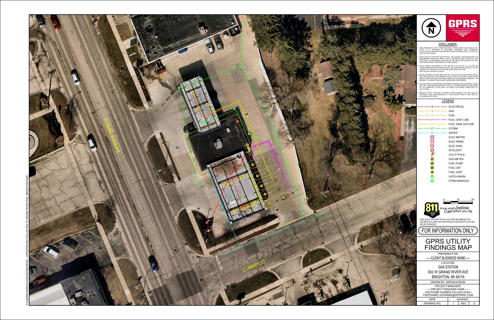
The site lacked reliable as-built information and an accurate CSM, making it difficult to understand potential contaminant migration pathways and respond effectively to environmental concerns. To address these challenges, GPRS performed utility locating, video pipe inspection (VPI), 3D laser scanning, and drone photogrammetry to map underground storage tanks, utilities, and site infrastructure.
GPRS deliverables included accurate utility maps and a CSM to visualize migration routes, communicate with stakeholders, make informed remediation decisions, and protect the team on site and the environment.
Read the Michigan gas station case study.
Why Choose GPRS for a CSM?
In order to develop an effective Conceptual Site Model, it requires more than collecting environmental data. Its development requires a complete understanding of the site's subsurface and structural conditions. GPRS combines utility locating, video pipe inspection, reality capture, BIM modeling, and SiteMap GIS technology to provide the accurate, field-verified information needed to support environmental investigations and remediation projects.
With a comprehensive view of underground infrastructure, potential migration pathways, and existing site conditions, environmental professionals can make more informed decisions, reduce project risk, improve stakeholder communication, and move forward with greater confidence. The result is a stronger foundation for environmental assessment, corrective action planning, remediation, regulatory compliance, and long-term site management.
Contact us today to discuss your project and discover how our field-verified data can support smarter environmental decision-making.
Have Questions?
Contact Matt Piper: GPRS Market Segment Leader Environmental
[email protected]
720-618-8453

Frequently Asked Questions
What is a Conceptual Site Model (CSM)?
A Conceptual Site Model (CSM) is a visual and narrative representation of a site that identifies contaminant sources, migration pathways, environmental media, exposure routes, and potential receptors. Environmental professionals use CSMs to better understand site conditions, support environmental investigations, evaluate risk, and guide corrective action and remediation decisions.
How can GPRS data improve the accuracy of a Conceptual Site Model?
GPRS provides field-verified data through utility locating, video pipe inspection (VPI), reality capture, and infrastructure mapping services. This information helps environmental teams identify subsurface infrastructure, understand potential contaminant migration pathways, locate data gaps, and develop a more complete understanding of site conditions. By incorporating accurate site data into the CSM, stakeholders can make more informed investigation, remediation, and regulatory decisions.
What types of projects benefit from a GPRS-supported Conceptual Site Model?
A GPRS-supported CSM can benefit a wide range of environmental projects, including Phase I and Phase II Environmental Site Assessments, petroleum release investigations, brownfield redevelopment, landfill assessments, remediation projects, regulatory compliance activities, and site closure efforts. Any project that requires an understanding of subsurface conditions, contaminant migration, or environmental risk can benefit from a more accurate and comprehensive CSM.


