

.svg)
In commercial real estate, access to accurate, comprehensive site data is essential for making informed decisions across every phase of a property’s lifecycle. From acquisition and valuation to design, construction, and long-term management, 3D laser scanning provides real estate professionals with precise, millimeter-level insights that enhance efficiency and reduce risk. This reality capture technology transforms how properties are documented, analyzed, marketed, and maintained, empowering commercial real estate professionals to work smarter, faster, and with greater confidence.
What is 3D Laser Scanning?
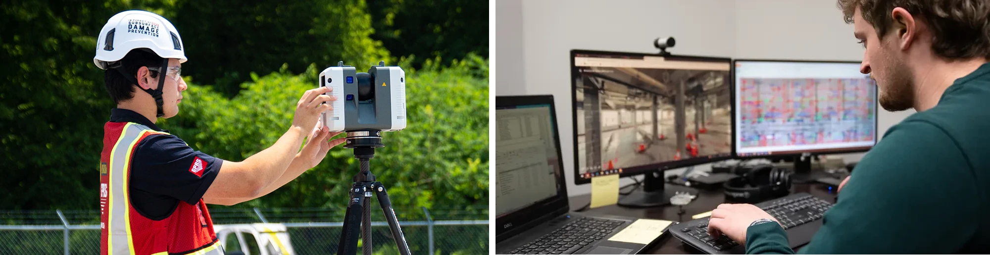
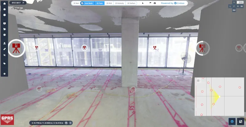
3D laser scanning captures high-resolution spatial data by emitting LiDAR laser beams to measure distances with extreme precision. This process generates precise digital representations of physical spaces or objects, known as point clouds, that represent the scanned area in three dimensions. Point clouds can be processed into detailed 2D drawings, 3D models, virtual tours, and more, providing an accurate, real-world representation of a building or site.
3D laser scanning delivers comprehensive as-built site data with speed, accuracy, and no physical contact to aid the evaluation, design, construction, and facility management of commercial real estate projects.
How Do CRE Professionals Utilize 3D Laser Scanning?
CRE professionals are utilizing 3D laser scanning technology in these aspects of a property’s lifecycle.
Property Documentation
- Capture architectural, structural, and MEP features with millimeter-level precision for accurate records
- Permanently document underground utilities, power, water, and telecom systems to support safe planning and construction
- Convert scan data into utility maps, 2D CAD drawings, and 3D BIM models for comprehensive building documentation
- Apply BOMA standards to measure areas within a building, including gross building area, usable area, and rentable area to calculate rentable square footage
Example: 3D laser scanning services captured every inch of a roughly 219,000-square-foot soft drink production facility, so that a digital twin of the space could be created to enable safe and efficient operations and maintenance. Read more about this project.

Property Valuation
- Receive accurate as-built data to support environmental assessments, zoning compliance, and structural evaluations before acquisition
- Utilize accurate square footage to determine property value, calculate rental rates, and assess usable vs. rentable space
- Allow investors to assess property conditions, revealing structural issues, cracks, and misalignment to identify and budget for repairs or maintenance
- Create a detailed visual and dimensional record of the property for buyers and sellers, insurance underwriting, and risk assessment
Example: A real estate investment firm used 3D laser scanning to capture accurate as-built data of a 200,000 sq ft industrial facility before acquisition. This data supports environmental assessments and zoning compliance, and helps appraisers determine the true market value based on usable square footage and structural integrity.

Lease Area Analysis
- Provide highly accurate measurements to verify rentable square footage, resolve discrepancies, and ensure BOMA compliance, streamlining lease negotiations
- Visualize and validate shared or common areas, such as lobbies, corridors, and amenity spaces, by clearly distinguishing between rentable and non-rentable square footage
Example: A property management company verified rentable square footage in a downtown office tower using BOMA-compliant laser scans. This resolved a dispute with a tenant over common area allocations and ensures lease terms reflect accurate rentable vs. usable space.
Marketing
- Present precise site layouts, floor plans, dimensions, and BOMA calculations to help tenants and buyers understand key property details
- Create immersive 3D models and 3D virtual tours that let tenants explore properties remotely, expanding reach and accelerating leasing
- Enhance listings with high-resolution images, 2D floor plans, and 3D virtual tours to showcase layout and flow
Example: A brokerage firm marketed a new mixed-use development by creating immersive 3D virtual tours and high-resolution floor plans. Prospective tenants can explore retail and office spaces remotely, accelerating leasing decisions and expanding reach to out-of-state clients.
Property Management
- Standardize documentation across multiple properties for consistent asset tracking and strategic planning
- Generate finish drawings to help building owners and facility managers understand layouts, systems, and equipment locations
- Use 3D scans as the foundation for a digital twin to support ongoing operations and maintenance
Example: 3D laser scanning services were performed for a 10-story office building, capturing existing above-ceiling interstitial HVAC systems on each floor, as well as mechanical rooms, chiller rooms, air handling unit rooms, and a basement tunnel connecting the utility area to the office building. Over 240,000 square foot of space was laser scanned to document the as-is conditions. The client was upgrading the HVAC system and GPRS developed a 3D model to aid the design process and reduce clashes. Read more about this project.

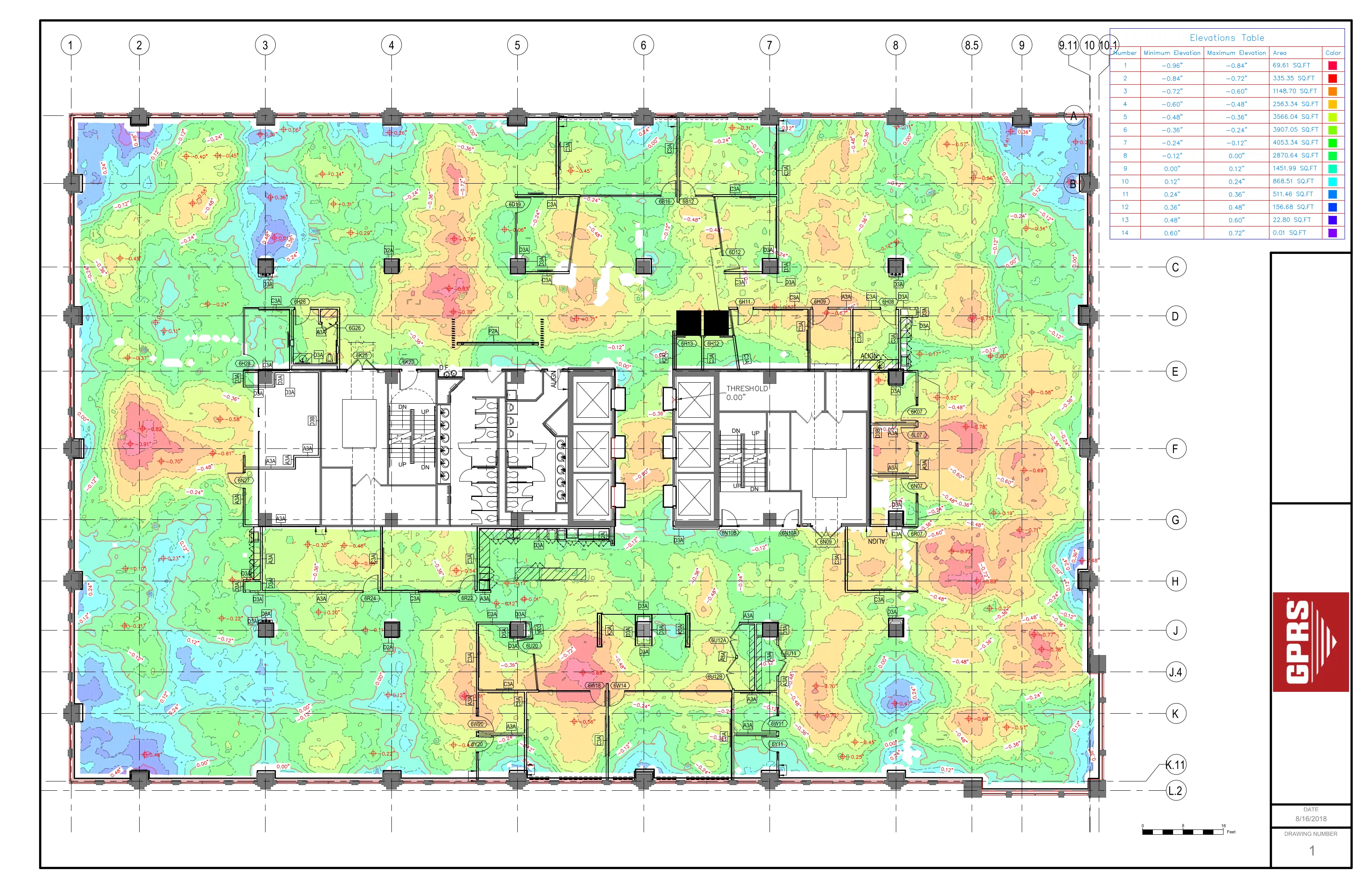
Space Planning & Optimization
- Enable developers to analyze floor plans, optimize layouts, and detect inefficiencies using precise spatial data
- Support compliance with building codes, accessibility standards, and sustainability goals
Example: The Pinnacle Penthouse atop New York City's Woolworth Building is a five-story blank-slate residence undergoing transformation. To support the interior design, the architect commissioned 3D laser scanning to produce a point cloud, 2D CAD plans, and 3D Revit model—providing the precise documentation needed to unlock the full spatial and architectural potential of this iconic space. Read more about this project.
.avif)
Tenant Fit-Outs
- Design flexible spaces tailored to tenant needs, including HVAC, lighting, and interior finishes
- Employ clash detection between proposed tenant improvements and existing building systems, such as structural elements, HVAC ducts, or electrical conduits
- Document retail layouts for product placement and inventory planning
Example: A general contractor was converting a 300,000 sq. ft. bank operations center into a GMP facility to produce pharmaceutical and medical device products. The four-story building contained office space, retail space, data center space, and life science lab space. 3D laser scanning accurately mapped the existing as-built conditions to create a 3D BIM model of the building for design and fit-out. Read more about this project.

Adaptive Reuse
- Digitally capture historic buildings with high-resolution laser scans to support restoration and renovation efforts to maintain architectural integrity
- Support architectural redesigns for adaptive reuse (e.g., office, retail, industrial) with accurate as-built data, drawings, and models
- Receive as-built detail of existing infrastructure for 2nd-Gen spaces to help confidently repurpose these spaces to reduce risks, delays, and costs
- Reveal hidden structural issues or irregularities to plan for repair strategies
- Aid in cost estimation, risk management, and construction oversight for repurposed buildings
Example: At Two Bryant Park in Manhattan, IA Interior Architects partnered with GPRS to renovate 14,000 square feet of retail space in a historic 1906 building. GPRS used LiDAR technology to reality capture the retail areas and basement, producing a detailed BIM model and 2D floor contours. Accurate as-built data enabled precise planning, layout optimization, and risk reduction, showcasing how 3D scanning streamlines adaptive reuse projects. Read more about this project.

Renovation Design & Planning
- Visualize renovation concepts and generate detailed blueprints to guide contractors and accelerate timelines
- Design within exact dimensions of existing structures to optimize site layout, avoid conflicts, and reduce rework
- Develop accurate design plans, bids, material estimates, and construction sequencing
- Visually depict remodeling options, including changes to walls, windows, and doors
- Ensure all designs meet building codes, ADA compliance, and regulatory standards
Example: GPRS created a phased 3D BIM model of the 637,180 sq ft Phillips Point East and West Office Towers in West Palm Beach to support a large-scale renovation, delivering precise as-built data for architectural, structural, and MEP planning. Read more about this project.

Construction Management
- Understand the property's layout, features, and potential, leading to more informed design and construction decisions
- Monitor construction progress with regular scans to ensure alignment with design plans and maintain quality control
- Track the progression of any issues and help to plan preventative maintenance
- Support final inspections, system commissioning, and transitioning to property management
Example: GPRS completed utility locating and 3D laser scanning of a hospital wing and parking area to support a hospital’s expansion. The client received an integrated 3D BIM model to precisely design and plan the building addition during preconstruction. Read more about this project.

Emergency Planning
- Develop site-specific emergency procedures and safety protocols
- Map fire extinguishers, emergency exits, escape routes, and shelter-in-place locations for emergency preparedness and training
Example: A corporate office building developed a digital emergency response plan using 3D laser scans to map fire exits, extinguishers, and shelter-in-place zones. This assists training and preparedness for employees and first responders.
What are the Benefits of 3D Laser Scanning for Commercial Real Estate Projects?
Accurate and Efficient Data Capture
3D laser scanning captures precise as-built conditions with millimeter-level accuracy, ensuring that every detail of a property is documented with confidence. This level of precision significantly reduces the risk of errors, rework, and costly delays that often result from outdated or incomplete documentation. By delivering detailed insights into a property’s current condition, reality capture technology empowers real estate professionals to make better-informed decisions from the start.
Comprehensive Property Documentation
The technology produces a complete digital record of a site, delivering point clouds, 2D CAD drawings, 3D BIM models, and more. 3D laser scan data provides spatial detail of architectural, structural, and MEP (mechanical, electrical, and plumbing) features, and documents the marked locations of subsurface utilities and objects embedded in concrete slabs. This comprehensive documentation supports a wide range of real estate applications, from inspection to initial planning and design to construction and long-term operations.
Streamlined Workflows
Accurate as-built data enhances coordination among developers, architects, contractors, and other stakeholders, helping to streamline project workflows. With ready-to-use digital assets, teams can accelerate timelines and reduce inefficiencies. As-built data also simplifies critical tasks such as appraisal, renovation planning, permitting, and material specification, allowing projects to move forward with greater speed and clarity.
Improved Collaboration
By providing a single source of truth, 3D laser scanning enables teams to collaborate more effectively across disciplines and project phases. Accurate maps, drawings and models improve communication and reduce misunderstandings. They also help teams estimate costs more accurately, ensuring that projects stay on budget and on schedule.
Critical Building Information for Decision-Making
Laser scanning delivers the essential data needed for lease administration, property management, space planning, and tenant fit outs. It also supports building valuation, adaptive reuse, and investment analysis. With access to reliable, up-to-date building information, commercial real estate professionals can make strategic decisions that maximize return on investment across their portfolios.
Risk Reduction and Cost Control
Early identification of hidden site conditions and encroachments helps mitigate risk and avoid unexpected issues during renovations. Accurate data supports valuation and budgeting, reducing the likelihood of costly surprises. Additionally, detailed documentation aids in insurance underwriting and claims processing, providing a reliable record in the event of damage or disputes.
What is an Example of 3D Laser Scanning for Commercial Real Estate?
A Manhattan Real Estate Developer Needed 3D Laser Scanning for Renovation
A Manhattan-based real estate developer purchased a 250,000 s.f. assisted living and nursing home facility in Lawrenceville, Illinois, without any existing floor plans or documentation, posing significant risks for renovation. To avoid delays and costly rework, GPRS provided 3D laser scanning services to capture the building’s architectural, structural, and MEP systems with 2-6mm accuracy. The deliverables, including a colorized point cloud, 2D AutoCAD drawings, and a 3D BIM model, enabled the developer to confidently plan the conversion of the facility into residential housing.
Read the complete case study >

How Can GPRS Help Commercial Real Estate Projects?
GPRS helps commercial real estate projects by delivering precise 3D laser scanning services that reality capture accurate as-built data for every phase of a property’s lifecycle, from acquisition and design to renovation and facility management. Using advanced scanning technology, GPRS delivers point clouds, 2D CAD drawings, 2D floor plans, 3D BIM models, and 3D walkthroughs that enhance collaboration, streamline workflows, and reduce costly errors. This data empowers real estate professionals to make informed decisions, manage lease optimization, aid property valuation, optimize space planning, plan for renovations, and ensure code compliance to minimize project risk and maximize project efficiency.