.svg)
Here are some words and phrases that you may come across when researching or communicating about utility locating, concrete imaging, leak detection, CCTV video pipe inspection, reality capture, and all the ways GPRS Visualizes The Built World®. Note that these are broad definitions meant to clarify the essential meaning for an average reader.
Follow the links provided for more information.
811 Service, aka One Call, is a state-provided, federally mandated free “before-you-dig” service that you must use before breaking ground on any project. Your state’s 811 system will then contact the owner of any registered public utilities on site so that the utility owner can have them located and marked out to help you dig safely. Learn more about 811/One Call services, here.
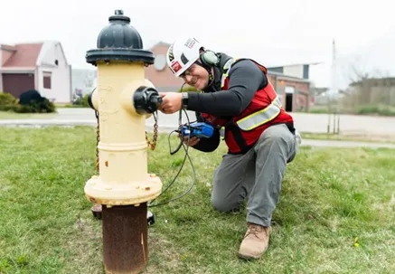
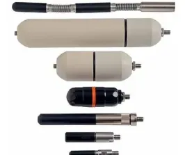
Acoustic Leak Detector equipment uses sophisticated ground microphones and specialized accessories to help Leak Detection Project Managers locate water leaks within subsurface and pressurized water lines. Pressurized acoustic leak detection can be used to pinpoint leaks in water utilities or in fire suppression systems. Learn about pinpoint leak detection here.
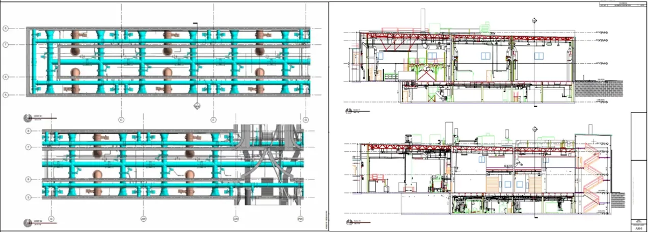
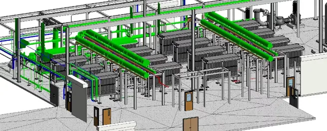
BIM is the acronym for Building Information Modeling, which is an intelligent software modeling process that engineers, contractors, and architects (AECs) can use to collaborate on a building’s design, construction, and operation. Learn more about BIM and GPRS’ Scan-to-BIM services here.
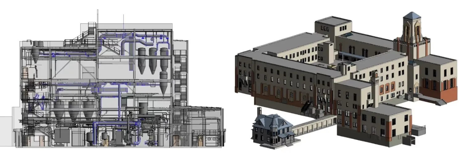
CAD stands for Computer-Aided Design. It is the technology and software designed to produce precise 2D technical drawings for architecture, construction, and engineering projects, and has expanded into 3D drawings and modeling. See how GPRS’ in-house Mapping & Modeling Team creates CAD & BIM deliverables, here.
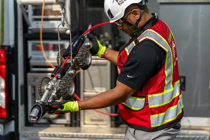
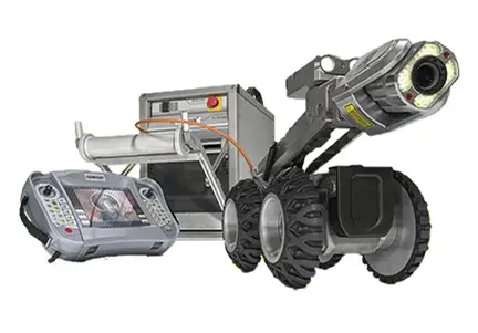
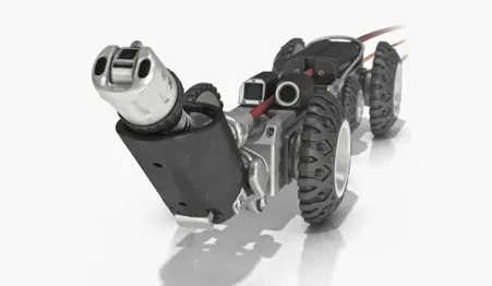
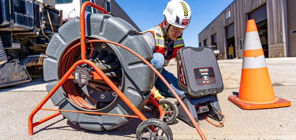
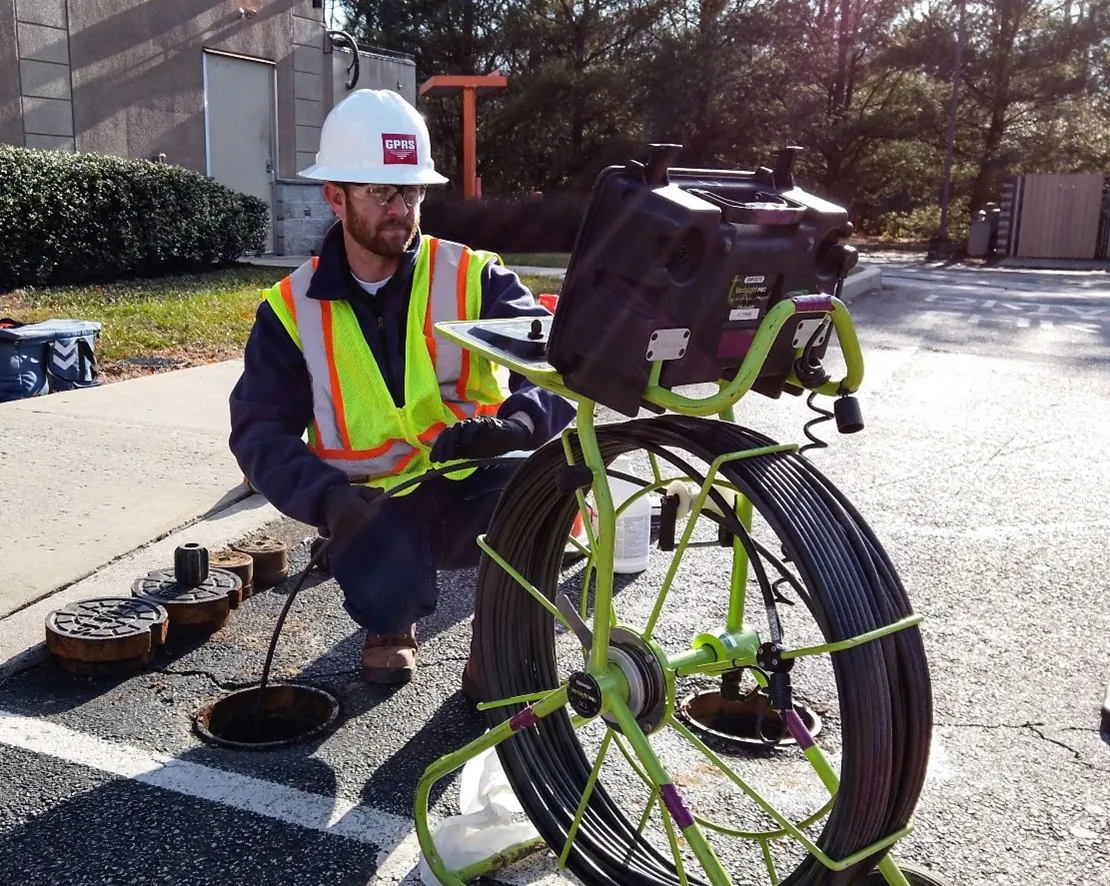
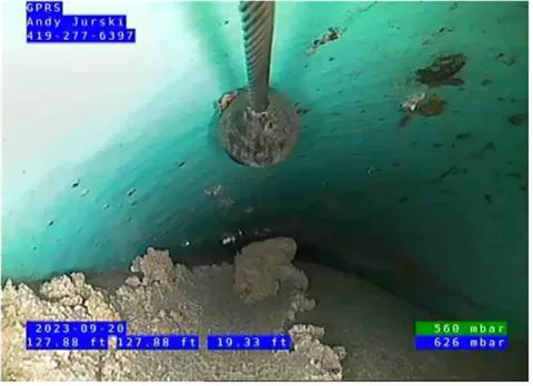
CCTV Crawlers stands for Closed Circuit Television Crawlers. Small, remote-controlled vehicles equipped with high-resolution cameras used to move through and investigate sanitary sewer and storm drain pipes as part of GPRS’ video pipe inspection services. Learn more about VPI, here.
CMU is the acronym for concrete masonry unit. It is a standard concrete block used in building construction, some more commonly referred to as cinder blocks.

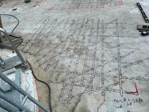
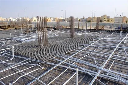
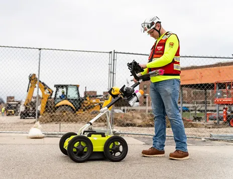
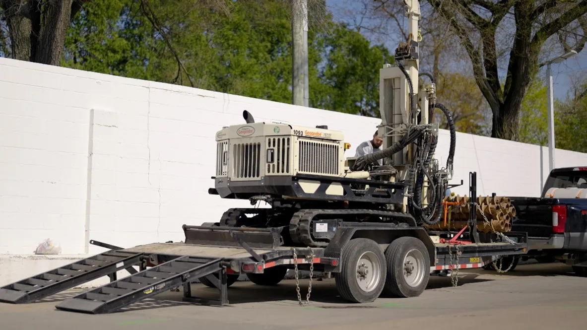
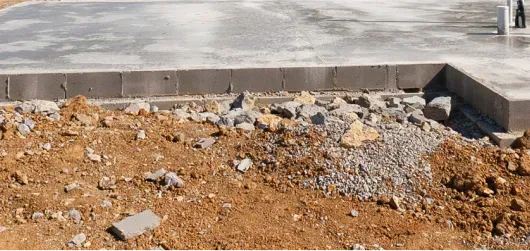
Concrete Imaging GPRS uses ground penetrating radar to locate and help Project Managers visualize what is within or underneath a concrete slab. Post tension cables, rebar, conduit, and other reinforcements can all be located by GPRS Project Managers trained to “see” inside slabs with GPR. Learn more about concrete scanning & imaging here.
Concrete Slab is a flat, often horizontal surface made of concrete commonly used in modern structures, patios, and driveways. There are several common variations of these slabs: post-tensioned, pan-decked, prefabricated, slab-on-grade, etc. Learn more about various types of concrete slabs, here.
Conduits are protective tubes that houses and route electrical wires used in various construction or structural applications. They usually are located in slabs with the use of GPR so you can avoid hitting one when cutting, coring, or drilling.
Coring is the use of a diamond-tipped core drill to create precise, circular holes in concrete structures. There are specific best practices that are recommended when cutting or coring into concrete. You can learn more about concrete cutting & coring safety, here.

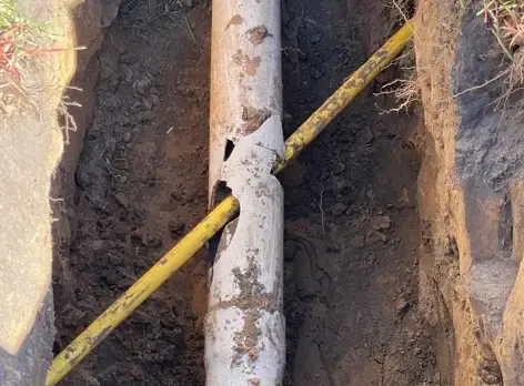
Cross Bore refers to a situation where a new utility line, typically installed using trenchless methods such as directional boring, inadvertently intersects and breaches an existing underground utility, most commonly a sewer line, although gas, water, telecommunication, and electrical lines are also at risk. There are an estimated 1 million undiscovered cross bores in utilities throughout the United States. Learn more about effective cross bore mitigation, here.
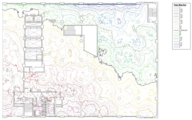
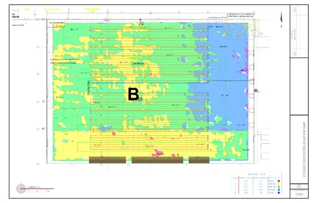
Deformation Maps are a tool used in construction and engineering to visualize the topography of a built surface. They provide a clear and detailed representation of the elevation of the floor or surface at various points. Learn more about deformation maps here.
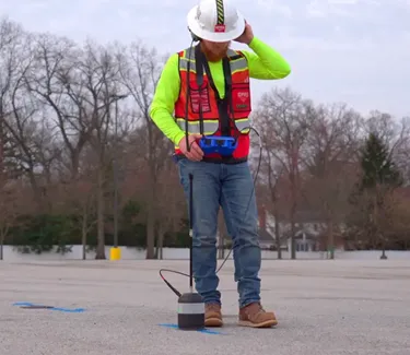
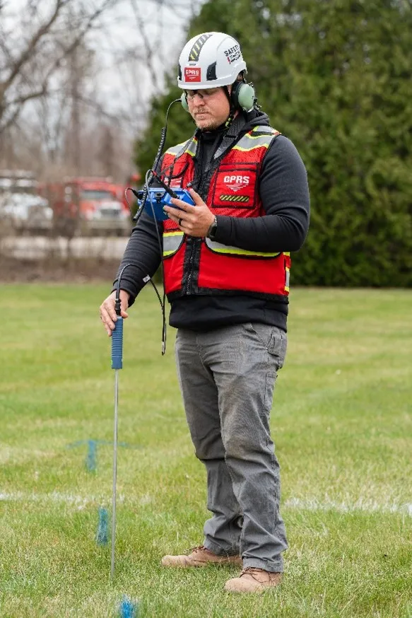
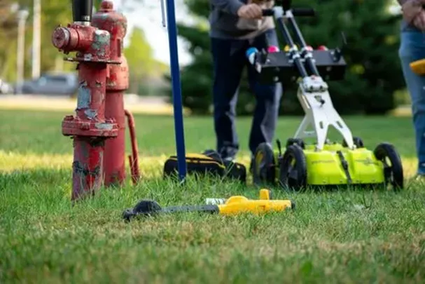
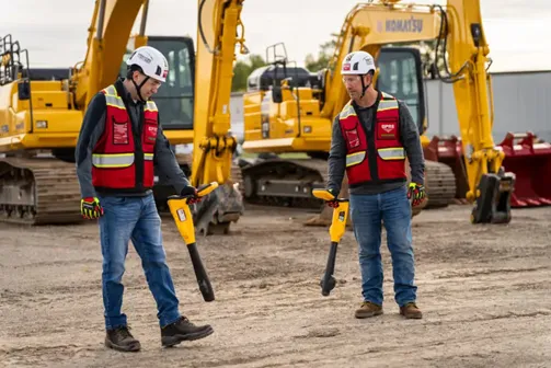
EM Locators is a shortened term for electromagnetic locators. This piece of utility locating equipment detects the electromagnetic signals radiating from metallic pipes and cables. It is a complementary tool to ground penetrating radar as part of GPRS’ Subsurface Investigation Methodology. Learn more about EM locators and their uses here.
EMI is the acronym for electromagnetic induction locators. This technology uses induced electromagnetic fields to determine the conductivity of soils and locate buried metallic objects and utilities. It is often part of the complementary tool set for GPRS Project Managers in utility locating. Learn more about EMI here.
ESG stands for Environmental, Social, and Governance, which is a set of standards used to measure an organization’s environmental and social impact. Learn more about ESG here.

FF/FL stands for Floor Flatness and Levelness. Floor flatness refers to how much the surface deviates from a two-dimensional plane. Floor levelness refers to how closely the floor conforms to the specified slope. Learn more about FF/FL and its growing importance in the construction industry here.
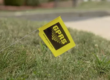
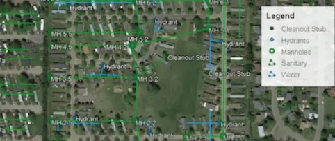
Field Markings are just what they sound like, markings placed on the surfaces of a scanned area to communicate utility location or concrete clearance information to clients, most often through paint, flags, or stakes. GPRS marks out the scanned area, whether a concrete slab or a piece of land, and provides specific notations. Scanned utility data is then uploaded to our GIS delivery software platform, SiteMap® (patent pending). In most cases, utility field markings are translated into layered digital utility maps within minutes. Learn more about field markings and what they represent here.
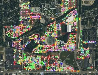
GIS is the acronym for Geographic Information Systems. Digital systems that capture, display, and store geospatial data, often through satellite imagery of the Earth. Learn how GPRS uses GIS systems to visualize our clients’ built world here.
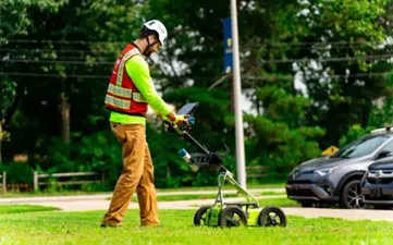
GPR is the acronym for Ground Penetrating Radar, the GPR in the name GPRS. GPR is a non-destructive detection and imaging method that identifies subsurface elements either underground or within a surface such as concrete by sending radio signals into the surface that bounce off any materials they encounter. Those “bounces” can then be interpreted and read by a highly trained Project Manager to accurately visualize and map underground utilities & facilities, or the interior of a concrete slab. Learn more about GPR and its uses here.
Green Box Guarantee is GPRS’ industry-leading program that provides customers with peace of mind before they cut, core, or drill into concrete slabs. If a GPRS Project Manager marks out a green box with the word “CLEAR,” we guarantee it is free of obstruction. If we get it wrong, we will pay the material cost of repair. Learn more about the Green Box Guarantee here.

Ground Disturbance Policy is the foundation of safe excavation. Also known as a “dig policy,” the rules and regulations in the plan outline how to safely perform activities that disturb the earth’s surface, like digging, trenching, or drilling. Click here to learn more.
KMZ is a zip-compressed file format containing map locations that can be viewed in various geographic information system (GIS) applications. Features can be recorded as points, lines, or polygons. Various information and annotations can be attached, such as photos, descriptions, coordinates, and more.
Lateral Launch Camera is a type of CCTV crawler with an attached camera used to inspect sewer laterals from the mainline. GPRS uses lateral launch cameras as part of video pipe inspections and/or a full-site utility locate to non-destructively investigate lateral storm and sanitary sewer lines upstream of a mainline. Learn more here.
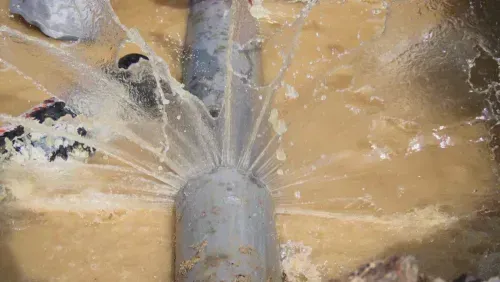
Leak Detection refers to a professional service that uses acoustic leak detectors and leak detection correlators to locate leaks and eliminate the need to pothole or remove structures to physically inspect leaking pipes prior to pinpointing the problem. Once the leak is detected, then you can pothole to confirm and repair, saving time, damages, and money. Learn more about GPRS Leak Detection services here.
Leak Noise Correlators are specialized electronic devices used to quickly and accurately pinpoint leaks in water lines and pipes through the results of radio waves. Read more about leak noise correlators and other tools used for GPRS’ Leak Detection services here.
Lean Construction is the integration of principles from a broader manufacturing philosophy that focuses on creating more value for clients while reducing waste. The core principles include Collaboration & Integrated Planning, Just-In-Time Delivery, Standardization of Processes, and Visual Management. Learn more about lean construction’s key principles and its positive impact on the construction industry here.

LEED Certification stands for Leadership in Energy and Environmental Design, which is a globally recognized green building rating system that offers a framework for healthy, efficient, and cost-effective green buildings. The certification consists of specific rating systems including Building Design & Construction, Interior Design & Construction, and Operations & Maintenance.

Line is the term used for wires, pipes, and other utilities that run underground. GPRS’ 99.8% underground utility and concrete scanning services can locate and map buried lines of all shapes and sizes. Learn more here.

Mainline Inspection is an inspection on the main sewer line, typically through Video Pipe Inspection services. GPRS deploys sturdy, robotic mainline crawler CCTV cameras to assess pipe conditions, document all defects, laterals, and map your mainline sanitary and/or storm sewer infrastructure. Learn more about mainline inspections and other VPI services offered by GPRS here.
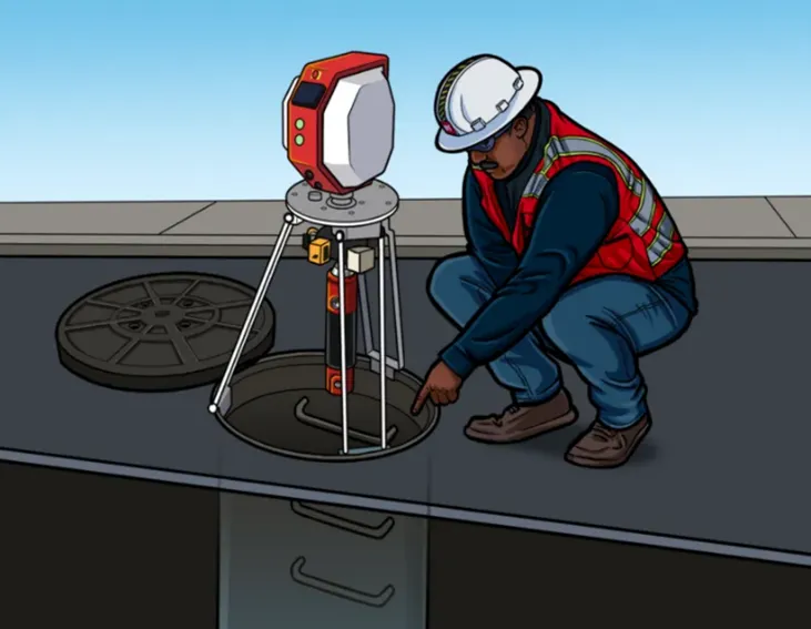
Manhole Inspection is the investigation processes used to ensure the integrity and safety of a sewer manhole, typically through Video Pipe Inspection services. GPRS Project Manager utilize a variety of complementary technologies to gather detailed information, document all defects, and accurately document existing conditions so clients have the information they need to make repairs, maintain your infrastructure, and mitigate risk. Learn more about manhole inspections and other VPI services offered by GPRS here.
MEP is an acronym for Mechanical, Electrical, and Plumbing systems, which are the technical disciplines that serve as the backbone of any building to ensure functionality, comfort, and safety. Learn more about MEP and the key factors for successful MEP design here.
NASSCO stands for National Association of Sewer Service Companies. This is an industry source for trenchless technology education, resources, and advocacy. All GPRS Video Pipe Inspection Project Managers require NASSCO certification in Pipeline Assessment, Lateral Assessment, and Manhole Assessment. Learn more about NASSCO here.
NDT is an acronym for Non-Destructive Testing. This is a method of investigation which allows subsurface locators to examine an area without digging, coring, or excavating. SIM-certified Project Managers complimentary technologies to accurately locate and map underground utilities without the need to break ground. Learn more about GPRS utility locating services here.
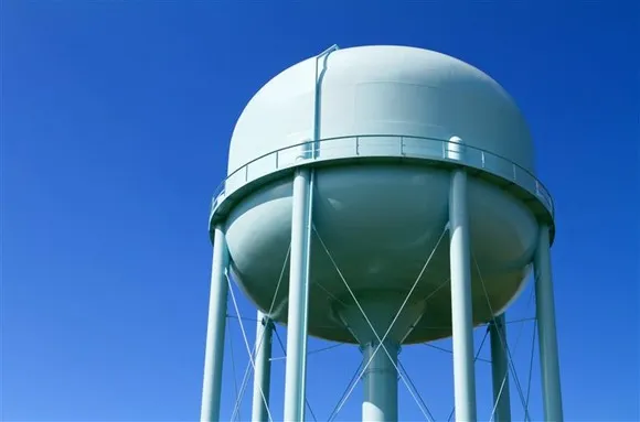
Non-Revenue Water Loss (NRW) is water leaking from water line infrastructure before it reaches a private water meter, accruing costs for the water distribution facilities. NRW is one of the main threats to aging water systems. GPRS understands the importance of this issue and advocates for proper, routine maintenance. Learn more about what GPRS is doing to counteract improper water & wastewater management here.
Pan Deck or Pan Decking is another term for metal concrete decking which is a specific variety of decking used from the 1940s - 1960s to mold and support poured concrete slabs in construction. Although the specific product known as pan deck hasn’t been manufactured in the United States for over 50 years, many in the construction trades still refer to all types of metal concrete decking as pan decking. Today, the decking is either a form deck that provides a mold for the curing concrete, or a composite deck that is made to adhere to the cured concrete and aid in its support. Learn more about pan decks and how GPRS can safely scan them here.

Phase I Investigation is Phase I Environmental Site Assessments are due diligence investigations used to assess whether hazardous materials are present on a property and determine the risk to prospective purchasers, owners, operators, insurers, and lenders. Learn more about Phase I Environmental Site Assessments here.
Phase II Investigation is Phase II Environmental Site Assessments consist of collecting soil, soil gas, vapor intrusion samples, and groundwater samples and then sending these to a lab to determine whether the operations have caused environmental contamination. Learn more about Phase II Environmental Site Assessments here.

Post-Tension Cables are cables made of steel wires encased in plastic sheaths that are tensioned and grouted after the concrete is poured to enable thinner slabs and longer spans between columns. GPRS Concrete Scanning services utilize ground penetrating radar (GPR) to locate and map PT cables, preventing costly and potentially dangerous subsurface damage. Learn more here.

PPE is the acronym for Personal Protective Equipment, which refers to gear and equipment that protect workers from hazards they may encounter on a job site. Learn more about PPE and other GPRS safety initiatives here.
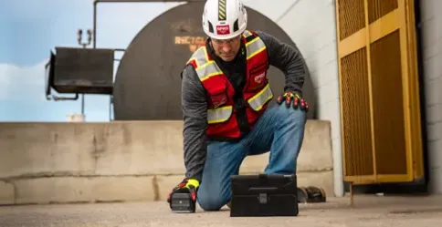
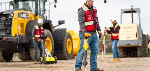
Project Manager refers to certified GPRS Field Team Members. GPRS Project Managers are consultants, trained in Subsurface Investigation Methodology (SIM), to provide clients with real-time, actionable information needed to plan, design, manage, dig, and build better. Learn more here.
Push Camera is a small camera system that can access pipes through smaller spaces to locate small lateral lines in a sewer system. Each camera is equipped with a sonde that can also be detected by a properly programmed EM locator to map non-metallic pipes as part of a full site utility scan or NASSCO VPI report. Learn more here.
RCP is the acronym for Reflected Ceiling Plans, which is a drawing that shows a top-down view of a room's ceiling, essentially depicting what the ceiling would look like if it were reflected onto the floor, including details like light fixtures, HVAC vents, and other ceiling-mounted elements. Learn more about RCP here.
Routine Water Loss Inspection is a service performed to reduce water loss before it becomes a larger issue. Inconsistent or improper water loss inspections can lead to non-revenue water loss which leads to the loss of money and can potential cause voids. Learn more about water loss inspections and how GPRS can help here.
Sewer Lateral is an underground pipe that carries wastewater from a residence or business to the public sewer main. Learn more here.
SIM stands for Subsurface Investigation Methodology. A standard operating procedure and set of professional specifications that work as a guide for utility locating experts when scanning for buried utility lines. All GPRS Project Managers are required to achieve SIM 101 certification, which requires 80 hours of hands-on training in a classroom setting and 320 hours of mentorship in the field. Learn more here.
Slab-On-Grade is a type of concrete slab that rests directly on the ground below. GPR only needs access to one side of a concrete slab or structure to scan the material for anomalies such as embedded conduit, so it can properly evaluate slab-on-grade.. Learn more here.
Sondes are transmitters that are usually inserted or sent through a pipe, and send an electromagnetic signal that EM locating equipment can detect above ground. GPRS Project Managers utilize EM locators along with sondes to map non-metallic pipes as part of a full site utility scan or NASSCO VPI report. Learn more here.
Subsurface Damage is damage that occurs on underground pipes, lines, and utilities, and is often caused by excavation. GPRS is committed to the pursuit of 100% subsurface damage prevention – on every job, in every market, nationwide. Read more about this goal here.
S.U.E. is the acronym for Subsurface Utility Engineering. It is a branch of engineering that involves the accurate location and mapping of buried utilities that adheres to certain standards and processes. Learn more here.
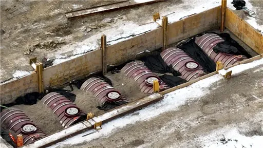
UST stands for Underground Storage Tanks. Underground tanks that store petroleum or other hazardous substances. GPRS Project Managers utilize industry-leading technology to assist with the detection of USTs. Learn more here.
Utility Locating refers to the process of scanning the ground for utilities non-destructively, often using ground penetrating radar and EM locators to find and map the locations of water, sewer, gas, electrical, telecommunications, and other buried lines. Learn more here.
VPI is the acronym for Video Pipe Inspection, which is uses industry-leading remote video cameras to assess conditions and prevent problems in water, sanitary and storm sewer, and lateral pipelines. GPRS NASSCO-certified Project Managers scope sewers to locate clogs, identify cross bores, find structural defects & damages, and conduct lateral sewer line inspections. Learn more about GPRS’ VPI services here.