.svg)
Water and Sewer


With the domestic spend on water and wastewater approaching $40B annually, the amount water and sewer infrastructure in place is staggering. As water and sewer infrastructure is being added to an already complex grid, there is an aging segment of these pipes and facilities that are in great need of replacement and repair.
The water sector of infrastructure is in dire need of an investment as it relates to the replacement and repair of these facilities and pipes. According to the American Society of Civil Engineers (ASCE) in their landmark report, the 2017 Infrastructure Report Card, the US has received a “D” rating for potable water piping. There are approximately 1,000,000 miles of potable water piping across the country. It is estimated that over 240,000 water mains break per year and with many of these pipes having been installed many decades ago, upgrades must be implemented. The American Water Works Association estimates $1 trillion are needed to maintain and expand water service to the nation in the near future.
Wastewater infrastructure also presents a challenge as it ages past its useful lifespan. With approximately 16,000 wastewater treatment plants across the country, it is essential to ensure that these facilities are able to keep up with the growth experienced in our country. Millions of new users will be connected to these plants over the next few decades. New infrastructure is needed to meet this demand. Further, the increase in demand for wastewater treatment places an enormous strain on existing facilities. As it relates to our wastewater facilities, the ASCE Report also gave this sector a ‘D+’ grade. Along with the aging infrastructure in the potable water and wastewater treatment sectors, our nation’s sewer pipes are in need of upgrades, maintenance, repair and in some cases replacement. With advancements in the utility industry’s ability to install new fiber lines and other utilities via directional drilling, risk has increased when it comes to dangerous cross bores. Pre and post inspections are needed and are being required on a larger scale across America.

GPRS Delivers Complete Infrastructure Visualization
GPRS is the only company in the U.S. that can capture your entire site or facility, above and below-ground, to provide you with accurate as-builts, private and public utility maps, 2D CAD drawings, 3D BIM models, virtual tours, WinCan reports, and more documenting architectural, structural, MEP, and subsurface utility existing conditions, and instantly deliver data via SiteMap®, GPRS’ cloud-based digital storage software and app.
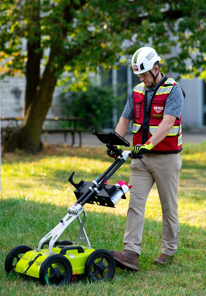
Utility Locating Services
GPRS utility locating service utilizes ground penetrating radar (GPR) and electromagnetic (EM) locating technology to locate, mark, and map existing underground infrastructure such as power lines, gas lines, pipelines, water lines, sewer lines, potential voids, and additional buried facilities and utility lines. This information is critical for projects where construction or excavation activities are planned to mitigate accidental utility strikes, plus keep your team and facility safe. GPRS delivers complimentary CAD utility site maps in PDF, KMZ, and SHP file formats, and can export your utility data into a wide variety of drawings, maps, and models to advance communication and collaboration on your project. All clients receive instant access to complete and aggregated site records in Sitemap® GPRS’ digital storage software and app, where data is geolocated, layered, and securely shareable.
Concrete Scanning Services
Concrete scanning is a non-destructive method to assess concrete using GPR to locate, identify, and mark utilities and objects such as rebar, post tension cables, beams, conduits, and piping embedded within concrete slabs and structures prior to anchoring, cutting, coring, and drilling. Concrete scanning ensures the safety of workers and prevents accidents by identifying potential hazards before any work occurs. Concrete markings can be 3D laser scanned to create a permanent record of the site, data can be delivered in 2D CAD drawings, 3D BIM models, and virtual site tours.
3D Laser Scanning Services
GPRS 3D laser scanning services document the exact architectural, structural, and MEP system layout and dimensions of existing buildings, facilities, and sites. We have captured as built site conditions for water treatment plants and wastewater treatment plants from 40 MGD to 1 BGD, documenting the interior and exterior of buildings; foundations; structural, mechanical, electrical and plumbing features; equipment, motors, conduit and piping down to ½ inch diameter. GPRS Project Managers use industry-leading Leica survey-grade laser scanners to capture 2-4 millimeter accurate existing site conditions in the form of a point cloud. Our in-house Mapping & Modeling Team can transform those point clouds into customized 2D CAD drawings, 3D BIM models, 3D mesh models, TruViews, and 3D virtual tours at any level of detail for visualization, analysis, design, construction, renovation, prefabrication, and facility modifications. We work directly with municipalities, engineering firms and privately owned facilities.
Our 3D Laser Scanning Experience Includes:
- Water Treatment Plants
- Wastewater Treatment Plants
- Water Distribution Systems
- Pumping Stations
- Elevated and Digester Tanks
- Pipe Galleries
- Filter Pump Rooms
- Sedimentary Basins
- Flocculation Basins
- Large Format Pipe Runs
- Water Purification Systems
- Polymer Rooms
Video Pipe Inspection Services
Video Sewer inspection and Video pipe inspection are great ways to determine if a pipe needs to be repaired or completely replaced. GPRS Video Pipe Inspection Services can inspect water and sewer pipes with our video crawler cameras (CCTV), inspect previously hidden sewer lateral lines via our lateral launch cameras, map complete pipe and sewer systems, and provide detailed NASSCO reports on the interior condition of pipes. Our arsenal even includes push cameras for hard to reach and smaller pipes. Cross bore mitigation and discovery is a key benefit to using a GPRS VPI service. The GPRS VPI team is fully equipped with video pipe inspection equipment and ready to service/inspect your water and sewer utility project, nationwide. When our Video Pipe Inspection team is paired with our industry-leading utility locating services, there is not a more comprehensive solution available.
Leak Detection Services
GPRS specializes in all types of leak detection services, including municipal, industrial, and residential. Our Project Managers are leak detection specialists who utilize multiple technologies to locate your leak and the expertise to map and provide many other insights into your water distribution and/or fire suppression systems. GPRS does this by utilizing a variety of equipment paired with our industry-leading SIM (Subsurface Investigation Methodology) processes. The equipment and methods used include acoustic leak detectors, leak noise correlators, video pipe inspection (CCTV) cameras & sondes, ground penetrating radar, and electromagnetic locating, among others.


Let's Get To Work
Schedule A Project


CUSTOM SERVICE PLANS

Scheduling

Pricing

Approach

mapping & Modeling
GPRS delivers the most up-to-date, accurate and comprehensive site data possible in the format required for your project. We provide complimentary KMZ and PDF maps with every utility locate we perform. Our Mapping & Modeling Team can create a wide variety of customizable maps and models, from a simple GPS-enabled map of your utility locate, to highly-detailed 2D CAD drawings and 3D BIM models, depending on your needs.
AS BUILT DRAWINGS
2D MAPS & 3D MODELS
SITEMAP® MOBILE APP

One Call Program

Public Property
Private Property

Embedment

CASE STUDY
Video Pipe Inspection to locate any possible unknown Lateral lines in Clinton Township Michigan
Before demolition began at a local hospital the General Contractor wanted to know if there were any unknown tie-ins to the facility’s sanitary sewer lines that were not on drawings. The Ground Penetrating Radar Systems Video Pipe Inspection Division was contacted to mobilize and inspect all sanitary and storm sewer lines in the area of demolition before an addition was to be added on to the hospital.

The client wanted to avoid any delays created by uncovering unknown sewer lines and water pipes. GPRS VPI division worked alongside our Ground Penetrating Radar division to provide an entire utility layout of the central and surrounding areas. While inspecting one sanitation line, our robotic crawler discovered two unknown taps on one of the pipes. These taps were located approximately 8.5’ beyond the range of detection for Ground Penetrating Radar; if Video Pipe Inspection had not been completed, these taps would not have been discovered until demolition - which could have resulted in further delays and/or possible damage. While inspecting the rest of the sewer and water pipes, the GPRS Video Pipe Inspection Project Manager was able to locate several areas of concern along the main sanitary line which can now be addressed during construction to avoid further issues.

After inspection, GPRS was able to locate the sanitary and storm lines on the surface for the client. In addition, GPRS was able to collect points with our GPS system to add onto a Google earth map for reference which makes future demolition projects much easier to navigate for the client. GPRS was able to utilize our Envirosight Rover X crawler, Vivax EM locating equipment, and our Geode GPS location equipment for the map. After the inspection was complete, the client was very satisfied with the results and noted how our Pipe Inspection Services saved the company from possible delays and unknown cost by locating these unknown sewer lateral lines. GPRS has the ability to inspect, locate, GPS and provide CAD drawings for all of your company’s pipe inspection needs.


Case Studies


Related Articles