833-569-7483

Facility Information at Your Fingertips

Your facility information, ready when you are. SiteMap® puts every detail at your fingertips for agricultural, manufacturing, industrial, and commercial facilities across North Carolina, Virginia, and Maryland.

A digital map interface showing detailed utility lines and infrastructure with multiple color-coded layers and feature details for SAN_CLEANOUT, alongside a sidebar menu with options like Jobs and Account.SiteMap Desktop Image  -I mproved User Interface & ExperienceMap-based interface showing aerial view with overlaid utility lines and icons, and a sidebar displaying file metadata and a ground photo of a marked construction area.
Map on a tablet screen showing the states of Virginia, Maryland, and North Carolina with variously sized blue circles indicating data points concentrated around major cities.

Tools Built to Save You Time

These are just a few of the many tools SiteMap offers to help you plan, build, and manage better.
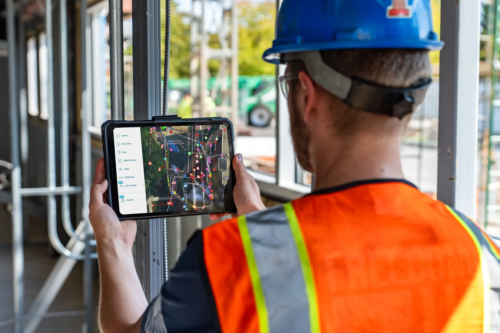
A man holding a phone with a picture of a building on the screen. - GPRS Images

Augmented Reality

Walk your jobsite and use your phone to see underground utilities and pipe flow appear exactly where they are in real time.
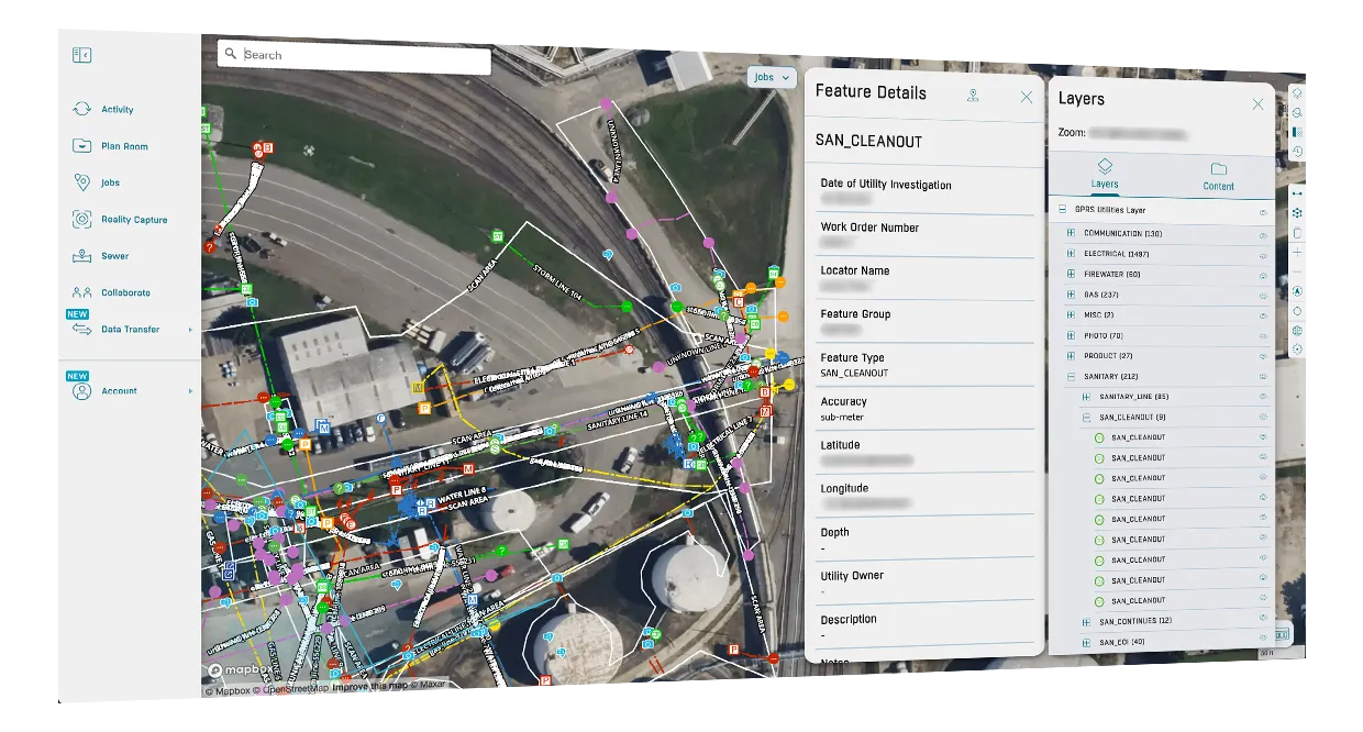
A man in a yellow vest stands in front of a computer screen. - GPRS Images

My Dig Board

A digital jobsite blueprint for clear, consistent communication on excavation paths, placements, and priorities.

A computer screen with a menu for a scheduling service. - GPRS Images

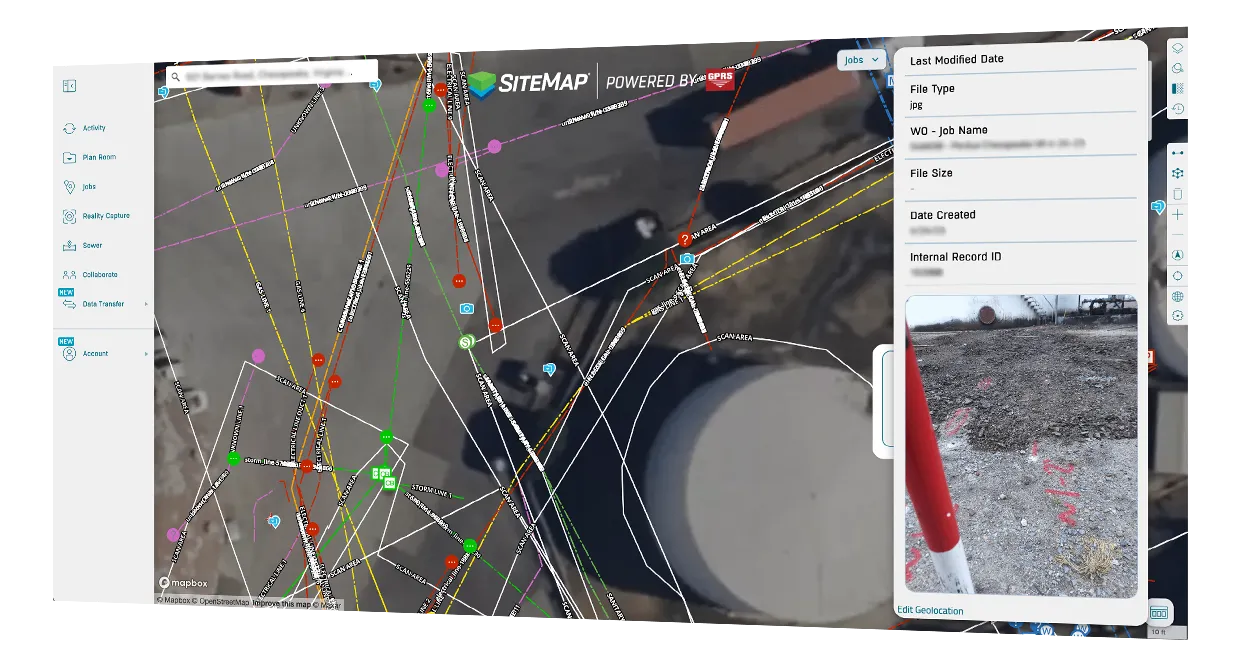
Customer Self‑Service Form

Request additional services in SiteMap, so your team gets what they need without the back and forth.

Here’s How You Win With SiteMap

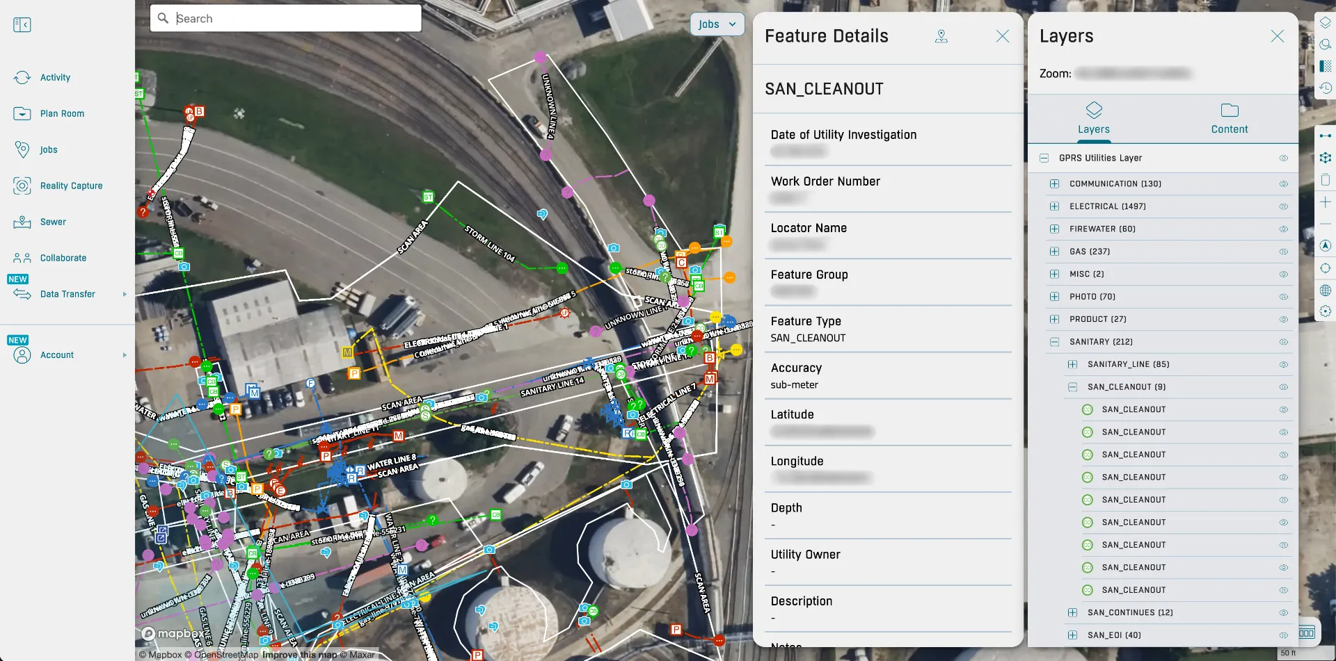
Accurate, connected site data keeps your business running smoothly. When every detail is easy to find and up to date, decisions can be made quickly and safely. That’s what SiteMap delivers. Our GIS platform brings all your facility information, past and present. Everything you need, all in one secure system. That means less time searching, more time planning, and complete confidence in every decision. It’s the ultimate deliverable for facility managers like you who manage what matters.

Aerial view of an industrial complex with storage tanks, pipelines, and infrastructure overlaid with a colorful digital sitemap showing various icons and lines representing site data and connections.
Make Confident Decisions
You can work from accurate, up-to-date site information.
SiteMap Desktop Image - One Click At a Glance
Your Facility in the Palm of Your Hand
All your facility data, organized, searchable, and ready when you need it.
SiteMap Desktop Image - Better Performance
Stay in Control
Your files and turnovers are always accessible. Ready when you need them.
SiteMap Desktop Image - Export on Demand
Pass Audits With Confidence
Attach SOPs and logs to assets for easy compliance checks.
SiteMap Mobile Image - Upgraded Mobile Application
Respond to Emergencies in Minutes
Find valves, mains, and utilities immediately when time is critical.
SiteMap Desktop Image - Improved Searching
Expand With Consistency
Standardize data across every site, from barns to processing plants.

Why Teams Choose SiteMap

Here’s what our clients say about using SiteMap for accurate utility data and job site planning.

Every GPRS customer receives a complimentary SiteMap® Personal subscription so that we can deliver layered utility maps, BIM models, CAD work, NASSCO video pipe inspection reports, concrete scanning data, leak detection reporting, and more.