
Highlights
THE BOTTOM LINE
INDUSTRY
SERVICE
LOCATION
Bowling Green, Kentucky
GPRS Insight
Deliverables
PROJECT APPLICATION
ASK
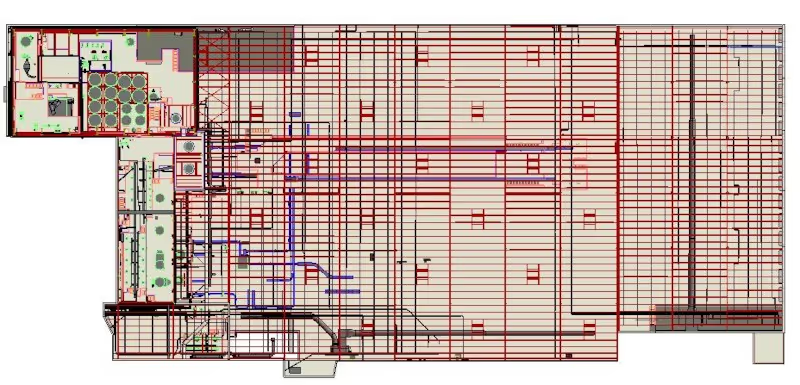
When plant engineers at a pet food packaging facility needed to make modifications, they asked GPRS 3D Laser Scanning to provide as built documentation and a 3D model to plan retrofits to the existing structure. The project site consisted of 140,000 sq. ft. of interior space. Approximately 100,000 sq. ft. of this was single-story warehouse space, consisting of a central palletizer, semi- truck loading bays and temporary material storage. The remaining 40,000 sq. ft. contained 7 levels of elevated platforms containing product packaging equipment. GPRS captured all architectural and structural features, equipment, conduit and piping.
Task
When plant engineers at a pet food packaging facility needed to make modifications, they asked GPRS 3D Laser Scanning to provide as built documentation and a 3D model to plan retrofits to the existing structure. The project site consisted of 140,000 sq. ft. of interior space. Approximately 100,000 sq. ft. of this was single-story warehouse space, consisting of a central palletizer, semi- truck loading bays and temporary material storage. The remaining 40,000 sq. ft. contained 7 levels of elevated platforms containing product packaging equipment. TruePoint captured all architectural and structural features, equipment, conduit and piping.
PROBLEM
- No as built plans existed for the facility. The plant was complex, capturing the existing spatial data of the conduit and piping in a high level of detail was important to the plant engineers.
- There were silos and other pieces of large equipment that would be difficult to measure precisely using traditional or manual measuring techniques.
Solution
- Two days on site, experienced project managers 3D scanned the 140,000 sq. ft. area with millimeter accuracy. 523 scans were taken with the Leica P50 and RTC 360 laser scanners. This project was scanned on the weekend to avoid disruption to production.
- After proper data registration, GPRS' in-house modeling team built an information-rich 3D BIM model for the client. The experienced team has optimized workflows for importing data, registration, creating deliverables, quality checks and transferring data to clients.
Benefits
- By using laser scanning instead of traditional survey methods, GPRS saved this client thousands of dollars in field survey work and drafting time, and provided greater detail than what would have otherwise been possible. With an accurate, comprehensive data set, plant engineers were able to complete virtual interference checks, avoiding design rework costs.


.svg)


.webp)


.avif)

