

.svg)

Highlights
THE BOTTOM LINE
GPRS helped an engineering firm replace outdated, fragmented as-builts with 20 discipline-specific LOD 350 Revit models, giving them accurate, design-ready existing conditions to plan major process upgrades at a Water Treatment Plant.
Industry
Water Treatment Facility
Service
3D Laser Scanning, CAD/BIM
Location
GPRS Project Manager Insight
GPRS helps engineering firms by delivering accurate subsurface and existing‑conditions data through 3D laser scanning, utility locating, and CAD/BIM modeling, providing the precise information needed to design and manage complex water and wastewater facilities.
Deliverables
Registered 3D Point Cloud Files (Autodesk Recap Files, .RCP), LOD 350 3D Revit Model (.RVT), Site Plan, Leica TruView Files (.LGS)
PROJECT APPLICATION
3D Laser Scanning and BIM Modeling for a Water Treatment Facility
ASK
Task
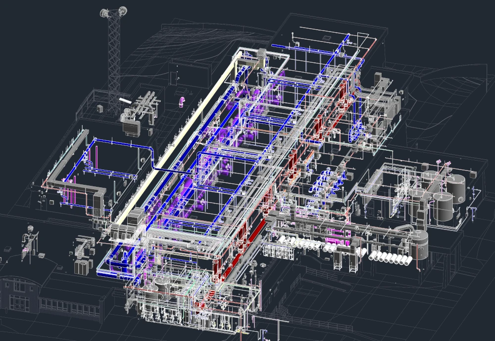
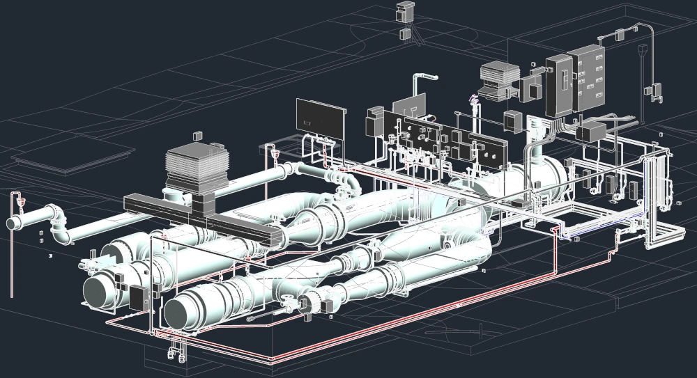
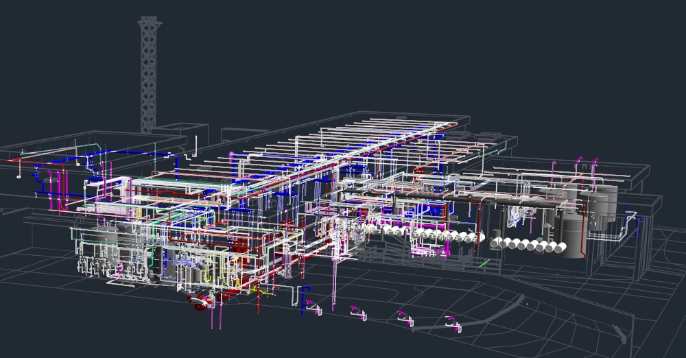
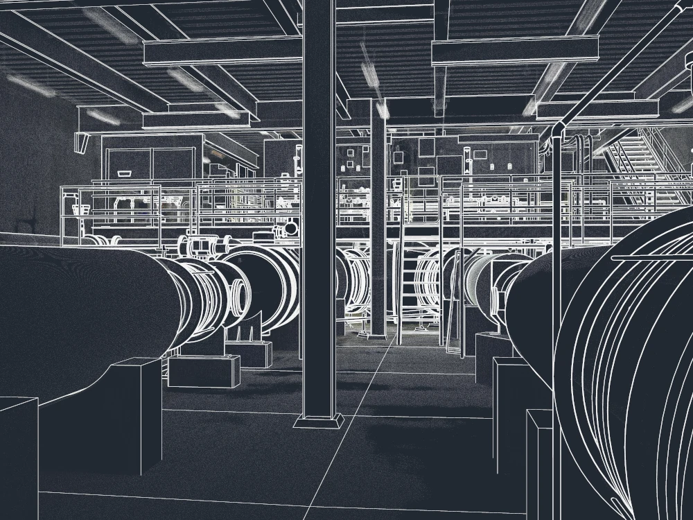
GPRS 3D laser scanned a water treatment facility and created LOD 350 Revit models for architectural, structural, MEP, electrical, and HVAC systems. All models were built to integrate seamlessly with the client’s existing Revit families and delivered via Autodesk Construction Cloud (ACC).
PROBLEM
An 80 MGD facility needed reliable existing conditions data to support a conversion from direct filtration to a conventional treatment process.
Challenges included:
- Outdated, inconsistent as-builts stored across multiple formats
- No unified reference for engineering, operations, or maintenance
- Strict scanning requirements
- Night/weekend fieldwork
- ½ inch accuracy
- Extensive scan coverage of complex structures
- Alignment with previous GPRS datasets
- Custom Revit families and naming conventions
- Collaboration through ACC
Without accurate geometry, the design team couldn’t confidently evaluate current assets or plan process upgrades.
Solution
GPRS performed a complete 3D reality capture and produced custom deliverables.
Key actions:
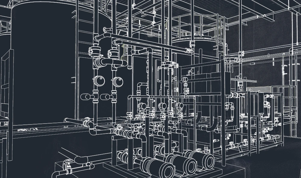
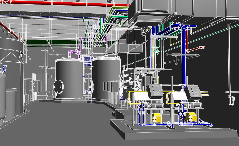
- Scanned all major facility areas, including admin building, raw water control, flocculation basins, CP chamber, generators, substation, pump stations, recovery basins, and chemical rooms
- Registered and aligned new data with previous GPRS models
- Delivered a registered point cloud, TruView 360° imagery, and 3D virtual tour
- Enabled engineering teams to calculate distances, areas, and volumes directly within the point cloud
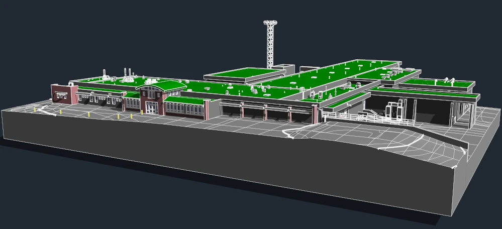
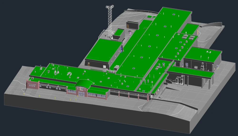
- Provided a detailed site plan showing buildings, fences, gates, and topography for easy model integration
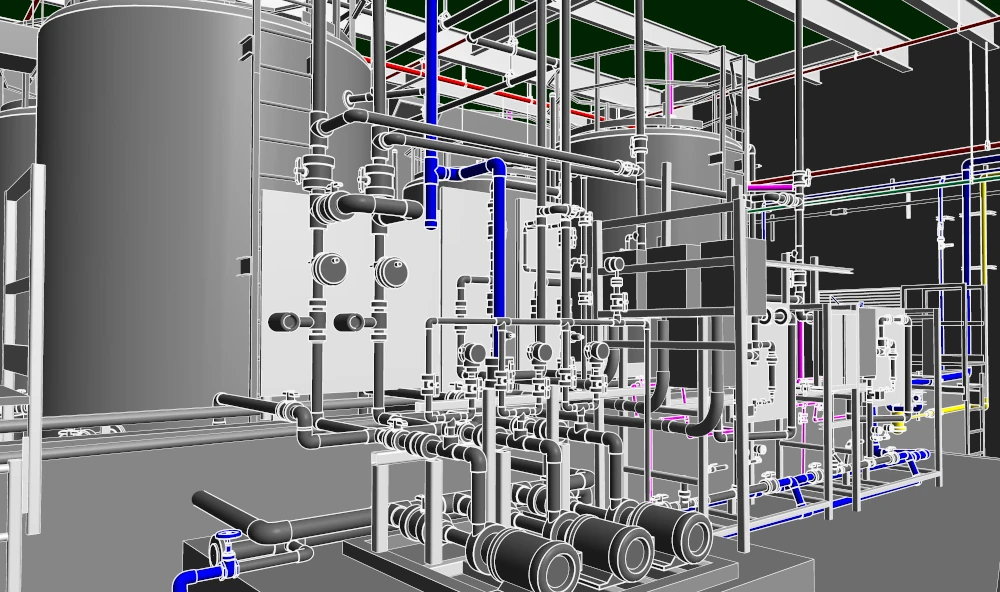
- Produced 20 LOD 350 Revit models, including architectural, structural, MEP, electrical, and HVAC systems
This consolidated all facility data into a design-ready BIM environment.
Benefits
- Models adhered to the client's Revit family structure and naming conventions, no cleanup or reformatting required
- ACC collaboration ensured the client automatically received updates to all linked Revit files
- High accuracy 3D geometry minimized clashes, errors, and change orders
- Project engineers can access asset data in the field, reducing verification time and simplifying maintenance documentation
- Unified BIM supports O&M planning, CIP decisions, and overall infrastructure management
CASE STUDY GALLERY

.avif)
.avif)

.avif)


.avif)
