

.svg)

Highlights
THE BOTTOM LINE
GPRS Project Managers provided 99.8% accurate subsurface utility scans & maps to ensure that their comms tower was installed without striking underground electrical lines.
Industry
Service
Utility Locating
Location
Austin, Texas
GPRS Project Manager Insight
Deliverables
Site markings, Job Services Report, Layered digital utility map in SiteMap®
PROJECT APPLICATION
ASK
Task
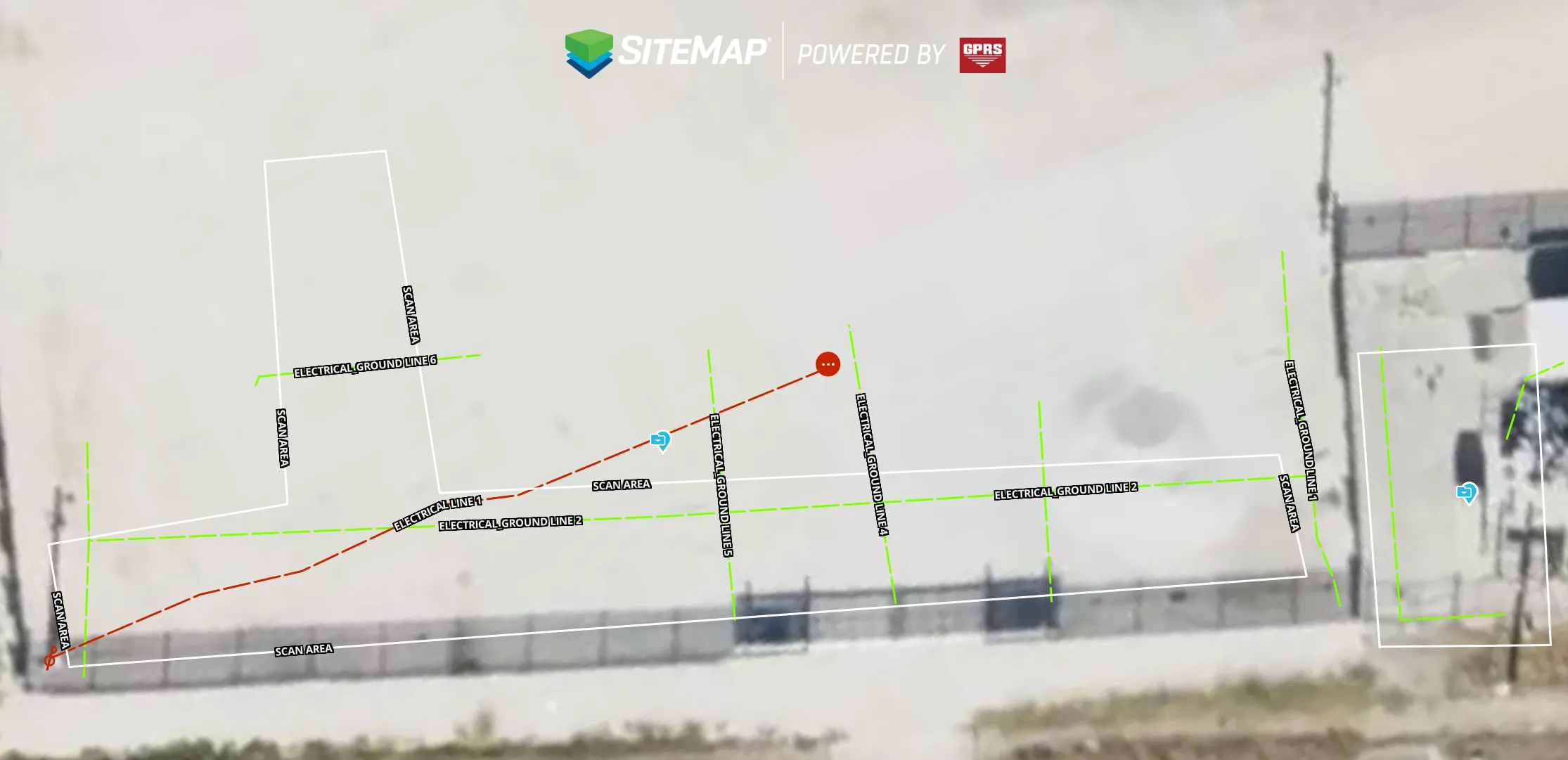
Verify the location and depth of subsurface electrical lines and grounding grid for a communications tower installation
PROBLEM
- The client needed to confirm the location of underground electrical lines and the substation’s grounding grid before installing a new communication tower
- Without an accurate layout of the grounding grid, the risk of striking the grid or other utilities was high
Solution
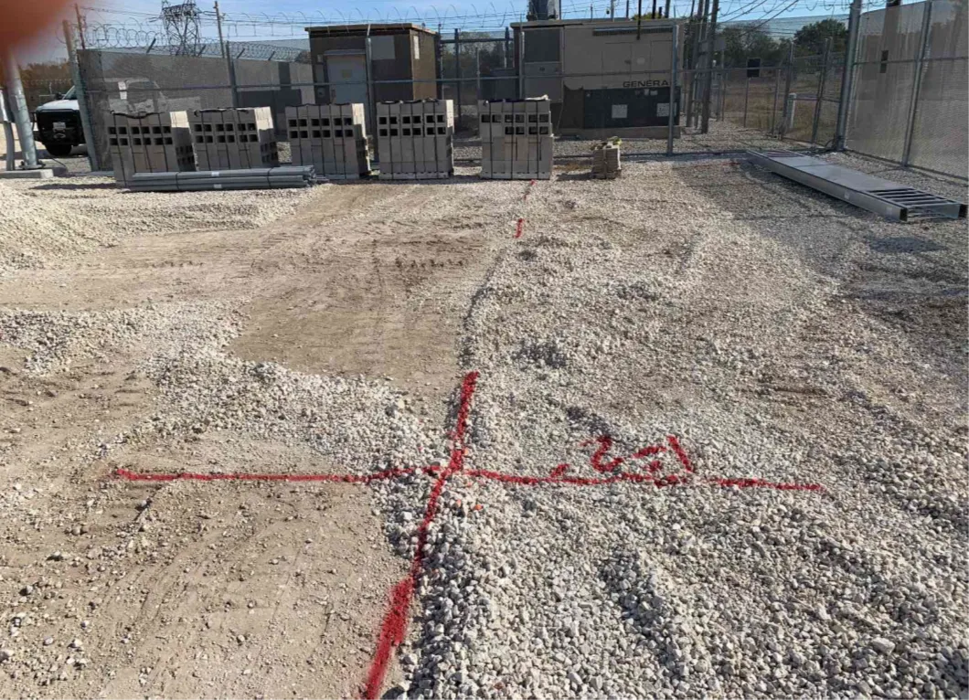
- GPRS Project Managers utilized an electromagnetic (EM) locator and induction clamps to verify the location and depth of the electrical lines
- They also used ground penetrating radar (GPR) with the induction clamps to identify the location and depth of the grounding grid
- They marked all their findings with red spray paint on the ground and documented them using GPS technology to create a digital map of the markings, which they uploaded into SiteMap for immediate use by the client
Benefits
- By verifying the location and depth of the subsurface lines, the project could progress safely
- The client received the scan results the same day, keeping their project on time
- With the scan results only a click away on SiteMap, they can analyze and reference the data during projects in the future
CASE STUDY GALLERY
No items found.


.avif)


.avif)


.avif)