.svg)
Request A FREE Quote
Fill out the contact form below, and a GPRS Project Coordinator will contact you to get the process started.
Thank you! Your submission has been received!
Oops! Something went wrong while submitting the form.
The GPRS DIFFERENCE
GPRS uniquely captures entire sites above and below ground, delivering accurate as-builts, utility maps, 2D CAD, 3D photogrammetry, and BIM through cloud-based SiteMap® solutions for construction and related industries.
.svg)
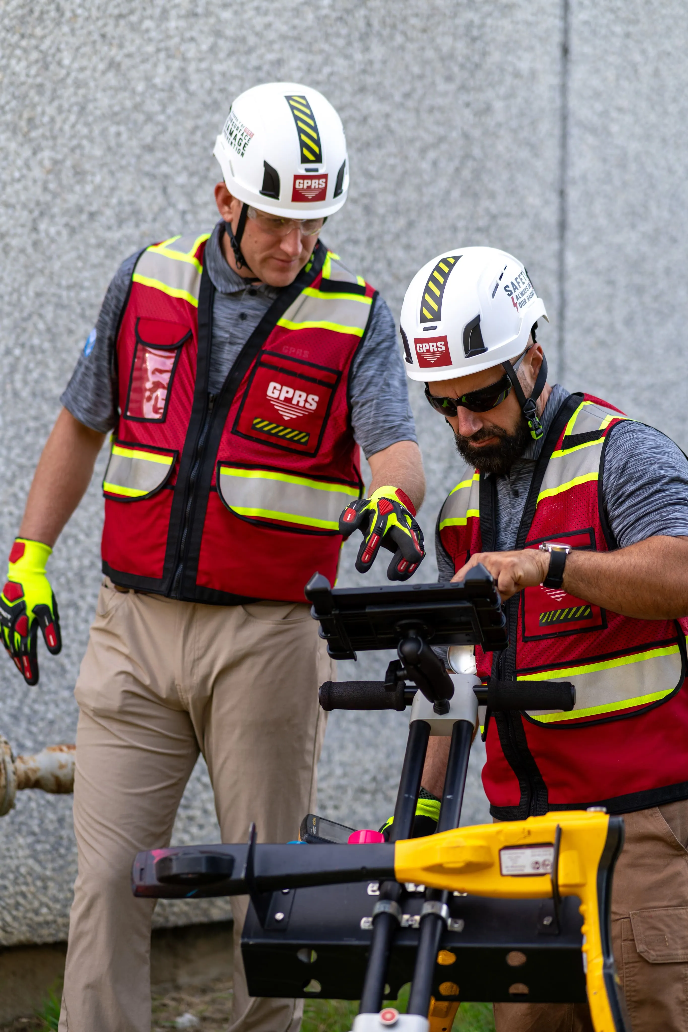
Boasting a 99.8% Accuracy Rate

GPRS delivers 99.8% accuracy using SIM-trained Project Managers for utility mapping, concrete scanning, sewer inspection, and 3D laser scanning nationwide. Our customer service team ensures reliable, consistent support for every project.
.svg)
Nationwide Coverage with 500+ Experts
GPRS delivers 99.8% accuracy using SIM-trained Project Managers for utility mapping, concrete scanning, sewer inspection, and 3D laser scanning nationwide. Our customer service team ensures reliable, consistent support for every project.
5+ Technologies to Deliver Detailed Maps
GPRS delivers 99.8% accuracy using SIM-trained Project Managers for utility mapping, concrete scanning, sewer inspection, and 3D laser scanning nationwide. Our customer service team ensures reliable, consistent support for every project.

GPRS 3-Step Service Process
GPRS uses advanced technology and expert fieldwork to deliver accurate subsurface and surface mapping. Our three-step process ensures reliable, actionable data via the cloud-based SiteMap® platform, supporting your project from start to finish.
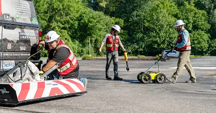
Data Collection
Skilled Project Managers use advanced technologies like ground penetrating radar, electromagnetic induction, CCTV cameras, and LiDAR to accurately capture subsurface and surface data.
1

Data Processing & Mapping
Collected data is processed by GPRS’s in-house team into detailed maps, 2D CAD drawings, and 3D models tailored to your project needs.
2

Delivery & Support
Final deliverables are provided via SiteMap® in multiple digital formats, with ongoing support to integrate data throughout your project lifecycle.
3
Case Studies
See how GPRS helps clients avoid delays, reduce risk, and keep projects moving. These case studies highlight our accurate utility locating, concrete scanning, and 3D imaging solutions in action.

.svg)
.webp)