

.svg)
ENVIRONMENTAL DUE DILIGENCE
Partner with GPRS for Accurate Utility Locating, Maps & Models

.svg)

.svg)


.webp)
.webp)
Environmental Due Diligence Solutions
GPRS Delivers Complete Subsurface & Site Mapping for Environmental Projects
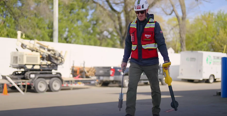
Whether you’re conducting an initial investigation, a round of delineation, or completing the final stages of remediation, GPRS provides the tools and techniques to keep your team safe and your client’s infrastructure protected.
GPRS identifies underground utilities and UST components so you can clear soil borings, install vapor pins, and drill safely. Our utility CAD maps protect infrastructure, while CSMs highlight potential contaminant pathways and guide next steps. We support your environmental work with utility locating, concrete scanning, video pipe inspection, and 3D laser scanning. All deliverables are hosted in SiteMap® for fast, accurate data access that reduces risk, supports compliance, and enables confident decisions.


Property Stakeholders
Owners, buyers, developers, and asset managers use GPRS to verify subsurface utility and as-built site data to reduce liability during transactions, redevelopment, or due diligence phases.
Ground Penetrating Radar (GPR)
Electromagnetic (EM) locating
LiDAR scanning

Environmental & Technical Teams
Environmental consultants, scientists, remediation firms, engineers, and EHS specialists rely on GPRS' accurate utility locating and concrete scanning to safely conduct sampling and remediation.
Concrete scanning
Concrete scanning
Leak detection
Corporate & Industrial Clients
Organizations managing property portfolios or operating regulated facilities reach out to GPRS for reliable information to maintain environmental compliance, support audits, and plan remediation or risk management.
Transmission and distribution upgrades
Substation renovations
Grid modernization initiatives

Regulatory & Legal Stakeholders
Regulators, attorneys, and compliance advisors depend on GPRS for clear, defensible site data, such as utility maps and CSMs to evaluate environmental liabilities, permitting, and reporting requirements.
Full-site visualization
2D CAD drawings
2D CAD drawings
3D BIM models
Virtual tours accessible via SiteMap®
How GPRS Supports Environmental Due Diligence
Years in Business and 120,000 Projects Completed
Accuracy in Utility Locating & Concrete Scanning
Access to Your Data with SiteMap® GIS Software & App
SIM-Certified Project Managers You Can Trust, Every Time
Soil & Groundwater Sampling
Key Challenges
Limited outage windows
Tight tie-in tolerances
Unknown embedded conditions
Our Solutions
Cross bore investigations
Structural condition assessments
Blockage and defect identification
Key Challenges
- Outdated or inaccurate utility maps
- Risks of strikes, spills, or injuries when drilling
- Strict regulatory standards that require documentation
Our Solutions
- Locate public and private utilities using GPR and EM technologies
- Deliver updated utility maps in interactive, CAD, PDF, and KMZ formats
- Identify safe boring locations so you can drill without strikes, delays, or added costs
- Field verified data for confident, compliant sampling
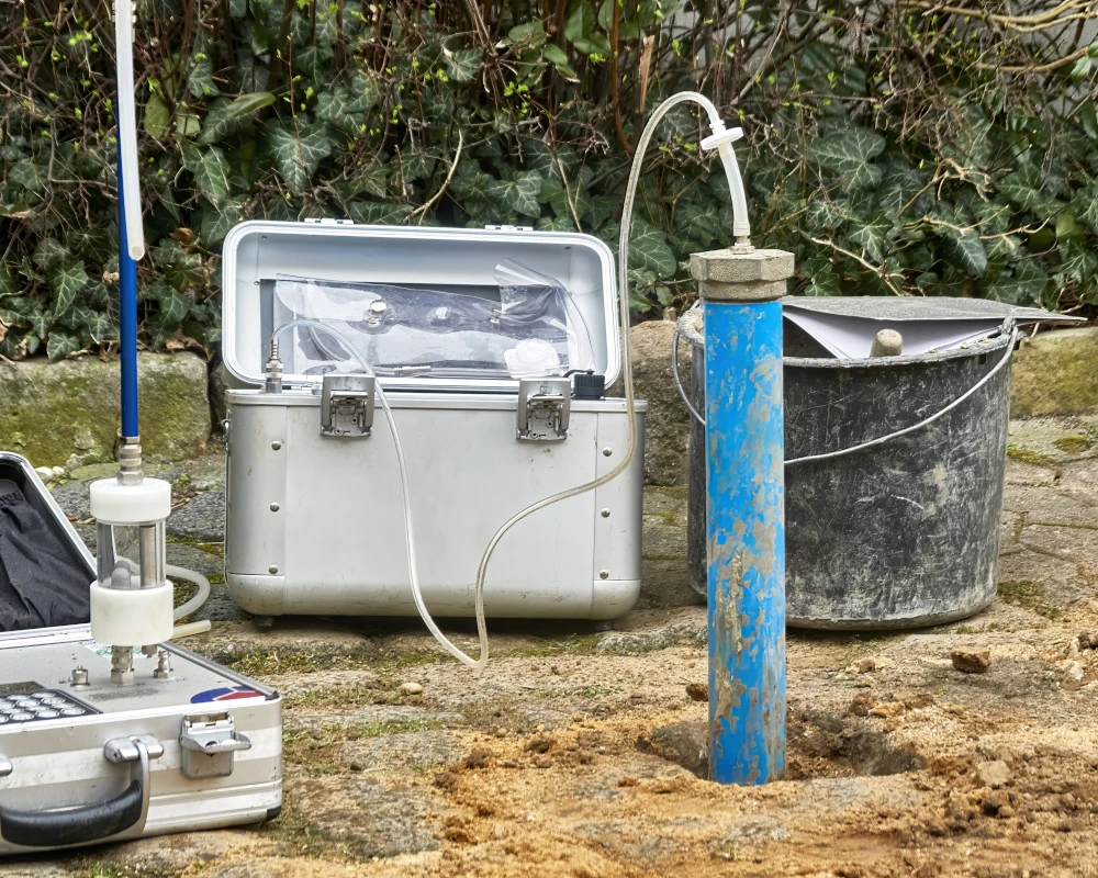
Soil Vapor Assessment
Our Solutions
Utility locating and mapping on public and private property
GPR and EM technology for underground and overhead transmission
Reliable data for HDD, redesign avoidance, and conflict resolution
Key Challenges
- Outdated building documentation
- Installing vapor pins without precise subsurface knowledge
- Risk of striking conduit, reinforcement, or shallow utilities during drilling
- Safety and compliance requirements for vapor intrusion investigations
Our Solutions
- Concrete scanning and utility locating performed by SIM certified Project Managers identifies reinforcement, conduits, and shallow utilities before drilling
- Subsurface data, mapping, and modeling informs safe vapor pin installation
- Accurate, field-verified information reduces disruption, prevents strikes, and supports compliance with health and safety regulations
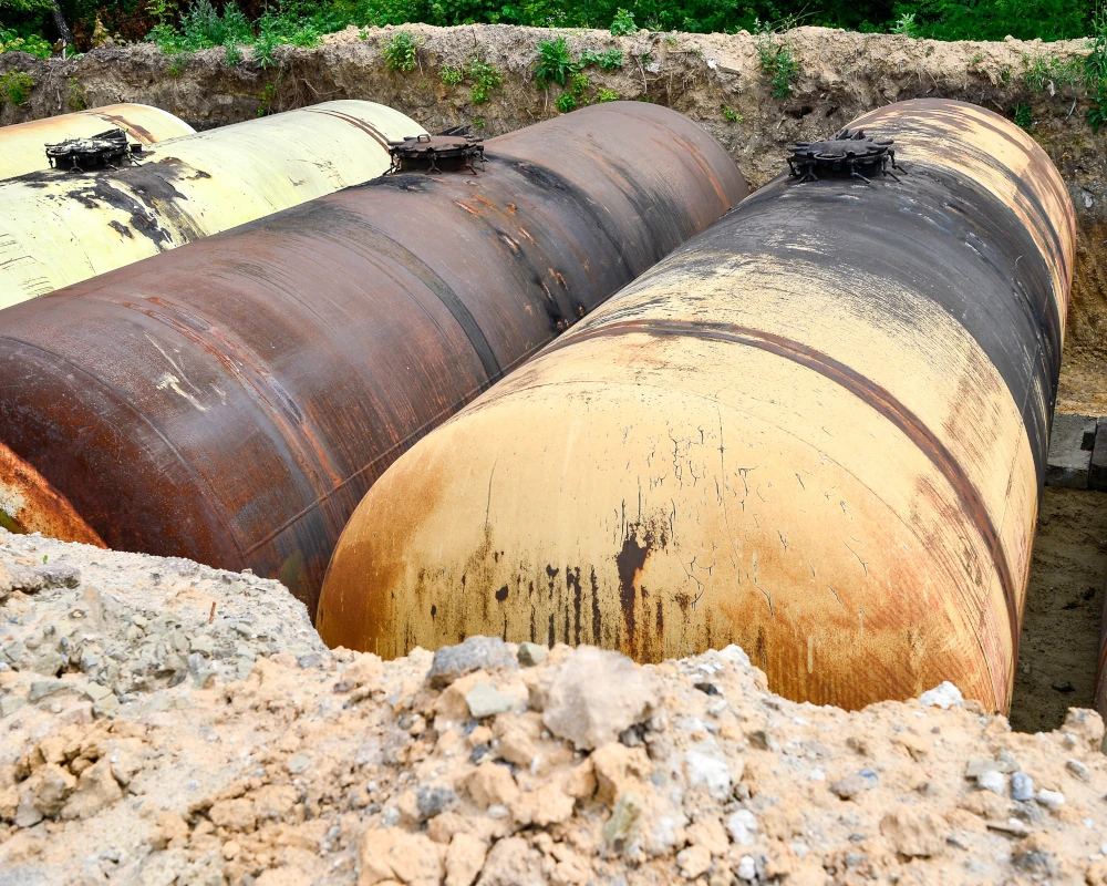
UST Investigations & LUST Support
Key Challenges
- Missing or outdated records makes locating underground storage tanks difficult
- Orphaned, abandoned, or improperly documented USTs increase project and environmental risk
- Inaccurate tank locations lead to costly mistakes, delays, or regulatory issues
- Remediation and compliance efforts require reliable environmental and site data
Our Solutions
- Utility locating safely identifies orphaned, abandoned, or active UST systems
- CAD maps clearly show tank locations and associated infrastructure
- Conceptual Site Models (CSMs) are created from field-verified site information to support remediation planning
- Accurate data reduces risk, protects property value, and supports due diligence and regulatory compliance
Our Solutions
Mapping grounding grids, duct banks, and buried conductors
Laser scanning of switchyards, control buildings, and equipment clearances
Millimeter-accurate E57 point clouds and digital twins for design, outage planning, and expansions
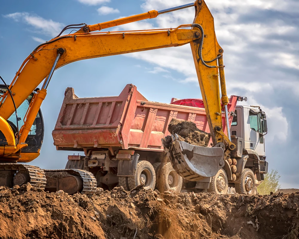
Delineation & Remediation
Key Challenges
- Contamination in soil, groundwater, or vapor requires precise mapping
- Inaccurate subsurface data can lead to over or under delineation, increasing project time and cost
- Refining your Conceptual Site Model (CSM) requires reliable field data across utilities, structures, and subsurface pathways
- Effective remediation planning requires clear, verified site conditions
Our Solutions
- Utility locating, concrete scanning, and video pipe inspection accurately identify subsurface conditions
- CAD & BIM team produces utility maps and CSMs
- Field-verified data guides precise delineation and targeted remediation
- Data streamlines workflows to save time, reduce costs, and support NFA or Regulatory Closure
Our Solutions
Reality capture for overhead clearance verification
Utility locating for dense underground corridors
NASSCO-certified VPI and CCTV inspections
HDD planning with cross-bore prevention and post-install verification
Why Environmental Consultants Choose GPRS
GPRS delivers digital representations of the as built environment with construction grade accuracy, giving you the verified information required for soil, groundwater, and vapor investigations. With GPRS as your trusted partner, you can focus on what you do best, assessing impacts, ensuring compliance, and guiding projects toward safe, effective outcomes.
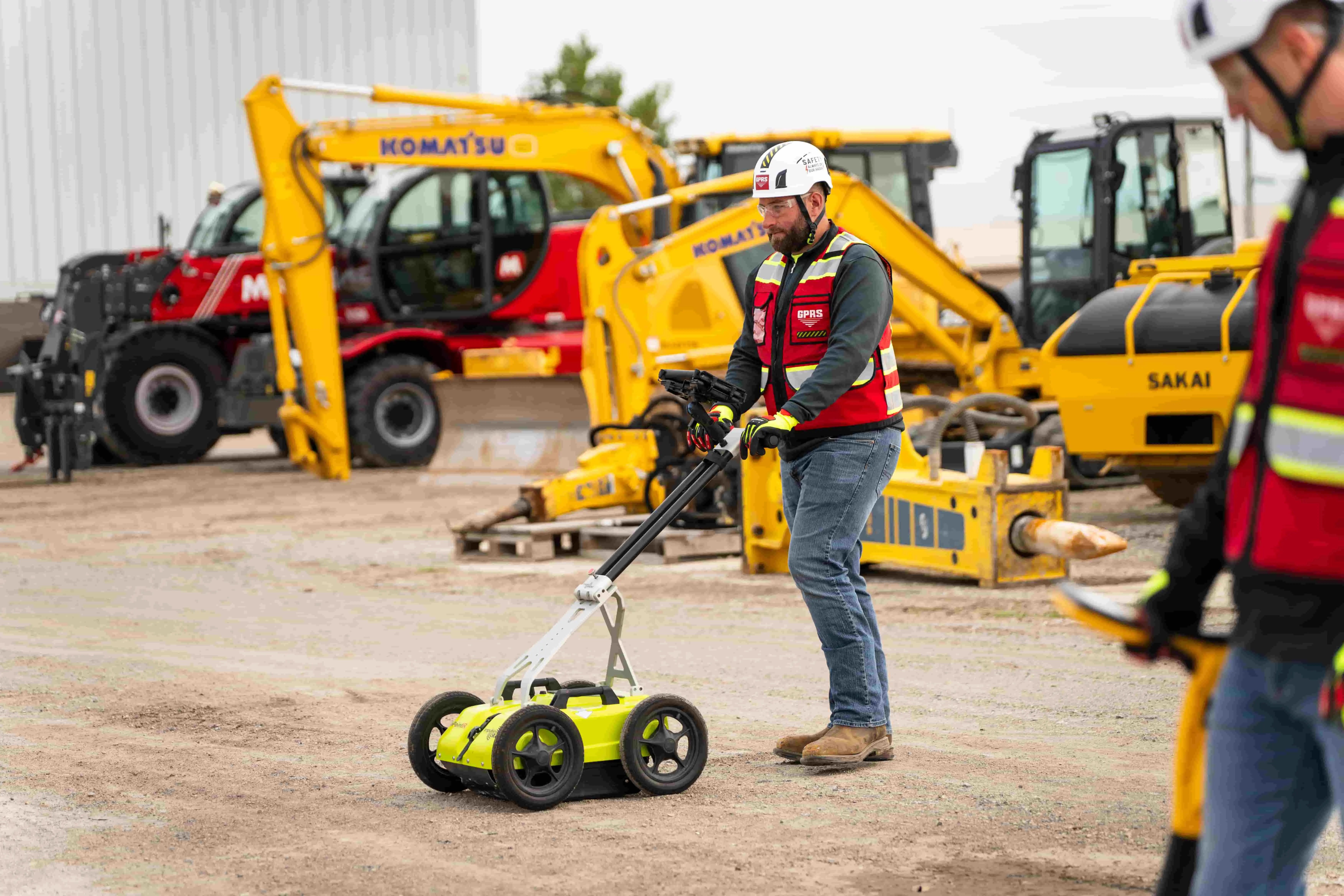
GPRS maintains a 99.8% accuracy rate in utility locating, concrete scanning, and infrastructure mapping. We capture millimeter-accurate point clouds with 3D laser scanning and produce custom CAD drawings and BIM models, while also providing NASSCO-certified video pipe inspection using PACP, LACP, MACP standards to assess sewer, water, and lateral pipelines.
GPRS deliverables include interactive utility maps, CAD drawings, conceptual site models (CSMs), all delivered via GPRS’ SiteMap GIS platform for fast access to project records. GPRS data easy integrates into your CAB/BIM workflows streamline sampling, assessment, and remediation.
Our services protect workers, infrastructure, and the public during sampling, hazard identification, and remediation planning.
Data collection aligns with regulatory requirements for environmental investigations.
We have elite project managers located in every major market and city near you. This nationwide network is deployed across every market in the US, enabling us to mobilize quickly through our Rapid Response program. This team of field professionals is trained to help you visualize your infrastructure, both above and below ground.
What Our Clients Say
Frequently Asked Questions
Environmental due diligence evaluates a property’s environmental conditions and risks. Buyers, lenders, developers, and attorneys request on site reviews to understand potential liabilities, like contamination or hazardous materials, before they purchase, occupy, refinance, or use a property as loan collateral.
Environmental due diligence is a key part of any commercial real estate deal because it helps buyers and lenders understand whether a property has any environmental issues that could impact health, safety, or value. The process typically starts with a Phase I Environmental Site Assessment (ESA), which reviews the site’s history and current conditions to identify any potential problems. If the Phase I ESA raises concerns, a Phase II ESA may follow, involving soil, groundwater, or air sampling to confirm whether contamination is present.
USTs are tanks and associated piping buried underground to store petroleum or other hazardous substances. They are commonly found at gas stations, airports, truck fleet refueling facilities, automotive service stations, dry cleaners, and industrial facilities. USTs must be designed, installed, and maintained to prevent leaks and ensure environmental safety.
LUSTs occur when underground tanks develop cracks, rust, or fail due to mechanical or structural issues. These leaks can release hazardous substances into the surrounding soil and groundwater, leading to significant environmental contamination.
Utility locating ensures drilling locations are cleared before sampling begins. GPRS identifies public and private utilities so you can install borings or vapor pins without strikes or delays. Learn more about GPRS utility locating services.
GPRS provides utility maps, CAD drawings, and conceptual site models (CSM) to support assessment and remediation. All deliverables are stored in SiteMap®, GPRS’ GIS Software and app, for quick team access.
A conceptual site model or CSM is a 3D rendering of the subsurface data at a site that allows visualization of preferential pathways for delineation of liquids and may identify potential voids where soil vapor could create additional hazards. Read the case study about how a gas station used utility locating and as‑built data to document existing site conditions for upcoming upgrades and to support an emergency response plan for potential leaks.