

.svg)

Highlights
THE BOTTOM LINE
GPRS delivered comprehensive digital as-built documentation of a complex, historic courthouse to equip the architect with precise data to plan renovations, prevent costly construction errors, and comply with preservation regulations.
Industry
Historical Renovation
Service
Utility Locating, Concrete Scanning, 3D Laser Scanning, Mapping & Modeling
Location
Lovington, New Mexico
GPRS Project Manager Insight
“Accurate as-built data empowered the architect to make informed decisions and plan long-term infrastructure improvements, all easily accessed through SiteMap, GPRS’ cloud-based GIS platform.” – Emily Crego, GPRS Mapping & Modeling Team
Deliverables
Point Cloud, Digital and PDF Utility Maps, 2D CAD Drawings, 3D BIM Models, TruView, Virtual Tour, SiteMap®
PROJECT APPLICATION
ASK
Task
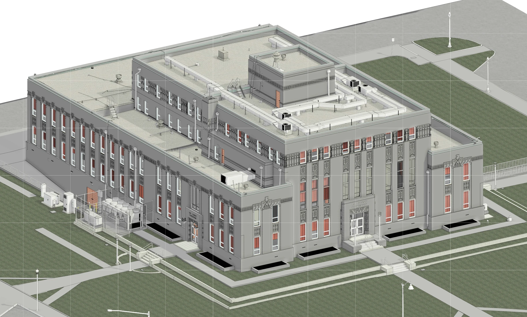
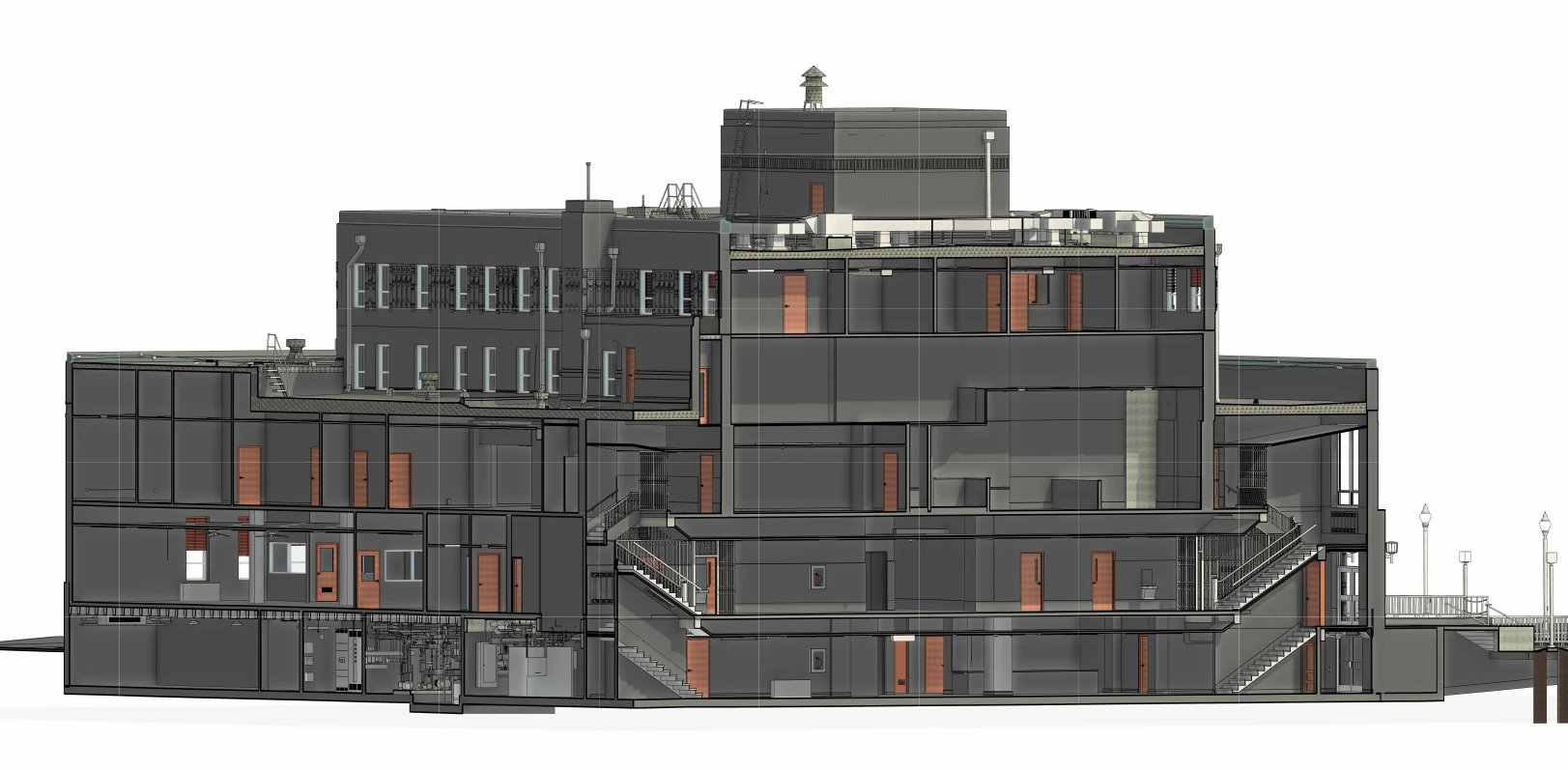
GPRS partnered with NM Building Enclosure Architecture to support renovations at the historic Lea County Courthouse. Through utility locating, concrete scanning, and reality capture, GPRS delivered comprehensive as-built data and generated CAD and BIM models that mapped underground utilities, concrete reinforcement, and all structural, architectural, and MEP systems, providing the architectural team with the insights needed to plan renovations with confidence.
PROBLEM
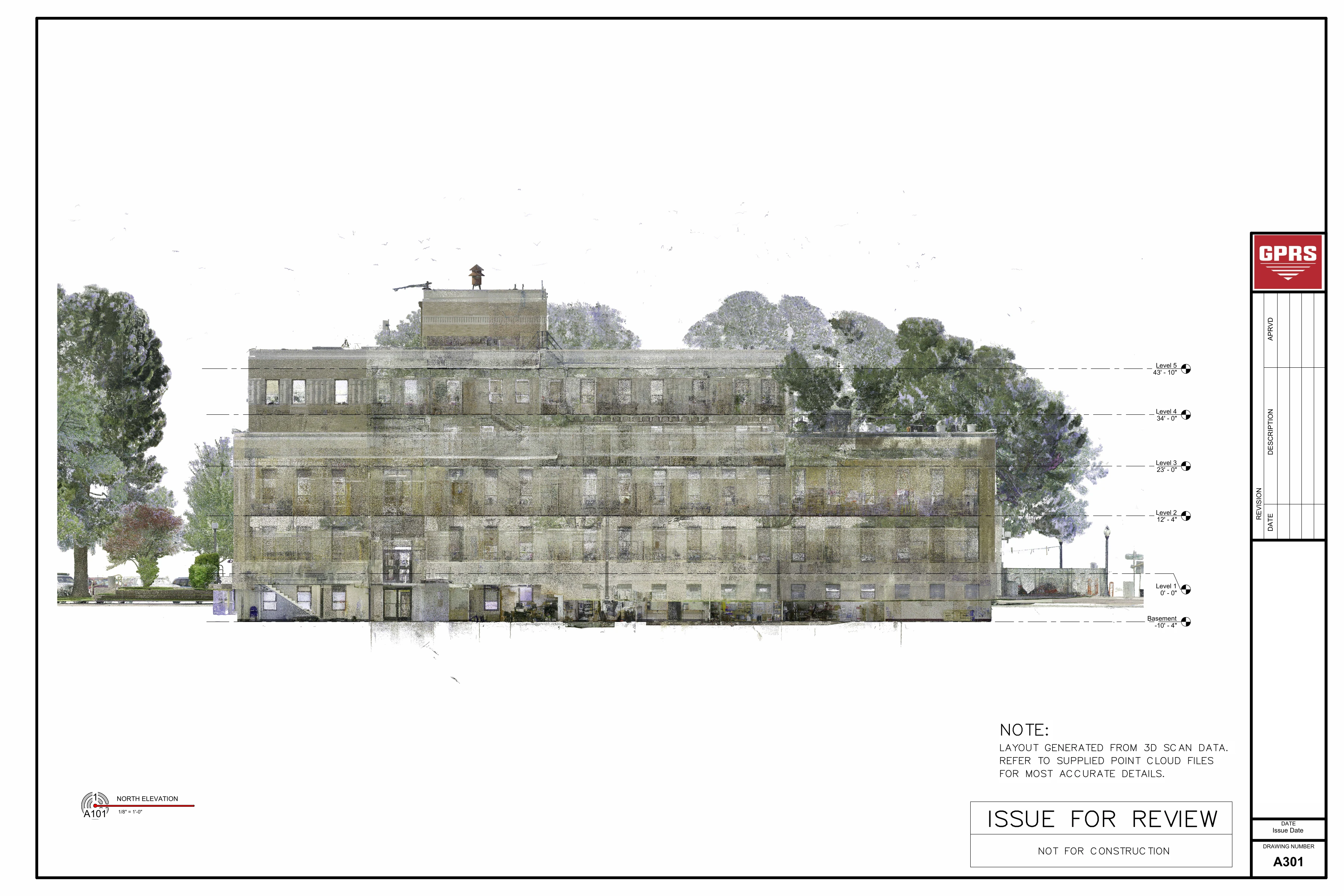
- Built in 1936 and last updated in 1957, the courthouse is a designated historic property that required state approval for renovation under New Mexico’s preservation laws
- Renovations were needed to expand office space and upgrade public-facing facilities to meet departmental growth
- The architect needed to document the aging infrastructure, including boiler room, plumbing, electrical panels, and elevators in need of replacement
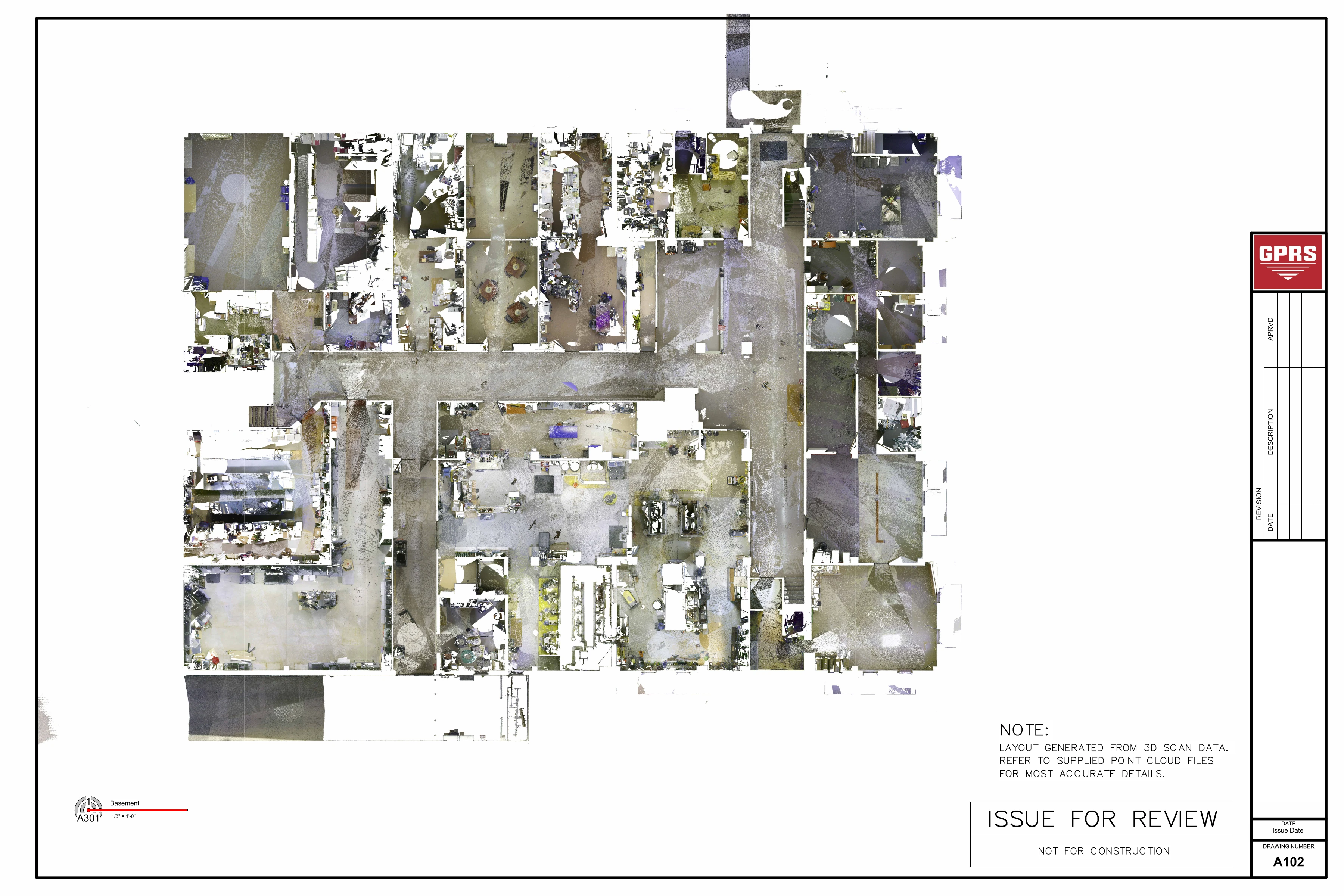
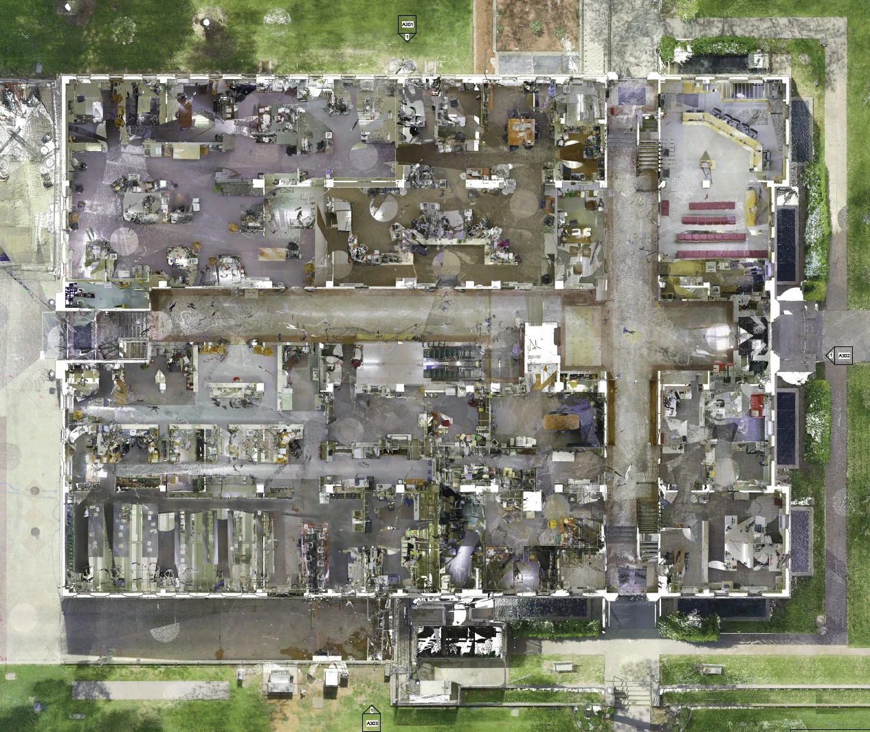
- The building footprint was complex, spanning 5 floors and 70,000 square feet, including a basement and three roof sections
- There were no up-to-date records of the building’s layout and infrastructure, which complicated design coordination and increased construction conflicts
Solution
- GPRS scanned the block surrounding the courthouse using ground penetrating radar to locate & map underground utilities, including electric, communication, gas, water, sewer, irrigation, and unidentified lines
- Four 4'x4' concrete areas in front of elevators in the building were GPR scanned to assess slab conditions and detect embedded features such as rebar and conduit
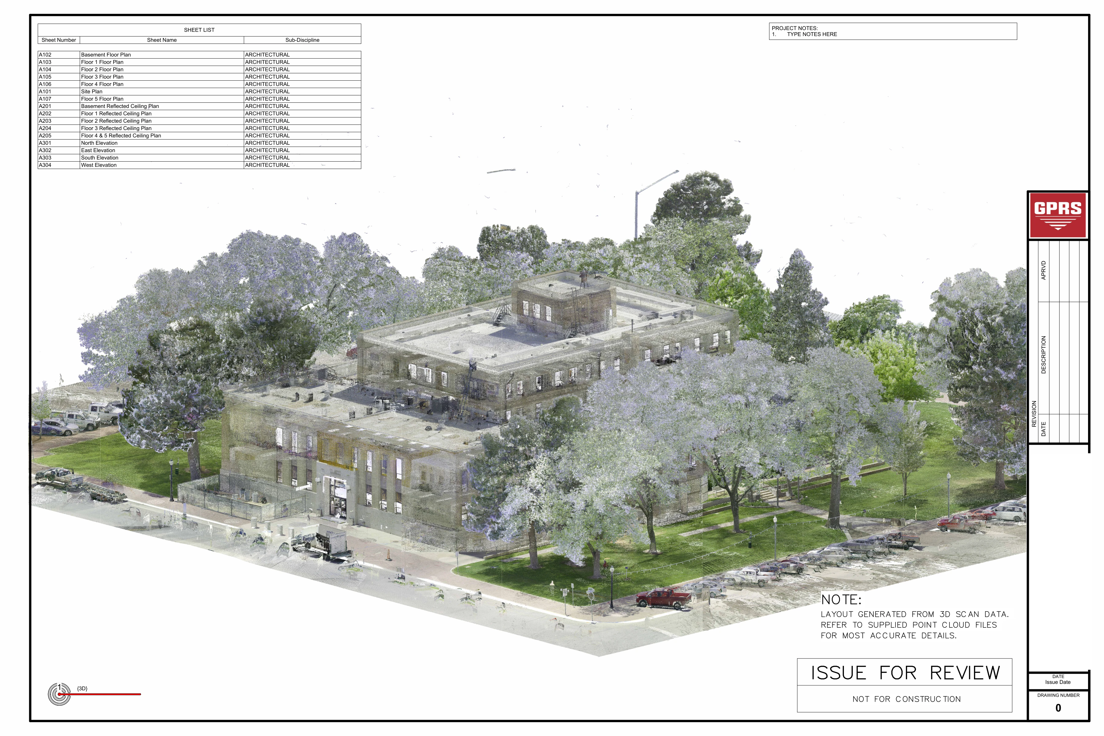
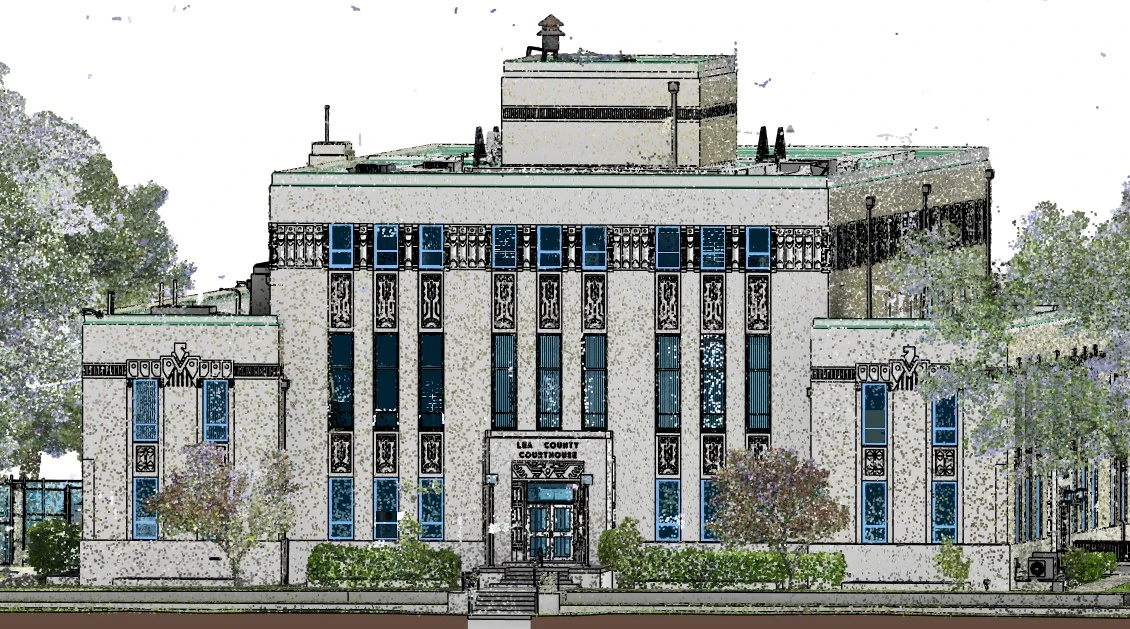
- Full-color 3D laser scans documented the courthouse’s interior, exterior, and roof structures, capturing all architectural, structural, and MEP components, as well as field markings from utility locating and concrete scans
- Scan data was converted into detailed 2D CAD drawings and Architectural/Structural & MEP 3D Revit models
- All maps, drawings, and models were securely uploaded to SiteMap®, GPRS’ cloud-based GIS software platform
Benefits
- The architect received accurate records of the building’s layout and infrastructure, minimizing guesswork and reducing construction risk
- Utility markings and concrete scan data helped to prevent costly strikes, structural damage, and delays during future work
- Captured data facilitated upgrades, space planning, and maintenance across all five floors
- The comprehensive above and below-ground documentation available 24/7 in SiteMap, guided safe renovations, streamlined maintenance, and will inform planning for the life of the historic building
CASE STUDY GALLERY


.webp)


.avif)

