

.svg)

BUILD BETTER WITH ACCURATE AS-BUILT DOCUMENTATION
Consider our team an extension of your own – a team that is dedicated to GPRS capturing accurate as-built conditions, above and below-ground to help you avoid utility strikes, clashes, change orders, delays, and rework and improve communication and collaboration to reduce accidents and ensure success.
What our Customers Say
BRINGING YOUR PROJECT IN ON TIME, ON BUDGET & SAFE
Start accurate, Stay accurate
.webp)
Pittsburgh International Airport
Accurate utility locates & maps can ensure subsurface and utility damage prevention on large development projects.
View Case Study


Pre & Post-Cross Bore Inspections
NASSCO-certified pre and post-directional drilling surveys can help telecom and other line installers more safely_place lines and quickly. mitigate cross bores.
View Case Study
Rudolph Libbe Hospital Addition
Integrated above and below-ground utility mapping & BIM modeling can help discover unknown subsurface facilities and clashes before they cost time and money.
View Case Study
.webp)
Utility Maps for Notre Dame Stadium
Utility mapping & 3D reality capture can combine to eliminate guesswork for excavators and create a permanent utility record of any site.
View Case Study
Concrete Scanning & Laser Scanning for Parking Garage Renovation
Creating interior 3D models of concrete slabs can ensure continuity. in as-built recordkeeping and provide clearances for future work.
View Case Study

Whether you’re breaking ground on a luxury high-rise, a new airport terminal, or a state or federal infrastructure project, GPRS provides the precise locations, utility maps, and accurate data you need to help keep your project on time, on budget, and safe.*
All of your accurate site data is secured and delivered via SiteMap® (patent pending), our industry-leading project and facility management software platform. SiteMap provides you with a GIS-based record of your site’s existing conditions – and can include everything from a layered, interactive underground utility map or a full WinCan sewer report through phased BIM and rectified drone photogrammetry. Your information can be updated, aggregated, and securely shared – to give you complete control. Every GPRS customer receives complimentary SiteMap Personal access as part of our services.
.webp)

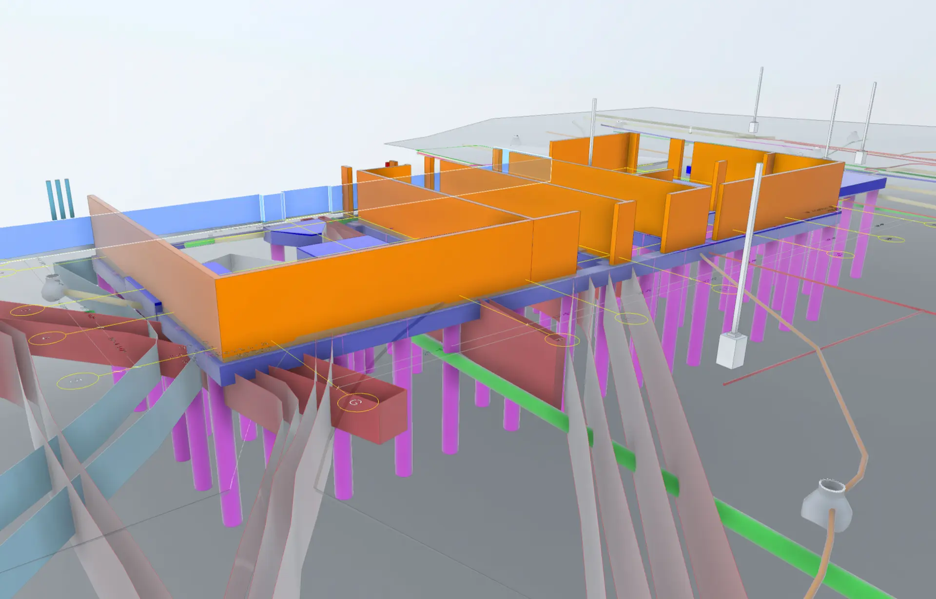
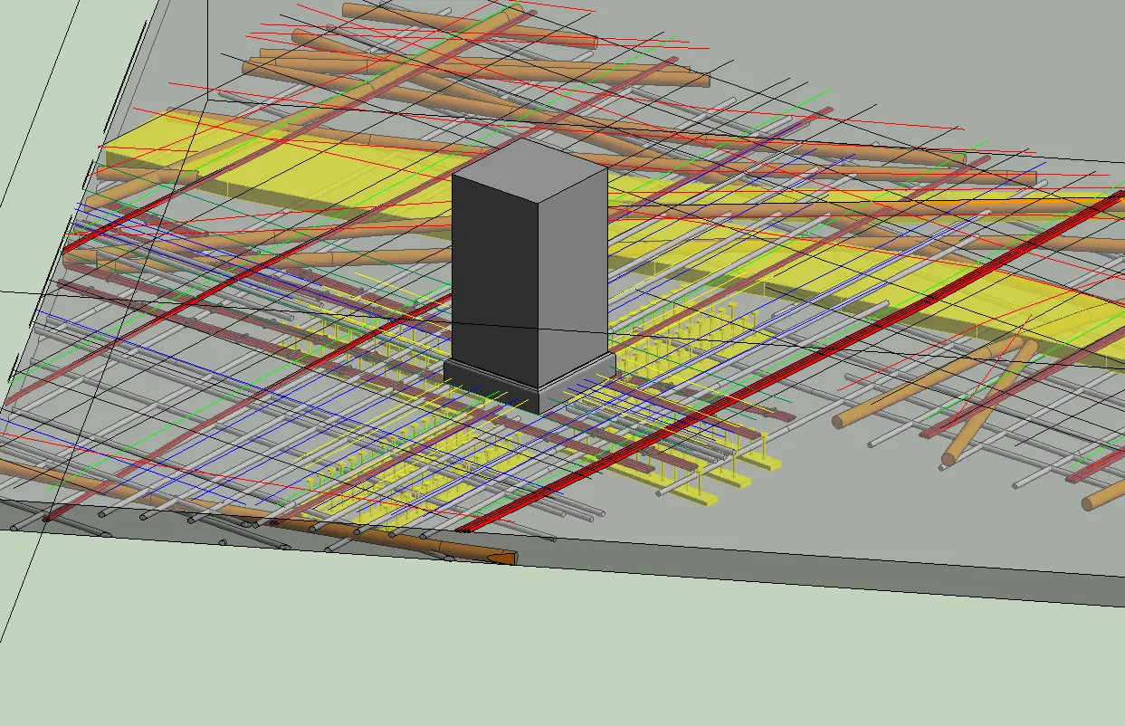
We are in pursuit of 100% subsurface damage prevention – that’s why we are dedicated to Intelligently Visualizing The Built World® for any project. We can even map what’s inside your concrete and provide depths on buried utilities to give you the most comprehensive jobsite information available.
Our in-house Mapping & Modeling Team can create anything from a PDF CAD utility map through complex, integrated 3D BIM models and walkthroughs of your structure and underground utilities.
GPRS CUSTOMER REVIEWS
"You can never be too safe, and it's always best to take preparations for safety before you begin a project and to utilize GPRS in any situation where you're going to excavate the soil."
Keith Van Alst
Frank Gay Commercial Services
Read More Reviews
"Contracting GPRS to do a 3D laser scan has been one of the best project decisions we made. With their help we were able to reduce cost, increase productivity, and deliver the project on time."
Cody Dobbins
Catawba Valley Engineering & Testing
Read More Reviews
"Excellent level of detail, and excellent summary of work provided via email. Following the scan there's no one else I've worked with that delivers this level of detail and quality."
Senior Project Superintendent
Read More Reviews
"GPRS detected voids between 12 to 15 feet below asphalt and concrete surfaces, providing a detailed report. We were highly satisfied with GPRS' findings."
Jeffrey Woodman
Bubes Brewery
Read More Reviews
"I am blown away by the services that GPRS provides. It is a total state-of-the-art setup, from the tech reports to the hands-on equipment, to the highly trained video tech. I recommend GPRS for any project; they are capable of doing more than you can imagine."
Rudy Raymond
Senior Project Superintendent
Read More Reviews
"Contracting GPRS to do a 3D laser scan has been one of the best project decisions we made. With their help we were able to reduce cost, increase productivity, and deliver the project on time."
Vincent M.
Superintendent
Read More Reviews