

.svg)
To better understand why and how construction technology decisions are made, Autodesk and FMI Corporation partnered to survey 600 construction professionals about how their teams spend time on the jobsite. The study revealed that the construction industry continues to suffer from outdated data and communication practices.
Autodesk provides software solutions for the architecture, engineering, and construction industries. FMI Corporation is a management consulting and investment firm focused exclusively on engineering, construction, infrastructure, and the built environment.
The data was compiled in an industry report titled Construction Disconnected. Key findings include:
1. Construction workers lose nearly two full working days each week resolving avoidable issues and searching for project information.
On average, each professional spends 14 hours weekly dealing with conflict, rework, and other tasks that detract from higher-priority activities. Respondents reported spending:
- Five and a half hours locating project data, such as revised drawings, material cut sheets, and other information relevant to the job.
- Nearly five hours resolving conflicts among stakeholders, including general contractors, owners, and subcontractors.
- Four hours managing rework, including identifying mistakes, assessing costs, and determining causes.
2. Nearly half of all rework stems from poor communication and inaccurate project data.
- Miscommunication and unreliable data account for 48% of all rework on U.S. construction sites.
- Respondents attributed 26% of rework to poor communication, citing unresponsiveness, ineffective collaboration, and the absence of a shared platform as the top causes.
- Another 22% was linked to poor project data, including incorrect information, limited access, and difficulty sharing updates across teams.
The article emphasizes that many contractors lack the tools needed to effectively manage every aspect of a construction project. Outdated communication and data collection methods fail to deliver centralized, real-time, and reliable information. This leads to inefficiencies, time-consuming tasks, and costly rework.
Reduce Rework and Improve Efficiency in Construction with GPRS and SiteMap
GPRS helps construction professionals overcome data and communication challenges by delivering accurate subsurface information, along with detailed above-ground architectural, structural, and MEP documentation.
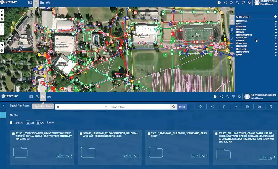
All project data is centralized in SiteMap®, a GIS platform that integrates directly into project workflows to support informed decision-making and reduce costly surprises. SiteMap is the solution construction professionals need to centralize real-time site information and reduce rework.
Suite of Aboveground and Below As-Built Solutions
GPRS provides a suite of services that include utility locating, concrete scanning, reality capture, video pipe inspection, and leak detection. These services are supported by advanced digital mapping and modeling solutions that help project teams mitigate risk, improve communication, and streamline construction across all phases.
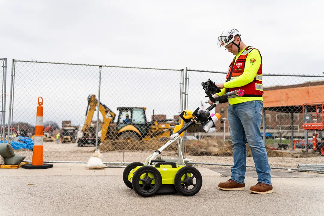
Utility Locating Solutions
Fact: A utility strike occurs approximately every 90 seconds in the United States, resulting in thousands of injuries and deaths over the past 20 years. These strikes, often caused by inadequate utility locating before digging, cost communities millions of dollars annually according to a report from Michigan Technological University. In 2022 alone, over 163,000 utility strikes were reported according to the Common Ground Alliance.
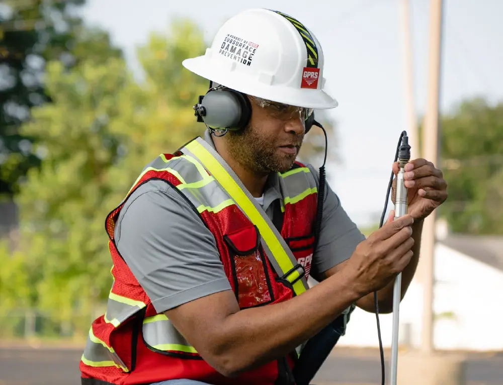
Accurate utility locating is critical to preventing costly and dangerous utility strikes. GPRS uses ground-penetrating radar (GPR) and electromagnetic (EM) locators to identify underground utilities before construction or excavation. SIM-certified Project Managers mark the location and depth of both public and private utilities, including gas lines, electrical cables, telecommunication lines, sewer lines, and other buried infrastructure using standardized color codes and symbols.
GPRS utility locating provides verified field data, information that is critical during pre-construction planning and excavation. It ensures that crews avoid damaging existing utilities, which can lead to project delays, safety incidents, and regulatory fines.
SiteMap stores geolocated, layered, and securely shareable interactive utility maps, and PDF utility maps. Users can export utility data into drawings, maps, and models to enable seamless communication and collaboration across project teams.
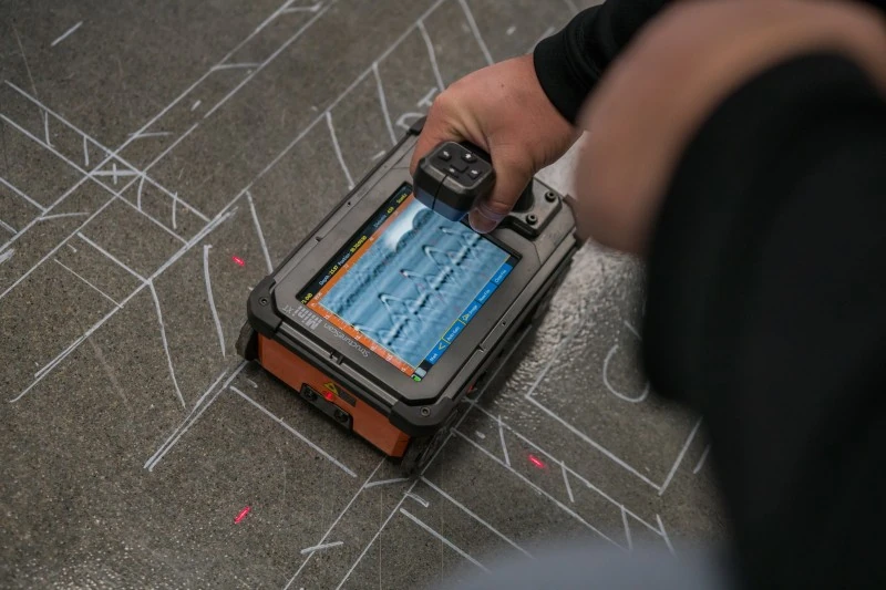
Concrete Scanning & Imaging Solutions
Fact: A single severed post-tension cable can cost upwards of $20,000 to repair/replace, and it can also lead to structural failure that endangers the lives of not only those completing the work, but anyone in the immediate area.
Before renovation, build-out, or excavation begins, existing concrete structures must be scanned to ensure safety and prevent damage. GPRS uses GPR to scan slabs, walls, and columns to detect embedded features such as rebar, post-tension cables, and conduit. This concrete scanning service provides precise detection and mapping, helping teams avoid structural damage and maintain compliance with engineering standards.
SiteMap stores LiDAR-captured field markings, 2D CAD files, 3D models, and detailed analysis reports for easy access and integration.
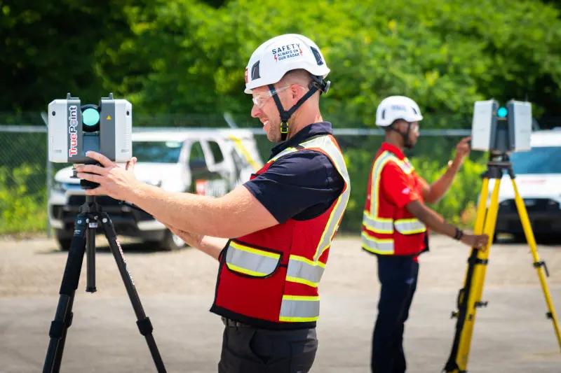
Reality Capture Solutions
Fact: A study from Dodge Data and Analytics, “Measuring the Impact of BIM on Complex Buildings,” found these results from AEC pros:
- 93% said BIM improved the quality and function of the final design
- 88% said BIM led to accelerated job completion
- 85% said BIM resulted in a reduction in the final construction cost
GPRS Reality Capture Services deliver precise as-built documentation of buildings and infrastructure using 3D laser scanning and photogrammetry. Deliverables include point clouds, 2D CAD drawings, 3D BIM models, mesh models, TruViews, and virtual tours that support accurate planning and construction.
Reality capture enhances collaboration by creating a digital twin of the physical site, accessible to all stakeholders. This shared access improves communication, supports better decision-making, and reduces errors. All reality capture data is uploaded to SiteMap, giving clients 24/7 access to verified documentation for planning, building, and facility management.
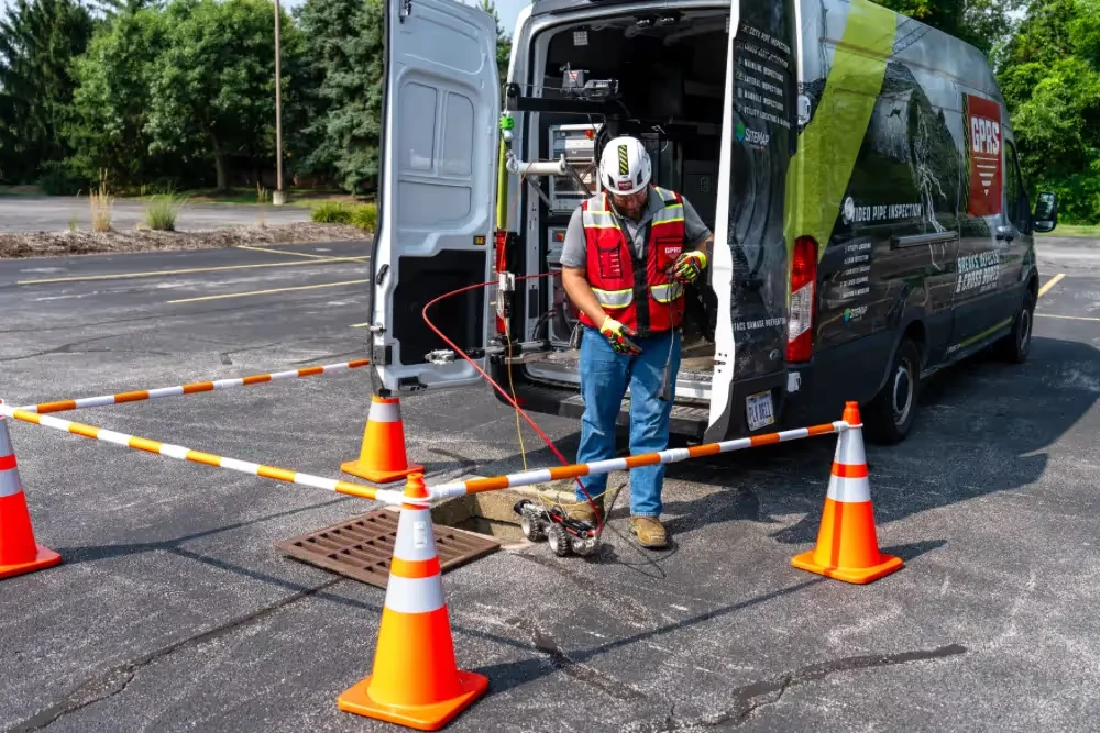
Video Pipe Inspection Solutions
Fact: Video pipe inspection can lead to substantial cost savings by identifying problems early, preventing them from escalating into expensive repairs. Some companies have reported a 90% reduction in maintenance costs after implementing video inspections according to 1st Choice Pro Services.
Most sewer pipe defects occur in buried infrastructure that cannot be inspected without excavation or specialized equipment. GPRS uses robotic crawlers and lateral launch CCTV cameras to inspect water and sewer systems. These video pipe inspections produce high-resolution video and defect mapping, documented in NASSCO-certified WinCan reports. Each defect is located, classified by severity, and integrated into a digital map.
SiteMap includes interactive sewer maps by segment, detailing entry and exit points, pipe condition, flow, length, material, images, and video. Hyperlinks to WinCan reports and footage allow clients to easily locate and assess sewer line conditions and defects.
Leak Detection Solutions
Fact: According to the Report Card for America’s Infrastructure, 6 billion gallons of treated water are lost daily to untreated leaks. 2.5 trillion gallons of water are lost annually to pipe defects. That's enough to fill 3.75 million Olympic-sized swimming pools.
Undetected water leaks can cause extensive damage to structures and utilities. GPRS uses acoustic and tracer gas technologies to locate leaks in pressurized water systems without excavation. These methods allow technicians to pinpoint leak sources quickly and accurately.
GPRS leak detection services provides detailed reports and recommendations to help clients resolve issues efficiently and minimize disruption.
Data Management Solutions: GPRS SiteMap GIS Platform
To unify and deliver the data collected through its services, GPRS developed the SiteMap GIS platform. This cloud-based system stores and visualizes utility, concrete, structural, architectural, MEP system information and VPI reports in a centralized, interactive software. SiteMap allows users to access accurate site information from any device, at any time.
The platform supports project planning, risk management, and compliance documentation. It integrates with CAD and BIM software, enabling seamless data exchange between field and office. SiteMap also includes tools for annotation, measurement, and version control, ensuring that teams always work from the most current information.
By consolidating data into a single source of truth, SiteMap eliminates the confusion and inefficiencies caused by fragmented communication. It empowers project teams to collaborate more effectively, reduce rework, and deliver projects on time and within budget.
How can GPRS help you centralize site data and reduce rework?
Click here to schedule a SiteMap demonstration.