

.svg)
Should You Rent, Buy, or Hire a GPR Service?
If you're considering ground penetrating radar (GPR) for your next project, you are likely to have questions about how it works, what it can detect, and whether it's better to rent, buy, or hire a service. This guide breaks down the key considerations, so you can make an informed decision that fits your project’s needs, timeline, and budget.
What is Ground Penetrating Radar (GPR)?
GPR is a safe, non-destructive technology that uses radar pulses to detect and map subsurface features. It’s commonly used to locate underground utilities, scan concrete for embedded objects, and provide detailed imaging for a wide range of applications, from construction and engineering to telecommunications and facility management.
What Can GPR Locate?
GPR can detect a wide variety of subsurface elements, including:
- Utilities: Gas, electric, telecom, and water lines, regardless of whether they are made of metal, PVC, or plastic, or what they carry.
- Concrete Features: Rebar, post-tension cables, conduits, and potential voids.
- Underground Structures: Tunnels, foundations, mines, and potential sinkholes.
- Infrastructure: Septic systems, drain fields, storage tanks, and more.
What are the Benefits of Using GPR Technology?
Using GPR technology for utility locating and concrete scanning before construction or excavation has several key benefits:
- Reliable underground data for better planning and design
- Reduced risk of damaging critical utilities
- Enhanced safety by identifying hidden hazards
- Improved job site coordination and efficiency
- Fewer delays from unexpected findings
- Minimized service disruptions
- Compliance with safety and regulatory standards
How Does GPR Work?
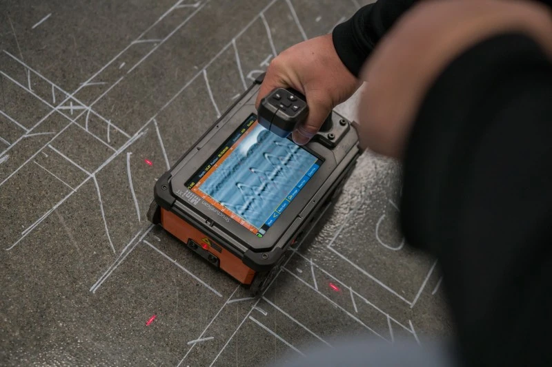
Ground penetrating radar works by sending radar signals into a surface, such as soil, concrete, or asphalt. When these signals encounter an object like a pipe, conduit, or rebar, they reflect back to the surface. A trained technician interprets these reflections to determine what’s below and where it’s located. GPR is a fast, safe, and highly accurate method for detecting subsurface features without the need for digging or drilling. Read Ground Penetrating Radar, Explained.

How Accurate is GPR?
GPR achieves a high level of accuracy, though results can vary depending on the type of material and the conditions of the ground.
At GPRS, we follow strict standards to ensure reliable results in any environment. When scanning concrete, our equipment typically achieves accuracy within ±¼ inch to the center of an object and ±½ inch to its depth. For utility locating, accuracy is generally within ±6 inches to the center and ±10% of the depth. Concrete antennas provide higher resolution for detailed imaging but have limited depth range, while utility antennas scan deeper with slightly lower resolution. Understanding the strengths and limitations of each system helps ensure the right tool is chosen for your project.
How Fast is GPR Data Collected?
GPR data collection is quick, often just a few minutes for small areas. For example, scanning a concrete slab or room may take 5–15 minutes. Larger areas like performing utility locating services for parking lots or construction sites may take a few hours, depending on size and complexity. Speed is influenced by several factors, including the surface type (soil, concrete, asphalt), the level of detail required, and any obstructions or access limitations.
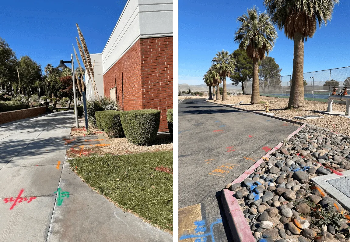
How Do Clients Receive GPR Data After it's Marked on the Ground?
Once GPR locations are marked on the surface, typically using color-coded paint, flags, or chalk for quick visual reference, the data is shared with clients through a combination of field markings, detailed reports, and digital deliverables. Technicians provide a summary of findings that include descriptions of detected features, estimated depths, and supporting site photos. What Do the Utility Marking Colors Mean?
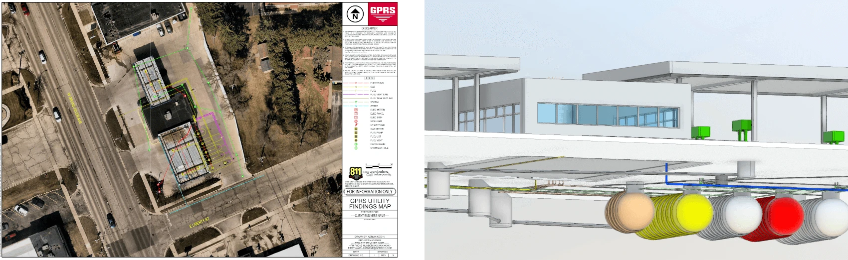
GPR data can be delivered in various digital formats, including PDF utility maps for clear documentation, KMZ files with geolocated points marking specific subsurface features, and SHP files for detailed utility mapping compatible with GIS software.
To create a permanent digital record of surface markings for design and planning, 3D laser scanning or photogrammetry may be used. Data is often provided in BIM, CAD, or GIS formats such as RVT, DWG, DXF, DGN, and more.
GPRS also offers SiteMap®, a cloud-based platform where clients can easily view, download, and manage their subsurface data.

What Does it Cost to Rent a Ground Penetrating Radar Unit?
Based on actual KWIPPED Marketplace supplier quotes, ground penetrating radar rental costs are:
Daily: $284
Weekly: $1,138
Monthly: $3,406
While renting may seem cost-effective for short-term use, it comes with challenges. GPR rental requires significant training and experience to operate effectively. Short rental periods may not allow enough time to become proficient, and interpreting the data without expertise can lead to errors. Environmental factors like wet clay, salt, or rough terrain can also impact results. Over time, frequent GPR rentals can become more expensive than purchasing equipment outright.
When is it Better to Rent GPR Equipment?
Renting is best for short-term projects. It's not cost-effective to buy GPR equipment for just one use. It’s also useful if you already have trained staff and just need temporary access to the technology.
What Does it Cost to Purchase a Ground Penetrating Radar Unit?
Based on actual KWIPPED Marketplace supplier quotes, the cost to buy a ground penetrating radar unit is:
Average purchase price: $19,228
Purchasing GPR equipment offers long-term advantages. It lets you control usage fully. You can customize it for your project's needs. Plus, it removes those recurring rental fees. While the initial investment is higher, ownership becomes more cost-effective for regular users. It also ensures faster deployment and steady availability. Plus, it boosts project efficiency with reliable, high-quality subsurface imaging.
Who Should Consider Buying GPR Equipment?
Organizations that often perform subsurface investigations, such as construction firms, environmental consultants, or utility companies, can benefit from purchasing GPR equipment. It allows for flexible use, faster deployment, and long-term cost savings.
What is the Downside to Buying GPR Equipment?
Buying GPR equipment requires a big upfront cost. Also, owning it means handling tasks like maintenance, software updates, storage, and training staff. It’s not ideal for occasional use or teams without GPR expertise.
Why Hire a Ground Penetrating Radar (GPR) Service?
Hiring a GPR service is a smart choice. You get expert subsurface imaging without the hassle of owning equipment. It’s efficient and cost-effective. Professional GPR service providers offer expert knowledge and the right tools. Their experience helps interpret data better, leading to more accurate and useful results. This is ideal for critical projects, or when a fast turnaround is essential. Outsourcing takes away the hassle of maintaining equipment, updating software, and ensuring safety compliance. This makes it a cost-effective and low-risk choice.
What are the Benefits of Hiring a GPR Service?
- Expertise and Accuracy: Trained technicians assess the site, select the right equipment, and deliver precise data interpretation, reducing the risk of errors.
- Speed and Efficiency: GPR scans can be completed quickly, with real-time results and rapid post-processing, helping to keep projects on schedule.
- Access to Advanced Technology: Service providers often use the latest GPR systems, ensuring high-resolution imaging and reliable detection of subsurface features.
- Improved Safety: Accurate location of utilities, rebar, and other hidden hazards minimizes the risk of accidental strikes during excavation or drilling.
- Cost Savings: For short-term or infrequent needs, hiring a service is more economical than purchasing equipment, avoiding costs related to storage, maintenance, and training.

What Factors Should Influence My Decision to Rent, Buy, or Hire a GPR Service?
Think about your project's frequency, budget, timeline, staff skills, and how accurate you need it to be. If you need fast, reliable results without investing in training or equipment, hiring a GPR service is usually the best choice.
What are Some Examples of Projects Where Hiring a GPR Service is the Best Option?
On a construction site, before excavation begins, GPR is used to locate underground utilities like gas lines, water pipes, and electrical conduits. It is best to hire a GPR service for expert interpretation and safety compliance, especially for one-time or high-risk projects.
When renovating an office building, GPR is an essential tool for scanning concrete slabs to locate rebar, post-tension cables, and conduits before coring or drilling. For the most accurate results and safety assurance, it's best to hire a professional concrete scanning service.
During Phase I or II environmental investigations, GPR is used to detect buried tanks, drums, or other anomalies. It is best to hire a service for accurate data collection and reporting, especially when regulatory compliance is required.
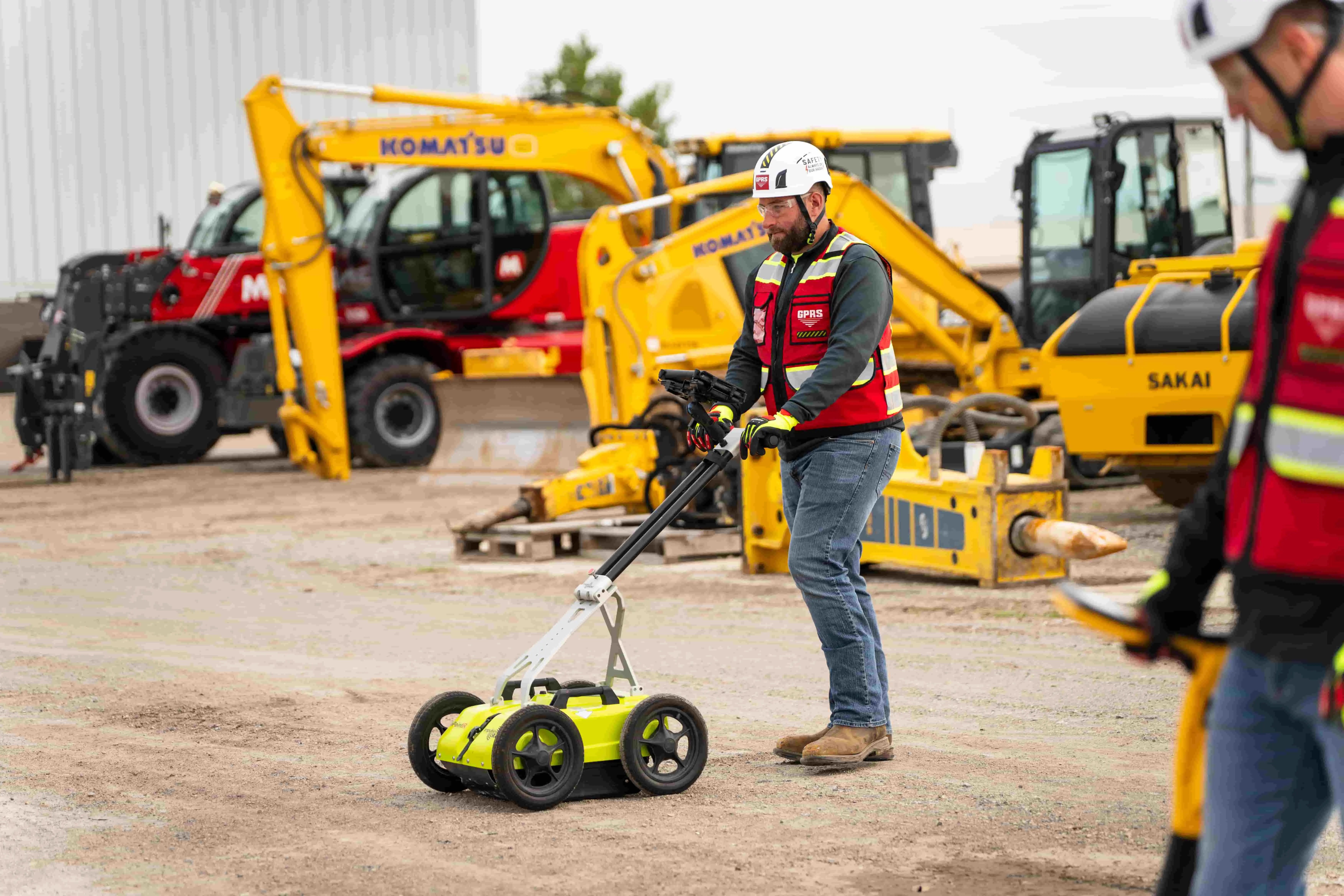
Why Hire GPRS?
Every decision you make on a job site can cost time, money, and even lives. That’s why GPRS maintains a consistent 99.8%+ accuracy rate in GPR utility locating and concrete scanning & imaging. Because it’s our job to help you keep your jobs on time, on budget, and safe.
Our nationwide team of elite Project Managers aren’t just expert technicians – they are consultants who help you get what you need to do the job right, and safely. GPRS has completed over 500,000 utility locating and concrete scanning projects across the U.S.
Every GPRS Project Manager is trained in and follows our Subsurface Investigation Methodology (SIM), an industry-leading training program that ensures elite-level performance.
Our teams use multiple technologies to deliver the most accurate utility locating and mapping data available. Whenever possible, we include line depths in our locates and offer flexible data visualization options tailored to your needs.
All data is mapped directly on the site, plus can be mapped in CAD and 3D and uploaded into an interactive, facility management platform, SiteMap, providing accurate, real-world information collected directly from your jobsite.
Before any construction or excavation begins, knowing what lies beneath the surface is critical. GPRS helps you plan with confidence, avoid costly surprises, and keep your project on track.
If you’re looking for ground penetrating radar rental, ground penetrating radar rental near me, GPR rental, GPR rental near me, concrete scanner rental, rebar scanner rental, or concrete scanning service near me, perhaps hiring a GPR utility locating and concrete scanning & imaging service could be the best option for you. Reach out to GPRS for a free project quote today.