

.svg)
Whether it’s 10,000 square feet or 200,000 square feet, it’s what’s in the space that matters. And what matters the most to you is receiving precise, high-quality as built data of your building and infrastructure. 3D laser scanning will capture a 3D digital representation of your site with millimeter accuracy.
How much can be 3D laser scanned in a day? The amount of space that can be 3D laser scanned in a day can widely vary depending on the complexity of the environment being scanned, the 3D laser scanners used on site, the experience of the project manager, and the level of detail requirements.
The Environment Being Scanned
The time it takes to laser scan a building or site can vary depending on the project size and complexity. It’s important to take a number of factors into consideration to determine the length of time each 3D laser scanning project will take: square footage, number of rooms, building complexity, building occupancy, and level of detail required.
For example, GPRS can 3D laser scan a vacant commercial building or a small mechanical room in one day. A large manufacturing facility could take a few days, depending on how densely packed the equipment is.
According to Nate Baker, Service Line Leader for 3D Laser Scanning, "Depending on the scope of the project we can complete a 10,000 square foot office or a 200,000 square foot warehouse in a day. Often, we can determine the project scope with a short virtual meeting, or we can schedule a complete site walk to ensure our quote is 100% aligned to your requirements.”
For complex structures, such as multi-room spaces or multi-floor spaces, data capture can be expedited with the RTC360, a lightweight and portable 3D laser scanner. For dense MEP rooms, the Leica P50 ScanStation can be used to accurately map the equipment and piping in high detail. Some sites, such as manufacturing plants in operation or occupied office buildings, will have special requirements, such as evening or weekend scanning.
It’s important to take all of these factors into consideration when determining the amount of time it will take to 3D laser scan a site. That’s why GPRS works closely with each client to define the project scope and requirements -- and develop customized quotes and timelines for each project.
3D Laser Scanners Used on Site
The 3D laser scanning equipment selected will determine the time it will take to laser scan the site. There are many brands of professional laser scanners with various speed, range, and accuracy. For example, in less than 2 minutes, the Leica P-Series laser scanners can capture 1 million points per second with a range of more than 1 kilometer with 2-4mm accuracy. And the Matterport Pro3, updated with LiDAR-based scanning, captures 20mm accuracy within a 10m range (with a maximum 100m scanning range), collecting 100,000 points per second in under 20 seconds per sweep.
GPRS Project Managers are highly trained to assess the project scope and determine the best laser scanner to use on site to achieve your project goals.
To begin laser scanning a site, a scanner is placed on a tripod, leveled, and set up to the project requirements. Control points are established and a site plan is created. To ensure the complete capture of a project, scanners are positioned according to the site plan to capture data from varying viewpoints. The scanner’s range and level of detail determines the distance between these scan positions.
Once the site is scanned, post processing and data alignment must be completed to ensure accuracy. Some laser scanners pre-register scans in the field to expedite registration.
GPRS Project Managers undergo an extensive training program to ensure their competence in laser scanning equipment, field knowledge, and providing the best possible results for each project. GPRS Project Managers have the following laser scanners for data capture: the Leica P-Series ScanStations, Leica RTC360, Leica BLK360, and Matterport Pro3. Each scanner has a unique range and accuracy.

Leica P-Series ScanStation (P50/P40/P30)
- Long-range scanner with a 1-kilometer range reduces field and setup time.
- Unparalleled point cloud data with 2-4mm accuracy, plus HDR imaging.
- High-speed scan rate of 1 million points per second.
- Survey-grade point cloud ties to coordinate system, verifying locations to deliver accurate and reliable data.
- Features a dual-axis compensator to mitigate movement and ensure level scans, the foundation for precise point clouds.

Leica RTC360 Laser Scanner
- Powerful, mid-range laser scanner provides 2-6mm accuracy.
- Lightweight and portable, weighing less than 12 pounds with a collapsible tripod.
- Highly-automated, one-button operation for fast, hassle-free scanning.
- Extremely high-speed scan rate of 2 million data points per second.
- Captures colorized point cloud and HDR imagery in under 2 minutes.
- Visual Inertial System (VIS) pre-registers scans in the field, expediting registration.
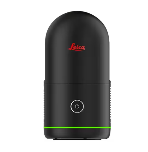
Leica BLK360 Laser Scanner
- Used for smaller applications, this compact laser scanner fits in a backpack, and weighs under 2 pounds.
- Short range scanner with a 60m range captures 4-7mm accurate point clouds and HDR spherical images.
- Quickly completes a scan in 20 seconds, capturing point clouds at a rate of 680,000 points per second.
- Hassle-free and highly-automated one-button operation.
- Visual Inertial System (VIS) pre-registers scans in the field, expediting registration.
- Quickly exports LGS or RCP files to Autodesk Suites.
- Stream point cloud data and HDR images to an iPad or Cyclone Register 360 via Wi-Fi.

Matterport Pro3
- Scan both indoor and outdoor spaces to produce full-color digital twins with LiDAR and camera at a 10m range with 20mm accuracy.
- Versatile scanning range (0.5m to 100m) offers flexibility in data capture.
- Data is collected at 100,000 points per second in under 20 seconds per sweep.
- A custom 30-megapixel sensor and 12-element lens produces excellent quality 6068 x 3413 photos, downloadable in a JPG format.
- Recommend that technicians do not exceed 8m between scans for large, open areas.
- The Pro3 E57 point cloud has 10 points per degree vertically and 10 points per degree horizontally.
An Experienced Project Manager
There is a significant learning curve to attaining proficiency in 3D laser scanning. GPRS Project Managers go through a rigorous training program to learn equipment use and best practices. Not only do they learn how to use the laser scanners, they learn efficient workflows, alignment, registration, data clean-up, target usage, and software.
GPRS Project Managers are educated on the best scanner to obtain the level of accuracy required by the client. They will complete the job efficiently, meaning fewer labor hours, and lower costs for your project.
More complex projects may require a team of Project Managers, or multiple days on site to complete the scanning process efficiently. No matter what the job – whether it would be scanning a huge data facility or a chemical reactor - GPRS Project Managers are trained to do the job right the first time.
We refer to our team members as Project Managers because they manage each project from start to finish and are highly trained to assess the scope of the project, provide a detailed quote, and deliver millimeter-accurate as built data, maps, and models.
Level of Detail Requirements & 3D BIM Modeling
The term “Level of Detail” (LOD) is used by architecture, engineering, and construction (AEC) professionals to describe the amount of information and detail that needs to be included in a 3D BIM model. When 3D laser scanning a site, it is important that the Level of Detail required for the model is defined. This will determine the accuracy of the 3D laser scan and the point cloud data captured.
GPRS’ Mapping & Modeling Team will refer to the Level of Detail requirements to build the graphical and non-graphical information of each element in the building information model.
Consult with your GPRS Project Manager to define the LOD requirements for an accurate estimate based on the specific requirements of your project. By using LOD specifications, the GPRS Mapping & Modeling Team can clearly execute the precision requirements of the BIM model for faster project delivery.
What is Level of Detail for BIM Models
So How Long Does It Take to Laser Scan?
These are some general calculations for a single laser scan with the Leica P-50 ScanStation:
- Project set-up (5 minutes)
- Camera scanning and rotating (2 minutes)
- Moving the camera to the next scan location (2 minutes)
- Multiply this by the total number of scans required to cover the area
A Project Manager can estimate the total number of scans for your project and provide a good estimate of the time it will take to perform 3D laser scanning services.
As each position’s scan is completed, a reduced data set that includes a point cloud and image is made instantly available to the Project Manager via a tablet or mobile device, so that they can annotate, tag, add additional field photos, and even record audio messages to document field notes on the point cloud survey, so that nothing is lost or left to memory.
Once the full survey is finished, the higher resolution point cloud, photos, and the Project Manager’s notes are then sent to our talented and skilled Mapping & Modeling team to register and process the point cloud data into the deliverable that best suits your needs.
The GPRS Mapping & Modeling team can deliver the raw point cloud data or create customized maps and models such as virtual tours, 2D sheets, 3D meshes, and BIM models for each client. Projects are uploaded to cloud-based data platforms, delivered via Sharefile, or sent on a hard drive.


What Are Some of the Applications for 3D Laser Scanning?
There are an infinite variety of real-world laser scanning applications. Here are some of the most common ways 3D laser scans are used:
- As built survey, reality capture, or existing conditions survey
- Construction verification, sequencing, and scheduling
- Design engineering for facility upgrades or expansions
- 2D and 3D map of a building
- Prefabrication
- Clash detection
- Architectural documentation or historical preservation
- Calculating volumes, deformation analysis, and overhead clearances
- Virtual design and construction
- Collecting geospatial data
- Creating a digital twin
- Performing advanced analysis to easily aggregate, query, visualize and analyze data
Your application will determine what kind of scan, the necessary resolution of the point cloud and photography, and what kind of maps, models, and drawings, your project requires.
What Industries Use 3D Laser Scanning?
Why Call GPRS 3D Laser Scanning? The GPRS DIFFERENCE
GPRS is one of the top laser scanning service providers in the United States. We have Project Managers in every major U.S. market equipped with 3D laser scanners to quickly document accurate site data.
Our Project Managers undergo an extensive training program to ensure their competence in laser scanning equipment, field knowledge, and providing the best possible results for every project. Our Mapping & Modeling Team constantly advances their education to improve efficiency and expedite deliverables for clients. Constant personal development enables us to provide the best quality and service.
When you hire GPRS, you know you’re hiring the most accurate in the business who will get the job done right – and fast – the first time