

.svg)
The Hidden Cost of Inaccurate Data in Construction
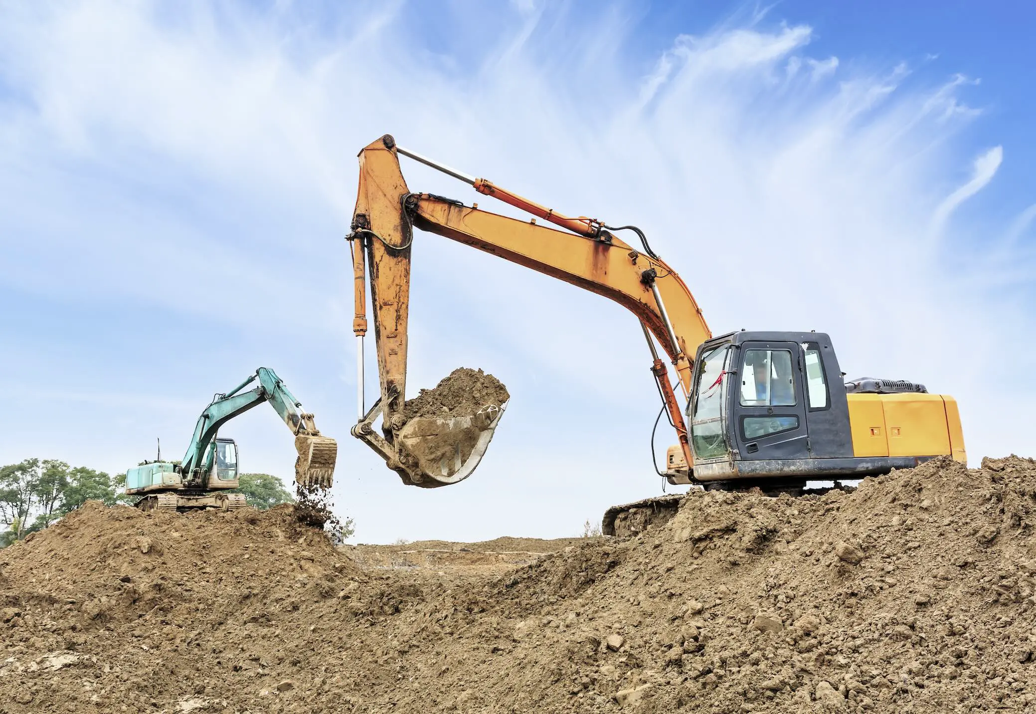
In construction, costly delays and budget overruns are often blamed on field conditions, design changes, or unforeseen issues. But in reality, many of these problems stem from a much earlier point in the project lifecycle: incomplete or inaccurate information.
For excavation, utility, and general contractors, issues like utility strikes or MEP rework may feel like routine setbacks. However, when viewed at scale, these incidents represent a much larger, industry-wide problem, one that costs billions of dollars each year.
The True Cost of Utility Strikes
Striking an underground utility is more than just an inconvenience, it’s a major financial and operational risk.
According to the Common Ground Alliance (CGA), utility strikes cost the United States an estimated $30 billion annually, with a strike occurring approximately every 10 seconds across North America. On average, a single strike costs around $56,000 per incident and can cause 8–12 weeks of project delays.
These incidents don’t just impact budgets. They can also create serious safety hazards, damage critical infrastructure, and strain relationships between project stakeholders.
Concrete Scanning Mistakes Add Up Quickly
Above-ground risks can be just as costly.
Cutting, coring, or drilling into concrete without accurate information can result in severed post-tension cables, damaged conduit, or compromised structural reinforcement. Even a single mistake can cost $20,000 or more to repair, not including potential safety risks, structural impacts, and project delays.
These risks highlight a common theme: when teams lack precise visibility into existing conditions, even routine work can lead to expensive consequences.
Rework: The Silent Budget Killer
While utility strikes and scanning errors are highly visible, rework is often the most significant, and least understood, cost driver in construction.
Industry research from PlanGrid and FMI shows that 48% of all construction rework is caused by poor data and miscommunication, resulting in more than $31 billion in avoidable costs each year.
On average, rework consumes 5–9% of a project’s total budget. For a $50 million commercial project, that translates to $2.5 million or more in preventable costs.
Rework doesn’t just impact finances, it affects schedules, productivity, and team morale. And in most cases, it can be traced back to missing, outdated, or inaccurate project data.
The Root Problem: Incomplete or Inaccurate Information
Despite advances in construction technology, many projects still rely on:
- Outdated as-built drawings
- Fragmented documentation
- Inconsistent field verification
- Disconnected data sources
When teams plan, design, or excavate using incomplete information, they’re often forced to make assumptions, and assumptions introduce risk.
Before any shovel hits the ground, any drill touches concrete, or any design is finalized, the quality of your data determines the outcome of your project.
How Accurate Data Reduces Risk
The key to avoiding utility strikes, minimizing rework, and keeping projects on schedule is simple in concept: start with accurate, field-verified data.
Modern technologies now allow teams to clearly understand both above-ground and subsurface conditions before work begins. These include:
- Ground penetrating radar (GPR) and electromagnetic locating for subsurface utilities and concrete imaging
- 3D laser scanning and photogrammetry for precise existing conditions
- Video pipe inspection for underground infrastructure
- CAD and BIM modeling and GIS platforms for centralized data access
When combined, these tools provide a complete view of a project site, reducing uncertainty and enabling better decision-making at every stage.
GPRS Solutions for Your Company
GPRS delivers accurate, actionable data that helps reduce the billions of dollars lost annually to utility strikes, minimizes costly rework caused, and supports smarter planning, design, and construction.
Whether you’re planning a renovation, preparing for excavation, or validating existing conditions, working from incomplete or inaccurate data is a gamble.
One missed utility, one hidden obstruction, or one incorrect assumption can bring an entire project to a halt.
Accurate data doesn’t just improve efficiency, it protects your schedule, your budget, and your team.
GPRS Services and Deliverables

Utility Locating
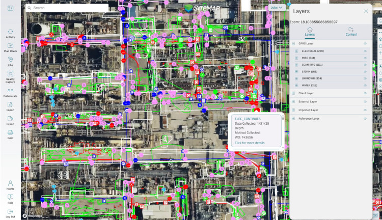
Know exactly what’s below the surface before excavation begins. GPRS provides private utility locating using ground penetrating radar (GPR), electromagnetic (EM) locators, and RTK positioning. We identify underground utility location, depth information where possible, mark findings on-site, and deliver GPS-enabled maps in .KMZ, .SHP, .PDF, CAD, and BIM formats. Layered digital maps and 3D virtual tours are available in the SiteMap GIS platform, giving your team a clear, accurate view of subsurface utilities.
Concrete Scanning
Cut, core, and drill safely with precise identification of rebar, conduit, and post tension cables. Concrete scanning mark outs clearly identify safe cutting areas on-site, while CAD and BIM deliverables provide precise digital models and drawings for planning, coordination, and long-term project documentation. Our Green Box Guarantee ensures areas marked in a green box are clear of obstructions.
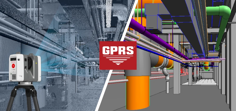
3D Laser Scanning
Capture your site with millimeter-level precision. GPRS provides 3D laser scanning, photogrammetry, and BOMA measurement services using state-of-the-art equipment and processes. Deliverables include point clouds, 2D CAD drawings, 3D BIM models (including Revit), 3D mesh models, TruViews, subscription-based 3D virtual tours (LiDAR or photogrammetry), floor contours, reflected ceiling plans, BOMA lease plans and area analysis, and more with an accuracy of 2–6 millimeters.
Video Pipe Inspection
Understand underground sewer infrastructure before problems escalate. GPRS deploys robotic mainline crawlers, lateral launch cameras, push cameras, and manhole cameras to inspect mains, laterals, and manholes. All inspections are performed by NASSCO-certified Project Managers and coded to PACP, LACP, and MACP standards. GPRS VPI services assess pipe conditions, document cross bores and defects, and map wastewater, sanitary, and storm sewer infrastructure. Inspection reports are delivered through WinCan video pipeline inspection software, providing detailed defect location maps and severity ratings based on NASSCO coding standards. All GPRS VPI reports are accessible within the SiteMap® sewer layer, enabling your team to quickly understand system conditions and make informed decisions before repairs, helping avoid costly and disruptive excavation.
Leak Detection
Find hidden water loss fast. GPRS offers acoustic leak detection services for municipal, industrial, and commercial water infrastructure. Services include subsurface leak detection, water main leak detection, water loss surveys, emergency leak detection, fire suppression system checks, and valve exercising. Acoustic detection is paired with leak correlation technology for real-time verification and can be integrated with VPI services and utility locating services.
What You Get on Every Project
On site, we go above and beyond basic service providers to give you accurate data with a suite of deliverables customized to your project’s stands. We provide:
- Clear, accurate field markings
- Precise, high-quality GNSS RTK data collection
- 3D reality capture site documentation
- Custom CAD and BIM deliverables
- Sewer and water system insights
- Pinpoint leak detection
- Comprehensive job summary reports
- 24/7 access to deliverables via SiteMap
Access Your Data Anytime with SiteMap
GPRS doesn’t just deliver data; we provide GIS software access for you to share all of GPRS’ deliverables with project stakeholders.
All GPRS customers receive complimentary SiteMap Personal access upon utility locating project completion. This secure, shareable GIS platform is available 24/7 via computer, tablet, or smartphone mobile app. Consistent, reliable access to your data means you can check in whenever you need to, from wherever you are, Your team receives personal access to as-built data, maps, and models you can trust.
SIM-Certified Accuracy You Can Trust
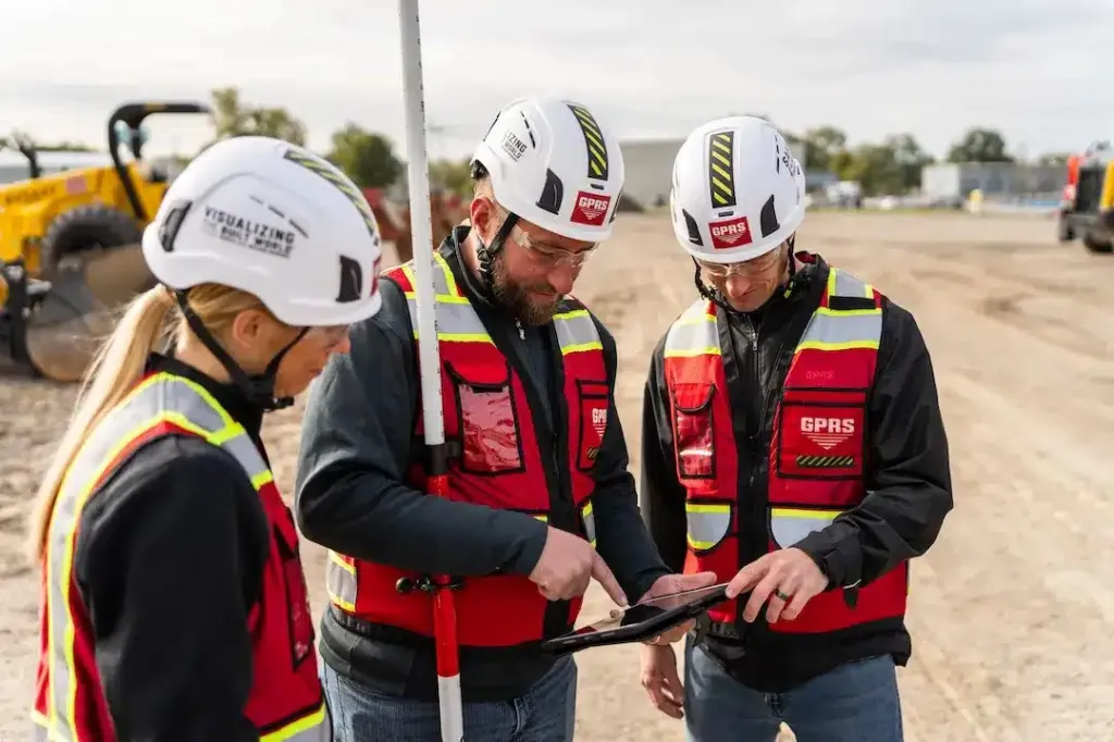
Every GPRS Project Manager is SIM-certified in Subsurface Investigation Methodology, the most comprehensive training program in the industry for utility locating, concrete scanning, and reality capture. This structured, repeatable process ensures safe, accurate data collection across every project.
SIM certification includes over 400 hours of field and classroom training, where Project Managers are trained to use GPR and EM locating technologies, follow proven workflows, and deliver consistent, high-accuracy results. This training enables teams to identify subsurface features such as utilities, rebar, and post tension cables with a < .20% incident rate on more than 1 million jobs nationwide.
For 3D laser scanning services, GPRS Reality Capture Project Managers complete an additional 40 hours of specialized LiDAR training, ensuring expertise in scanning equipment, data capture, and field execution. This results in highly accurate point cloud data with typical tolerances of 2–4 millimeters.
For customers, this means reduced risk, safer projects, and reliable data you can trust to support confident decision-making.
A Commitment to Accuracy, Transparency, and Service
We combine cutting-edge technology with an unwavering commitment to service, but what truly defines GPRS is how we treat our customers. Every client is our top priority. Every project receives our full attention. We want you to feel like you are our only customer, because when your team needs answers, you deserve an expert you can trust.
Our Project Managers make sure you understand exactly what was completed, what was found, and what it means for your next steps. There are no gaps, no guesswork, just complete transparency and reliable information you can act on.
Build with Confidence
As construction projects become more complex and margins become tighter, the importance of reliable data continues to grow.
Before you:
- Break ground
- Cut or core concrete
- Begin design or renovation
- Manage your facility’s assets
Make sure you’re working with accurate, field-verified information, above and below ground.
Contact us today to learn how GPRS can help you eliminate risk and gain complete visibility into your project before work begins.