

.svg)

Highlights
THE BOTTOM LINE
GPRS utility locating allowed for safer, accurate design and installation of a nuclear power plant security barrier in keeping with strict government regulation.
Industry
Power
Service
Utility Locating, Utility Mapping, SiteMap®
Location
GPRS Project Manager Insight
“My goal is to deliver the best services and create the safest jobsite possible for my clients.” — Stephen Rochholz, Area Manager
Deliverables
Utility Maps: CAD, PDF, KMZ and SHP file exports, all available in SiteMap
PROJECT APPLICATION
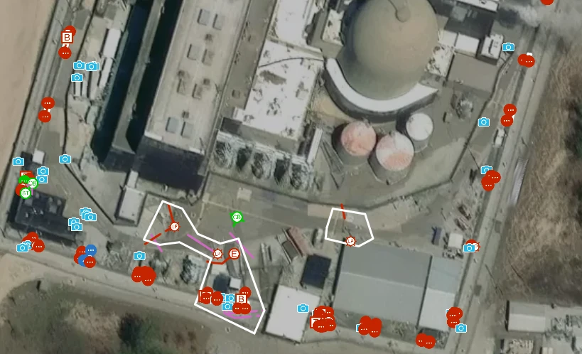
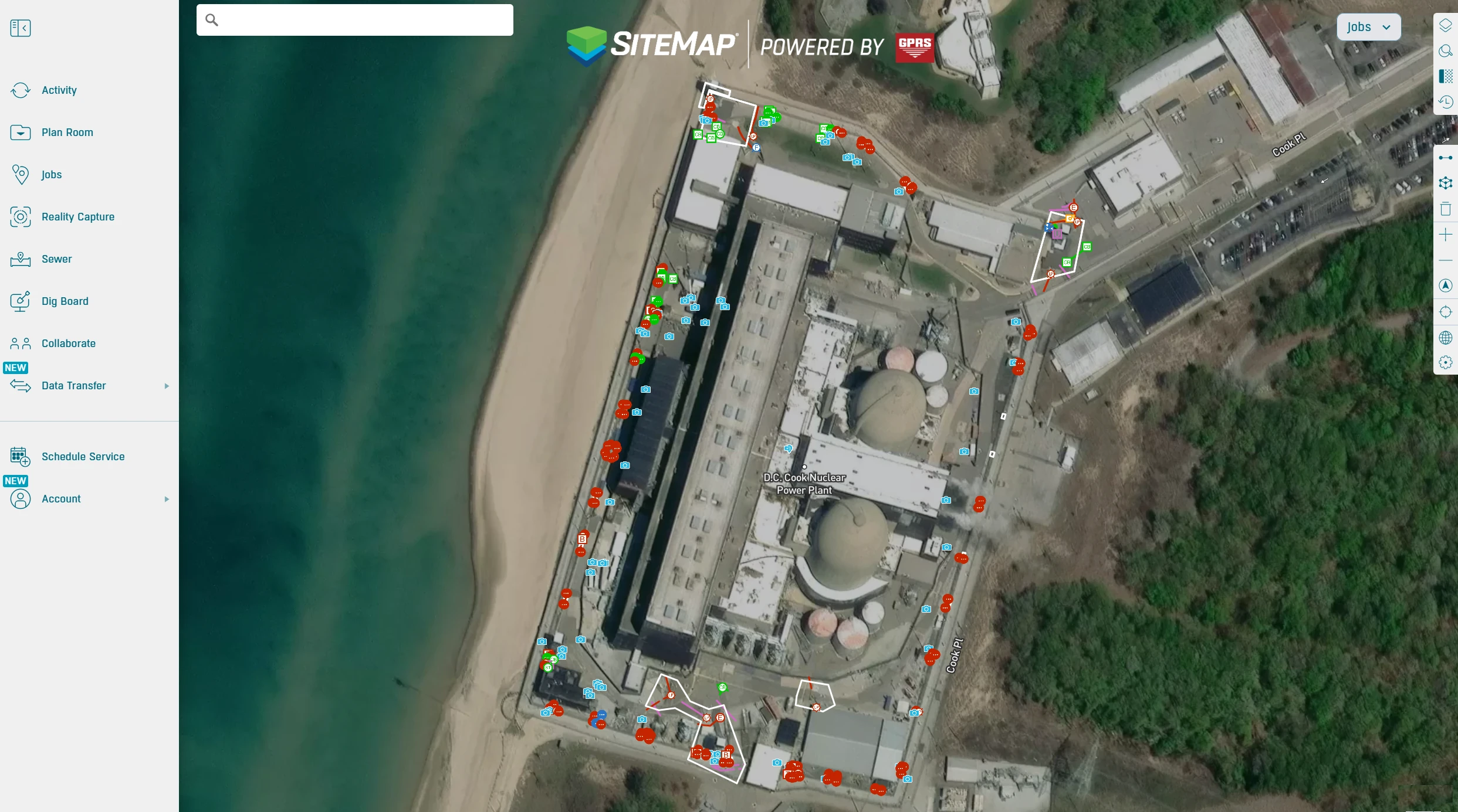
Utility Locating at Power Plant
ASK
Task
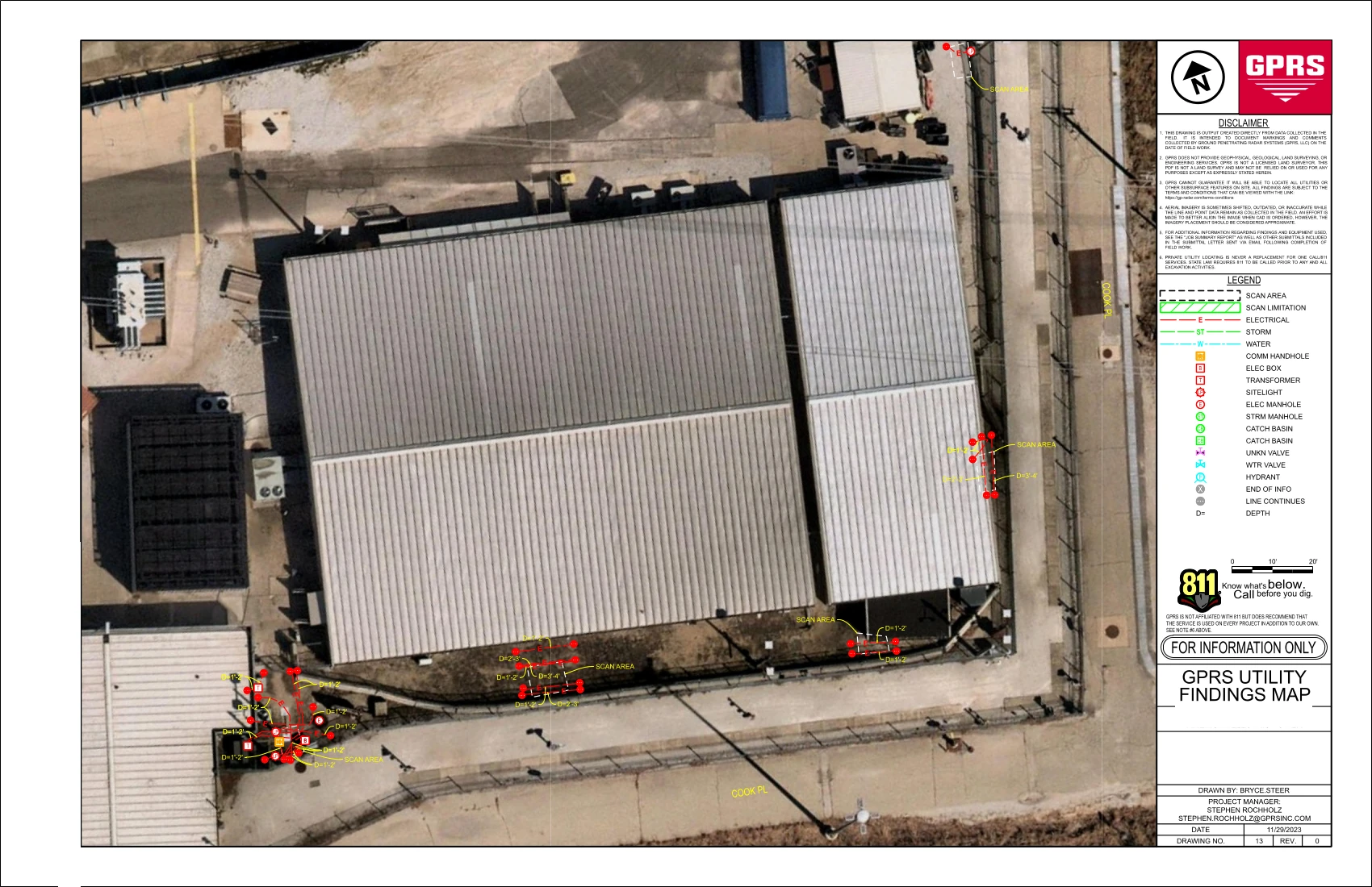
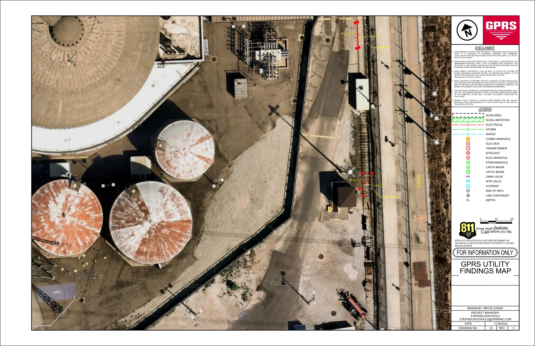
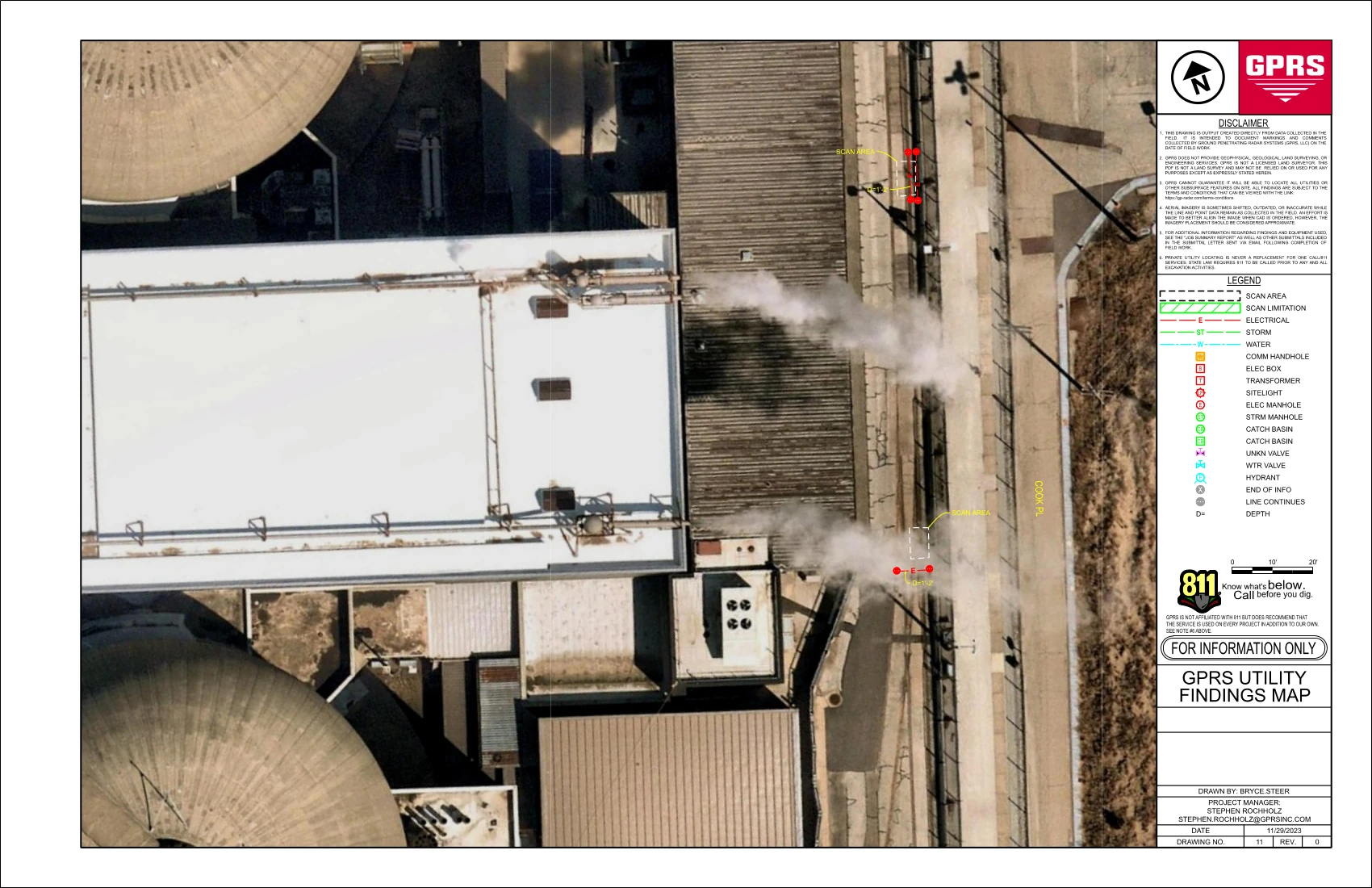
Providing accurate utility locations and mapping to support installing a new fence at a power plant. The general contractor required accurate subsurface information for: 30 areas in preparation for 4 ft. x 4 ft. concrete block installation; 2 areas planned for hydro-excavation and footer installation; and 4 areas where the client suspected concrete fence post supports were buried.
PROBLEM
Nuclear plant security fencing is governed by strict federal regulations. The planned new security barrier required installing fence posts using an auger, a high risk activity without accurate subsurface utility data.
Complicating factors included:
- Extensive private utilities not marked by 811
- The presence of high voltage electrical, water, and storm sewer lines
- The need to maintain plant security and operational continuity throughout the project
Solution
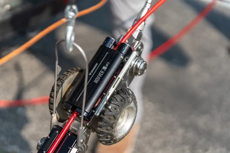
GPRS deployed advanced locating technologies, as part of the Subsurface Investigation Methodology process (SIM), including:
- Ground Penetrating Radar (GPR)
- Electromagnetic (EM) pipe and cable locating
GPRS identified both metallic and non-metallic utility lines, including high voltage lines, enabling accurate subsurface mapping. All utilities were clearly marked on the surface using paint, flags, and appropriate indicators.
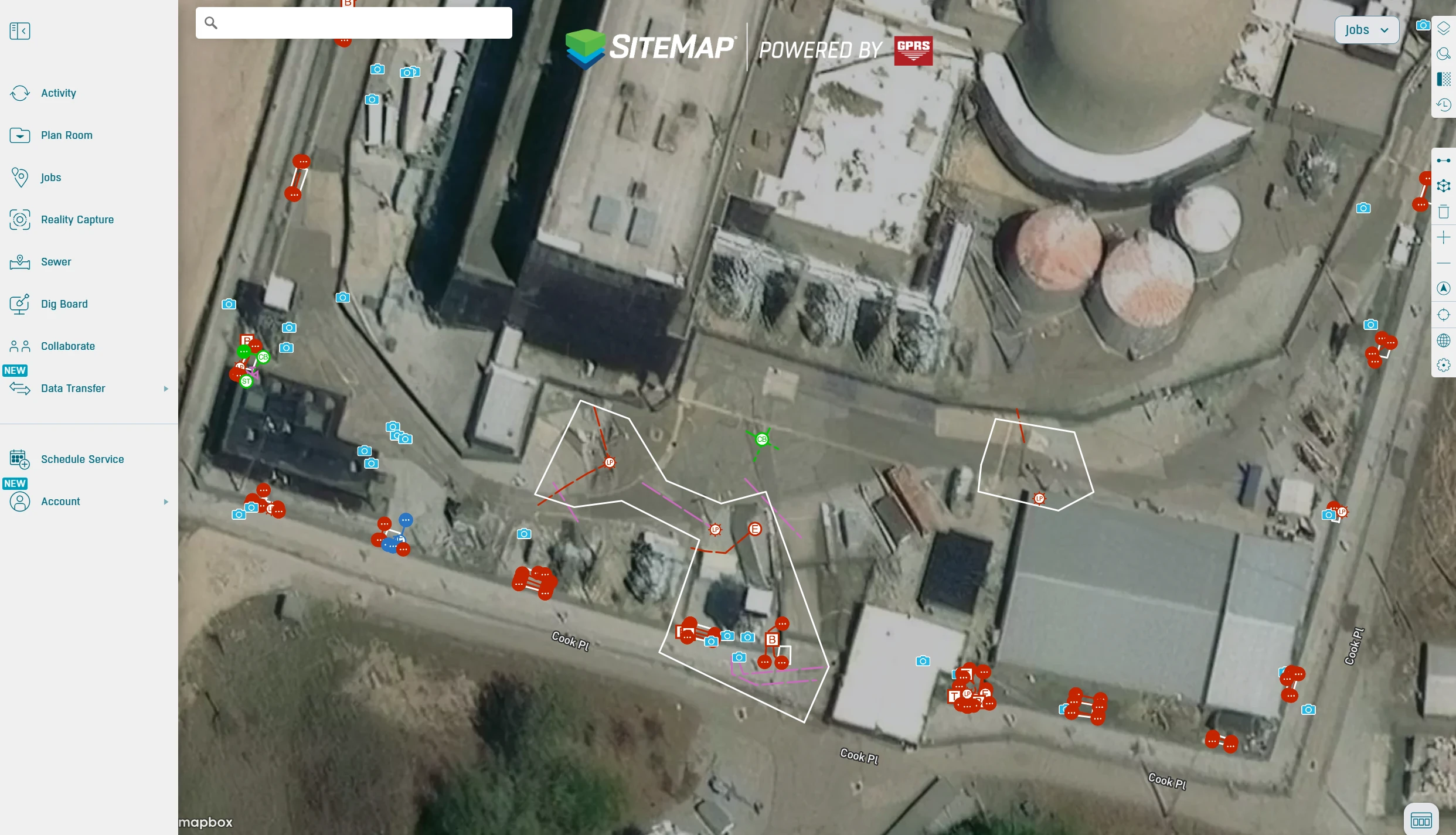
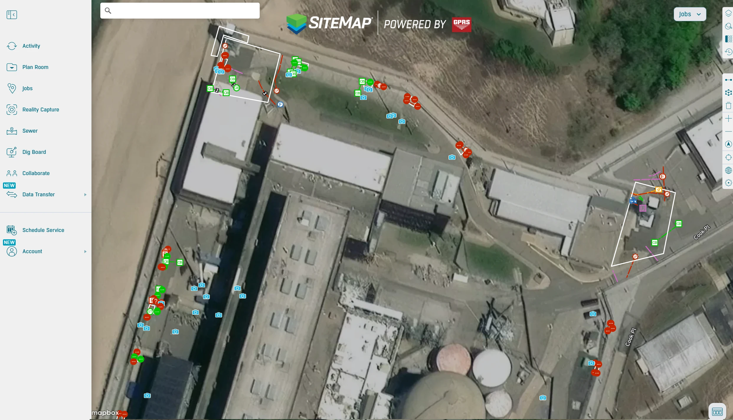
All findings were collected via GPS and delivered through SiteMap®, GPRS’ GIS platform, providing:
- CAD and PDF utility maps
- KMZ and SHP file exports
- Full digital map viewer access for collaboration and project coordination
Benefits
The client relied on GPRS to deliver precise, field‑validated utility locations and digital maps, ensuring safe excavation and installation.
- GPRS SIM certified, security cleared Project Managers, performed consistent, high quality locating in a sensitive environment
- Accurate, field validated utility data helped the client eliminate guesswork and reduce the risk of strikes during excavation
- Centralized, digital utility maps in SiteMap foster seamless communication and collaboration across the project team
CASE STUDY GALLERY


.avif)

