

.svg)

Highlights
THE BOTTOM LINE
Reality capture provides the precise spatial data needed to power wayfinding apps and enable real-time AR navigation to help users confidently navigate complex indoor and outdoor environments.
Industry
Healthcare
Service
Reality Capture
Location
Altanta, Georgia
GPRS Project Manager Insight
Reality capture plays a significant role in enhancing wayfinding, particularly in complex indoor or large outdoor environments. It allows for the creation of accurate digital representations of real-world spaces that can then be used by software companies to develop intuitive and efficient navigation systems.
Deliverables
3D BIM Model, 2D CAD Drawings, Virtual Tour
PROJECT APPLICATION
Reality Capture for Wayfinding
ASK
Task
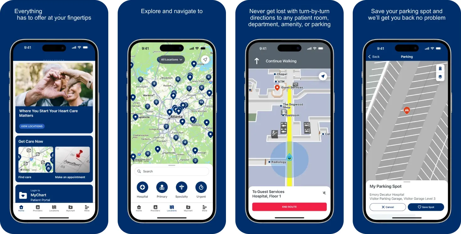
GPRS captured precise digital representations of six uniquely structured parking garages at a healthcare campus in Atlanta, enabling a software company to build a wayfinding app that improved navigation for patients and visitors.
PROBLEM
- The hospital campus featured multiple parking structures with inconsistent layouts, some aboveground, some underground, and some interconnected across levels.
- Patients and visitors frequently experienced difficulty navigating from their vehicles to their medical offices, resulting in frustration, delays, and operational strain on staff.
- The total space 3D scanned was 1,681,500 SF and included the following parking garages within the scope of work.
- Green Parking Garage - 6 Levels - 510,000 SF
- Blue Parking Garage - 2 Levels - 160,500 SF
- Purple Parking Garage - 5 Levels - 222,500 SF
- Gold Parking Garage - 3 Levels - 271,000 SF
- North Employee Garage - 6 Levels - 285,000 SF
- South Employee Garage - 5 levels - 232,500 SF
Solution
- Before reality capture began, the team conducted walkthroughs of each parking deck with the client to confirm the scope and develop scanning strategies tailored to the vast and complex layouts, ensuring no disruption to hospital operations.
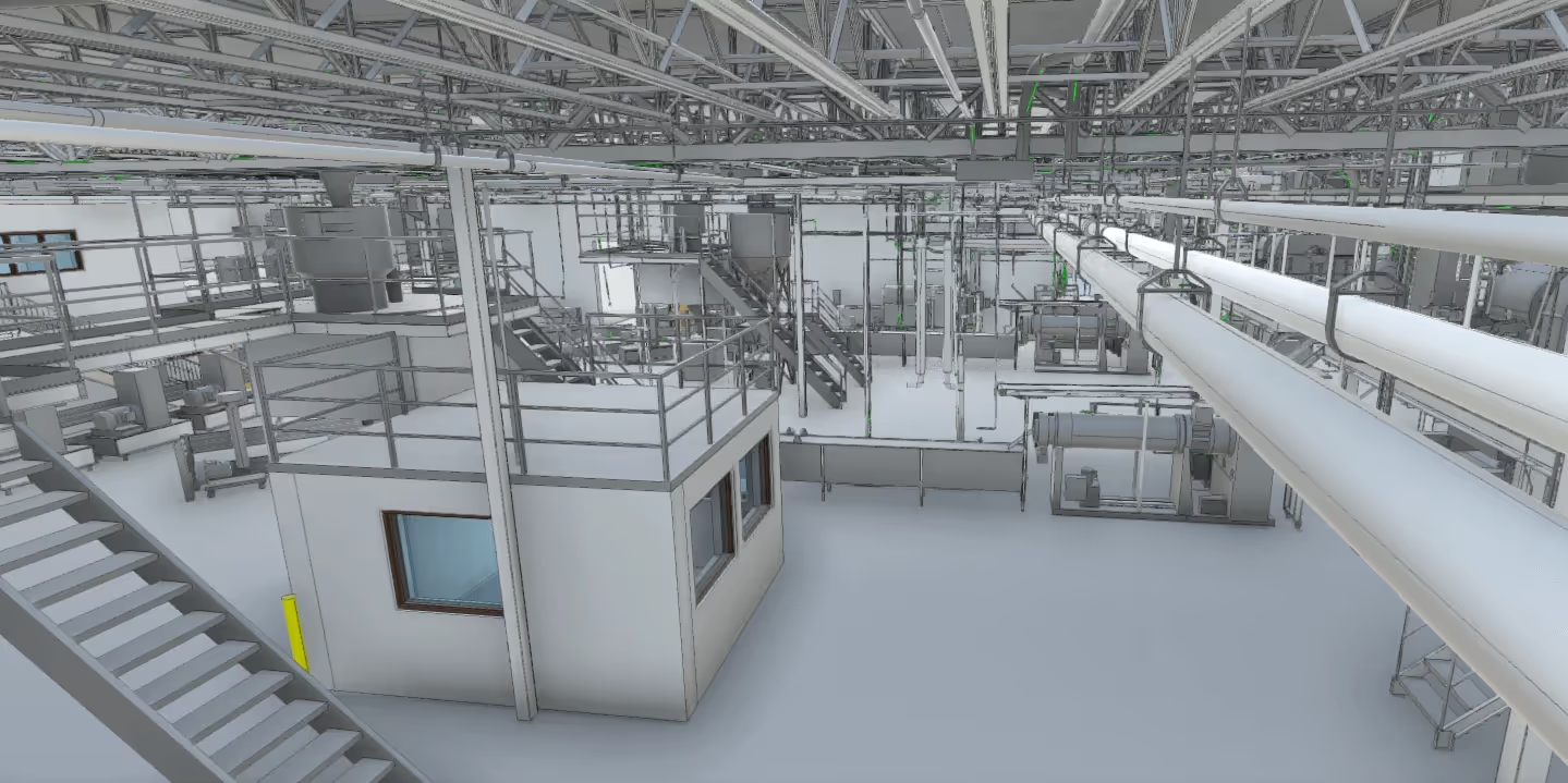
- Over the course of just one week, a three-person GPRS team used the Matterport Pro 3 and Leica RTC360 laser scanners to capture every parking level, space, stairway, and hospital access point.
- Accurate reality capture data was used to create individual 3D BIM models for each parking garage and a unified campus model, which served as the foundation for generating 2D plans and immersive virtual tours.
- Deliverables were integrated by the software company into a mobile wayfinding app featuring AR capabilities and indoor positioning to guide users through the hospital campus with ease.
Benefits
- Reality capture provided the spatial accuracy needed to power the app’s real-time AR navigation and location-saving features.
- The 3D BIM model formed the foundation for accurate routing, orientation, and destination mapping.
- Reality capture supported augmented reality (AR) overlays by aligning digital cues, like directional arrows or points of interest, with physical features in real-world spaces.
- Accurate wayfinding reduced staff reliance for wayfinding assistance and improved operational efficiency across the campus.
- Additionally, the CAD and BIM files can be used to support future upgrades and ongoing maintenance.
CASE STUDY GALLERY


.avif)


.avif)